


Australia and Japan helping to reveal the secrets of the hidden 'continent' of Zealandia
21 November 2017
Earlier this year, a group of international scientists attracted worldwide attention when they published research identifying Zealandia as the Earth's 'lost seventh continent'. Large parts of Zealandia lie within Australian waters just off our east coast, however given it is almost entirely submerged beneath the ocean, little is known of Zealandia's geology. So a research project between Australia and Japan is shedding light on this unique sunken land mass.
Geoscience Australia has released new geophysical data from the central Lord Howe Rise, the deep-sea plateau forming the geological 'backbone' of Zealandia. The seismic data and bathymetry data were collected in 2016 using the Japanese Government's scientific research vessel Kairei as part of an ongoing scientific research project by Geoscience Australia and the Japan Agency for Marine-Earth Science and Technology (JAMSTEC).
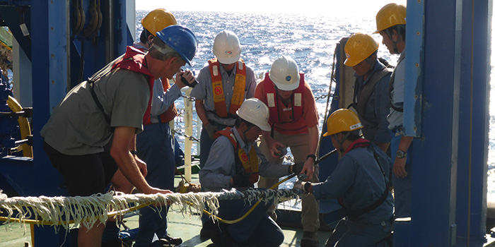 Japanese and Australian scientists working aboard the Japanese Government's scientific research vessel Kairei in April 2016.
According to project leader, Dr Ron Hackney, working with JAMSTEC has enabled Geoscience Australia to utilise the Japanese Government's cutting-edge scientific capabilities to collect high-quality data in an area far from the Australian coast.
"The most effective way to approach science is collaboratively; it means we can bring to bear different experts to look at a problem and develop more creative solutions. Our ongoing partnership with JAMSTEC means we gain access to the Japanese Government's vast scientific resources - such as their state-of-the-art scientific drilling vessel Chikyu - and the Japanese in turn can broaden their global capabilities and expertise," Dr Hackney said.
The seismic data reveals previously unknown deep rock layers that will be valuable for scientists in understanding the tectonic forces that caused Zealandia to break away from Australia and the geological evolution of the region. The bathymetry data produces detailed maps that chart the shape of the sea floor across part of Zealandia, revealing features such as extinct undersea volcanoes.
Zealandia is also important to climate research because sedimentary basins such as those found on the Lord Howe Rise preserve an archive of past climate conditions. This knowledge provides insights into the environment that existed while Zealandia was isolated and submerged over tens of millions of years. Scientists can use this information as a guide to future climate, and to test evolutionary concepts for sub-sea microbial life over a 100-million-year timeframe.
Geoscience Australia and JAMSTEC will use the newly-acquired data to plan for a deep stratigraphic drilling project through Zealandia's sedimentary basins and into basement. This scientific drilling project is expected to be conducted in 2020, pending funding, as part of the International Ocean Discovery Program (IODP), one of the longest running and most successful global scientific collaborations.
Later this year Geoscience Australia and JAMSTEC will use the new data to guide additional detailed seafloor and sub-seafloor mapping and sampling around potential IODP drill sites. The information collected will add to our increasing knowledge of the unusual but fascinating continental fragment that lies beneath the ocean.
The Lord Howe Rise geophysical data is now available via the Lord Howe Rise Project web page.
Further information:
- The Geological Society of America: Zealandia: Earth's Hidden Continent article