


Better prepared for bushfires and floods
14 November 2016
Natural disasters have a significant impact on Australia's economy, environment and society. They can result in loss of life, property and infrastructure, and damage our natural environment. And while we cannot prevent natural disasters, Australia can improve community resilience through effective preparation, monitoring and response.
In preparation for floods and bushfires, emergency managers put a range of strategies in place to help ensure the safety of our community. Geoscience Australia provides crucial information to support these efforts to ensure the safety of individuals, and to minimise impacts on property and infrastructure.
When natural disasters such as bushfires, tropical cyclones and floods occur, emergency management authorities need to make timely and accurate decisions to ensure lives are protected and potential impacts on property and infrastructure are minimised. During these events, Geoscience Australia provides essential mapping information to help emergency management authorities to make informed decisions. This includes provision of satellite imagery and maps that can assist emergency managers while the natural disasters are happening, and afterwards during the recovery phase.
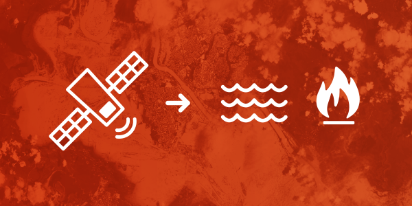
Geoscience Australia processes satellite data to help emergency managers respond to floods and potential bushfires
Using satellite data to help emergency managers
Every year in Australia, floods cause millions of dollars of damage to buildings and critical infrastructure, such as roads and railways, as well as to agricultural land and crops. Geoscience Australia accesses a range of satellites to gather emergency management intelligence. For example, satellite imagery such as the Water Observations from Space (WOfS) is a web service that displays where and how often surface water has been detected across Australia since 1987, helping to map water bodies and floodplains. It is useful for identifying where widespread slow-moving flood events have occurred in the past; and can help indicate areas that are susceptible to this type of flooding in the future.
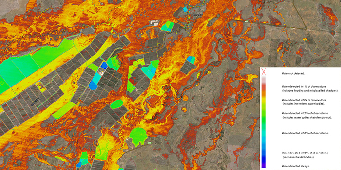
An example of the variation between water seen often (such as dams in blue colours) and water seen rarely
(such as flooding in red colours) around the southern Queensland town of Dirranbandi
Geoscience Australia also gathers and processes satellite data to support the Sentinel Hotspot monitoring system (https://sentinel.ga.gov.au/). This service analyses satellite imagery across Australia and detects hotspots, or potential bushfires. The Sentinel Hotspot system monitors the continent with updates every six hours that can alert emergency managers and the general public to bushfires that may pose a risk to communities and property. Emergency managers use the Sentinel Hotspot system, in combination with other information sources, to detect bushfires in regional and remote areas. For example, the system can help to detect remote fires after dry lightning strikes, or verify regional fires reported by the public.
An upgrade to the Sentinel Hotspots capability is currently being developed that will ultimately increase this frequency from 6-hour updates to 10-minute updates that will enable emergency services to monitor fire development in near real-time.
Better building design for bushfires
Earlier this year, Geoscience Australia's hazard researchers released a new Bushfire Attack Level Toolbox developed with support from the Western Australia Department of Fire and Emergency Services.
The software tool evaluates and maps potential exposure of buildings to bushfire, taking into consideration the Fire Danger Index, slope of the land, types of surrounding vegetation and their proximity to buildings. It also considers potential ember attack, the effect of radiant heat or direct flame attack.
Emergency management authorities use the tool for pre-disaster season preparation activities such as hazard reduction burns. It can also be used by building engineers and accredited bushfire hazard assessors to help design and construct buildings that are better protected from bushfire attack.
Further information:
- Value to the Nation: Ensuring Australia's Community Safety