


New dataset provides clues to potential mineralisation
10 July 2014
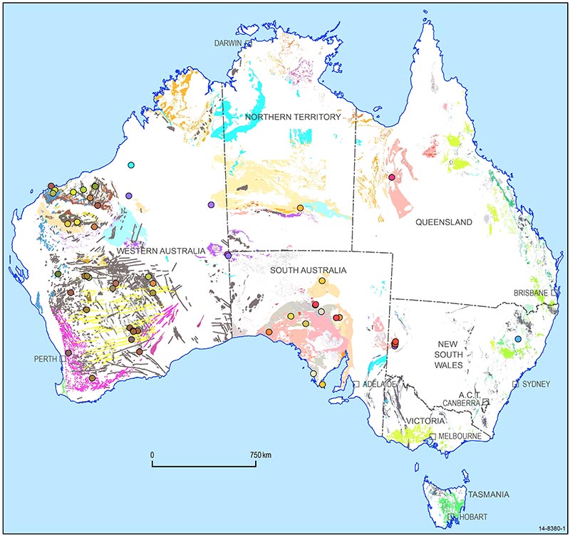
Mafic-Ultramafic Magmatic Events
series for Australia.
Geoscience Australia has released new map data which will aid the search for new mineral deposits and improve our understanding of the geological evolution of the Australian continent.
The Australian Mafic-Ultramafic Magmatic Events GIS Dataset shows for the first time in a single dataset the distribution of mafic and ultramafic magmatism across Australia.
Mafic and ultramafic rocks host deposits of important minerals such as nickel, platinum group elements (PGE) and chromium. These minerals are used in industrial processes and high-tech products, including steel making, catalytic converters and batteries.
Relative to other continents with comparable geology, Australia is under-represented in known mafic-ultramafic intrusion-hosted nickel, PGE and chromium mineral deposits. This dataset provides a new source of information to encourage mineral exploration in under-explored and potentially mineralised environments, aiding the search for new deposits.
Mafic and ultramafic rocks are volcanic and intrusive magmatic rocks that form when molten rock, magma, from deep in the Earth's crust or mantle rises into the upper crust, where it crystallises to form rock. It is these rocks that potentially contain concentrations of metals at levels that make them economically viable to mine.
The search for world-class magmatic nickel-PGE resources requires frameworks from the continental scale to the scale of the magmatic system, from the mantle through to their intrusion in the shallow crust. The Australian Mafic-Ultramafic Magmatic Events GIS Dataset provides this continental framework.
The dataset builds on previously released Archean and Proterozoic maps, completing the series with the addition of the Phanerozoic magmatic record. The 74 events identified in the complete dataset range in geological age from the Eoarchean 'Manfred Event', around 3.7 billion years old and confined to a few small remnant outcrops within the Yilgarn Craton, Western Australia, to the widespread record of Cenozoic (66 to 0 million years old) magmatism in eastern Australia.
Users are encouraged to integrate their own geological, geochemical and geophysical datasets into this fundamental time-space-event framework. By integrating this magmatic events dataset with others, such as crustal architecture and lithosphere thickness, geologists can evaluate new regions for exploration and evaluate indicators to under-explored and potentially mineralised magmatic regions across Australia.
The new dataset is now available for download via Geoscience Australia's website.
Further information: