


Ten years of Australia-Indonesia partnership strengthens disaster management
7 May 2018

Today in Jakarta, Australia and Indonesia are celebrating a 10-year partnership on disaster management.
Since 2008, the Australian and Indonesian Governments, science agencies and universities have worked together to strengthen disaster management, develop policy informed by science and technology, and greatly improve decision making around disaster management in Indonesia.
By helping people prepare for, respond to, and recover from disasters, more lives can be saved, impacts on the most vulnerable members of society reduced, and infrastructure protected.
Our partnership has strengthened the evidence base for disaster management, including:
- the InaSAFE, a decision support tool, enabling disaster managers to integrate real-time data on earthquakes, volcanoes and floods to inform disaster responses,
- the first National Tsunami Hazard Map, used to prioritise investment in tsunami mitigation activities across Indonesia,
- a new National Earthquake Hazard Map, which will help inform revisions to building standards for infrastructure and homes, and
- volcanic ash fall forecasting capability used to assess ash falls from eruptions and inform the location of critical infrastructure.
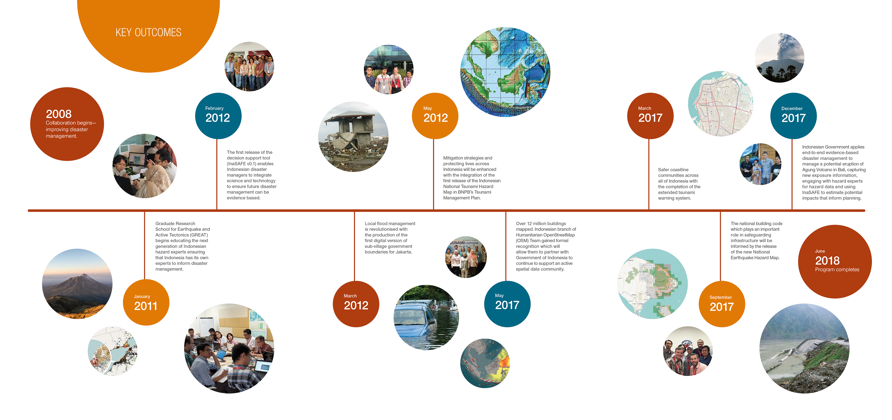 10 Years timeline of achievements for the Disaster Management Innovation Program in Indonesia
Australia has also worked with the Indonesian tertiary education sector to establish a program to train the next generation of hazard scientists and strengthen links between our universities. Australia has benefitted from collaborative efforts to better understand the source of earthquakes and tsunamis in our region.
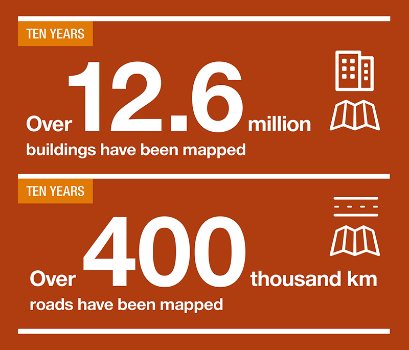
The mapping of over 12.6 million buildings, and over 400,000 kilometres of roads since 2008 is key to understanding the impact of a hazard event. This data will inform disaster management during a response phase following a disaster or the planning phase to explore the impacted by disasters.
Data and tools developed during the partnership are now being used internationally by organisations such as United Nations Office for the Coordination of Humanitarian Affairs and the World Food Program, and other donors are now investing in replicating aspects of this program in other major Indonesian cities.
Chief of Geoscience Australia's Community Safety and Earth Monitoring Division, Dr Andy Barnicoat, said "Australia and Indonesia shares a major tectonic plate boundary and one of the longest maritime boundaries in the world. Today's event celebrates our shared commitment to working together to manage and respond to the challenges faced in our region."
The event in Jakarta recognises the efforts of organisations and experts with a shared commitment to community safety.
For further achievement and project outcomes timeline see: Improving Disaster Management in Indonesia.