2.2.3 Landing Grounds
2.2.3.2 Example 2
| |
| Location of Example: |
152°59'38" East, 25°27'16" South |
| Distinctive Characteristics: |
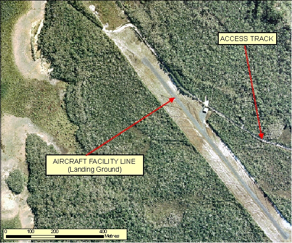
- In Figure 2.2.3.2a there is one access track and a small building associated with it which is common for non-commercial landing grounds
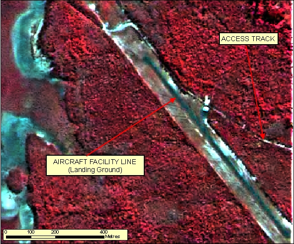
- In Figure 2.2.3.2b the dark grey/blue signature of the Landing Ground is in strong contrast to the red signature of the surrounding vegetation.
- Landing Grounds appear as relatively long, straight, paved or graded features.
- They are not part of the road network and generally have only a few access points.
- They are often noticeably wider than surrounding roads.
- In some cases, especially commercial landing grounds, they have a smaller taxi strip running parallel.
- A buffer of Vegetation is generally cleared along the edges of the Landing Ground to minimise risk to aeroplane safety.
|
| Regional Considerations: |
- In rural and remote areas Landing Grounds can be more isolated from surrounding infrastructure and simplified to a single strip. Access points may not be visible on imagery.
- Whereas in more populated areas Landing Grounds can be of a more complex nature often with more than one landing strip (i.e. cross strip) and maybe more difficult to differentiate from licensed facilities without Reference Material.
|
| Figure: 2.2.3.2 Representation of a Landing Ground. |


Topic contact: mapfeedback@ga.gov.au Last updated: January 20, 2012


