2.2.3 Landing Grounds
2.2.3.3 Example 3
| |
| Location of Example: |
151°34'18" East, 24°46'38" South |
| Distinctive Characteristics: |
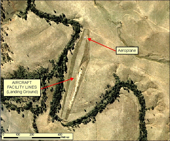
- In Figure: 2.2.3.3a the Landing Ground is clearly shown by the contrast of the short grass compared to the surrounding longer grass. In this photo it is unusual but fortunate to see the aeroplane at the northern end of the runway.
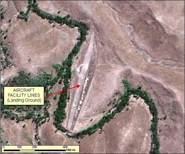
- In Figure: 2.2.3.3b the Landing Ground is clearly shown by the contrast of the short grass compared to the surrounding longer grass.
- Landing Grounds appear as relatively long, straight, paved or graded features.
- They are not part of the road network and generally have only a few access points.
- They are often noticeably wider than surrounding roads.
- In some cases, especially commercial landing grounds, they have a smaller taxi strip running parallel.
- A buffer of Vegetation is generally cleared along the edges of the Landing Ground to minimise risk to aeroplane safety.
|
| Regional Considerations: |
- In rural and remote areas Landing Grounds can be more isolated from surrounding infrastructure and simplified to a single strip. Access points may not be visible on imagery.
- Whereas in more populated areas Landing Grounds can be of a more complex nature often with more than one landing strip (i.e. cross strip) and maybe more difficult to differentiate from licensed facilities without Reference Material.
|
| Figure: 2.2.3.3 Representation of Landing Grounds in association with surrounding features. |


Topic contact: mapfeedback@ga.gov.au Last updated: January 20, 2012


