


Agreement recognises Australia's expertise in satellite imagery
18 June 2015
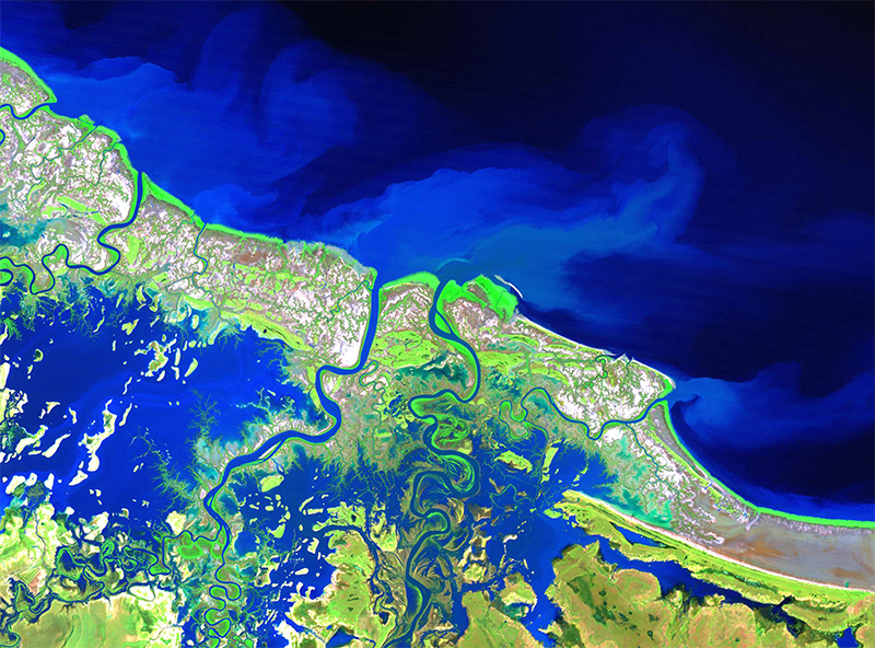
Landsat 5 false colour satellite image of
the Nicholson River, Queensland in
flood during the 2009 wet season
Geoscience Australia and the U.S. Geological Survey (USGS) have signed an agreement to establish a comprehensive new partnership to maximise land remote sensing data that can help to address issues of national and international significance.
Dr Chris Pigram, Geoscience Australia's Chief Executive Officer, welcomed the agreement explaining that the new partnership elevates an already strong relationship to a new level, and will see both organisations harness their respective skillsets to further unlock the deep understanding of our planet that the Landsat programme provides.
A key element of the partnership involves a major upgrade to Geoscience Australia's Alice Springs satellite antenna which will see the station play a much more significant role in the international Landsat ground-station network.
Following this commitment by the Australian Government for a $3 million upgrade, the Alice Springs antenna will transmit command and control signals to the Landsat satellites and support downloading of satellite imagery for the broader South East-Asia and Pacific region. Alice Springs will be one of only three international collaborator ground stations worldwide playing such a vital role in the Landsat programme.
The partnership will also include a strong focus on applying new science and `big data' techniques, such as the Australian Geoscience Data Cube developed by Geoscience Australia and the USGS land change monitoring, assessment, and projection capability, to help users unlock the full value of the data from the Landsat programme.
Read more in the Geoscience Australia-USGS media release.