


Exploring the marine secrets of Northern Territory's Bynoe Harbour
26 August 2016
A team of marine scientists have completed a marine mapping survey of the sea floor of Bynoe Harbour in the Northern Territory, building on the existing knowledge and understanding of this unique seabed habitat.
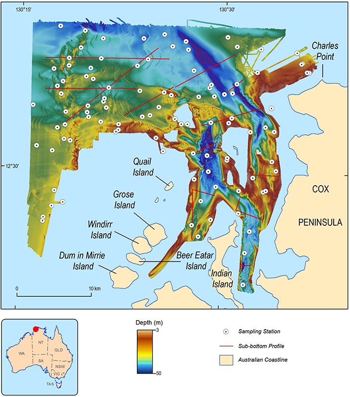
Location map showing the extent
of seabed mapping, sampling and
profiling in Bynoe Harbour
The survey was conducted earlier this year by scientists from Geoscience Australia, the Australian Institute of Marine Science, and the Northern Territory Government. Information collected will support the development of habitat maps that describe the sea floor flora and fauna, and programs that monitor the health of these sea floor ecosystems. These programs ensure the protection and sustainable development of marine resources in the harbour. The project will also improve the understanding of how currents are shifting sediments in Darwin and Bynoe Harbours, which will assist with the upkeep of major shipping channels in and out of the Port of Darwin and future infrastructure development.
Through the survey, scientists have found that Bynoe Harbour contains habitats similar to nearby Darwin Harbour, and so this less-developed harbour can be used as a comparative reference for monitoring the Darwin Harbour marine habitat. The survey mapped the depths and hardness for approximately 725km2 of sea floor using Geoscience Australia's high-resolution multibeam echosounder equipment, mounted on the Australian Institute of Marine Science research vessel RV Solander. The survey also collected sediment samples from approximately 100 sites to assess the composition of the sea floor and examine the marine animals living within it; such as worms, molluscs and crustaceans.
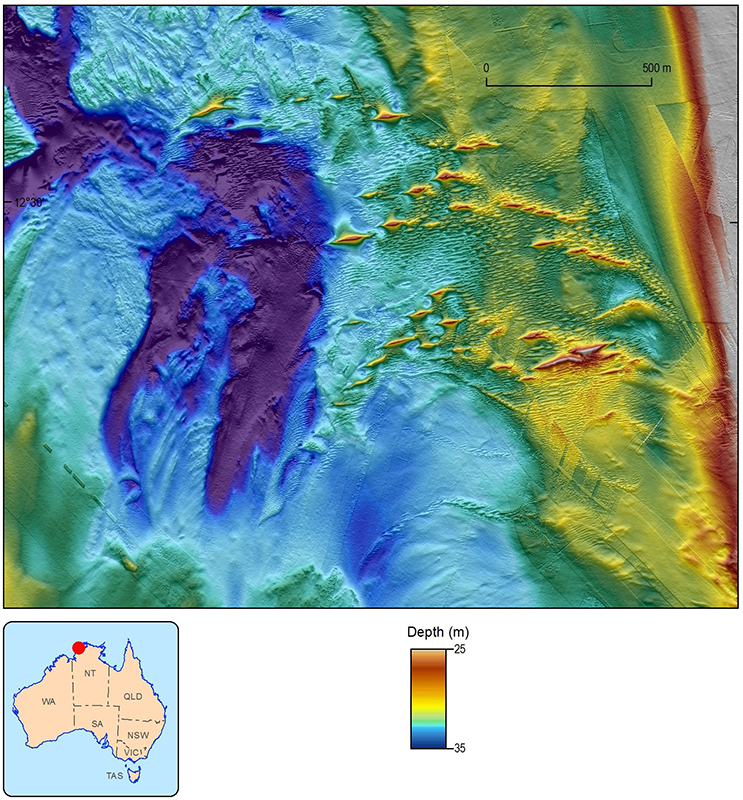
Image from the high resolution
echosounder showing the complexity
of the seabed
This survey built on work previously undertaken in 2011, 2013 and 2015 by the Northern Territory Department of Land Resource Management, Geoscience Australia, the Australian Institute of Marine Science, and the Darwin Port Corporation to map the depths and characteristics of the sea floor in Darwin Harbour, including Shoal Bay and Charles Point.
The previous surveys of Darwin Harbour undertaken in 2011 and 2013 revealed areas of complex seabed, including a drowned river valley and a number of large sand dune structures that had resulted from the movement of sediment along the seabed by the strong tidal currents known to this area.
During the next 18 months, research will extend to shallow, inshore waters of Shoal Bay, Charles Point and Bynoe Harbour. Additional sediment samples and an underwater video survey will take place to further describe the sea floor communities.
This project is being led by the Northern Territory Government, with support by the Ichthys LNG Project's Coastal Offset program, in collaboration with Geoscience Australia and the Australian Institute of Marine Science.
For further information: