


Gaining a deeper understanding of the sea floor through unprecedented access
12 July 2018
Geoscience Australia has been awarded the 2018 Special Achievement in GIS Award (SAG) by Esri, the global leader in Geographic Information System (GIS) technology.
Selected from a pool of more than 100,000 organisations world-wide, GA received this recognition for the scientific discoveries made while mapping the world's deep seabed during the search for missing Malaysia Airlines flight MH370. GA has also made this data freely available allowing the world to visualise and gain a deeper understanding of one of the largest and most publicised marine surveys ever conducted.
The SAG award recognises the international benchmark Geoscience Australia set using Geographic Information System (GIS) technology to collect and analyse large volumes of data during the search.
In San Diego to accept the award as part of Esri's User Conference on 11 July, Geoscience Australia Chief Scientist Dr Adam Lewis said that while the data were collected for the sole purpose of locating the missing aircraft, it was important to recognise that this is some of the first high resolution data of this region, and will be valuable to the scientific community.
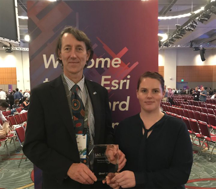 Geoscience Australia's Chief Scientist, Dr Adam Lewis and GIS specialist, Megan McCabe, accepted the award in San Diego
"The findings will benefit global ocean exploration, the fishing industry, and government cooperation for future marine search and rescue,"Dr Lewis said.
"The scope of the search was unprecedented, and produced the most detailed underwater map ever created; it showcases Geoscience Australia's expertise, and will benefit science for decades to come."
Esri Managing Director of Esri Australia and South Asia Brett Bundock said Geoscience Australia's use of GIS technology to distil and analyse more than 710,000 square kilometres of shipboard bathymetry data and more than 120,000 square kilometres of side scan sonar acquired by underwater vehicles has allowed the world to visualise and gain a deeper understanding of one of the largest and most publicised marine surveys ever conducted.
"The maps created by Geoscience Australia provide more precise insight into tides, sea floor depth, ocean temperatures and seabed terrain than has ever been available before," he said.
"Using GIS technology to create an accurate and detailed picture of the sea floor is critical for understanding factors such as: environmental change; tsunami forecasting; mineral extraction; oil and gas exploration; infrastructure construction; and cable and pipeline routing - to name just a few areas.
"We congratulate Geoscience Australia for their meaningful achievements in this field which will make a significant difference not only to Australians, but to communities around the world."
The search for MH370 involved collecting large volumes of data in a remote part of the southern Indian Ocean. The search was conducted in two phases: the first phase collected bathymetry data to develop maps of the sea floor topography in the search area; these maps then safely guided the second phase of the search, carried out by towed and autonomous underwater vehicles. A team of experts used Esri GIS technology to derive meaningful insights from the data gathered.
Chief of Geoscience Australia's Environmental Geoscience Division, Dr Stuart Minchin, said the discoveries made during the search included new underwater volcanoes, mountains, and trenches, and were able to correct some errors for recorded ocean depths, in some cases inaccurate by 2,000 metres.
"The data collected, and the insights gained from it, have been made available to anyone in the world in high-resolution, this is a world-first in government open data,"Dr Minchin said.
"The maps created by Geoscience Australia provide information about tides and sea floor depth, ocean temperatures and reveal sea floor terrain that has never been seen before.
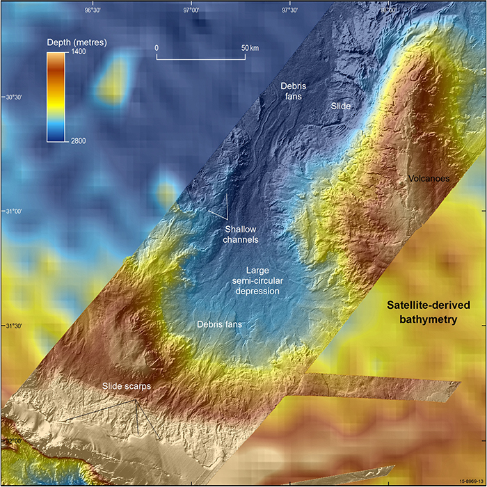 Before and after vision of data collected by Geoscience Australia during the MH370 search
"It was very important to us to ensure that we made this data accessible to a range of users, not just experts, as you never know where the next idea or discovery may come from. That is why we created an interactive Story Map, which provides a narrative which places the data in context. This of course allows experts to examine the data, but importantly, it also creates a way for the general public to explore the data as well."
For more experienced users, the MH370 search data are available through two data visualisation platforms on the Geoscience Australia website, and the National Computational Infrastructure is hosting the full 'raw' data for experts to download.
To view the Geoscience Australia MH370 data see: http://www.ga.gov.au/about/projects/marine/mh370-data-release.
For further information about the award see: https://www.esri.com/en-us/home.