|
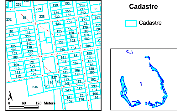
Cadastre |
|
|
| Dataset | |
| Title | Cadastre |
| Custodian | Department of Land Administration (DOLA) |
| Jurisdiction | Western Australia |
| Description | |
| Abstract | This dataset contains polygon cadastral data and non-spatial attribute data for the Cocos (Keeling) Islands. Horsburgh Island and North Keeling Atoll are not included in this dataset. |
| Search Word(s) | LAND
Cadastre LAND Ownership |
| Geographic Extent Name(s) | Cocos (Keeling) Islands Edition 1 2010 1:25000 - Geoscience Australia GEOCAT 70146 |
| Data Currency | |
| Beginning Date | Not known |
| Ending Date | AUG2004 |
| Dataset Status | |
| Progress | Complete |
| Maintenance and Update Frequency | not known |
| Access | |
| Stored Data Format | DIGITAL - ESRI Shapefile |
| Available Format Type | DIGITAL - ESRI Shapefile |
| Access Constraint | Please read the license agreement for limits to the access of the satellite imagery included on this CD. If you are unsure whether you are a registered user please consult this table. |
| Data Quality | |
| Lineage |
In December 2004 Geoscience Australia received the scheduled cadastral update from Tony Yeomans of the Department of Land Information (DLI, formerly DoLA). This update consisted of two ESRI shapefiles and two access databases. One of the ESRI shapefiles contains current property boundary information and the other contains lodged changes to property boundaries. Both ESRI shapefiles arrived at Geoscience Australia pre-projected in UTM (GDA94). The reason for differences between the lodged cadastre and the current cadastre is that current data could have been calculated or digitized, etc. When lodged data is integrated into current, the area is spatially upgraded with the new survey data (lodged data) as this would be more accurate. One access database contained data relating to tenure information including address. The other contained data on reserves. In January 2005 Geoscience Australia also obtained ground audit data from Peter Brockmulen of the Department for Planning and Infrastructure (DPI, formerly DoLA). This ground audit was conducted in 2004 at the request of the Department of Territories and Rural Services in Western Australia. It contains data describing land use and reserve usage. To produce the final cadastral information the files were modified and combined as follows. Due to initial consultation with users of the GIS it was decided to keep the cadastre containing current property boundaries and the cadastre containing lodged changes to property boundaries separate. As such the following changes were made to each file separately. Additionally the cadastral boundary for North Keeling Island, taken from the last version of the cadastre, was joined to the current cadastre shapefile. From discussion with users of the GIS it became apparent that the field LOT_TYPE was causing confusion with it's meaning. This is because it is a computer generated field that does not reflect the tenure of the land. Instead land tenure is derived from the PI_PARCEL field. To avoid this problem Geoscience Australia removed the LOT_TYPE field and replaced it with a TENURE field derived from the PI_PARCEL field and based on the definitions from the NORM manual as supplied by DLI. Using tenure information from the database supplied by DLI and from the land audit information supplied by Peter Brockmulen, Geoscience Australia joined on the fields ADDRESS, ZONING, RESERVE, PURPOSE and MANAGEMENT were joined on lot number. For multiple instances of lot numbers information was entered manually based on the land audit information supplied by Peter Brockmulen. From reserve data supplied by DLI the fields RSV_VESTIN, RESERVE_US and LGA were joined using the PIN field. Finally Geoscience Australia made the decision to move the cadastral data to be in line with previous data such as orthophotography. As such the following xy shift was used on both the cadastre and the lodged shape files:
In the 'cadastre_dli' folder of the cadastre directory is included the lodged and cadastre shape files as projected by DLI but with all data joined. |
| Notes of Previous Versions. | Territories
Office contract DOLA to maintain this data under a 'Service Delivery
Arrangement'. Prior to 1992 AUSLIG maintained the data on behalf of
Territories Office.
August 2004: Geoscience Australia was supplied with the latest Cocos (Keeling) Islands cadastre by DOLA in Western Australia as an ESRI shapefile. This included for the first time a polygon for North Keeling Island which outlined the coast. The following steps were carried out to merge the cadastre with previously collected ground audit data:
These changes were made using Arc View. December 2003: GA received an updated cadastre from GHD Pty Ltd in the CKIG92 projection. This 2003 cadastre shapefile, and all previous versions of the cadastre were projected to UTM(WGS84) zone 47S for addition to the 2003 GIS March 2003: Geoscience Australia obtained a resupply of the Cocos cadastre from DOLA via Nic dell’Aquila, Territories Office Canberra. The date of the shapefiles DOLA supplied were 7/2/03. The projection was geographics. Geoscience Australia projected the cadastre to CKIG92 using Arc View 3.2. Then using ArcGIS with all the new layer selected one node was snapped to the prior Cocos GIS cadastre. For the south eastern islands the prior polygons were used as these again did not match by around 40 meters. See the following lineage for an explanation. The prior attributes were again joined in to the DOLA cadastre. February 2000: AGSO projected the data from Geographic (WGS84) to Cocos (Keeling) Islands Grid 1992 using ArcView 3.2a projection utility. Deleted erroneous polygons (large area, small visible extent) from shapefile after checking that they were spatially non-unique and contained no attributes. AGSO also joined Cocos ground audit data acquired as a DBF to the cadastre table. August 2000: AGSO moved all small islands between Home Island and South Island to match the orthophotography. This was done by manually editing the shapefile in ArcView 3.2 (XY-shift and/or Stretch). Islands which formed logical groups were moved/stretched as a group in order to minimise modification of the original data. August 2000: AGSO warped South Island and all nearby small islands to visually match the orthophotography (translation/rotation/stretching was not adequate). This was done using the ShapeWarp 2.2 ArcView Extension and a third-order polynomial fit on 28 Ground Control Points which resulted in an RMS Error of 4.58057.
|
| Positional Accuracy | Absolute positional accuracy is not known. Because this is understood to be the islands' authoritative cadastre, the cadastre has been used as the reference dataset. Comparison with the Orthophotography and other datasets indicate that for islands other than the main islands, accuracy may not be as high as hoped. For South Island, prior to AGSO's warping it to match the orthophotography, mismatches with the orthophotography were up to approximately 45 metres. Following warping, mismatches are up to approximately 5 metres. |
| Attribute Accuracy | not known (The field A_Pin was assumed equivalent to the Pin field in the Ground Audit data and the tables were joined. For a discussion of AGSO's evaluation of Ground Audit attribute accuracy see the System Documentation). |
| Logical Consistency | This shapefile contains lines that denote cadastral boundaries. Through their use, it has been noted that the spatial content is complete and consistent in describing cadastral boundaries. Attribute data contains fields that are not completely filled however all records have a unique ID number. |
| Completeness | Appears complete for areas other than Horsburgh and North Keeling Islands. Attributes are apparently not complete (there are a lot of blank entries where, for GIS use, entries should not be blank). |
| Contact Information | |
| Contact Organisation | Department of Land Administration (DOLA) |
| Contact Position | Product Officer, Land Enquiry Centre |
| Mail Address | PO Box 2222 |
| Locality | Midland |
| State | Western Australia |
| Country | Australia |
| Postcode | 6936 |
| Telephone | (08) 9273 7344 |
| Facsimile | (08) 9273 7655 |
| Electronic Mail Address | Tony_Yeomans@dola.wa.gov.au |
| Metadata Date | 19-01-2004 |
| Additional Metadata | |
| Projection | UTM(WGS84) Zone 47 - originally supplied as Geographic (WGS84) projection. |