AUSGeoid2020
Page last updated:1 September 2022
AUSGeoid2020 has been developed to support the improved determination of AHD height estimates HAHD from GNSS observations. AUSGeoid2020 provides ellipsoid to AHD separation values NAHD onshore with uncertainty.
HAHD = h − NAHD
Given that AHD is only an onshore datum, AUSGeoid2020 should only be used onshore or near to shore.
AUSGeoid2020 is a combined gravimetric-geometric model. The gravimetric component is a 1' by 1' grid of ellipsoid-quasigeoid separation values created using data from gravity satellite missions (e.g., GRACE, GOCE), re-tracked satellite altimetry, localised airborne gravity, land gravity data from the Australian national gravity database and a Digital Elevation Model to apply terrain corrections.
The geometric component is a 1' by 1' grid of quasigeoid-AHD separation values and is developed using a dataset of collocated GNSS ellipsoidal height and AHD heights. The geometric component attempts to account for an offset between AHD and the quasigeoid that ranges from about -0.5 m (AHD below quasigeoid) in the southwest of Australia to about +0.5 m (AHD above quasigeoid) in the northeast of Australia. The offset between AHD and the quasigeoid is primarily due to the method by which AHD was realised. Given that the warmer, less dense water off the coast of northern Australia is approximately one metre higher than the cooler, denser water off the coast of southern Australia, by constraining each of the tide gauges to zero AHD, the effects of sea surface topography were propagated into the adjustment.
Figure 1a: The AUSGeoid2020 model. Units in metres.
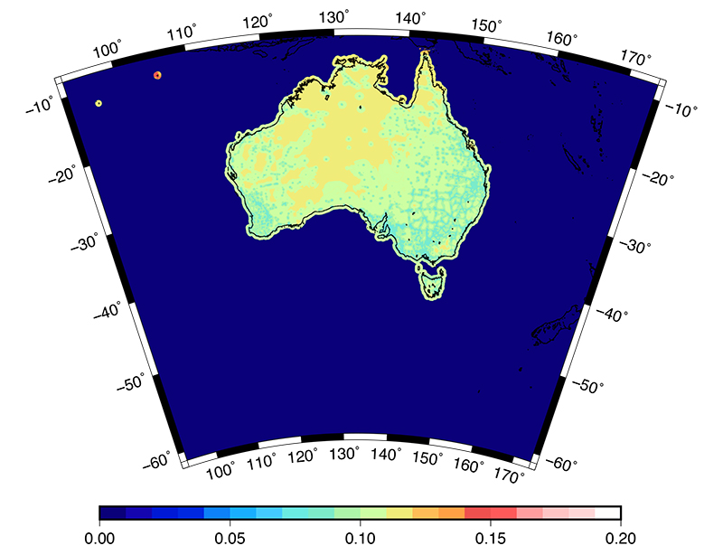
Figure 1b: Associated location-specific error model. Units in metres.
Format of AUSGeoid2020
AUSGeoid2020 is provided in two formats: ASCII text file (.txt) and NTv2 binary grid (.gsb). Separate ASCII files exist for the ellipsoid to AHD separation (Table 1) and the uncertainty in the ellipsoid to AHD separation (Table 2).
Table 1: ASCII format of AUSGeoid2020 ASCII file
| ID | ellipsoid to AHD separation (m) | Latitude | Longitude | deflection of the vertical (seconds) | |||||
|---|---|---|---|---|---|---|---|---|---|
| GEO | NAHD | D | M | S | D | M | S | ξ | η |
Table 2: ASCII format of AUSGeoid2020 uncertainty ASCII file. The deflection of the vertical are set to zero in the uncertainty file
| ID | uncertainty (1 sigma) | Latitude | Longitude | deflection of the vertical (seconds) | |||||
|---|---|---|---|---|---|---|---|---|---|
| GEO | σNAHD | D | M | S | D | M | S | ξ | η |
AUSGeoid2020 tools and services
A web application is available on the Geoscience Australia website to perform AUSGeoid computations using AUSGeoid98, AUSGeoid09 and AUSGeoid2020.
You can download the ASCII file version, along with binary versions of the AUSGeoid2020 files: