News & events Latest news and events
Filter
Type
Topic
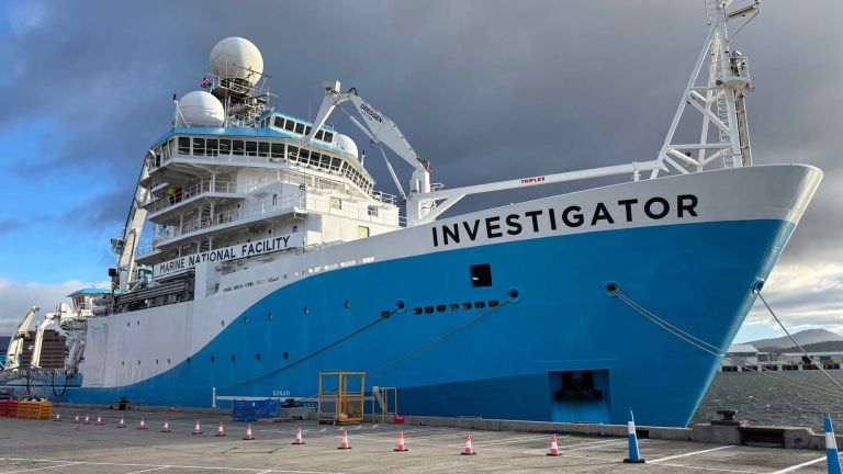
New seabed mapping voyage to strengthen Australia’s marine data on the east coast
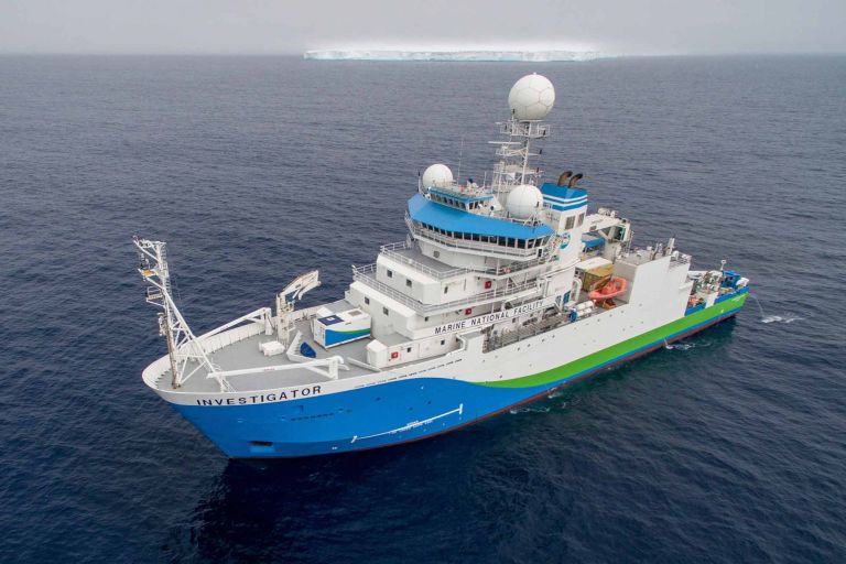
Geoscience Australia is participating in a voyage aboard the CSIRO research vessel (RV) Investigator between Hobart and Brisbane from 16 to 22 July to collect new seabed mapping data and improve the quality of Australia’s national seabed mapping coverage.
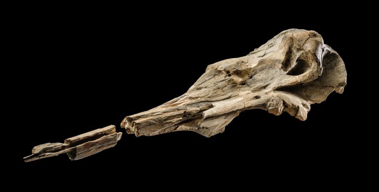
Ancient fossil from Antarctica brings deep time science to the National Museum of Australia
From 1 July 2026, visitors to the National Museum of Australia's (NMA) new Antarctica exhibition will come face to face with a piece of Antarctic history, a fossilised skull of Australodelphis mirus, an extinct dolphin.
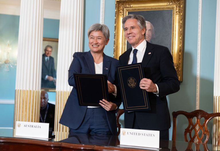
Australia and Papua New Guinea
Papua New Guinea lies within one of the world’s most active and complex tectonic regions. While earthquakes cannot be predicted or prevented, timely and accurate information can help authorities and communities prepare, respond and reduce their impacts.
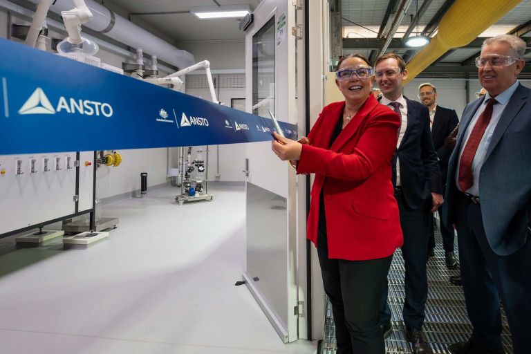
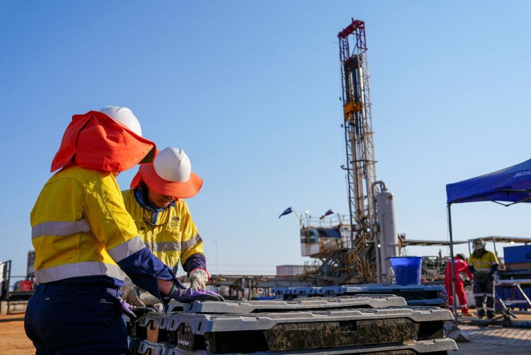
New facilities strengthen Australia’s critical minerals capability
Geoscience Australia is contributing national-scale geoscience expertise through the Australian Critical Minerals R&D Hub.

Australia’s full national topographic library at your fingertips
Geoscience Australia has completed the nationwide release of its AUSTopo 1:250,000 digital topographic map series, putting authoritative, up to date topographic coverage of the entire country just a click away.

Geoscience Australia launches new 10-year strategy to shape the nation’s future
Minister for Resources the Hon Madeleine King MP today launched Geoscience Australia’s new enterprise strategy, setting a clear direction for how the organisation will deliver trusted geoscience insights to support Australia’s resilience, innovation and prosperity over the coming decade.

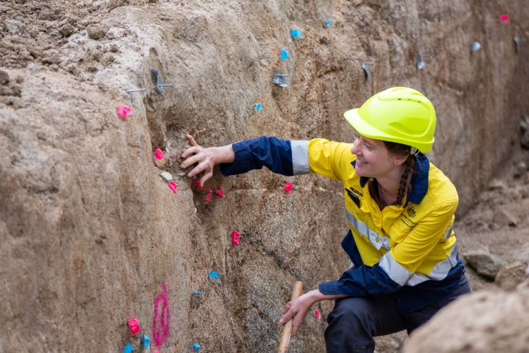
Science in action: Stories from women shaping Australia's Geoscience
Every day, women contribute to every layer of Australia’s geoscience capability, from those just starting out to those leading nationally significant programs.
2026 Distinguished Geoscience Australia Lectures and Public Talk Series has arrived!
Our Public Talks are back for 2026! This year, we’re going bigger, bolder and more inspiring than ever. Every fortnight, we’re bringing you conversations that explore the latest Earth science.

Release of Australia’s Identified Mineral Resources (AIMR) 2025 report
As home to some of the largest Mineral Resources of many of the world’s critical minerals, Australia is well-placed to support global demand, according to Geoscience Australia’s recently published 2025 edition of Australia’s Identified Mineral Resources 2025 (AIMR).

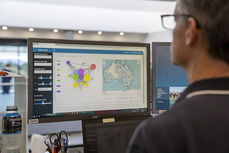
Mineral potential assessment reveals new areas for likely unconformity-related rare earth element discoveries
Geoscience Australia has unveiled new research that reshapes Australia’s understanding of where unconformity-related rare earth element (REE) deposits may be found, revealing previously unrecognised regions with strong potential for future discovery.
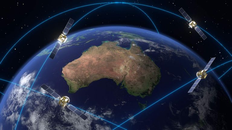
Positioning Australia expands capabilities with Ginan V4 release
Geoscience Australia today announced the release of Ginan V4, the latest version of its home-grown, open-source toolkit for precise point positioning.
Australia and Papua New Guinea: A century of scientific partnership
As Papua New Guinea celebrates 50 years of independence, it’s a great opportunity to look back at the much longer scientific story that we share with our northern neighbour.
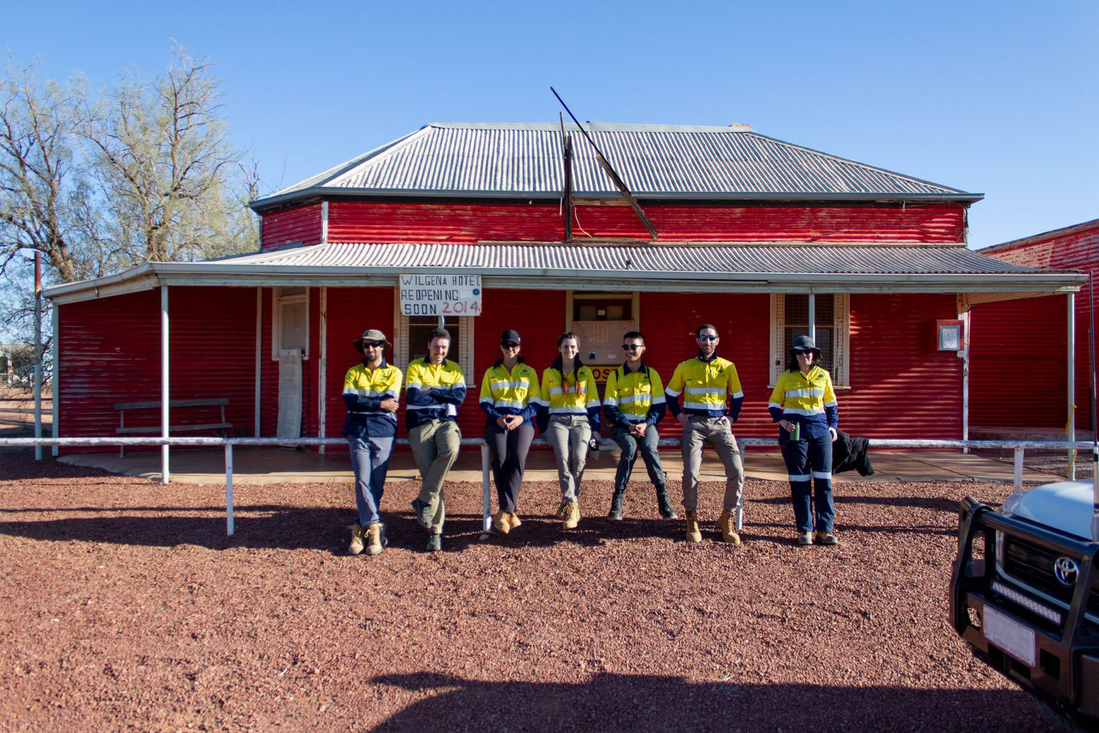
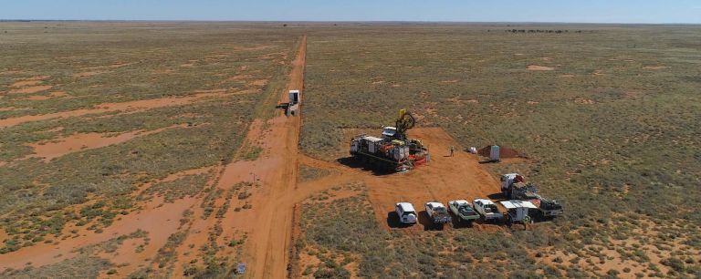
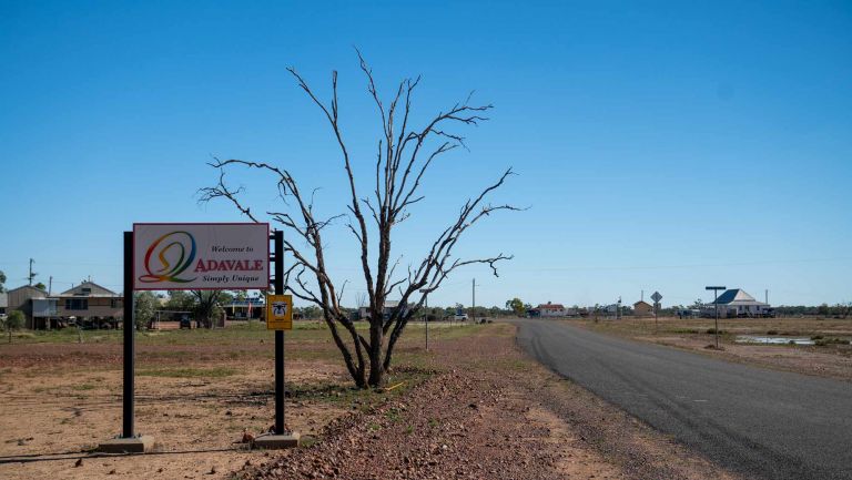
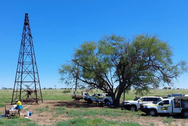
Geoscience Australia’s deepest stratigraphic drilling campaign unlocking the secrets of the Adavale Basin
Geoscience Australia have completed the single deepest drilling campaign in modern organisational history.

Dr Verity Normington in new book celebrating Rebel Girls in STEM with disabilities and chronic illness
A new book highlighting women changing the world through science, technology, engineering and mathematics (STEM) features Geoscience Australia geoscientist and a chronic illness and STEM advocate, Dr Verity Normington.
Australia’s Energy Commodity Resources publication reinforces Australia’s position as a global leader
Geoscience Australia’s latest edition of Australia’s Energy Commodity Resources (AECR) publication reinforces Australia’s position as a global leader in energy resources, production and exports.
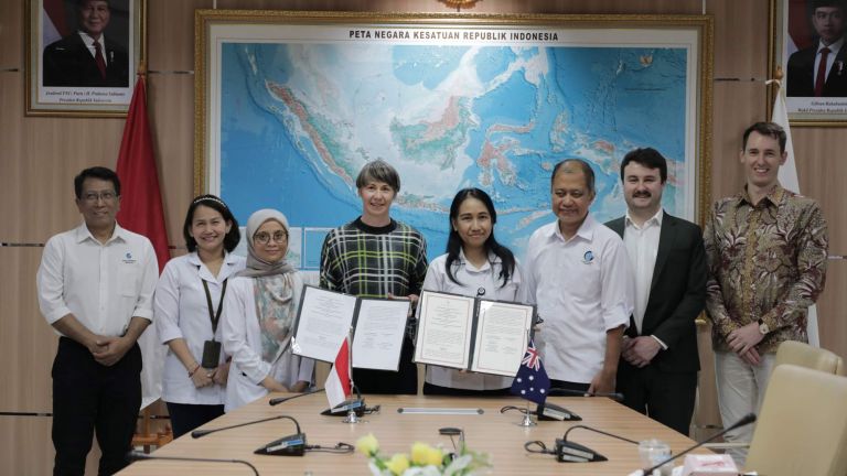
Sharing marine science expertise with our neighbours
Australia and Indonesia work together to grow marine data capacity
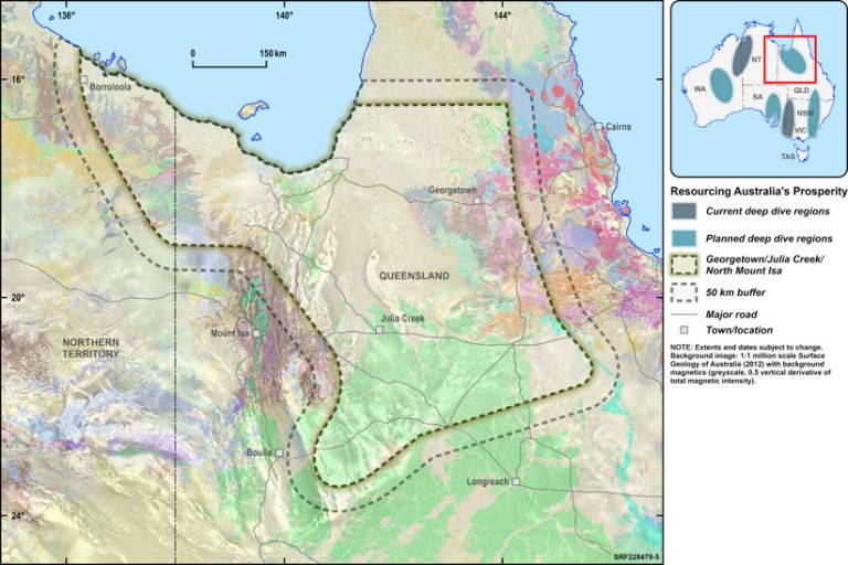
Resourcing Australia’s Prosperity – what to expect in the first 10 years
Geoscience Australia have showcased their planned projects for the first 10 years (2024-2034) of the Resourcing Australia’s Prosperity initiative.
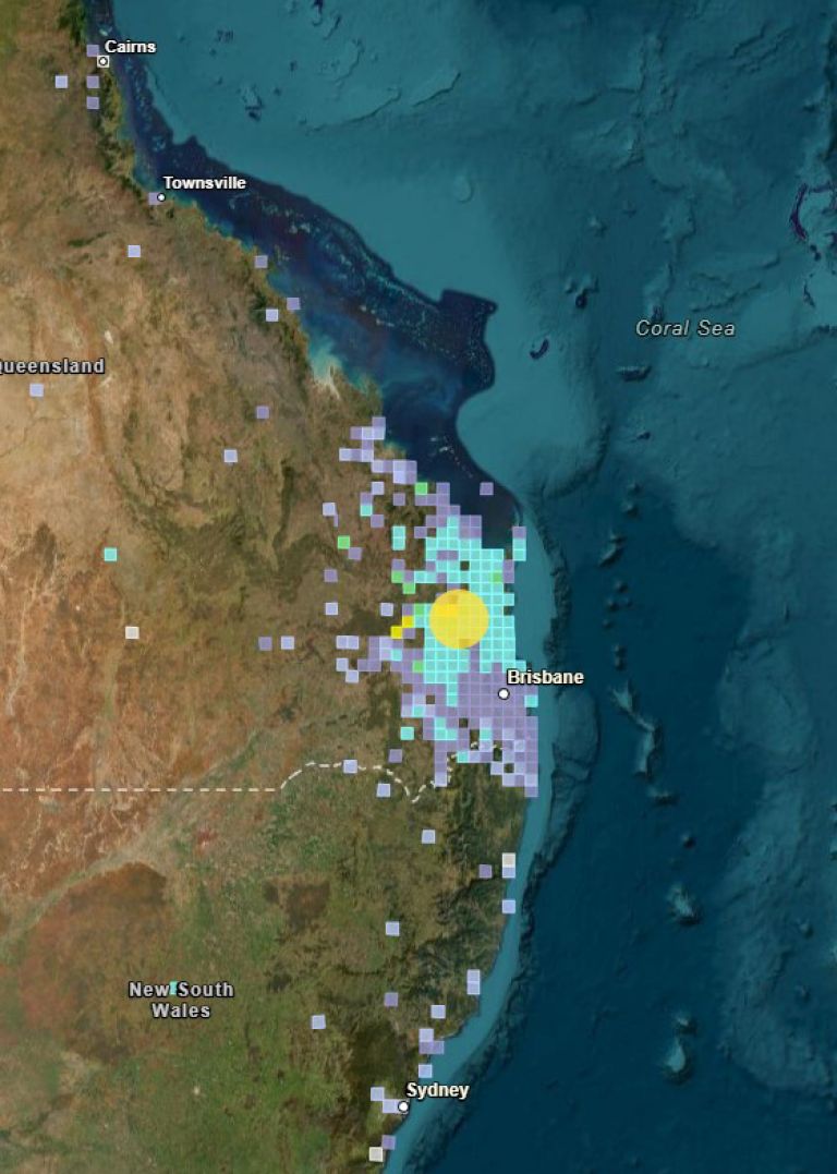
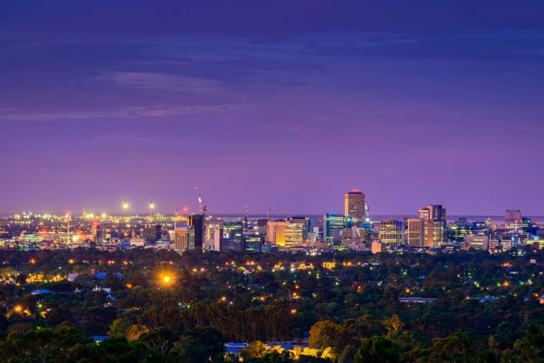
Magnitude 5.6 earthquake near Kilkivan, QLD
A magnitude 5.6 earthquake hit south eastern Queensland at 9.49 AM on Saturday 16 August, near the town of Kilkivan and around 40 kilometres west of Gympie.
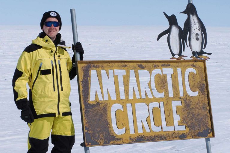
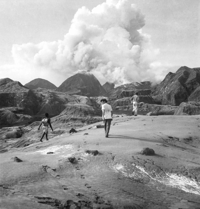
A summer of Antarctic Geoscience
As Australia shivers in the winter, it’s a good time to look back over a successful summer of Earth science in the Antarctic.

Resourcing Australia’s Prosperity – the first 10 years
Join us online, Tuesday 26 August, 11:30am – 1:00pm AEST, to hear more about what's planned under the 4 components for the first 10 years of Resourcing Australia’s Prosperity.
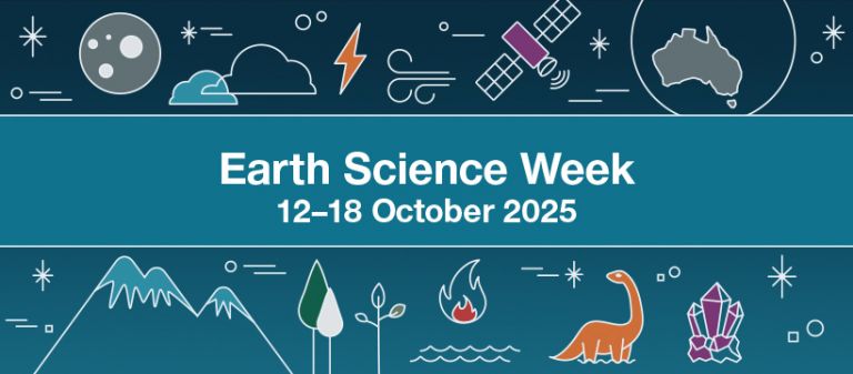
Earth Science Week
Geoscience Australia has something for everyone this Earth Science Week, held from Sunday 12 to Saturday 18 October 2025. Register your own event, find one near you or check out our digital supporter toolkit.
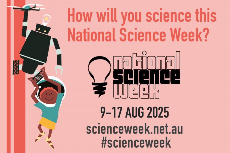
National Science Week
National Science Week is Australia’s annual celebration of science and technology. Held from Saturday 9 to Sunday 17 August 2025.
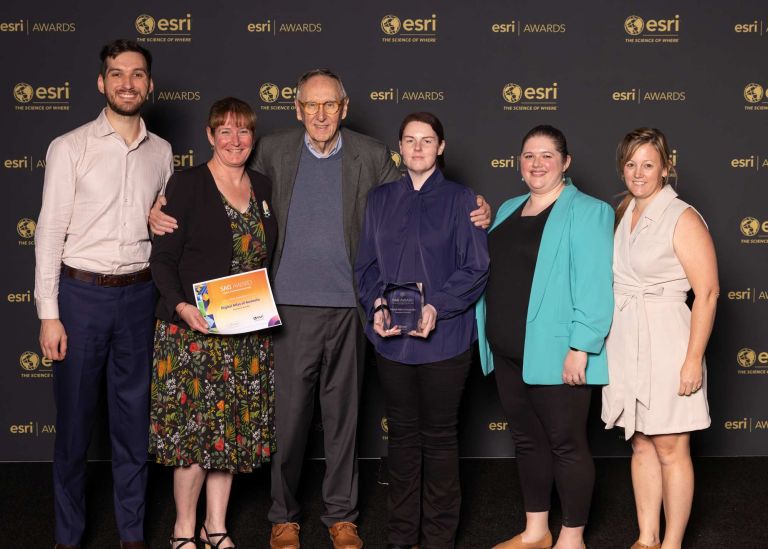
Geoscience Australia receives international recognition for geospatial excellence
Geoscience Australia has earned international recognition for geospatial excellence, receiving a Special Achievement in GIS Award for the development and delivery of the Digital Atlas of Australia.
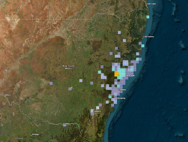
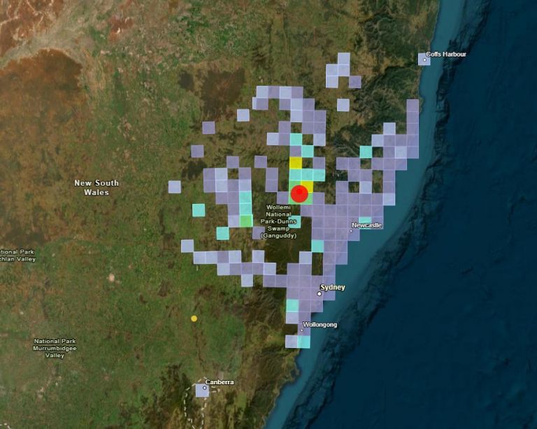
Magnitude 4.6 earthquake near Singleton, NSW
A magnitude 4.6 earthquake hit the New South Wales Hunter region at 2.55 AM on Wednesday 23 April near Singleton.
Public Talks at Geoscience Australia
Our Public Talks are back, and we are thrilled to welcome you to the 2025 series. These talks, held fortnightly on Wednesdays at 11am can be joined in person at our Canberra headquarters or live online and will include seven Distinguished Geoscience Australia Lectures (DGALs) over the year.
Australia takes world leading role in global critical minerals supply
Australia is home to some of the largest resources of the world’s critical minerals. Geoscience Australia’s annual stocktake report of these mineral resources has been released in the 2024 edition of Australia’s Identified Mineral Resources (AIMR).
Supporting gender equity through improved talent attraction
Geoscience Australia has been awarded a 4th Science in Australia Gender Equity (SAGE) Cygnet Award for supporting gender equity through improved talent attraction, demonstrating its commitment to sustainable gender equity, and a diverse and inclusive workplace culture.
International Day of Women and Girls in Science
Today on International Day of Women and Girls in Science, Geoscience Australia is celebrating the diverse range of talent found right here in our backyard.
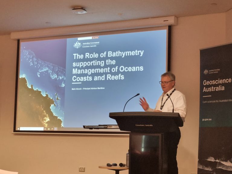
Geoscience Australia's Principal Advisor Maritime Mark Alcock named in 2025 Australia Day Honours list
Geoscience Australia Principal Advisor Maritime Mark Alcock has been awarded a Public Service Medal (PSM) for his service to the community through international leadership in maritime affairs.

New Chief Executive for Geoscience Australia
Geoscience Australia welcomes the news today, from Minister for Resources and Northern Australia, the Hon Madeleine King MP, announcing Ms Melissa Harris as the new Chief Executive Officer of the organisation.
New clean energy resource discovered under our feet
A new report from Geoscience Australia, in collaboration with the Geological Survey of New South Wales, has found elevated levels of natural hydrogen and helium in locations throughout New South Wales.
New science sheds light on Australia’s potential risk for earthquakes
Geoscience Australia has released the first update to the National Seismic Hazard Assessment since 2018, identifying Darwin and the eastern highlands through into Latrobe Valley as areas where there is a higher risk of strong ground shaking.
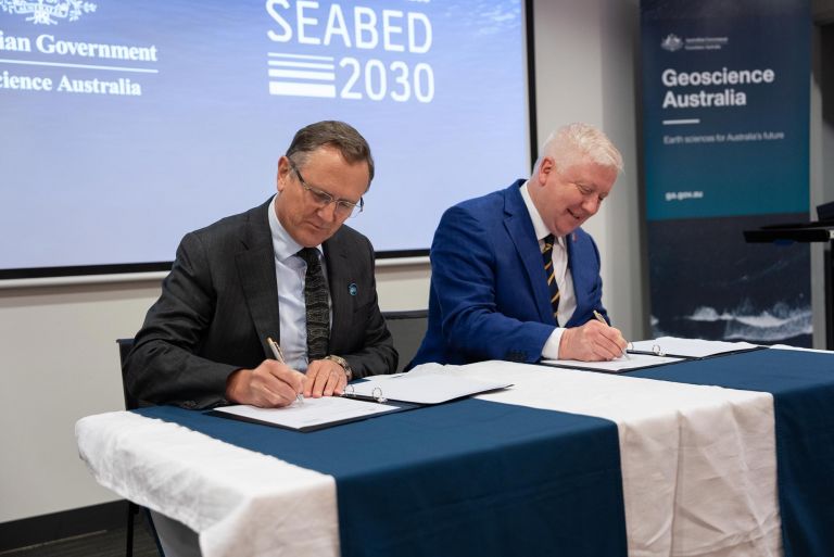
Seabed mapping on a global scale: New international agreement
Geoscience Australia is contributing to global action on seabed mapping by signing a Memorandum of Understanding with The Nippon Foundation-GEBCO Seabed 2030; the first Australian Government organisation to do so.
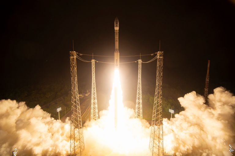
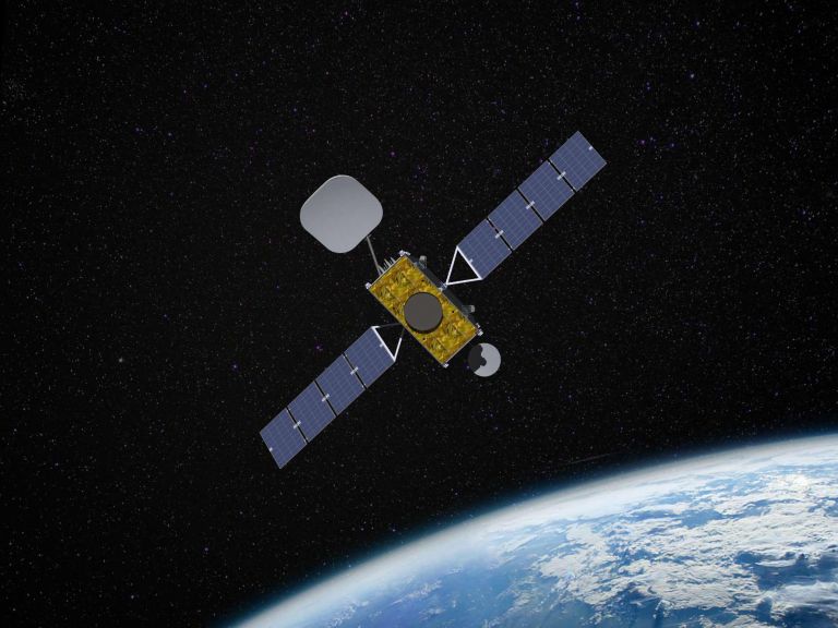
Sentinel-2C launch
Successful satellite launch aids informed decision making.
Earth Science Week 2024
Discover how Earth science is everywhere this Earth Science Week.

GeoInsight wins Good Design Australia Award for Design Strategy
Geoscience Australia’s new region-based spatial exploration tool GeoInsight has won a Good Design Award for Design Strategy at the 2024 Australian Good Design Awards ceremony.
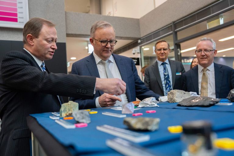
Prime Minister visit to Geoscience Australia
Prime Minister Anthony Albanese breaks ground as the first sitting prime minister to visit Geoscience Australia.

Dr James Johnson announces retirement
Dr James Johnson has announced his retirement as Chief Executive Officer (CEO) of Geoscience Australia.
New insights into Australia’s unknown potential for high-purity quartz resources
A new paper published in the Australian Earth Sciences Journal by Geoscience Australia has established a baseline understanding of Australia’s potential for High Purity Quartz (HPQ) resources, an area that has been significantly under-reported.
Magnitude 4.7 earthquake in Upper Hunter, NSW
The Upper Hunter region has been rocked by a magnitude 4.7 earthquake at 12:01 PM on Friday 23 August near the town of Denman, near Muswellbrook, NSW.
Transformational geoscience - Exploring for the Future final publication released
As the Exploring for the Future program officially concludes, over 750 attendees connected online across 4 days to delve deeper into the science of the transformational 8-year program.
Geoscience Australia inspires future Earth scientists at GSG STEM Expo
This Thursday, during National Science Week, the Government Scientists Group (GSG) and its members transformed the Great Hall at Parliament House into the GSG STEM Expo.
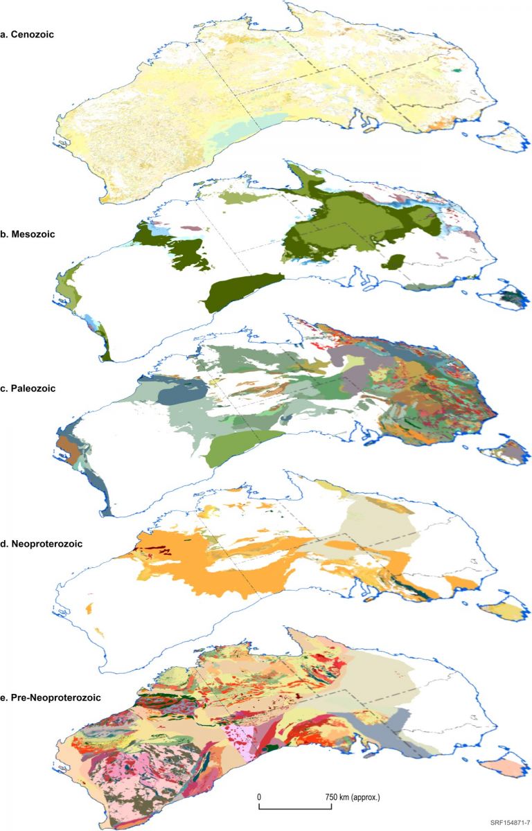
Continental mapping uncovers Australia’s hidden geology
A new map has been released by Geoscience Australia, showing a layered view of Australia’s surface and subsurface geology by progressively stripping away geological layers up to 1 billion years old.
Landmark geoscience program lays the groundwork for a future made in Australia
Geoscience Australia’s Exploring for the Future program has officially concluded, celebrating its success with an online Showcase starting today, and a publication that summarises its results, achievements and impacts.
Australia joins Landsat Next satellite program
Australia has formally joined the United States-led Landsat Next satellite program, cementing an enduring partnership and building on nearly half a century of collaboration in satellite land imaging.
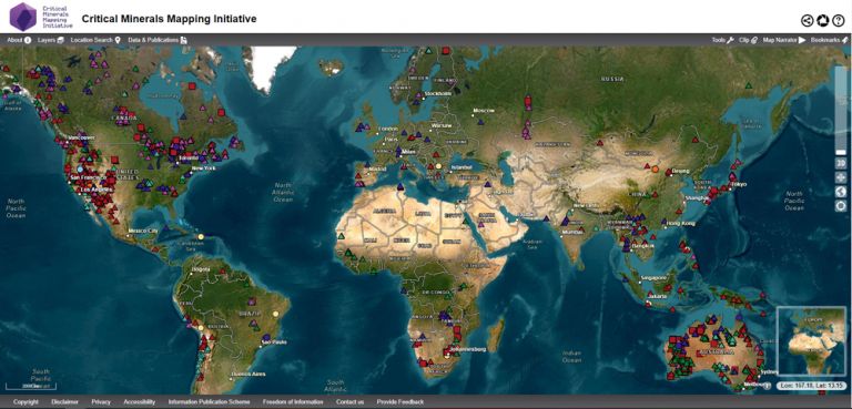
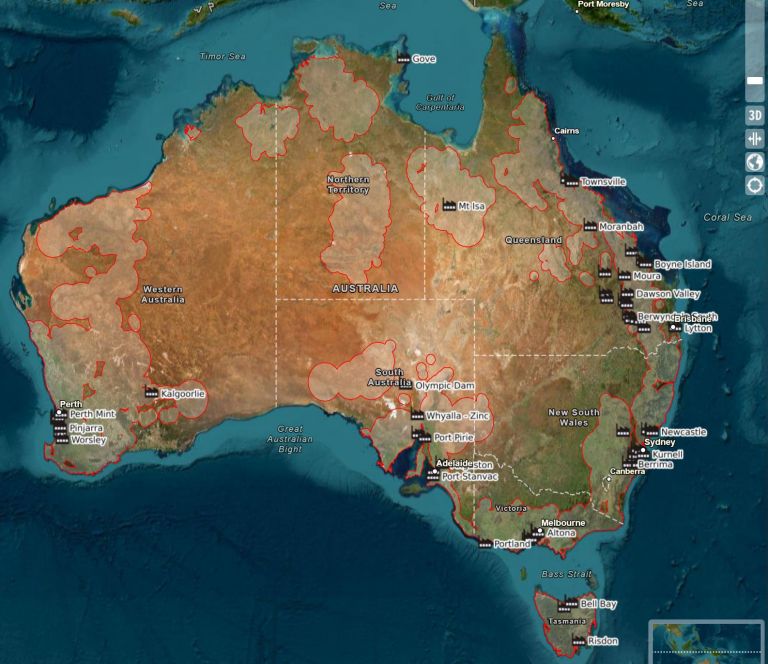
Critical Minerals Mapping Initiative database updated to over 25,000 samples
A major update has been delivered to the Critical Minerals in Ores database and portal, increasing the available online high quality multielement geochemistry of mineralised ore samples from 7,300 to over 25,000.
Landsat informing better wetland management in Australia and Africa
Learning from the past to plan for a better future: Supporting nature-based climate change solutions through Earth observation.
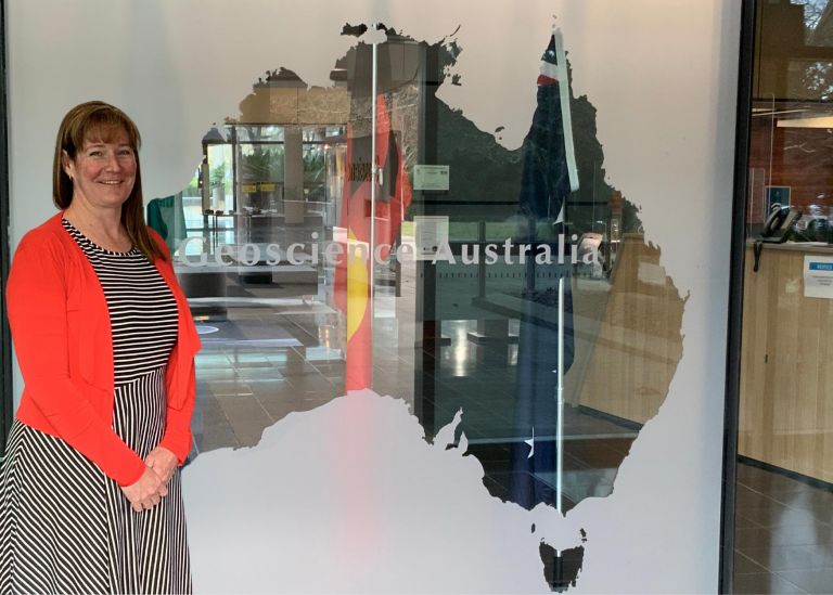
Geoscience Australia welcomes new Chief of Place and Communities Division
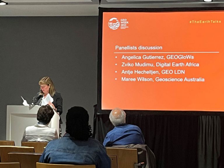
Geoscience Australia is pleased to announce the appointment of Maree Wilson as the new Chief of Place and Communities Division.
Geoscience Australia informing improved cyclone preparation on the Gold Coast
When Geoscience Australia produced the latest scientific advice about the risks and potential impacts of severe wind in Southern Queensland, the City of Gold Coast picked up the ball and ran with it.
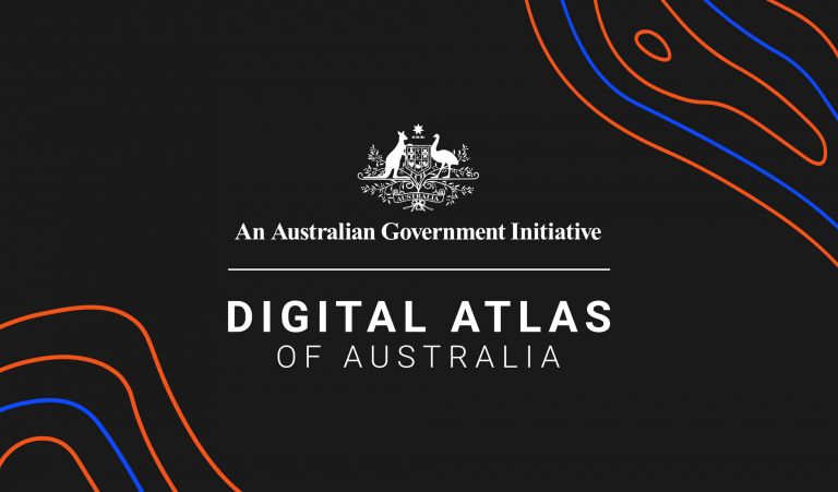
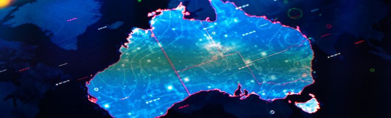
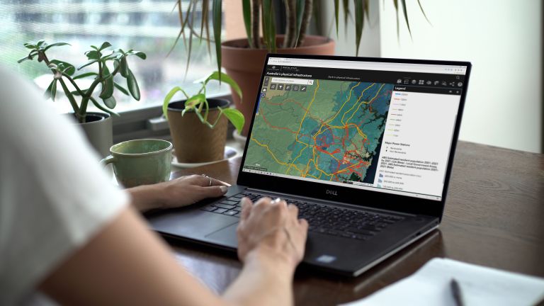
Minister King launches the Digital Atlas of Australia
The Australian Government has released an innovative online platform that will change how essential national data is accessed and used, helping us make better decisions for Australia's future.
Investments to map Australian resources that will power our future prosperity
As part of the 2024-25 May Budget, the Australian Government announced it will fund Geoscience Australia to accelerate the discovery of critical minerals, ground water and other resources necessary for the net zero transition.
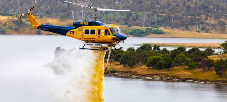
Satellite imagery to help aerial firefighters find usable watersources
Upgraded Digital Earth Australia (DEA) Waterbodies to form part of new decision support tools.
Generational investment in Australia's resources to deliver a Future Made in Australia
The Albanese Government will deliver a generational investment to find new deposits of minerals and sources of energy to help build a Future Made in Australia, as part of a big focus on resources in next week’s Budget.
SouthPAN upgrade delivers improved positioning services to users
Geoscience Australia’s satellite-based augmentation system, SouthPAN, has reached a new milestone, elevating services to a reliable 99.5% accurate service availability, up from 95% previously.
Minister King explores the new Rocks That Shape Australia exhibition
Minister for Resources and Minister for Northern Australia Madeleine King has visited the Rocks That Shape Australia exhibition at Geoscience Australia.
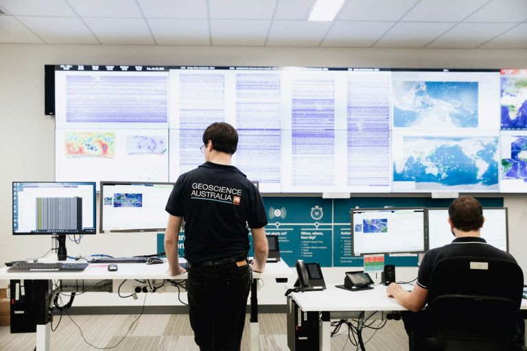
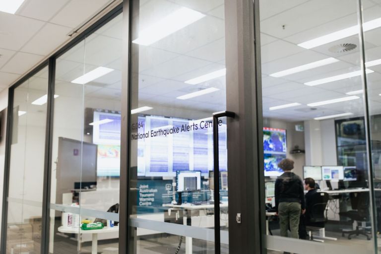
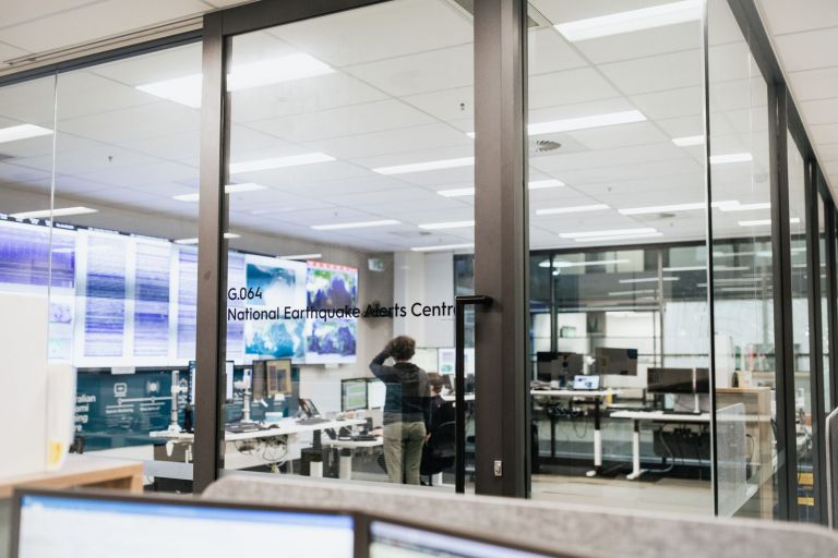
Earthquake information for media outlets
In the event of a significant earthquake, Geoscience Australia will provide up-to-date information for the public and media outlets in a timely manner.
Landsat helping to address food security challenges in Africa
Learning from the past and planning for the future. Using Earth observation products and tools in the fight to achieve global food security.
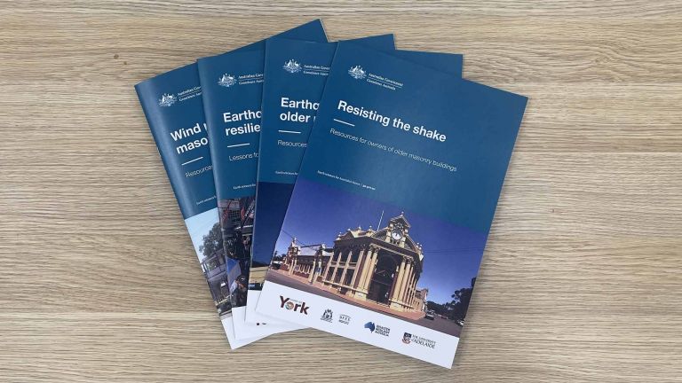
Resilience to the shake: science protecting older buildings against earthquakes
If an earthquake hits, how stable is your home or business? What can you do to make it safer and help it to survive a shake?
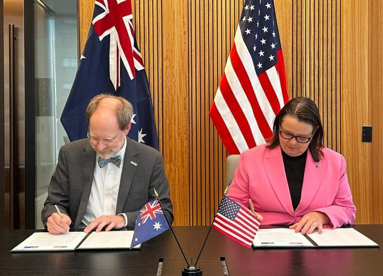
Australia to join US satellite program in Landsat 2030 International Partnerships Initiative
The Australian Government has agreed to join Landsat Next, the pioneering satellite program led by NASA and the US Geological Survey.
EFTF 2024 Showcase
Geoscience Australia will hold the final Exploring for the Future online public Showcase during the week of 12 August 2024, marking the conclusion of the 8-year program and celebrating its enduring legacy. Everyone is welcome!
New report shows Australia’s critical minerals are leading the way
Australia is a leading supplier of the minerals the world needs to reach net zero according to the latest Australia’s Identified Mineral Resources (AIMR) report.
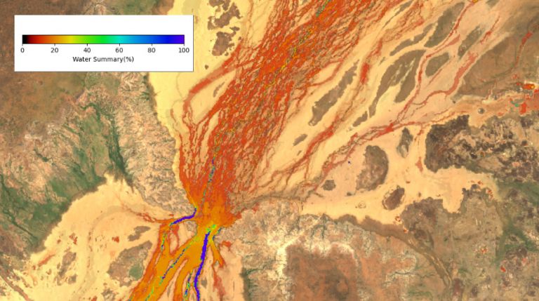
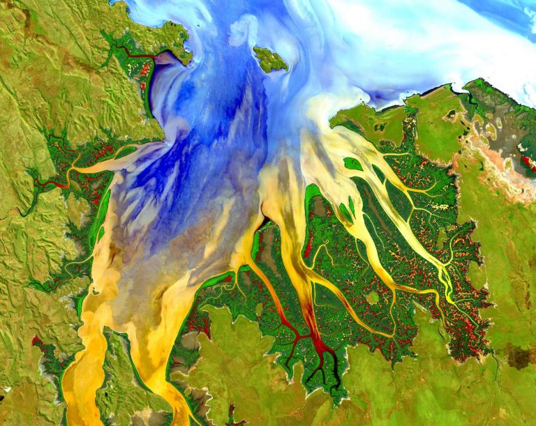
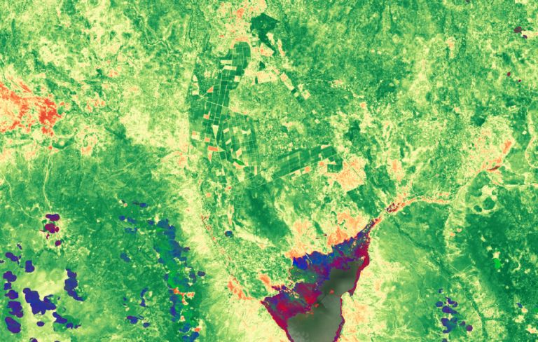
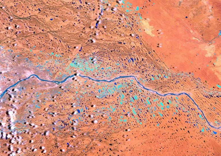
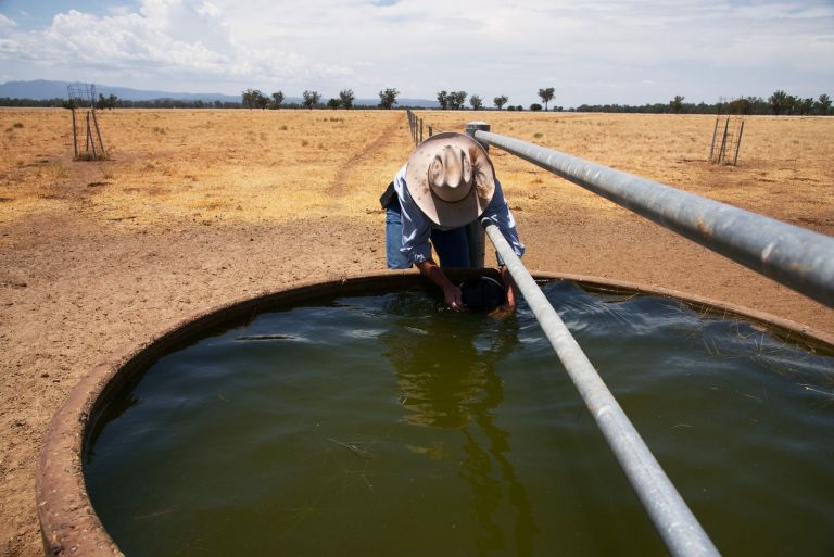
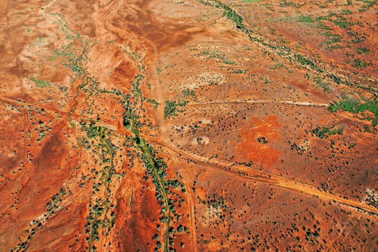
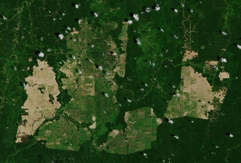
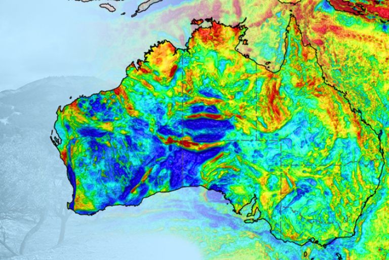
Floodwater cuts through dry Channel Country
The channels are always changing on the way to Kati Thanda-Lake Eyre in South Australia where recent heavy rains have seen flood plains filled in central Australia.
Unlocking insights on Australia’s people and economy
Explore location data on Australia's population and economy from the Australian Bureau of Statistics in the Digital Atlas.
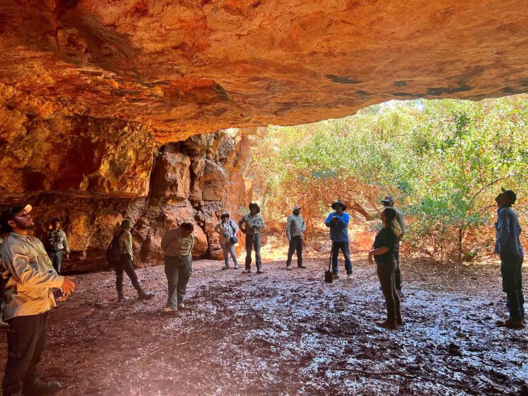
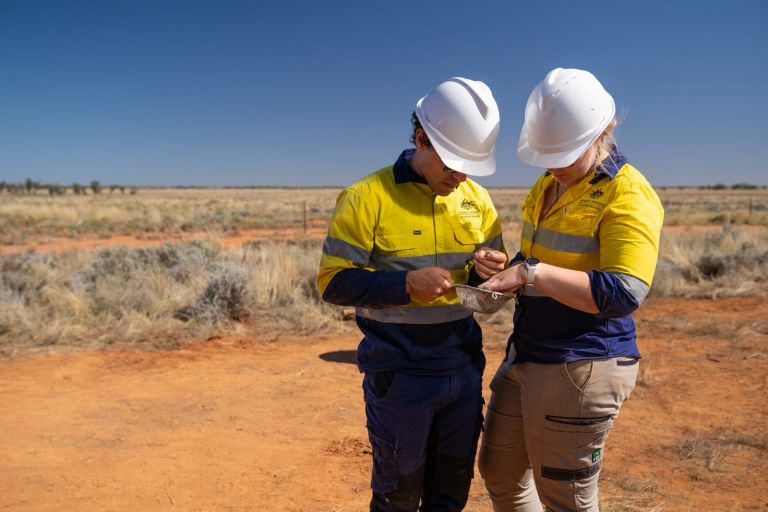
Caring for Country: Geoscience Australia strengthens ties with First Nations rangers
First Nations’ peoples hold the original knowledge of our land and sea. By linking their Caring for Country activities with Geoscience Australia’s Earth science data and knowledge, we can work together to achieve better outcomes to create a holistic view of our nation.
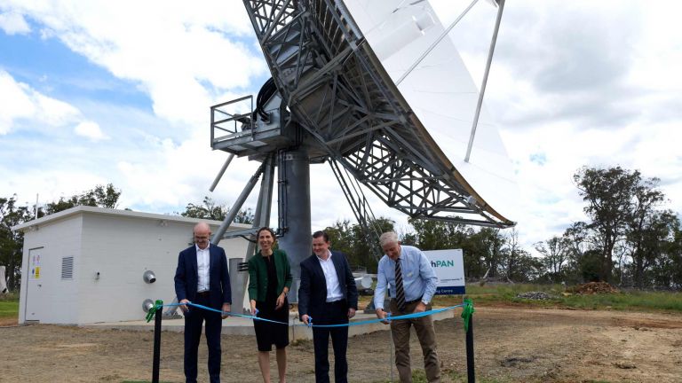
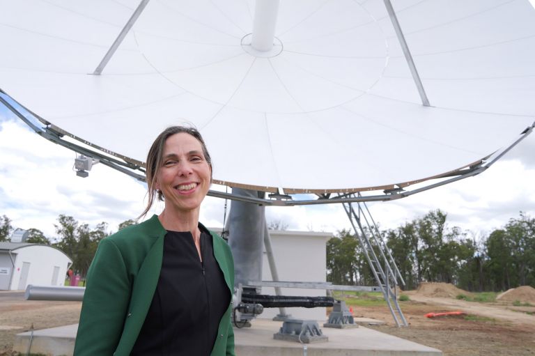
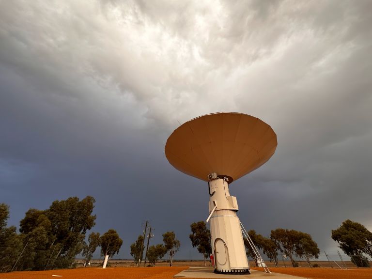
New satellite dish puts Australia in prime position
A ceremony today at Uralla in regional New South Wales marked the completion of the construction of the first of four satellite dishes being delivered under the Southern Positioning Augmentation Network (SouthPAN) program.
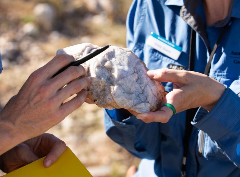
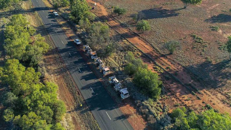
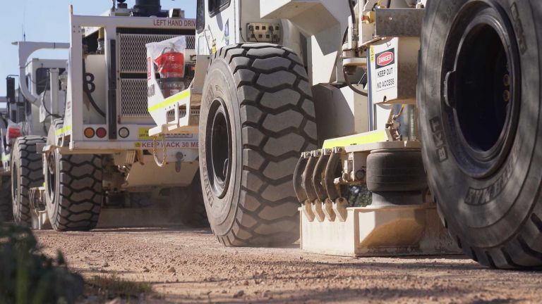
New scientific drilling results suggest potential major mineral prospectivity in western NSW regions
New results from a far-western New South Wales stratigraphic drilling campaign, conducted between March and June 2023, have shown the region’s potential to host new mineral resources, including gold, copper and nickel, as well as the critical minerals vital for Australia’s low emissions future.
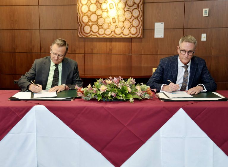
Geoscience Australia and ASNO sign 5-year MOU for the provision of nuclear explosion monitoring services
The Australian Safeguards and Non-Proliferation Office (ASNO) and Geoscience Australia have entered a 5-year arrangement to extend their partnership on monitoring for nuclear explosions globally under the Comprehensive Nuclear-Test-Ban Treaty (CTBT).
Landsat supporting greater international water security
Looking to the past to protect the future: Landsat-based Earth observation products and tools informing water security initiatives around the world.
Geoscience Australia on the world stage of Earth Observation
Australia has endorsed a post-2025 strategy that will provide a clear vision for the Earth Observation community to work together to address climate change, natural disasters and food security.
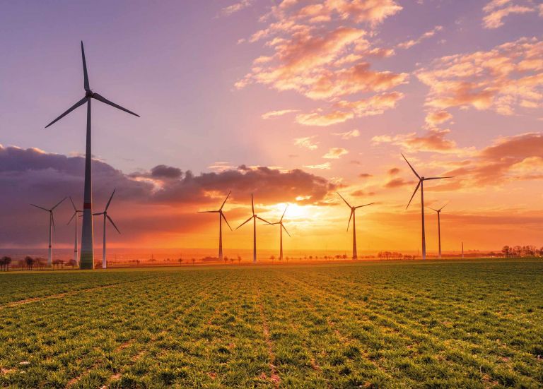
Eureka Prize-winning map pinpoints Australia’s renewable potential
Companies looking at green hydrogen or steel projects in regional Australia will have access to a free online tool to speed investment decisions.

Retrofitting Melbourne’s buildings to withstand earthquakes
Cost-effective mitigation strategy development for building-related earthquake risk.
Assessing the resilience of ageing buildings against earthquake hazards
How our collaborations and science improved the safety of communities in York, Western Australia.
Recent seismic activity in Australia
Australians in parts of Victoria, New South Wales and the Northern Territory may have felt the earth move beneath their feet over the past several days, after a seismically active period across the country.
Mapping Australia’s heavy minerals in world-first
The Australian Government’s Exploring for the Future program is continuing to deliver for the resources industry with the release of a new tool to support the discovery of minerals critical to the net zero transformation.
New seabed maps give sneak peek at what lies beneath
More than 1,500 individual seabed surveys have been combined to give sectors such as marine park management and offshore renewable industries - as well as storm surge modellers - a more comprehensive snapshot of what lies at the bottom of our oceans.
Mapping Australia's groundwater
The Australian Government is working to secure Australia's future water resources through a first of its kind stock take of the nation’s underground water reservoirs.
Using the power of Landsat and Digital Earth tools to understand coastlines in Australia and Africa
How leading-edge Landsat based Earth observation products and tools are helping us to understand Africa’s and Australia’s coastlines.
Precise positioning a huge boost to Australian economy: report
Government investment in precise positioning infrastructure will have injected an additional half a billion dollars into the economy by 30 June 2038, according to a new report commissioned by Geoscience Australia.
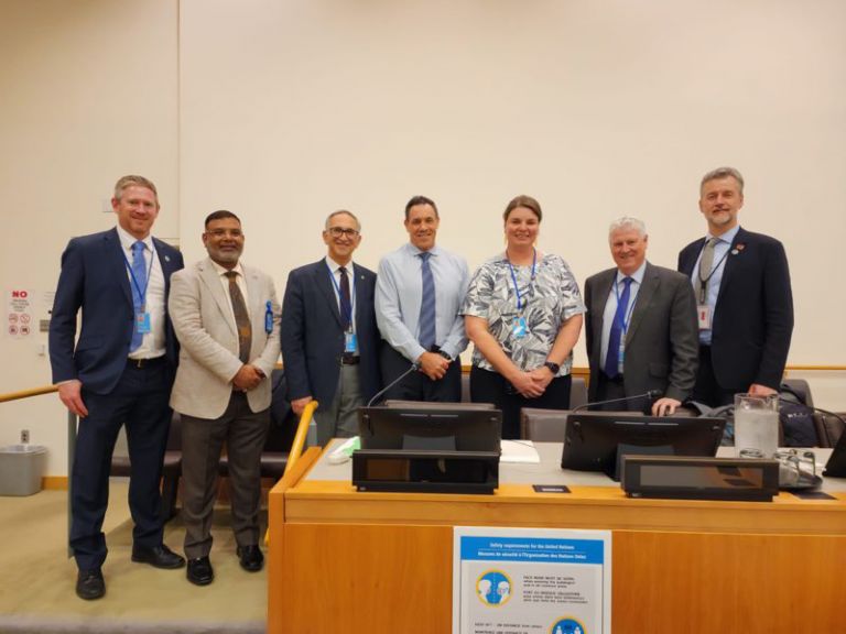
Geoscience Australia leads Australian delegation at UN-GGIM
Geoscience Australia recently led the Australian delegation to the 13th session of the United Nations Committee of Experts on Global Geospatial Information Management.
Ginan brings greater enhancements to precise positioning with version 2 release
Ginan, a home-grown suite of open-source tools that is used to analyse GNSS data in real-time has been given a boost with enhancements to provide users with real-time processing of observations from all the GNSS constellations without differencing or combining the data.
Trusted Environmental and Geological Information Program repository to support sustainable future
A new repository of geological and environmental data for key basin regions in Queensland and South Australia will help safeguard the environment while securing Australia’s low-emissions future.

The Economic Fairways Mapper wins coveted Eureka Prize for Innovative Research in Sustainability
The Economic Fairways Mapper research team, a Monash University and Geoscience Australia partnership, has won the Eureka Prize for Innovative Research in Sustainability announced at the 2023 Australia Museum Eureka Awards ceremony last night.
Government geoscience data and analysis supports $76b of added value to the economy: report
The work of Geoscience Australia and state and territory geological surveys is key to Australia’s drive to become a global renewable energy superpower, according to a new report by Deloitte Access Economics.
Geoscience Australia first in nation to receive three Cygnet Awards for action on workplace inclusion
Geoscience Australia has become the first Australian organisation to be presented with three prestigious Science in Australia Gender Equity (SAGE) Cygnet Awards, in recognition of its commitment to embed genuine and sustainable gender equity, and a diverse and inclusive workplace culture.
Antarctic geoscience: building a picture of the frozen continent
Scientists have unveiled the latest additions to Geoscience Australia’s Antarctic collection following an expedition to the icy waters of East Antarctica earlier this year.
Discovering the hidden geology of a buried basin
The longest deep-crustal seismic survey ever conducted by Geoscience Australia has been completed in central-western Queensland.
Using Earth observation to address climate change in South-East Asia
An initiative led by CSIRO and Geoscience Australia has supported Australian and South-East Asian scientists, students and innovators to build market interest for products and services that use Earth observation to address the impacts of climate change across South-East Asia.
A true partnership to improve position, navigation and timing services in Australia
What do precision agriculture, weather predictions and synchronising financial transactions all have in common?
Introducing the Digital Atlas: Unlocking the Power of Location-Based Data
In an exciting step forward in how we access and use location data, the Digital Atlas of Australia beta was released to the public on 30 June 2023.
Australia retains energy export world leader status
Geoscience Australia’s most recent stocktake of the nation’s energy resources has reinforced Australia’s importance in the global energy supply chain.
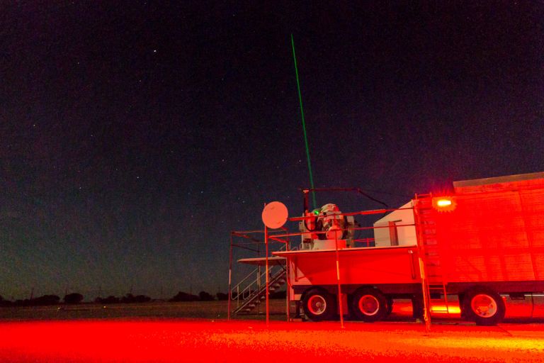
Yarragadee: the ‘geodetic supersite’ in the West Australian desert
Out in the West Australian desert at Yarragadee Geodetic Observatory station, Geoscience Australia scientists are shooting high-powered lasers at satellites flying thousands of kilometres overhead.

New phase of disaster resilience program to strengthen community safety in PNG
Australia has extended its Technical Disaster Risk Reduction Program by a further three years to support the Government of Papua New Guinea to monitor, detect and respond to natural hazards and keep communities safe.
Melbourne residents woken by 3.8 magnitude earthquake
More than 20,000 people in Sunbury, Victoria have reported feeling a magnitude 3.8 earthquake late last night.
Australia & New Zealand sign major contract with Inmarsat for new SouthPAN satellite service
Every major industry across Australia and New Zealand, from transport and construction to resources and agriculture, will gain positioning and navigation benefits from the Southern Positioning Augmentation Network’s (SouthPAN) new satellite service.

SouthPAN early Open Services are live
Industry can now access the benefits of accurate and reliable positioning services from the Southern Positioning Augmentation Network (SouthPAN), with early Open Services live as of 26 September 2022.
Advancing our understanding of the Great Artesian Basin
The Great Artesian Basin (GAB) is Australia's most significant hydrogeological system.
Data Driven Discoveries initiative to shed new light on resource potential
Geoscience Australia will re-examine decades-old seismic data as part of a new initiative to identify opportunities for energy, minerals and groundwater in a key underexplored basin.
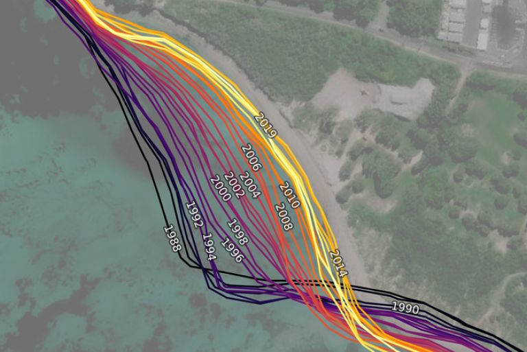
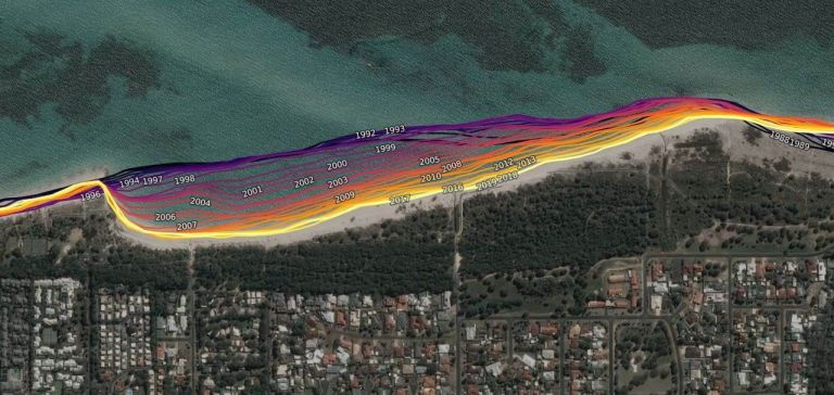
Satellite imagery reveals three decades of coastal change
The evolution of Australia’s coastlines can now be seen in unprecedented scale and detail, via a new tool developed by Geoscience Australia’s Digital Earth Australia (DEA) program.
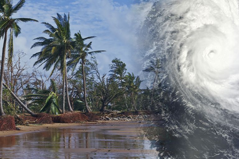
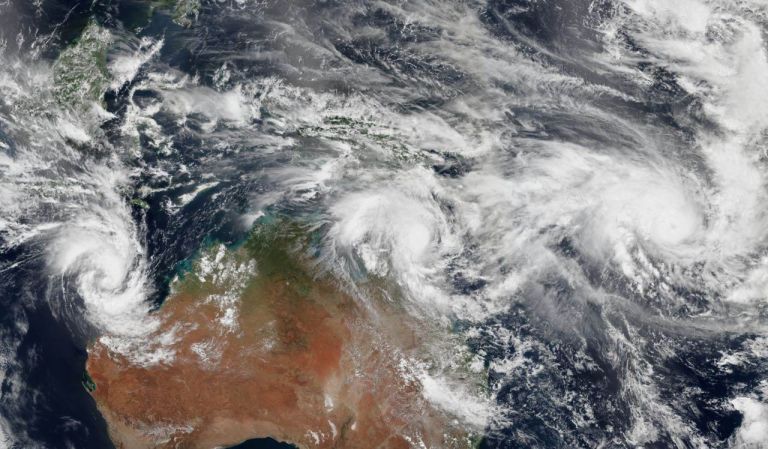
Preparing for the unexpected — Knowing when, where, and the impact of tropical cyclones
With the return of La Niña to Australia, it’s more important than ever for emergency managers and communities to be better prepared for severe weather.
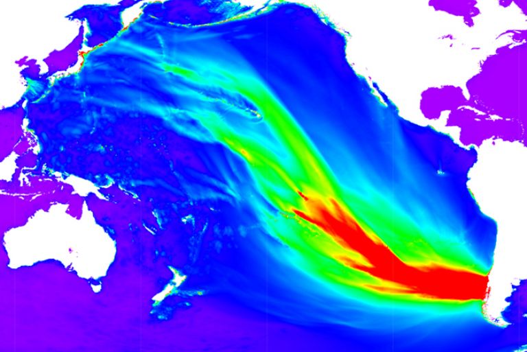
How the world’s largest earthquake made waves in Australia
Tsunami in Australia are rare, yet when they do occur, they pose a serious risk to our large coastal population. Looking at past events helps us understand how tsunami might impact Australia in the future.
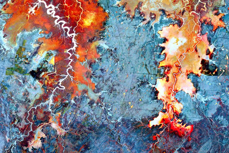
The beauty of Earth observations – art that informs our modern world
We have been observing the Earth and its processes for centuries to understand the world around us and how it’s changing.
Gravity: More than meets the eye
Ever opted to take the stairs over the lift for the sake of additional exercise? You’ll be pleased to know that on reaching the top, you’ll appear to weigh an average 100 mg less than what you did at the bottom!
Join our community
Get in touch
Have a question about Geoscience Australia or need help with using our data?
Email us at clientservices@ga.gov.au
or call 1800 800 173.