Marine geophysics
Page last updated:27 June 2014
Marine geophysics is a scientific discipline which uses the quantitative observation of physical properties to understand the seafloor and sub-seafloor geology. Both active and passive sensors are used to measure the shape and hardness of the seafloor as well as to define and map sub-seafloor structures.
Bathymetry and backscatter mosaics derived from multibeam sonar surveys are commonly used to make high spatial resolution maps of the seafloor which have numerous applications, including:
- geological research
- benthic habitat research
- marine boundary delineation
- safety of navigation
- defence.
Seismic systems and sub-bottom profilers use sound to actively image geological structures below the seafloor. Both use similar technology, but the seismic method is suited to registering deep structures for the purposes of preparing maps for such activities as petroleum exploration and developing an understanding of tectonics and basement architecture. In contrast, the lower power sub-bottom profilers image shows only the shallow sub-seafloor structures.
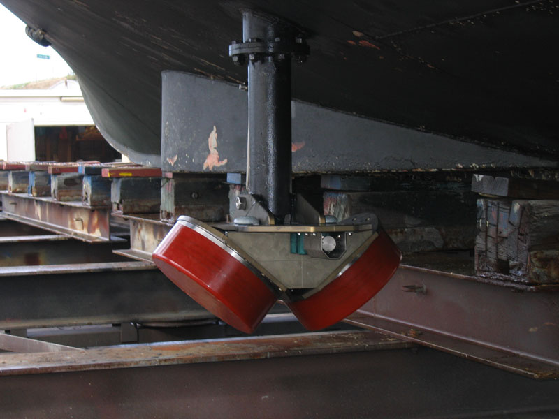
Transducers of a multibeam sonar in a dual head configuration
Potential field methods use magnetometers and gravimeters to passively measure the spatial changes in the magnetic and density properties of the Earth. These methods are especially useful for understanding the extent of regional-scale geological structures. Potential field datasets are often used in conjunction with seismic datasets to assist in the development of models that depict geological history and structure of sub-surface features.
Benthic video and still photography are survey techniques that are used to directly observe seafloor features typically over a relatively small area. Video and still photography is commonly used in combination with multibeam sonar so that seafloor features can be extrapolated over larger areas where direct observation is not practicable. Video and still photography has the added value of providing a tool to rapidly characterise benthic habitats and identify biota.