Southern Thomson Project
Page last updated:23 September 2025
Geoscience Australia, the Geological Survey of New South Wales and the Geological Survey of Queensland are undertaking a collaborative project in the Southern Thomson region of northern New South Wales and southern Queensland. The project is a contribution to the broader UNCOVER initiative, which seeks to address the challenges of 'greenfield' exploration in undercover areas in Australia through the provision of precompetitive fundamental geoscience data and concepts.
The Southern Thomson Project aims to understand the mineral systems potential of this region through four key objectives:
- Characterise subsurface geology and recognise favourable geological environments where major mineral systems may have been active
- Identify key elements that demonstrate mineral systems potential
- Understand the depth and nature of cover and
- Deliver new precompetitive data and concepts for industry, presenting the evidence for mineral systems potential in undercover, greenfield areas.
Project activities include synthesis and integration of available datasets, as well as the acquisition of an ensemble of geophysical, geochemical and geochronological datasets to allow prediction and testing of models of cover thickness and character, and styles of basement geology. The new understanding derived from this project will inform many future activities, especially those concerned with cover thickness determination and characterisation. A mineral systems analysis will also be conducted to assess the likely mineral potential of the region. In addition to other pre-competitive datasets, stratigraphic drilling will be acquired in key regions. The drilling will test geological models of undercover greenfield regions and also provide valuable core samples for a range of analytical studies.
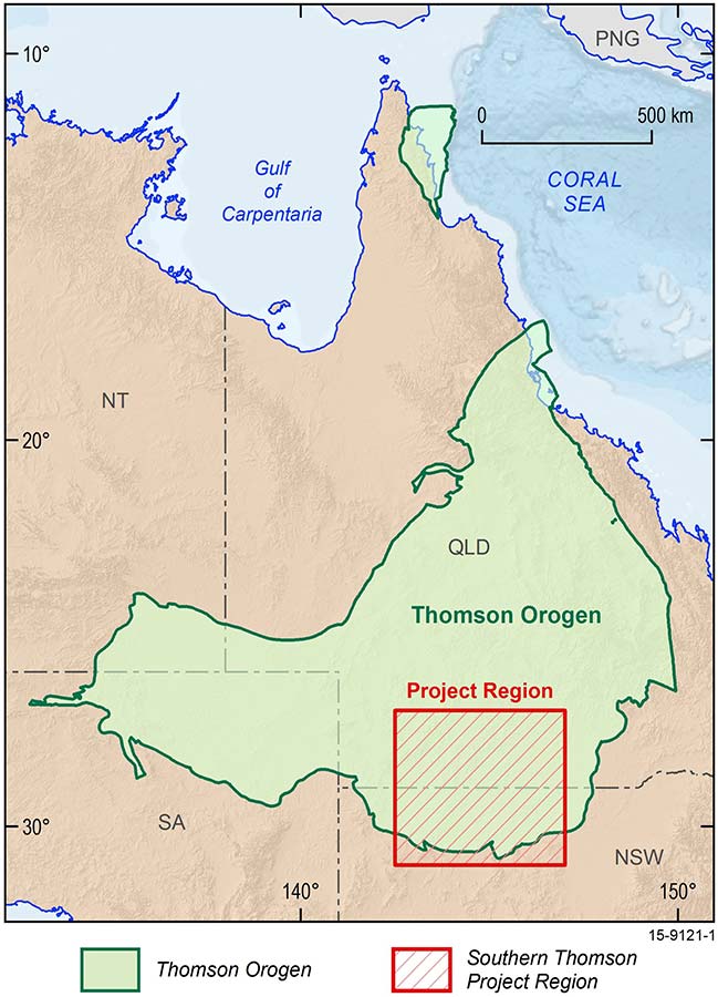
Map of northeastern Australia showing the location of the Thomson Orogen and the Southern Thomson Project region
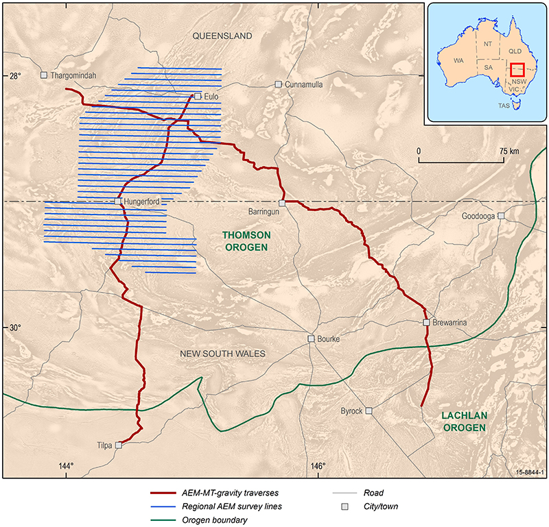
Map of the Southern Thomson Project showing the location of the new regional airborne electromagnetic survey, and magnetotelluric-gravity data traverses
Project deliverables
- Tongo 1 borehole completion record: Southern Thomson Project
- Congararra 1 borehole completion record: Southern Thomson Project
- Congararra 2 borehole completion record: Southern Thomson Project
- Euroli 1 borehole completion record: Southern Thomson Project
- Janina 1 borehole completion record: Southern Thomson Project
- Laurelvale 1 borehole completion record: Southern Thomson Project
- Milcarpa 1 borehole completion record: Southern Thomson Project
- GSQ Eulo 1 borehole completion record: Southern Thomson Project
- GSQ Eulo 2 borehole completion record: Southern Thomson Project
- Report on gold and molybdenum-tungsten potential of the southern Thomson Orogen, NSW
- Southern Thomson Magnetotelluric (MT) Survey Report and Preliminary Data Modelling
- An integrative approach to investigating crustal architecture and cover thickness in the Southern Thomson region: modelling new geophysical data
- Southern Thomson Region Geochemical Survey, Southwestern Queensland and Northwestern New South Wales
- Southern Thomson Orogen VTEMplus® AEM survey
- The Southern Thomson Orogen VTEMplus® AEM Survey: Using airborne electromagnetics as an UNCOVER application
- New SHRIMP U-Pb zircon ages from the Cuttaburra and F1 prospects
- Estimating Cover Thickness in the Southern Thomson Orogen - Results from the pre-drilling application of refraction seismic, audio-magnetotelluric and targeted magnetic inversion modelling methods on proposed borehole sites