Australian Landforms and their History
Page last updated:31 October 2014
Australia is a land of geological contradictions with some of the oldest features in the world alongside rocks which are in the process of formation. The continent is home to rocks dating from more than 3000 million years while others are the result of volcanic activity which continued up to only a few thousand years ago.
Recently, scientists have been able to obtain a much clearer picture of Australia's geological past through deep seismic surveys, which has provided new information about how the continent was formed, particularly around Broken Hill, Mount Isa, Iron Knob [PDF 62.1 KB] and West Arnhem Land [PDF 64.4 KB].
Although the shape of Australia is due largely to tectonic Earth movements and long term changes in sea level, most of its topography is a result of prolonged erosion by wind and water. About 50 per cent of Australia's rivers drain inland and often end in ephemeral salt lakes. Many of the features of the drainage pattern have a very long history, and some individual valleys have maintained their position for millions of years.
The Finke River in central Australia is one of the oldest rivers in the world and salt lakes of the Yilgarn region in Western Australia are the remnants of a drainage pattern which was active before continental drift separated Australia from Antarctica. Australia began its journey across the surface of the Earth as an isolated continent between about 55 and 10 million years ago, and continues to move north by about seven centimetres each year.
Australia's present topography is the result of a long landscape history, which, fundamentally, started in the Permian Period when Australia was very near the South Pole, and much of the continent was glaciated by large ice caps. After the ice melted, parts of the continent subsided and formed sedimentary basins such as the Eromanga Basin in South Australia. By early in the Cretaceous Period, Australia was already so flat and low that a major rise in sea level divided it into three landmasses as a shallow sea spread over the land.
In the following Paleogene and Neogene Periods Australia was made up of a broadly undulating landscape, varied by a number of sedimentary basins including the Murray, Gippsland, Eucla, Carpentaria and Lake Eyre basins. The Eastern Highlands also were uplifted about this time to form the Great Divide which separates rivers flowing towards inland Australia from rivers flowing to the Pacific Ocean. Erosion of the newly-formed continental edge on the eastern side formed the Great Escarpment, which can be traced from near the tip of Cape York Peninsula to south eastern Victoria.
Throughout the Paleogene and Neogene Periods, volcanoes erupted in eastern Australia and huge lava plains covered large areas. This activity continued up to a few thousand years ago in Victoria and Queensland. Australia's youngest mainland volcano is Mt Gambier in South Australia which last erupted only about 6000 years ago. On the remote Australian Territory of Heard Island and McDonald Islands in the Southern Ocean, volcanic activity occurred on Mawson's Peak in the mid 1980s, and activity on the nearby McDonald Islands occurred during the 1990s.
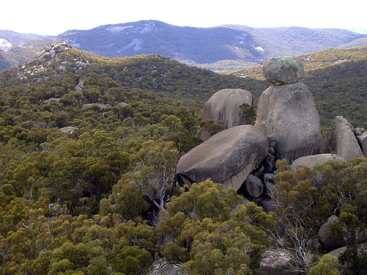
A unique rock formation in New South Wales known as the Sphinx.
Much of the Western Plateau has existed as a landmass for more than 500 million years and is made up of individual plateaus, including the Kimberley, Hamersley, and Yilgarn. These plateaus in part comprise cratons such as the Yilgarn Craton and the Pilbara Craton. In contrast, the Nullarbor Plain is an uplifted sea floor, a limestone plain of Miocene age. The rocks along a coastal strip around the Western Australian capital of Perth are much younger than the adjacent Yilgarn Craton and are separated from it by the Darling Fault escarpment.
Much of the centre of Australia is flat, but there are numerous ranges such as the MacDonnell and Musgrave Ranges, as well as some individual structures, of which the best known is Uluru. Faulting and folding in the areas took place long ago, and the current topography is the result of millions of years of erosion and redistribution of sediments removed from high areas and filled-in depressions in this largely internal drainage system. In the case of Uluru and the nearby Kata Tjuta, the surrounding countryside has been eroded to a plain around these resistant geological phenomena.
Towards the east, the flat land rises to the Great Divide which runs parallel to the east coast from the tip of the Cape York Peninsula in Queensland almost 4000km south to the Grampians in Victoria. This separates rivers flowing to the west and north from those flowing to the Pacific. The Eastern Highlands are made up of a series of mountains in the south topped by Mount Kosciuszko and volcanic plugs, ash domes and flow remnants further north. These are evident in areas such as the Mount Warning Shield Volcano formed about 23 million years ago on the New South Wales-Queensland border, the Glass House Mountains further north and Mount Surprise in North Queensland. These formations were created as Australia moved over a volcanic hotspot. Some southern plateaus are dissected by erosion into rugged hills with the eastern edge forming the high escarpments. Some of Australia's most spectacular waterfalls occur where rivers flow over the Great Escarpment.
The past few million years were notable for the Quaternary ice age which resulted in various glacial and interglacial periods. The last glacial period was at its most intense about 20 000 years ago, and by around 11 700 years ago the ice had retreated and rising sea levels separated mainland Australia from Tasmania and New Guinea. In Tasmania there is evidence of three different glaciations but on mainland Australia, there is evidence of only the last glaciation. During this event ice covered about 25 square kilometres in the vicinity of Mt Kosciuszko, with the most significant remnant being the Blue Lake cirque. On the other hand, glaciation in Tasmania during this period was more widespread and covered a significant part of the State's western region. The most well known remnants from glaciation in Tasmania are Crater Lake and Dove Lake near Cradle Mountain in the island's central highlands.
The landforms of today are the result of prolonged, continuous processes of movement and erosion over millions of years giving rise to a variety of landscapes across Australia. These are continuing to undergo change as the continent moves north. Changing climate has been important also, with increasing aridity during the past 20 to 30 million years having a distinct impact, especially in central Australia where lakes and river systems became drier and more reliant on flows from the wetter margins of the continent.