Asia-Pacific Reference Frame (APREF)
Page last updated:22 May 2024
Background of APREF
The use of positioning technology is growing rapidly in industries such as mining, agriculture and construction. There is an increasing demand for positioning services to inform emergency services, hazard modellers, and land, utility and asset managers. These users have a need for centimetre level or better geodetic infrastructure. To provide this, the Asia-Pacific region needs a consistent, continually refined and easily accessible reference frame.
In the Asia-Pacific region there are a substantial number of state-of-the-art Global Navigation Satellite System (GNSS) networks, which are commonly operated by national mapping agencies or private sector organisations. These networks represent an important and significant investment by the respective governments and industry in their own spatial infrastructure. However, when the Asia-Pacific region is viewed as a whole:
- the infrastructure is comparatively sparse, inaccurate, and difficult to access when compared to other parts of the world such as Europe and the Americas
- in general, the networks are not linked together, or to the global geodetic reference frame
- the lack of data sharing impacts on the accuracy and type of geodetic analysis that can be performed.
The Asia-Pacific regional geodetic reference frame is below the standard that is now available in other regions. This can be detrimental to regional scientific studies and national geodesy, leading to a loss in competitive advantage by nations in the Asia-Pacific region.
Recognising the importance of improving the regional geodetic framework, member countries of the 18th United Nations Regional Cartographic Conference for Asia and the Pacific (UNRCC-AP; October 2009, Bangkok), agreed to improve the reference frame in the Asia-Pacific region. APREF has made significant progress in developing the Asia-Pacific regional geodetic infrastructure; however, it can still be characterised as being a work in progress. APREF is a voluntary, collegial, non-commercial endeavour, where participating organisations contribute their own resources.
Objectives of APREF
The broad objective of APREF is to create and maintain a densely realised and accurate geodetic framework, based on continuous observation and analysis of GNSS data. APREF addresses issues associated with the definition, realisation and maintenance of the Asia-Pacific Reference Frame.
In the short-term, the APREF project:
- encourages sharing of GNSS data from Continuously Operating Reference Stations (CORS) in the region
- has developed an authoritative source of coordinates, and their respective velocities, for geodetic stations in the Asia-Pacific region.
In the longer term, the APREF project:
- will develop and maintain the APREF Permanent CORS Network, in close cooperation with International GNSS Service (IGS)
- improve the contribution of APREF sites to the International Terrestrial Reference Frame (ITRF)
- provide more infrastructure to support geodetic projects
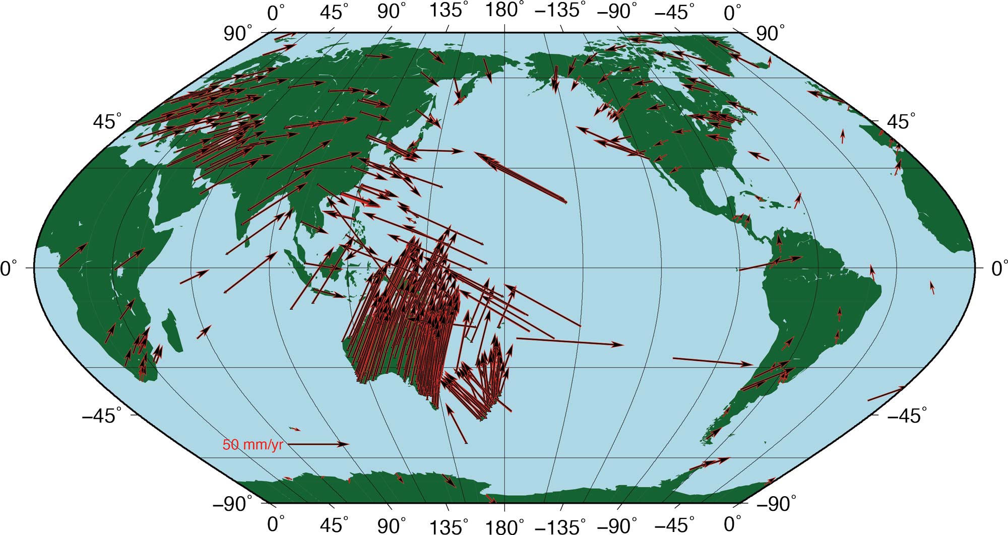
- establish a dense velocity field model in Asia and the Pacific for scientific applications and the long-term maintenance of the Asia-Pacific reference frame
- organise regular symposia addressing activities carried out at national and regional levels related to the work and objectives of APREF.
APREF organisational structure
The APREF project consists of:
- Central Bureau
- Network operators
- Data centres
- Analysis centres.
The Central Bureau, within Geoscience Australia, functions as the 'day-to-day' APREF coordinating body. Specifically, the Central Bureau ensures that APREF products are made available to the global geodetic community. Furthermore, GA are the combination centre responsible for analysing, combining and validating the individual solutions of the contributing Analysis Centres, and for expressing the combined solution in the ITRF. The APREF project has three Local Analysis Centres (LACs): Geoscience Australia, Office of Surveyor-General Victoria, Australia, and the Institute of Geodesy and Geophysics, Chinese Academy of Sciences
Participating agencies
In response to the March 2010 Call for Participation, a large number of agencies have agreed to participate in APREF, Table 1 summarises their commitments.
| Country/Locality | Responding Agency | Proposed Contribution | ||
|---|---|---|---|---|
| Analysis | Archive | Stations | ||
| Afghanistan | National Geodetic Survey (USA) | 2 | ||
| Alaska, USA | National Geodetic Survey (USA) | 7 | ||
| American Samoa | National Geodetic Survey (USA) | 1 | ||
| Australia | Geoscience Australia | ✓ | ✓ | 167 |
| Australia | Curtin University | 1 | ||
| Australia | Department of Natural Resources, Mines and Energy, QLD | 13 | ||
| Australia | Department of Environment, Land, Water and Planning, Victoria | ✓ | 161 | |
| Australia | Department of Infrastructure, Planning and Logistics, Northern Territory | 5 | ||
| Australia | Department of Primary Industries, Parks, Water & Environment, Tasmania | 4 | ||
| Australia | Department of Finance, Services & Innovation, New South Wales | 165 | ||
| Australia | RTK NetWest | 21 | ||
| Australia | IPS Radio and Space Services | 3 | ||
| Australia | Department of Transport and Main Road, Queensland | 45 | ||
| Australia | Hexagon | 89 | ||
| Australia | UPG and Trimble | 40 | ||
| Australia | Position Partners Pty Ltd | 100 | ||
| Australia | Department of Environment and Science QLD | 13 | ||
| Australia | RPS Australia East Pty Ltd | 5 | ||
| Australia | Cody Corporation Pty Ltd | 1 | ||
| Australia | Gladstone Ports Corporation | 1 | ||
| Australia | Jet Propulsion Laboratory | 1 | ||
| Australia | National Geospatial-Intelligence Agency, USA | 2 | ||
| Australia | European Space Agency European Space Operations Centre | 1 | ||
| Brunei | Survey Department, Negara Brunei Darussalam | 1 | ||
| Brunei | Japan Aerospace Exploration Agency | 1 | ||
| Canada | Geodetic Survey of Canada | 1 | ||
| China | The Institute of Geodesy and Geophysics, Chinese Academy of Sciences | ✓ | ||
| China | Helmholtz Centre Potsdam GFZ German Research Centre for Geosciences Geodes | 1 | ||
| China | Jet Propulsion Laboratory | 3 | ||
| China | National Institute of Metrology, China | 1 | ||
| China | Chinese Academy of Surveying & Mapping | 1 | ||
| China | Tibet Autonomous Regional Buerau of Surveying and Mapping | 2 | ||
| China | Urumqi Astronomical Observatory | 1 | ||
| China | Wuhan University | 1 | ||
| Cook Islands | Geoscience Australia and Lands Department of Cook Islands | 1 | ||
| Cook Islands | Geospatial Information Authority of Japan | 1 | ||
| Ethiopia | Ethiopian Mapping Agency | 3 | ||
| Federated States of Micronesia | Geoscience Australia and Weather Service of the Federated States of Micronesia | 1 | ||
| Fiji | Geoscience Australia and Lands Department of Fiji | 8 | ||
| French Polynesia | Geospatial Information Authority of Japan | 1 | ||
| French Polynesia | National Geospatial-Intelligence Agency, USA | 1 | ||
| French Southern Territories (the) | Centre National d'Etudes Spatiales | 1 | ||
| Guam, USA | National Geodetic Survey (USA) | 1 | ||
| Hong Kong, China | Survey and Mapping Office | 18 | ||
| India | Indian Institute of Technology Kanpur | 1 | ||
| India | Helmholtz Centre Potsdam GFZ German Research Centre for Geosciences Geodes | 1 | ||
| India | ISRO Telemetry, Tracking and Command Network, India | 3 | ||
| Indonesia | Bakosurtanal | 8 | ||
| Iran | National Cartographic Center, Iran | 6 | ||
| Iraq | National Geodetic Survey (USA) | 6 | ||
| Japan | Geospatial Information Authority of Japan | ✓ | 12 | |
| Japan | Helmholtz Centre Potsdam GFZ German Research Centre for Geosciences Geodes | 1 | ||
| Japan | Electronic Navigation Research Institute | 1 | ||
| Japan | Jet Propulsion Laboratory | 1 | ||
| Japan | Geographical Survey Institute | 1 | ||
| Japan | Space-Time Standards Laboratory National Institute of Information and Communications Technology, Japan | 1 | ||
| Kazakhstan | Kazakhstan Gharysh Sapary | 2 | ||
| Kazakhstan | Jet Propulsion Laboratory | 1 | ||
| Kiribati | Geoscience Australia and Weather Service of Kiribati | 1 | ||
| Kiribati | Geospatial Information Authority of Japan | 2 | ||
| Macau, China | Macao Cartography and Cadastre Bureau | 3 | ||
| Marshall Islands | Geoscience Australia and Weather Service of Marshall Islands | 1 | ||
| Malaysia | Department of Survey and Mapping Malaysia, JUPEM | 7 | ||
| Malaysia | Japan Aerospace Exploration Agency | 1 | ||
| Mongolia | Administration of Land Affairs, Construction, Geodesy and Cartography (ALACGaC) | 6 | ||
| Mongolia | Helmholtz Centre Potsdam GFZ German Research Centre for Geosciences Geodes | 3 | ||
| Nauru | Geoscience Australia and Lands Department of Nauru | 1 | ||
| New Zealand | Land Information New Zealand | 48 | ||
| New Zealand | Centre National d'Etudes Spatiales | 1 | ||
| New Zealand | National Geospatial-Intelligence Agency, USA | 2 | ||
| Northern Mariana Islands | National Geodetic Survey (USA) | 1 | ||
| Papua New Guinea | National Mapping Bureau, Papua New Guinea, and Geoscience Australia | 2 | ||
| Papua New Guinea | PNG Office of the Surveyor-General | 2 | ||
| Papua New Guinea | Porgea Joint Venture,PNG | 2 | ||
| Philippines | Department of Environment and Natural Resources, National Mapping and Resource Information Authority | 6 | ||
| Philippines | Jet Propulsion Laboratory | 1 | ||
| Philippines | Centre National d'Etudes Spatiales | 1 | ||
| Samoa | Geoscience Australia and Lands Department of Samoa | 1 | ||
| Samoa | Land Information New Zealand | 1 | ||
| Solomon Islands | Geoscience Australia and Weather Service of Solomon Islands | 1 | ||
| Thailand | King Mongkut's Institute of technology Ladkrabang | 1 | ||
| Tonga | Geoscience Australia and Lands Department of Tonga | 2 | ||
| Tuvalu | Geoscience Australia and Weather Service of Tuvalu | 1 | ||
| USA (Hawaii) | Jet Propulsion Laboratory | 2 | ||
| USA (Hawaii) | Federal Aviation Administration, USA | 1 | ||
| USA (Honolu) | National Weather Service, USA | 1 | ||
| USA | U.S. Coast Guard | 3 | ||
| USA | NOAA Earth System Research Laboratory | 1 | ||
| Vanuatu | Geoscience Australia and Lands Department of Vanuatu | 2 | ||
Data and products
APREF data and products contributed to and generated by the APREF project are provided with an open access data policy via the internet following the practice of the IGS. Products include:
- Daily GNSS RINEX data
- Station log files
- Weekly coordinate estimates in SINEX format
- APREF network and time-series plots
- Most recent report of the APREF project
How can I participate in APREF?
APREF encourages participation from organisations active in the Asia-Pacific region who are prepared to, on an ongoing basis (at least two years):
- provide GNSS data from CORS Stations
- provide access and on-line archiving of APREF data and products for users; and/or
- routinely analyse some, or all, of the APREF GNSS CORS data, providing station coordinate estimates.
To participate in APREF, the responding agencies should write a Letter of Intent to
APREF Central Bureau
Dr Anna Riddell
Positioning Australia Branch
Geoscience Australia
GPO Box 378 Canberra ACT 2601 Australia
Telephone: +61 2 6249 9359
This Letter of Intent should include the following information:
- organisation name and address
- name, address and contact details of the primary and secondary points of contact within the contributing organisation
- specific details of the organisation's proposed contribution to APREF.
Station and data standards
If possible, APREF stations should meet the standards of the International GNSS Service (IGS).
Critically, each station operator must ensure that the contributed stations will operate for at least two years. Furthermore, station metadata, such as receiver and antenna information, is a mandatory requirement for participation in the APREF project.
All GNSS data should be made available in RINEX format at a 30-second sampling rate and where available, participants may also submit broadcast ephemeris and meteorological RINEX files. Contributions of Regional Navigation Satellite Systems (RNSS) data are also most welcome. See Procedures for becoming an APREF station for further details.
Analysis standards
For those organisations wanting to contribute solutions, the analysis must be to the standard consistent with the IERS Conventions 2010 (for example using the Bernese, GIPSY, GAMIT, NAPEOS, EPOS, PAGES software packages). For further details see IERS Conventions Center.
Contributed solutions are in the SINEX format.
APREF mandate
APREF was mandated by Resolution 1 (Regional Geodesy) of the 18th United Nations Regional Cartographic Conference (UNRCC) for Asia and the Pacific, 26 - 29 October 2009, Bangkok, Thailand. APREF is also endorsed by the: International GNSS Service (IGS), United Nations Office for Outer Space Affairs (UNOOSA), and the Federation of International Surveyors (FIG).