A new 3D Petroleum System Model for the Exmouth Sub-basin, related data and interpretation is available from NOPIMS or ausgeodata@ga.gov.au. The data and models cover the area from the Exmouth SLB15 MC 3D MSS Seismic Survey (ENO0603273) and is built on interpretation of the entire Mesozoic succession and has included an improved understanding of fault timing and the complex resulting structure.
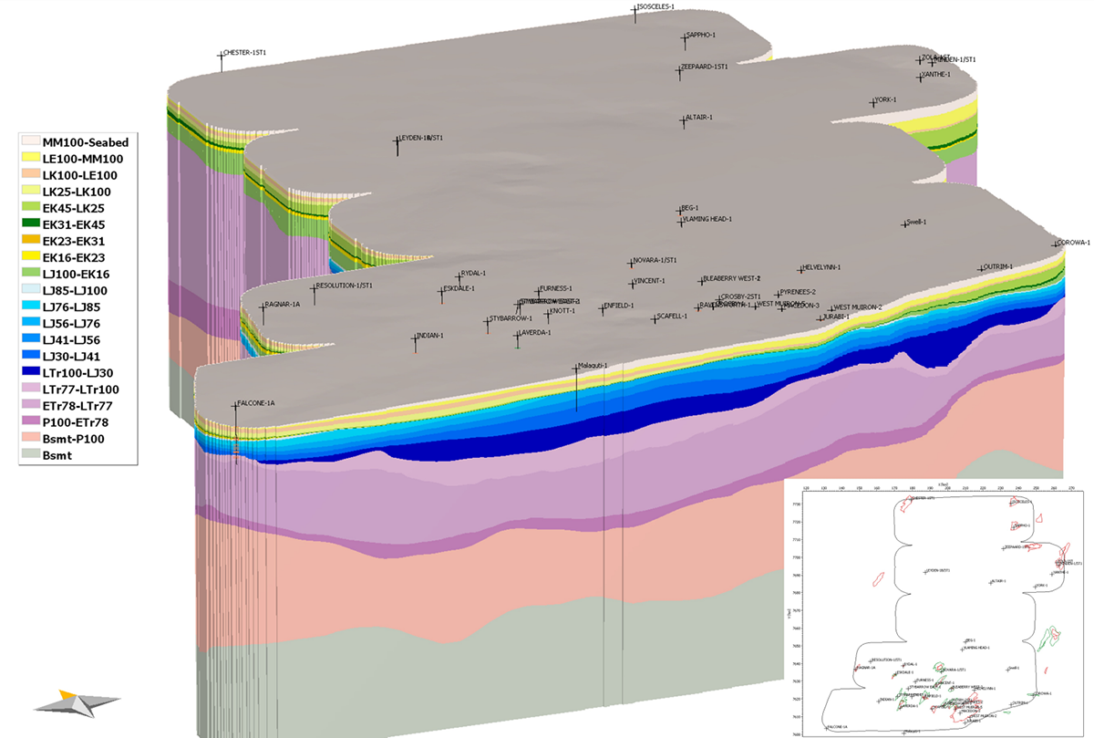
Figure 1: 3D model based on the Exmouth SLB15 MC 3D MSS Seismic Survey.
List of Models
- Exmouth-3D_gen-only
- 3D model (master model)
- Generation-only
- Not sampled (original grid distance: 250m)
- Source rock properties assigned to the basal sublayers of each Jurassic source rock
- Exmouth-3D_migr_2x2
- 3D model (master model)
- Hydrocarbon migration and accumulation (combined migration modelling method)
- Sampled by factor 2x2 (grid distance: 500m)
- Source rock properties assigned to the basal sublayers of each Jurassic source rock
- Exmouth-3D_gen-only_Scen-2
- 3D model (scenario 2)
- Generation-only
- Not sampled (original grid distance: 250m)
- Source rock properties assigned to the entire Jurassic section
- Exmouth-3D_migr_2x2_Scen-2
- 3D model (scenario 2)
- Hydrocarbon migration and accumulation (combined migration modelling method)
- Sampled by factor 2x2 (grid distance: 500m)
- Source rock properties assigned to the entire Jurassic section
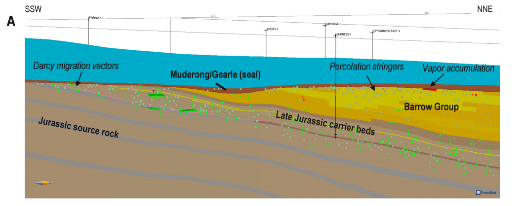
Figure 2: ‘Combined migration’ modelling along a ~S-N section extracted from the simulated 3D model with litho-facies overlay.
Products available
- Basin study report – including horizons, faults and well tops.
- PetroMod project including;
- 3D basin and petroleum system models based on the 2017 3D Schlumberger Multiclient broadband seismic survey.
- 2D basin and petroleum system models based on data from open-file 2D seismic legacy composites courtesy provided by Geoscience Australia.
- 1D basin and petroleum system models extracted from the 3D master model at selected well locations
- Petrel project including;
- Final interpreted geological surfaces and faults used as model input for petroleum system modelling
- Well data
- Cultural data
- Extracted 2D seismic grid from underlying Exmouth SLB15 MC 3D MSS Seismic Survey PSDM volume (in TWT)
- 2D Seismic PreSDM Extract (10km x 10km ~2000 km) and ~600 km of well tie seismic from the Exmouth SLB15 MC 3D MSS Seismic Survey is also available in SEGY format.