NOPTA is currently preparing to release a new NOPIMS website to better integrate with the NEATS website, data discovery and streamline submissions.
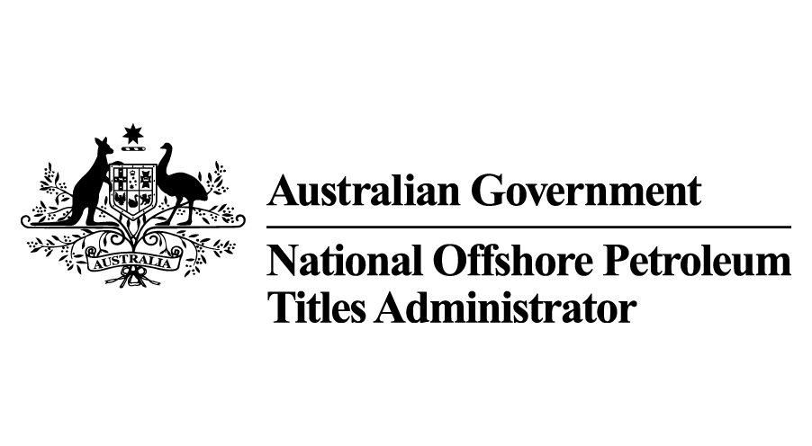
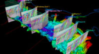
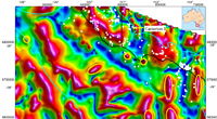
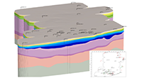
Reports and data, including analysis and interpretation of 129 wells and 26,150 km2 3D seismic, incorporated into regional predictive models highlighting potential CCS storage opportunities.
Have your say on the way you access and receive data to help optimise our services and future-proof our data delivery solutions.
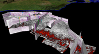
Pre-stack Depth Migration Reprocessing of 29 3D surveys covering 26,150 km2 to improve understanding of CCS in offshore Northwest Australia.
14 X 3D surveys merged covering an area of 8092 sqm.
10 potential release areas available for consultation. Processed will close Tuesday 27 June 2023
Regional Otway Basin interpretive data product for OB2020 seismic survey and 2020 reprocessed seismic data.
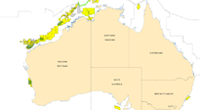
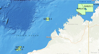
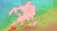
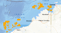
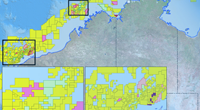
Bidding is now open for 10 areas across the Bonaparte, Browse, northern Carnarvon and Gippsland basins.
Over 8,200 line kilometres of gravity and magnetic data enhanced to produce 1000 m grid cell size.

Registration to attend the 2022 Offshore Petroleum Exploration Acreage Release webinar is now open. The event will stream on Wednesday 24 August at 1:30pm AEST.

Closed. Area nominations for the 2022 Offshore Greenhouse Gas Storage Acreage Release close 11:59 pm AEST Sunday 31 July 2022.
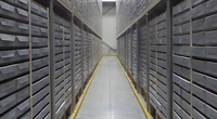
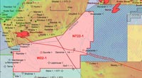
Bidding is now closed: 5 release areas available for offshore greenhouse gas storage exploration.
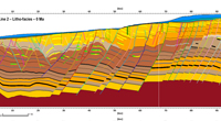
Regional interpretation and petroleum system modelling for the Deep-water Offshore Otway Basin
7516 km new 2D PreSDM, 6,453 km reprocessed 2D PreSDM and 18,524 km reprocessed 2D PreSTM.
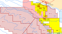
Bidding is now open for 21 areas across six basins.
Nominated areas for comment. Process will close the 8 March 2021.
The 2020 Offshore Petroleum Acreage Release shape file is now available on NOPIMS.
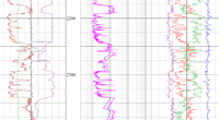
Direct access to 10 new digitised logs available for wells drilled offshore in the Otway Basin.
Consultation on potential areas for the 2020 Offshore Petroleum Acreage Release is now open.
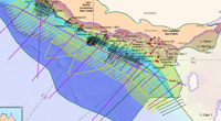
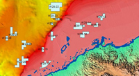
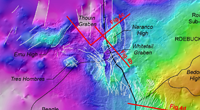
New 3D Petroleum System Model for the Exmouth Sub-Basin.
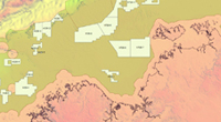
Updated data package now available for Triassic Horizon Grids, Isochron Grids, and Fault Maps, central North West Shelf.
Bidding is now open for the 2019 Offshore Petroleum Exploration Acreage Release.
Consultation on potential areas for the 2019 Offshore Petroleum Acreage Release has now closed.

We are pleased to present the latest developments made to the National Offshore Petroleum Information Management System. These enhancements will improve users experience by providing access to over 50 years of data submission under various legislation (PSSA, PSLA, OPGSSA).
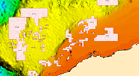
The 2018 Acreage Release areas are now available in the National Offshore Petroleum Information Management System as polygon outlines.
NOPIMS now includes open file information related to Petroleum Mining Samples held at NOPDCR in Canberra.

Geoscience Australia has won with NOPIMS, the National Archives of Australia's Award for Digital Excellence (Medium Agency Category).
In 2015, Geoscience Australia undertook the acquisition and processing of a pre-competitive dataset, the Gippsland Southern Margin Infill 2D Seismic Survey, GA0352.
Between November 2014 and January 2015, Geoscience Australia acquired 3 300km of new 2D seismic data in the northern Houtman Sub-basin.
The latest release of the NOPIMS includes an improved user interface; additional and improved functionalities, such as cross multi browser compatibility, new higher quality maps with ArcGIS integration; the inclusion of web services; and integration with Geoscience Australia's Web Map Services (WMS).