The Otway 3D Mega merge is a Geoscience Australia product covering an area of 8092 sq. km in the offshore Otway Basin (Fig 1.). It consists of data and processing report from the post-stack matching and merging of 11 legacy input 3D volumes from 14 surveys. Geoscience Australia awarded the work, to reprocess the 3D volumes into one single volume, to DUG to produce a regularised and seamless dataset of the highest possible quality within the rapid turnaround time.
The objective of the 3D Mega merge project was to produce a regularised and seamless dataset (Fig 1.) to assist a regional study of the Offshore Otway Basin and improve the quality of existing interpretation, as well as facilitate industry’s accessibility to data to expedite exploration. Inputs to the final product included stacked volumes of varying vintage and processing flow, spanning 17 years; differences including processing versions, migration method, angle range and grid orientation. These were regularised to a common grid before matching and merging to produce a final output.
The resultant volume enables;
- more continuous tracking of events using auto trackers, including waveform picking
- production of normalised amplitude maps and extraction of seismic attributes to map extents of geological features across survey boundaries
- faster interpretation of structure and events using contiguous time slices and generation of similarity/variance attributes
- better delineation of structure through better imaging of fault blocks and readily recognising changes in fault trend.
The data is available from NOPIMS as 11 separate files and volumes (final) for download (up to 54 Gb each) or as single volumes (raw and final – ENO0810804) from ausgeodata@ga.gov.au. On the NOPIMS webpage, users will have to go to the “Reprocessing” tab, not Survey tab, to find it and Search for the following text entries:- “Mega” under “Name”, or “Geoscience” under “Operator” or “Otway” under “Basin”.
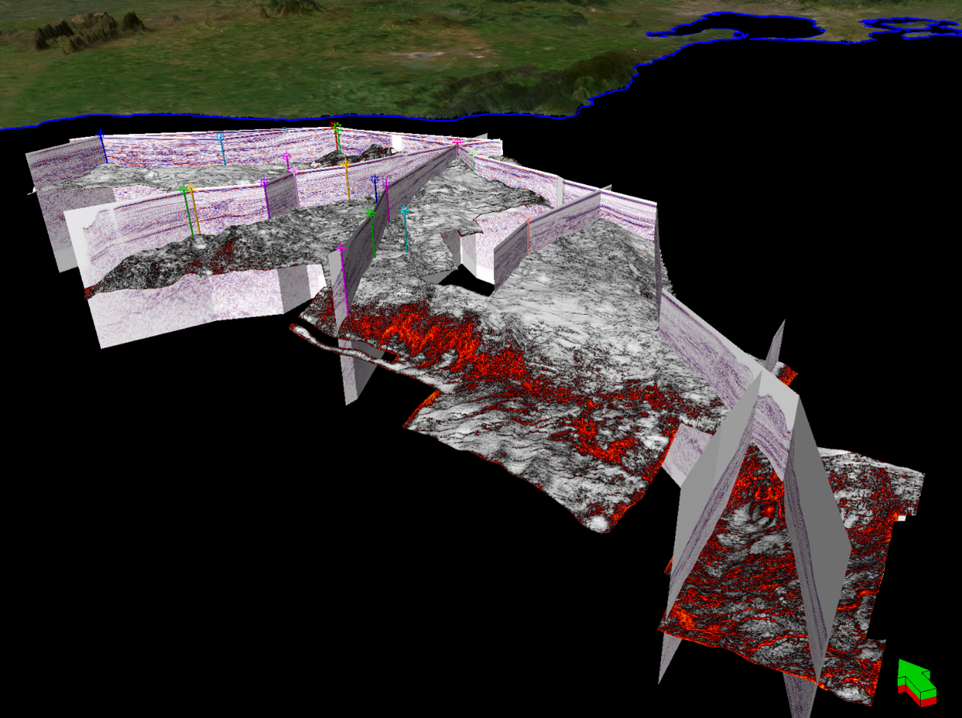
Figure 1. 3D perspective view of the 8092 sq. km Otway 3D Mega merge Product off the coast of Victoria, showing numerous composite lines through wells and a variance calculated drape on a Cretaceous surface.