The Repository
Page last updated:28 January 2025
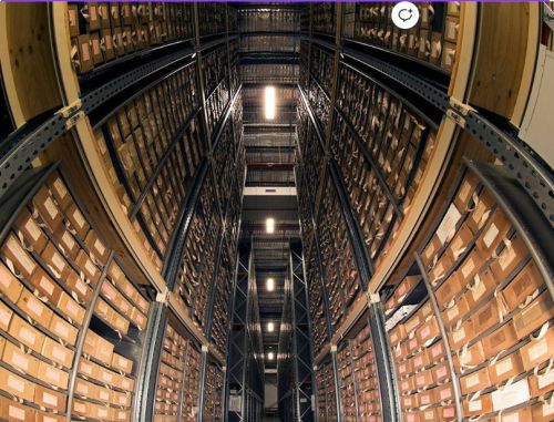
Geoscience Australia's Repository is the custodian of nationally significant collections of data and physical samples which are important for industry, government, academic and community stakeholders.
Collections comprise of exploration, development and production related data and samples predominantly from the Australian continental shelf. They are primarily acquired by petroleum exploration and development titleholders, who are required to submit them to the government under the below legislation:
- The Offshore Petroleum and Greenhouse Gas Storage Act 2006
- The Offshore Petroleum and Greenhouse Gas Storage Resource Management and Administration Regulations 2011
Explore the Repository
Check out this video to have a tour of our Repository at the Geoscience Australia building in Canberra, ACT or take a 3D virtual tour for yourself.
Relevant information


NOPIMS
The National Offshore Petroleum Information Management System has been redeveloped by NOPTA in collaboration with the WA Department of Mines Industry Regulation (DEMIRS) and Safety and Geoscience Australia (GA) under the National Offshore Data Core Repository agreement (NOPDCR).