Space weather
Last updated:9 November 2023
Geoscience Australia’s role in space weather monitoring
Imagine if all the electrical grids and devices in the world suddenly stopped working; or all the satellites currently in orbit dropped out, resulting in no satellite communications, and no GPS.
In our modern world this would be catastrophic. Economies would take a devastating hit, human lives could be put into danger, and whole infrastructures could suffer.
Space weather, also known as electromagnetic storm activity, has the potential to cause such impacts.
This is one of the reasons why Geoscience Australia maintains a network of geomagnetic observatories. Our observatories form part of a global network and contribute to Australian space weather monitoring services. This monitoring allows potential hazards caused by magnetic storms to be mitigated, protecting communities by minimising the impact to Australian infrastructure such as electrical grids.
What exactly is geomagnetic storm activity, and why can it wreak so much havoc?
Geomagnetic storms result from disturbances to the Earth’s magnetic field due to solar activity. The Earth's magnetic field is generated by electric currents deep in the interior and high above the surface of the planet. The Sun releases charged particles known as solar wind throughout the solar system. The magnetic field extends far into space where it encounters the moving plasma of the solar wind. Occasionally, powerful eruptions on the Sun’s surface cause coronal mass ejections (CME), impacting magnetic fields across the solar system. Most of the time our geomagnetic field shields the Earth from the solar wind by deflecting the high energy particles. However, sometimes the Sun is more active and the solar wind becomes stronger.
The resultant geomagnetic storms, or space weather, can disrupt satellites and induce currents in long conductors (like power lines) on the Earth’s surface, overloading the electric system and damaging transformers. Geomagnetic storm activity has the potential to significantly and detrimentally affect our access to space-based services (i.e. satellite), and severely degrade high frequency radio communications. It can also produce expanded auroral displays.
How do we know the potential impact of space weather? Well, it has happened before.
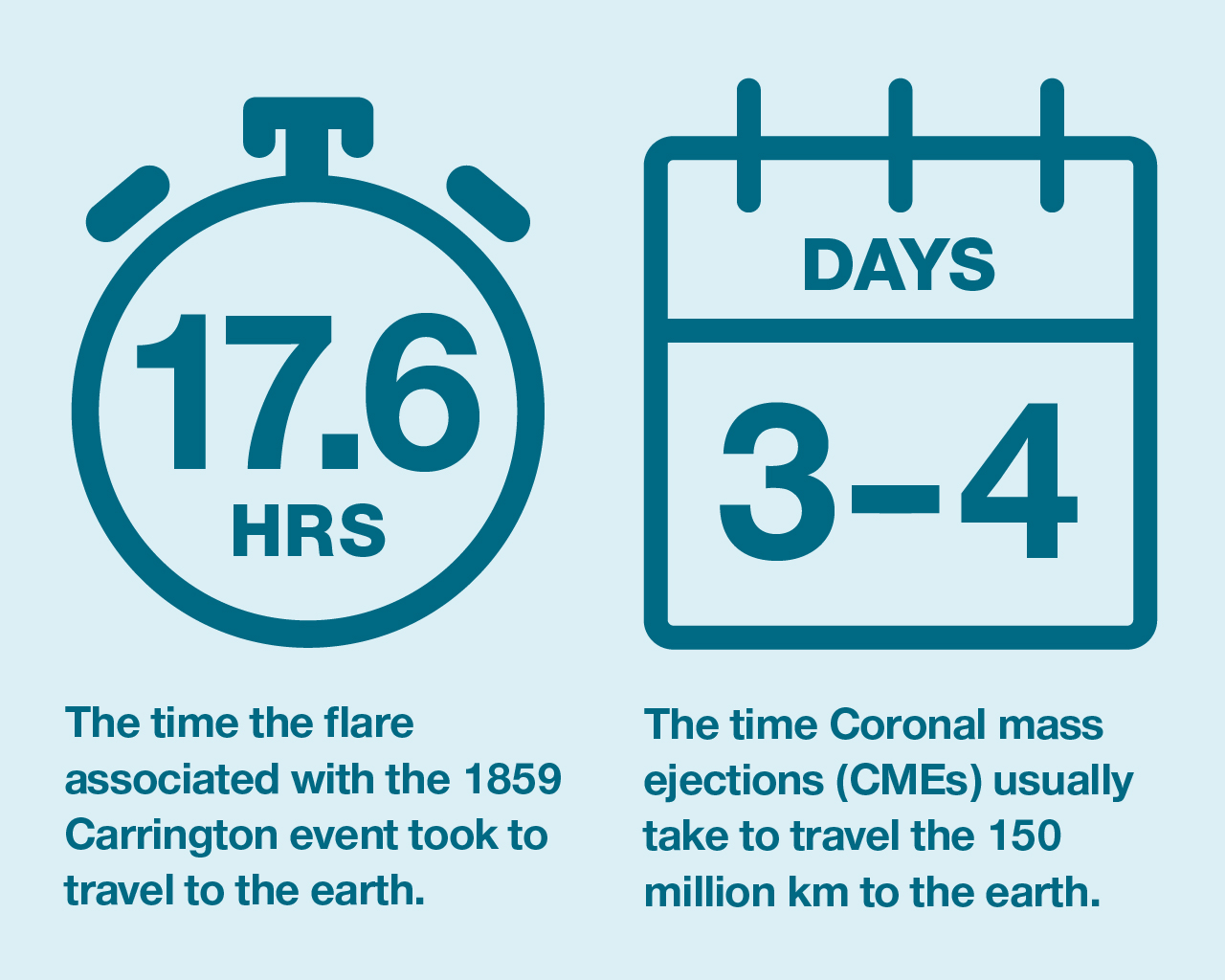
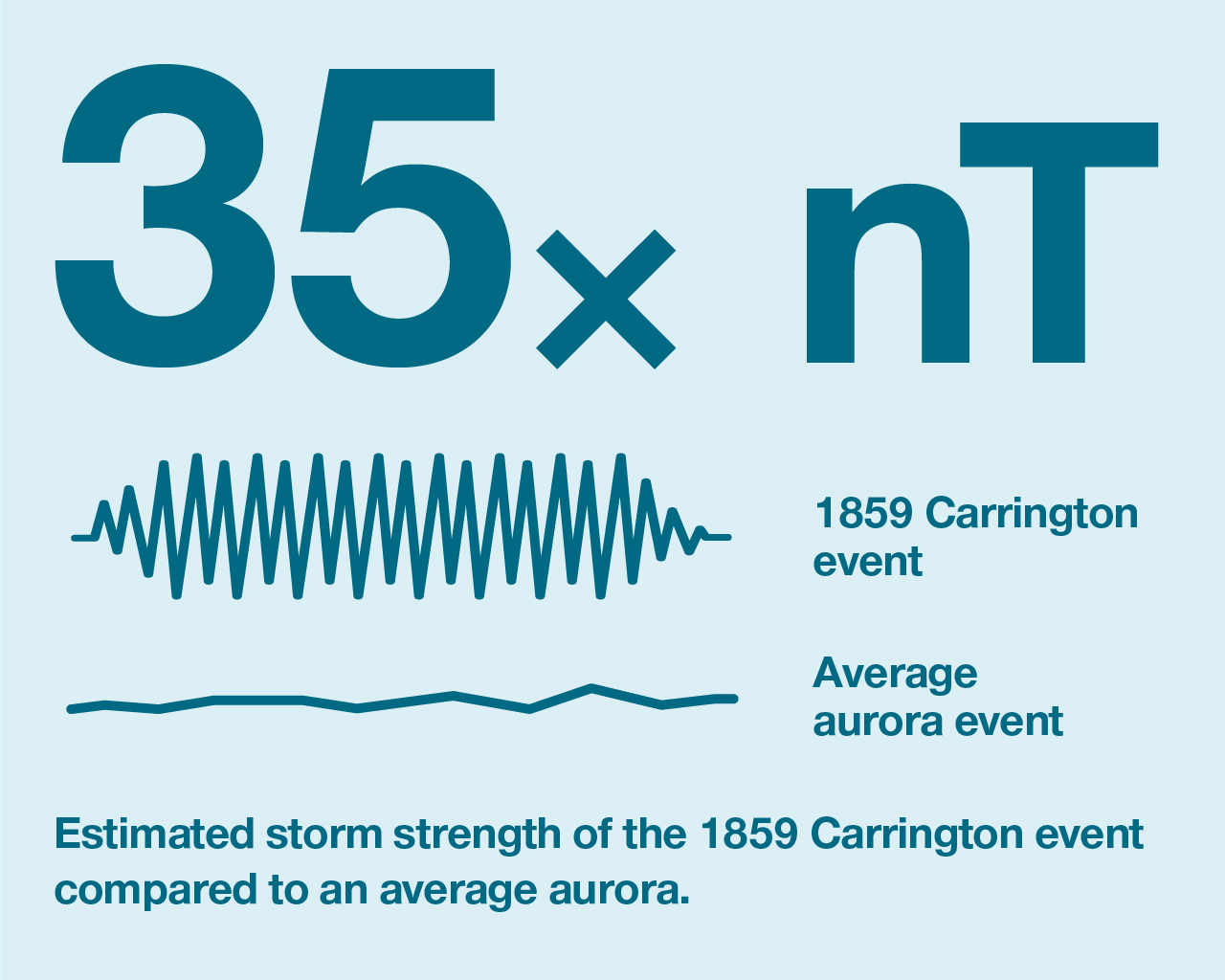
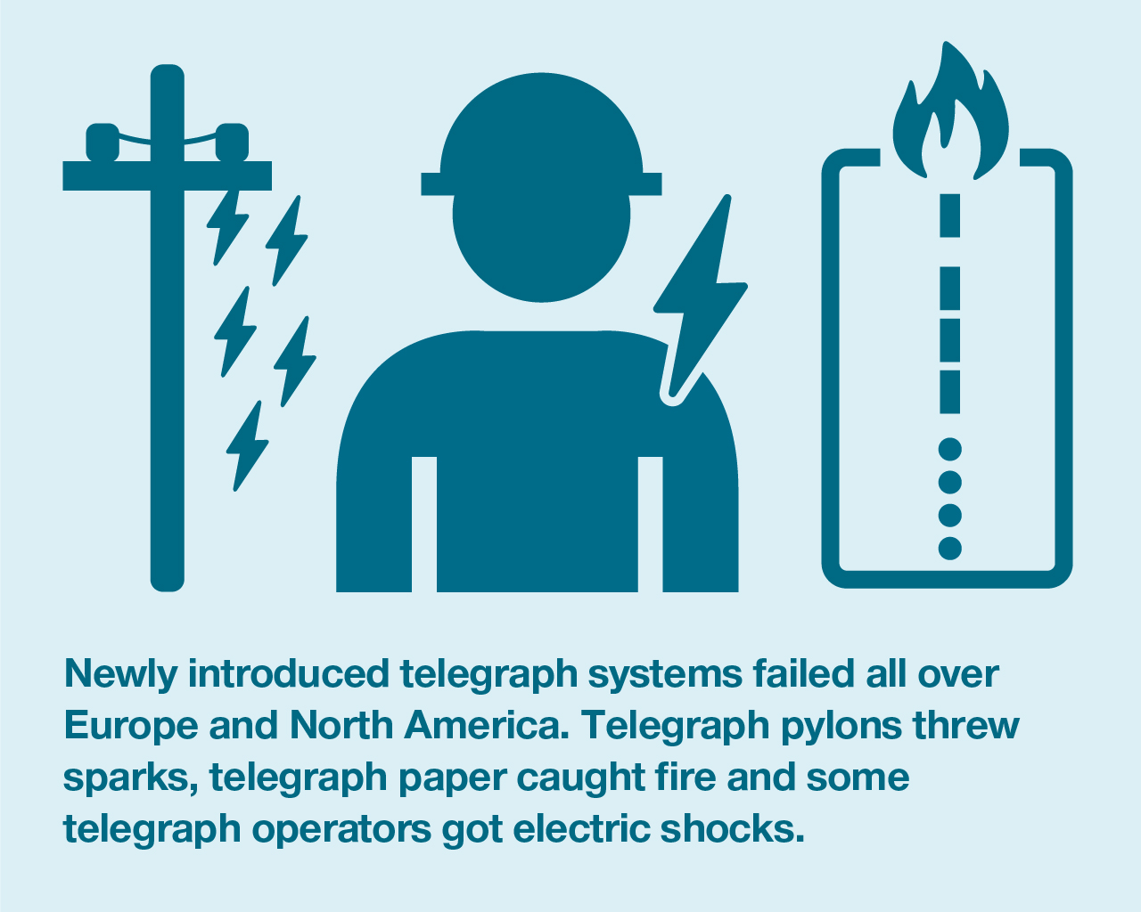
160 years ago, a powerful geomagnetic storm known as the Carrington Event occurred. Named after one of the British astronomers who observed and recorded it, the storm wrought havoc on the recently introduced telegraph systems with some telegraph operators experiencing electric shocks and equipment sparking.
Lloyd’s estimated that if a severe geomagnetic storm on the same scale occurred today, electrical outages could occur that would take months to years to recover, with a total economic cost for North America alone, numbering in trillions of USD.
And in March 1989 a smaller geomagnetic storm caused a nine-hour blackout in Quebec.
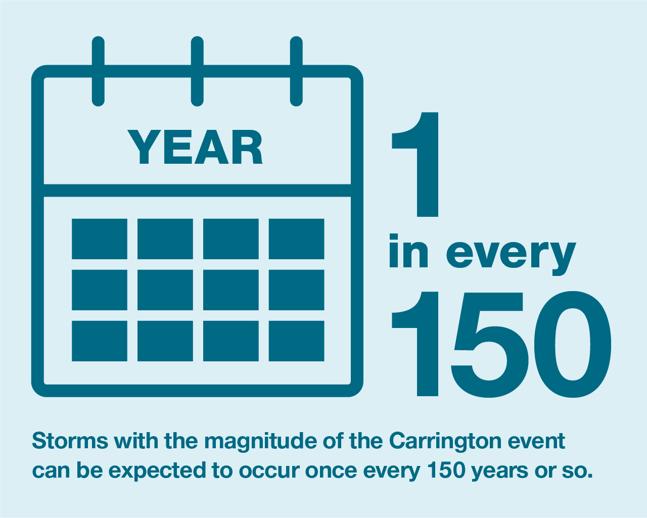
Although the probability of an extreme geomagnetic storm occurring is low, it is almost inevitable that one will occur eventually. Geomagnetic storms the size of the 1989 one occur roughly once every 50 years, while storms with the magnitude of the Carrington Event can be expected to occur once every 150 years or so.
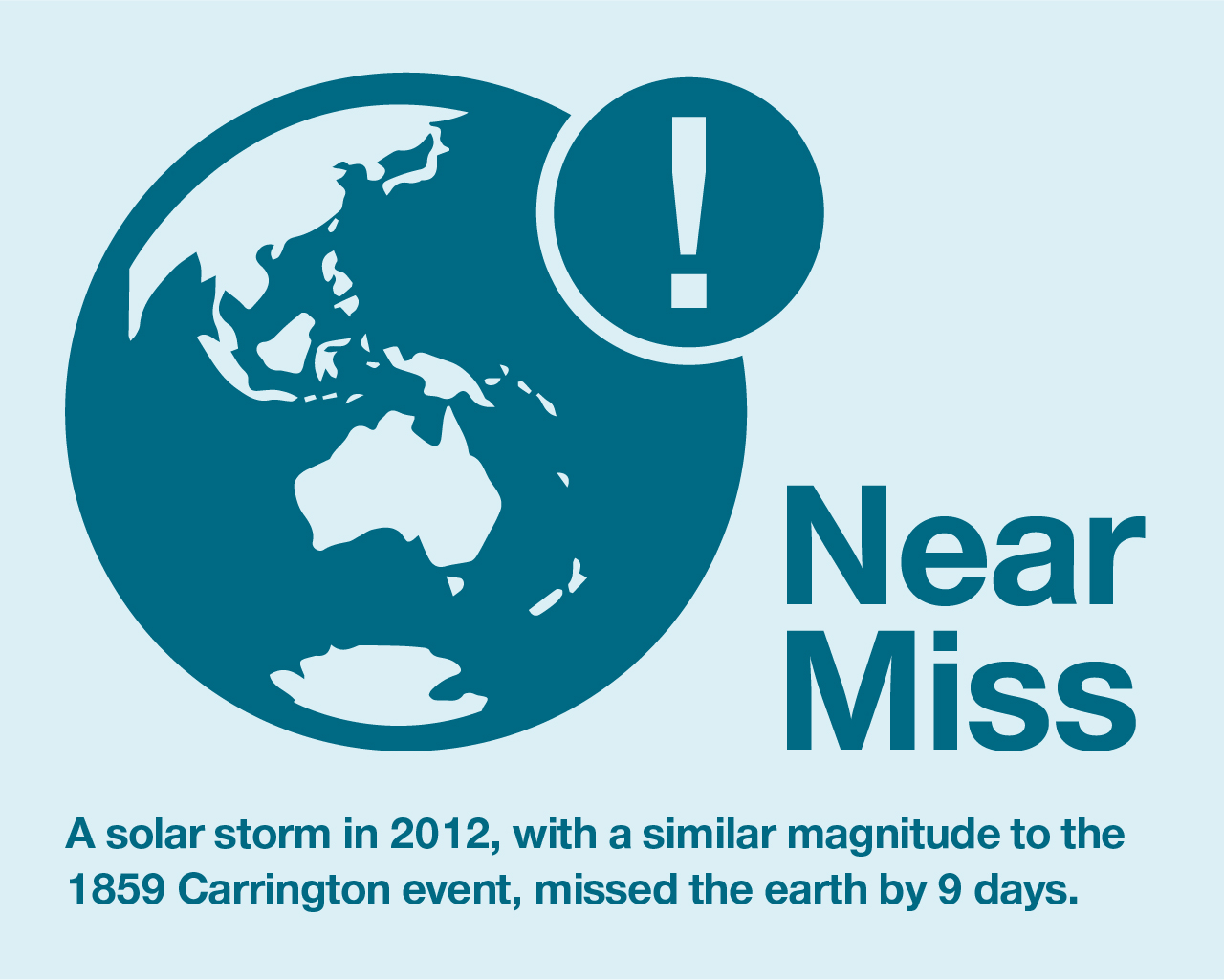
In fact, in 2012 the Earth experienced a “near miss” when a CME comparable to the one that caused the Carrington Event, tore through Earth’s orbit, but missed the Earth. If the erupting region of the Sun had been pointing directly towards the Earth, it would likely have had global effects.

What can we do to prepare for a geomagnetic storm? We monitor the Earth’s magnetic field.
The data we collect through our network of geomagnetic observatories allows governments and industry to prepare for and mitigate the impacts of geomagnetic storms.
We operate ten geomagnetic observatories: six on the Australian mainland, two in Antarctica, one on Macquarie Island and one in the Cocos Islands.
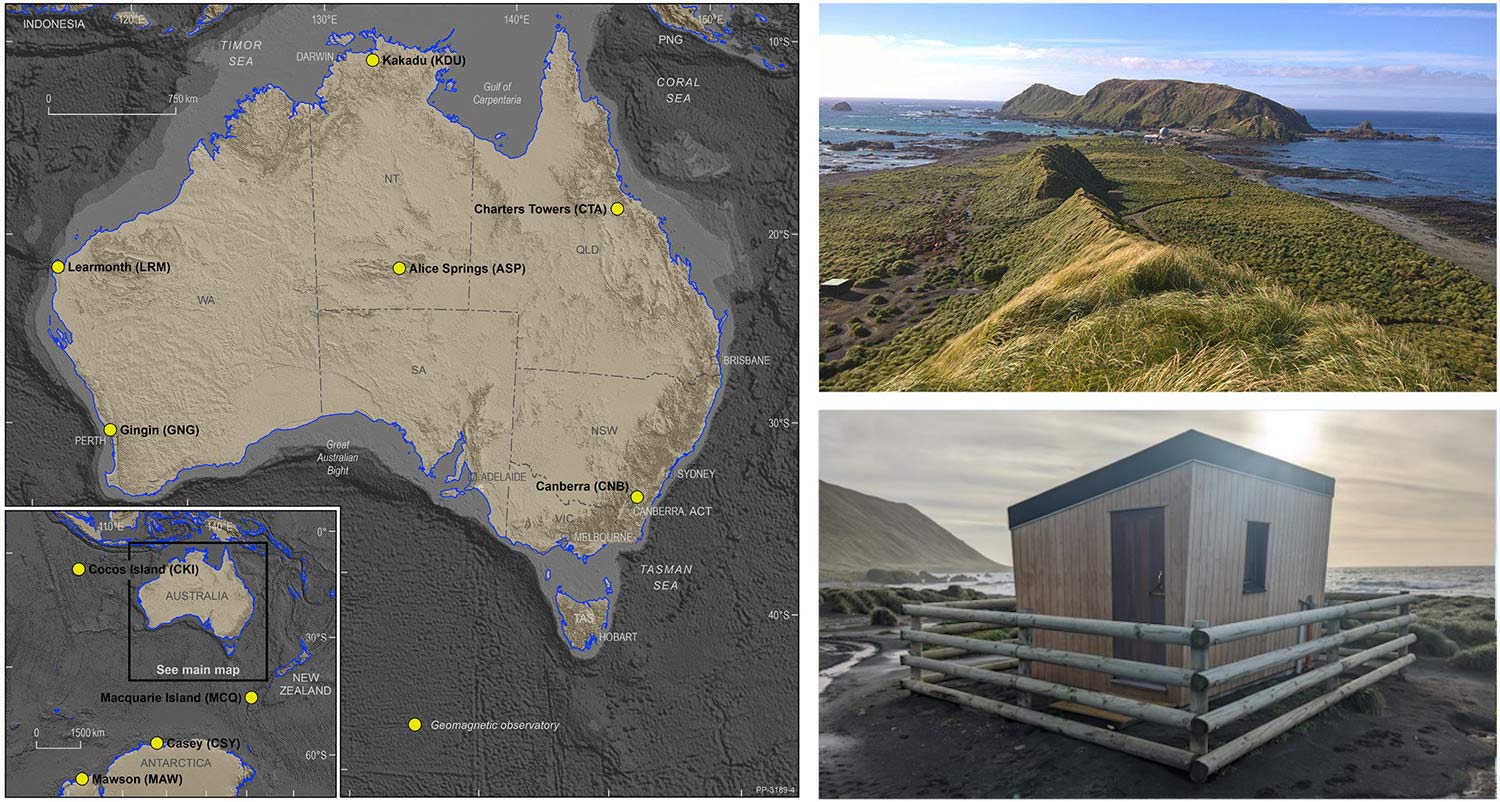
The locations of Geoscience Australia’s Geomagnetic Observatories. Top right: Macquarie Island Observatory and Station. Bottom right: Macquarie Island Observatory (MCQ)
Australia’s geomagnetic observatories form part of a global network, constantly monitoring the Earth’s magnetic field, recording changes second by second.
Our geomagnetic observatories consist of:
- One or more fluxgate variometers collecting realtime data in a magnetic exclusion zone to prevent anthropogenic impacts to collected data. This instrument is supplemented with a secondary magnetometer for data surety and quality control.
- An on-site observer makes regular absolute measurements of the magnetic field to calibrate the variometer data
Data from the observatories are quality certified through the International Real-time Magnetic Observatory Network (INTERMAGNET).
The magnetic field as measured at the surface of the Earth is composed of multiple sources.
- Most of the magnetic field is generated by the Earth’s core, and that component varies only very slowly over time.
- Other contributions come from the Earth’s crust, mostly due to magnetic minerals.
- More rapid variations are caused by space weather and electric currents in the upper parts of the Earth’s atmosphere, mostly resulting from variations in solar wind which also cause auroras.
Geomagnetic data can be used to gather information about all these sources, ranging in location from the Earth’s core to crust and upper atmosphere, and even detects the impacts of activity occurring at the surface of the Sun.
Now we have the data, what do we do with it?
Having this data means we can do real-time continuous monitoring of perturbations in the magnetic field. This allows magnetic disturbances to be tracked and recorded, so effects on vulnerable infrastructure can be mitigated, to avoid the negative impacts of geomagnetic storms.
Geoscience Australia provides this geomagnetic data in real-time to the Bureau of Meteorology Space Weather Services and similar international agencies where it, along with other ground-based and space-based data, contributes to daily space weather forecasts. The ability to forecast large disturbances in advance allows the relevant parties to implement space weather mitigation plans where necessary. This may involve vulnerable infrastructure being switched off, or power being rerouted, while providing time to prepare response and recovery efforts, to resupply power in the shortest possible timeframe following the event.
We also use magnetic data from the observatory network to calibrate aircraft compasses, magnetic direction finding equipment and satellite magnetometers. Observatory data is processed to produce definitive data, cleaned of spikes and offsets, calibrated utilizing absolute measurements; to produce time-series data reflecting the absolute values of the magnetic field at the observatory.
We produce mathematical models of the geomagnetic field in the Australian region and contribute data to the International Geomagnetic Reference Field (IGRF) model. Output from these models is referenced on topographic and aeronautical maps.
We also report on geomagnetic activity to contribute to global indices of magnetic activity, and monthly reports about rapid geomagnetic variations.
Finally, we conduct research to model Earth conductivity, which is important for predicting the impact space weather can have on large electrical conductors such as pipelines and power grids. Geomagnetic-induced currents in these large conductors depend on geomagnetic field variations and the geological conductivity of the area. Geoscience Australia’s research into Earth conductivity models provides a crucial understanding for properly preparing for the hazard posed by geomagnetic storms.
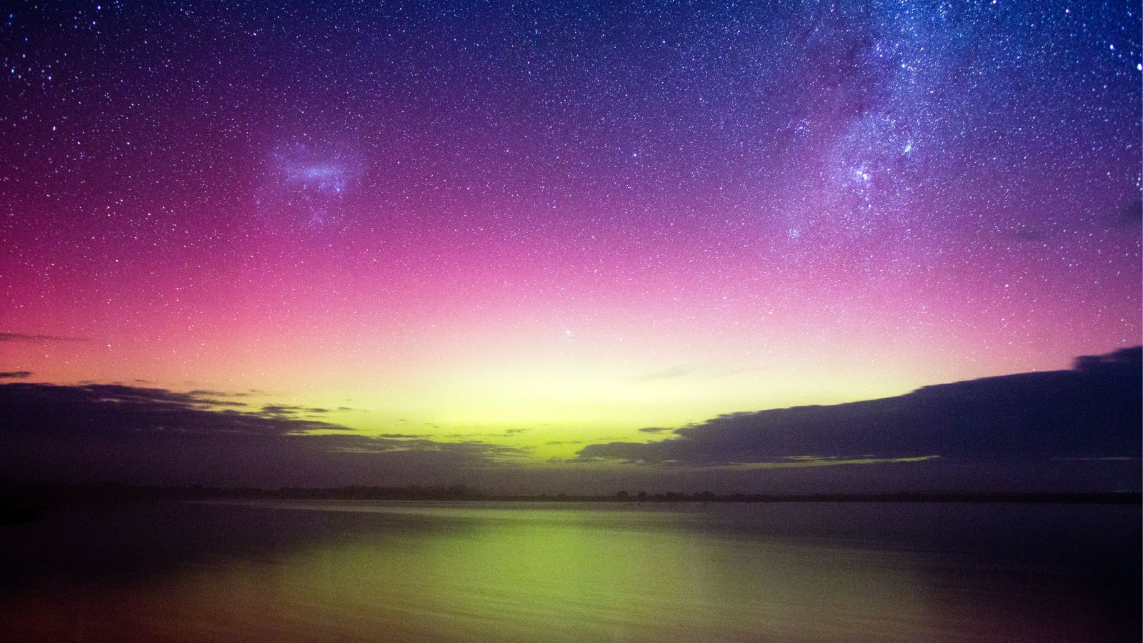
Aurora Australis, Victoria, Australia. Source: Dannogan
Auroras
Magnetic storms often result in the sighting of auroras, colourful displays that appear in the night sky, at places much nearer to the equator than where they are usually seen. Auroras are commonly seen in areas around Earth's polar regions. They are often referred to as the Southern Lights or Aurora Australis in the Southern Hemisphere, and the Northern Lights or Aurora Borealis in the Northern Hemisphere. Auroras are a dynamic and visually striking manifestation of magnetic storms on Earth.
Auroras happen when charged particles from the Sun enter the magnetosphere. Once inside, the geomagnetic field directs them toward the north and south magnetic poles. Travelling at high speeds the particles collide with gas molecules and atoms in the atmosphere, which energises them. A visible glow appears when they release the energy and return to their ground states, much like the way a fluorescent light works.
When a magnetic storm occurs, the auroral zones expand towards the equator from the polar regions, sometimes providing spectacular displays to residents of mid-latitude regions. During intense magnetic activity auroral displays have been reported from as far north as Queensland.
The different colours seen in auroras are produced by different gases in the atmosphere. At high altitudes, light gases like hydrogen and helium, create blue and violet auroras and high-altitude oxygen (about 320 km) is the source of the red emission. At lower altitudes (about 100 km) oxygen produces a brilliant yellow-green - the brightest and most common auroral colour. Ionised nitrogen produces blue light and neutral nitrogen produces a red glow (but a different hue to high altitude oxygen). Nitrogen can also create the purplish-red lower borders and rippled edges of the aurora.
You can access our geomagnetic data through our Geomagnetism - services and data page.
To learn more about our work, access our latest data or hazard assessment tools, visit the Community Safety page.