News
Antarctic geoscience: building a picture of the frozen continent
Published:17 August 2023
Scientists have unveiled the latest additions to Geoscience Australia’s Antarctic collection following an expedition to the icy waters of East Antarctica earlier this year.
In January of 2023 Geoscience Australia led a scientific expedition to the East Antarctic margin onboard research vessel (RV) Investigator, operated by CSIRO, Australia’s national science agency. Among other data and readings gathered on this voyage, they took three new marine sediment cores, which have now been added to Geoscience Australia’s collection.
Dr Alix Post, who was chief scientist on the voyage, explains.
“The new cores cover approximately the last 600,000 years,” she said. “They were taken from the seabed approximately 2,800 metres deep, 250 kilometres off Cape Darnley in East Antarctica.”
The new cores have been added to Geoscience Australia’s already extensive collection of Antarctic samples, which goes back over 70 years.
Dr Jodie Smith, head of the Oceans, Reefs, Coasts and the Antarctic Branch at Geoscience Australia, described the collection as a valuable national asset.
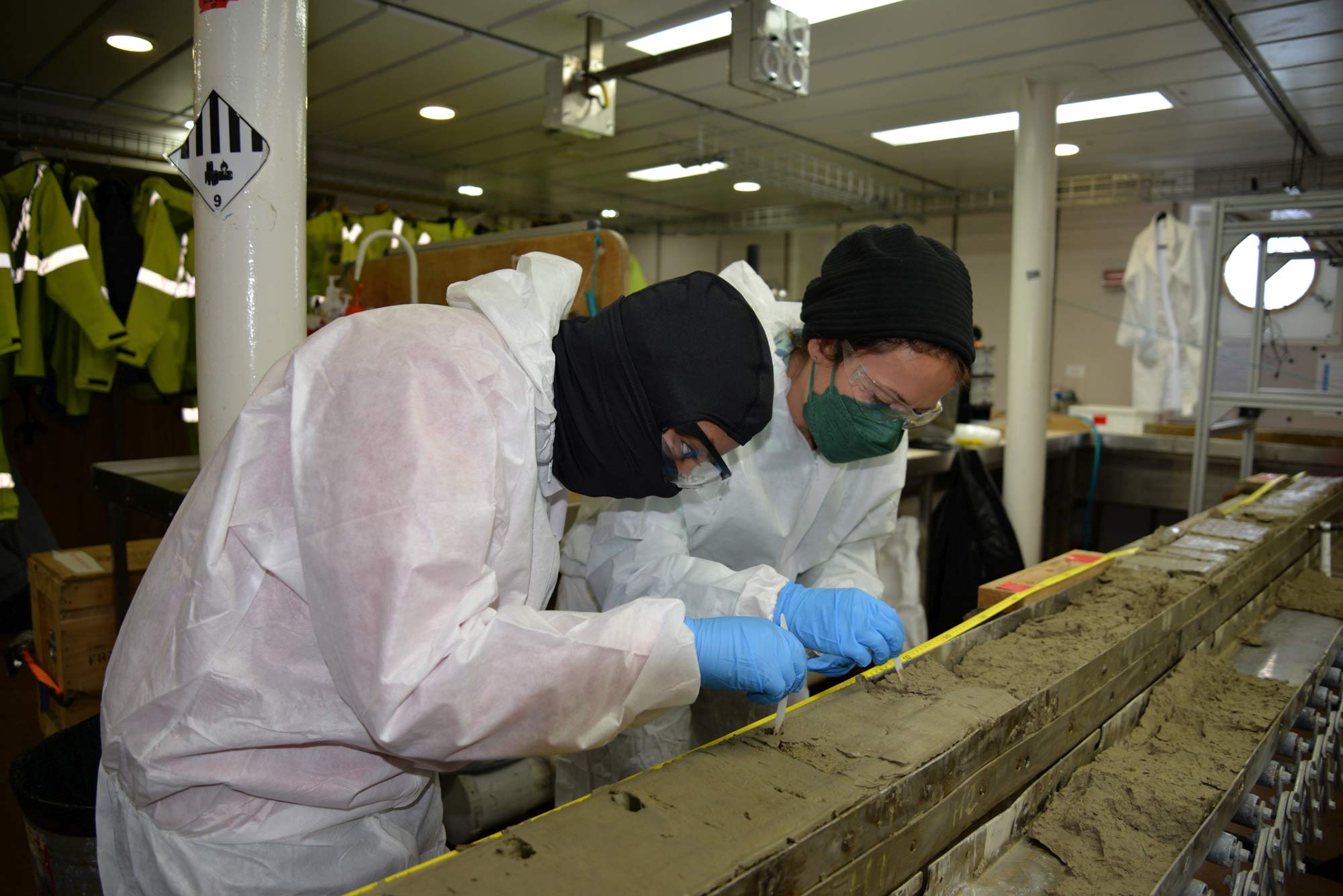
Scientists viewing the new sediment cores on board the RV Investigator. Full protective gear is worn to prevent sample contamination. Photo: Geoscience Australia – Andrew Carroll
“Geoscience Australia is the government lead for Earth sciences in the Australian Antarctic Program and the samples we hold are a unique resource for the Antarctic science community,” she said.
“The collection contains a variety of samples, including rocks, sediments and fossil specimens from both offshore and onshore environments, taken over decades of fieldwork in Antarctica.”
Dr Smith explained that Geoscience Australia’s work improves the scientific understanding of the Antarctic, which helps governments make informed decisions about the management and protection of the Antarctic environment.
Geoscience Australia adheres to the FAIR data principles—Findable, Accessible, Interoperable and Reusable—making the data from the collection openly available.
“Our new Antarctic Geoscience Portal makes it easy for scientists to access and study our samples and data, even if they are not able to visit Antarctica in person,” Dr Smith said.
The expertise offered by Geoscience Australia’s Antarctic team includes mapping the marine and land environments and tracking how the physical environment has changed over time. An essential role is also managing the collection of samples and data that the agency has gathered.
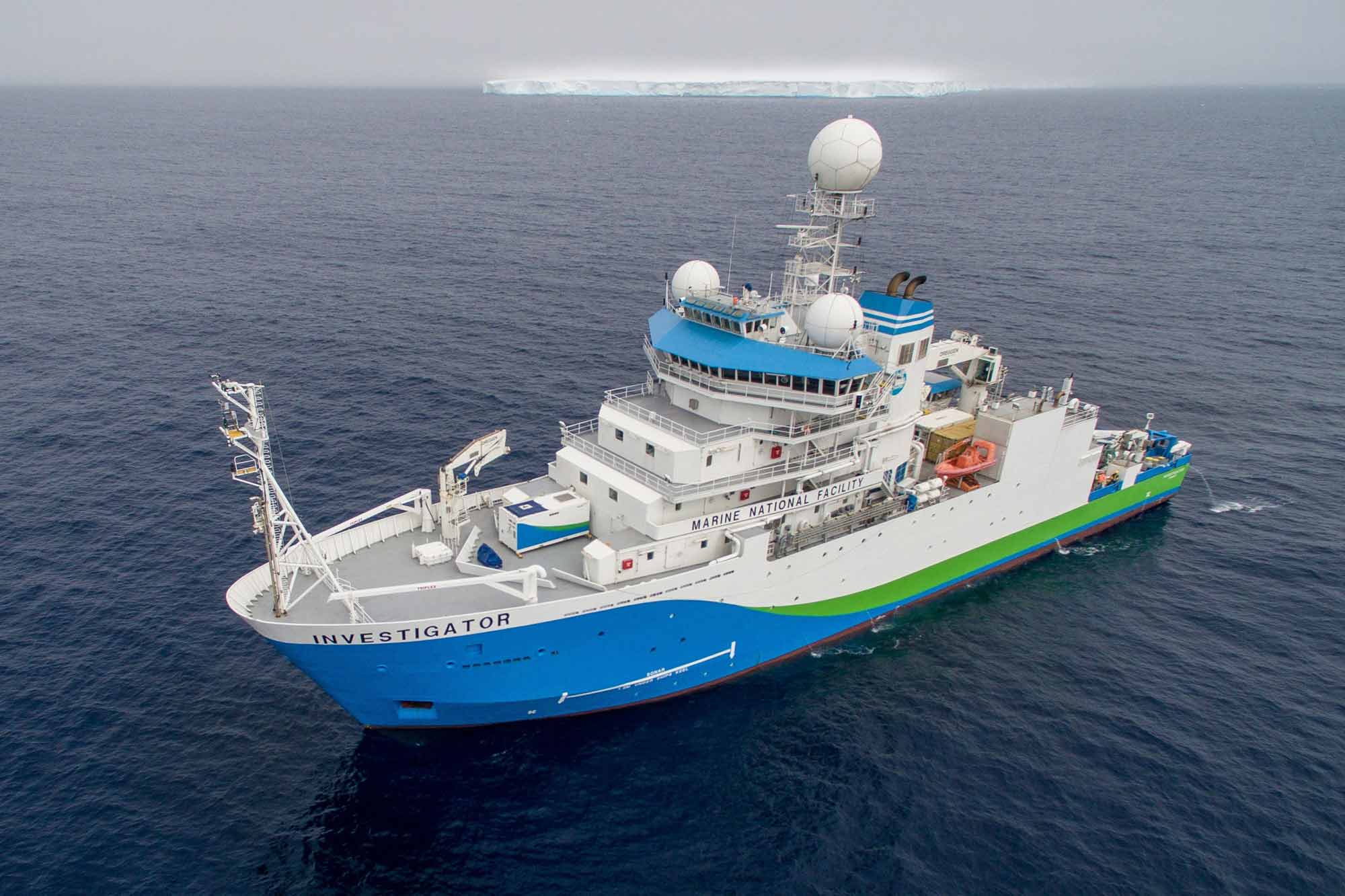
RV Investigator in Antarctic waters. Photo: CSIRO
“The three new cores are joining our existing collection of 195, from under the sea and from land-based environments,” Dr Smith explained.
Dr Post said that one of the main aims of the voyage was studying the formation of a globally significant water mass called Antarctic Bottom Water. This water mass drives global ocean circulation and regulates the global climate.
“We can use the cores to track the way this water mass forms, and how it has changed over time.”
Dr Post added that the initial analysis of the cores has been done, and this work can lead to valuable insights into the world’s climate history and help scientists estimate how the climate will behave in the future.
Dr Smith said, “Scientists are always building on earlier work, and our collection is available to the science community to gain new understanding of Earth science in the frozen continent."
“The portal makes it easier for people to search, discover and review our collection and existing data.”
"This is our way of making sure that scientists have as much information and data at their fingertips as possible.”
The Antarctic Geoscience Portal is now available for all users with an interest in Antarctic science.
This research was supported by a grant of sea time on RV Investigator from the CSIRO Marine National Facility.
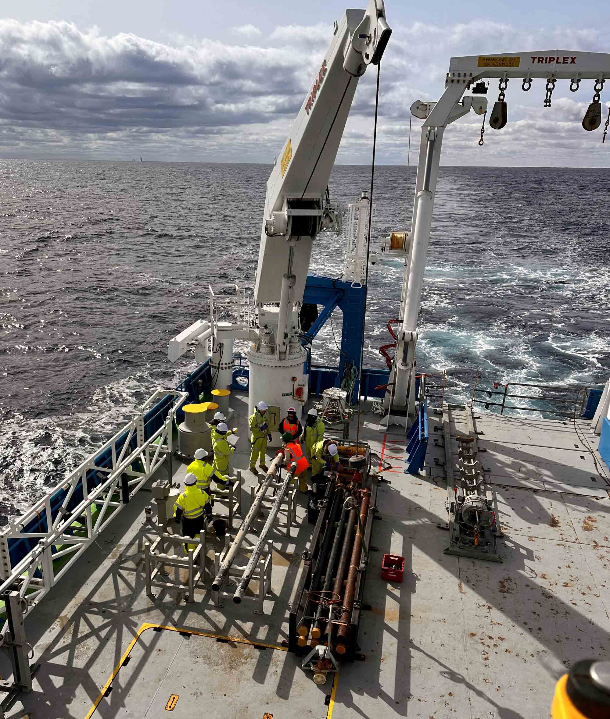
A piston corer being prepared for sampling. Photo: CSIRO-Francisco Navidad