News
Floodwater cuts through dry Channel Country
Published:8 March 2024
The channels are always changing on the way to Kati Thanda-Lake Eyre in South Australia where recent heavy rains have seen flood plains filled in central Australia.
Tropical Cyclone Kirrily hit the Central and North Queensland coast in late January, but much of the eastern seaboard was awash by rain brought in its aftermath.
The heavy falls caused much havoc in coastal areas but in the often-dry centre of the continent locals welcomed the deluge seldom seen.
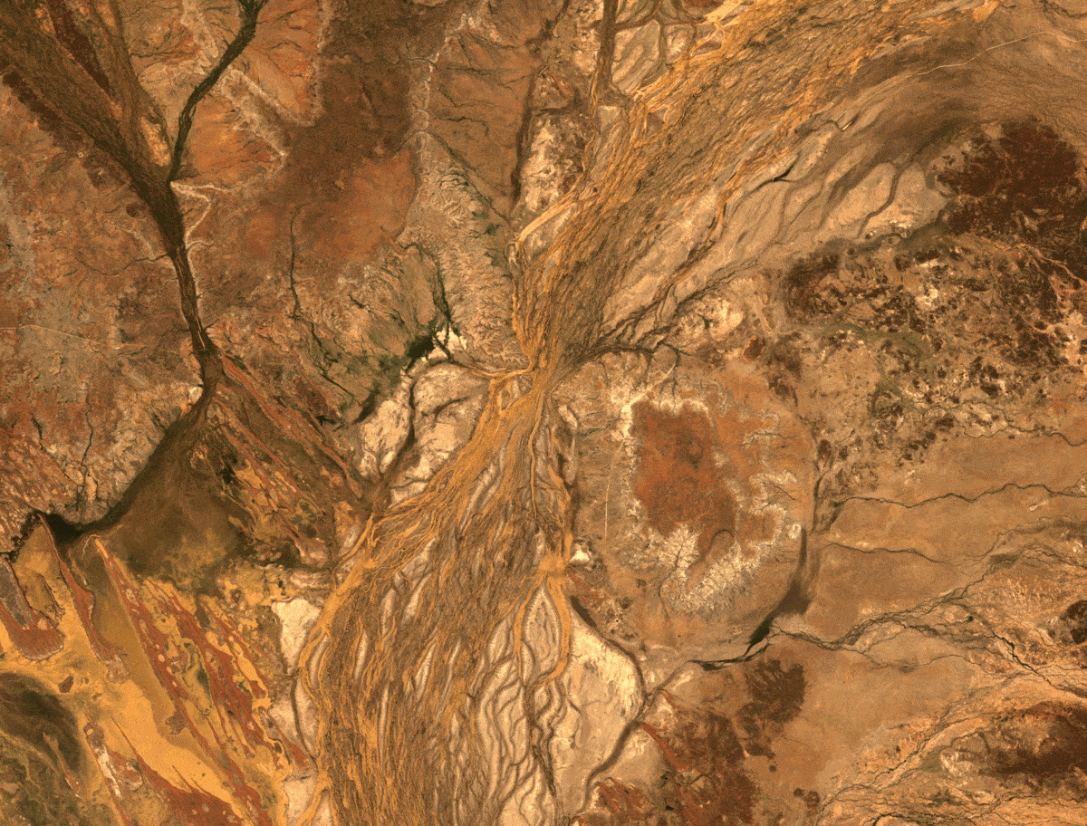
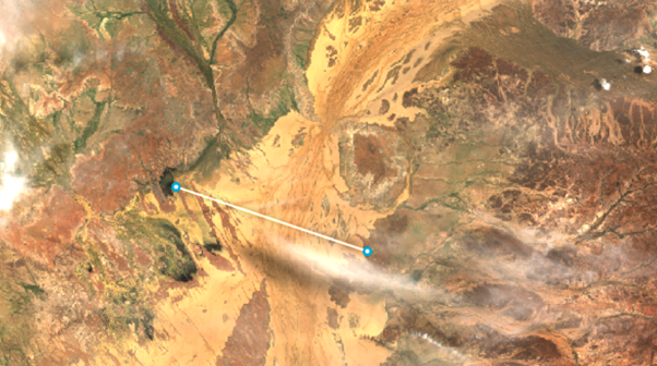
Images of what could be described as a slow-moving inland sea in southwest Queensland show the waters cutting along through the aptly named Channel Country. This is the parched landscape that scrapes across the Simpson Desert, flowing south through south-western Queensland to South Australia and down to Kati Thanda-Lake Eyre.
Photos of the floodwaters on the Diamantina River were captured in spectacular glory by locals on the ground.
Inspired by the terrestrial photography, we looked at the Boulia and Diamantina shires through the eyes of USGS Landsat and the European Commission’s Sentinel satellites to see how widespread these Central Australian flood waters were.
We looked at several scenes captured when these satellites passed over in December through to February, as the dry rivers filled with floodwaters.
How dry the riverbeds were previously can be seen with Digital Earth Australia’s (DEA) Analysis Ready Data products, such as DEA Water Observations and DEA Surface Reflectance.
Geoscience Australia’s Manager of DEA ICT Services and Strategy Dr Claire Krause said anyone can access the DEA products and tools to better understand things like inland water movements.
“With this data we can see how the Diamantina River has swollen beyond its usual channel,” Dr Krause said.
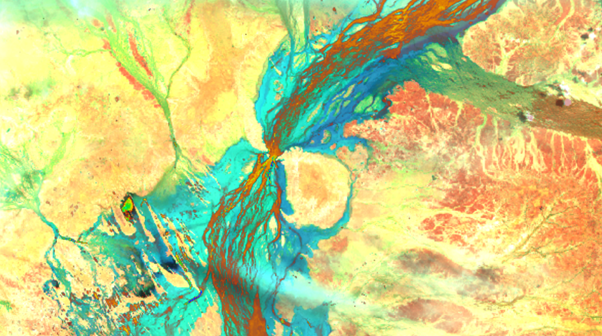
“In this True Colour image, you will notice how the brown river has a shine that makes it stand out from the dry ground around it.
“The dry, arid land has been engulfed with water that has travelled huge distances from North Queensland to central Australia. These flood pulses travel so far to eventually reach the ocean. It’s an interesting feature of the Australian continent.”
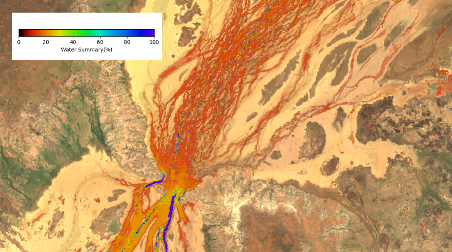
The overlain red vein coursing through the middle is the typical path of the Diamantina River, shown here as the yearly average presence of water using DEA Water Observations. Take note of the legend which indicates how little water there was throughout 2023.
Here is the same image using False Colour, which uses extra information from the satellite bands to show the floodwaters inblues and greens.
“Surface Reflectance shows the amount of light reflected from the Earth’s surface,” Dr Krause said.
“We can look at this in True Colour, which is what the human eye would see. Or we can enhance the images using False Colour, which uses extra information through multispectral images from the satellite bands to show the floodwaters in vibrant blue and green."
The size of these floods is something that has to be seen to be believed, and one of the best places to view them is from space.
In this image we see the breadth of the flood waters, with the line shown on the image measuring 25.2km across. Take a look through other images in the gallery and see the inland sea flowing through the Diamantina Shire over the past three months.