News
Landsat helping to address food security challenges in Africa
Published:26 March 2024
Learning from the past and planning for the future. Using Earth observation products and tools in the fight to achieve global food security.
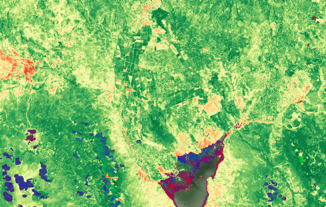
Farmland near Newland, Tanzania using DE-Africa products Standardised Normalised Difference Vegetation Index (NDVI) and Mean NDVI and Anomalie - 240101 - via DE Africa Maps
Access to food is a basic human need. Global food security challenges are impacting our ability to ensure all human beings can access adequate levels of food. Identified in The UN 2030 Agenda for Sustainable Development Goals (SDG 2), stakeholders and government bodies have been called on to end hunger, achieve food security, improve nutrition and promote sustainable agriculture.
33.8 million people are living with acute food insecurity in East Africa alone. A growing population - paired with decreasing food production – means it is predicted that Africa will only be fulfilling 13% of required food production by 2050. Africa’s vulnerability to food insecurity stems from a combination of factors such as population growth, climate change, limited access to resources, and political instability.
Despite these challenges, hope for the future comes from looking at the past. For more than five decades, Landsat satellites, developed by NASA and operated by the United States Geological Survey, have captured a wide range of information about the world’s land and water resources. They provide us access to a rich archive of imagery that shows how we can better manage and capitalise our land, driving sustainable increases in productivity and profitability. In 2018, Geoscience Australia developed Digital Earth Australia (DEA) to harness more than 30 years of this Landsat archive. DEA enables us to view changes and trends over time, allowing scientists and land managers to make decisions with the confidence of hindsight. Digital Earth Africa, built on DEA technology, has been operating since 2019 to provide these benefits to the African continent.
Digital Earth Africa products and tools provide valuable insights into crop, soil and vegetation conditions across the continent. Knowing the location and condition of crops and vegetation is necessary to understand patterns of change over time and can help decision makers to predict what they can grow in the future and where. These insights can help governments, industry and local farmers to make data-informed decisions to implement sustainable agricultural practices, enhance resilience to climate change, and foster inclusive economic growth.
According to the World Economic Forum, Digital Earth Africa has the potential to generate an impact of up to $900 million a year through the provision of EO data products for African agriculture.
Digital Earth Africa Fractional Cover helps to identify ground cover across different landscapes by splitting landscape observation data into three parts, showing representative values for the proportion of bare, green and non-green cover on the Earth’s surface. Fractional Cover data holds immense potential for uncovering captivating patterns and ground cover trends over large areas, allowing the user to identifychanges in seasonal vegetation, environmental conditions, and agricultural activities.
Fractional Cover can inform how governments, industry and farmers assess risks related to wind and water erosion, understand soil carbon dynamics, provide insight into optimising land management practices, and help evaluate rangeland condition. These valuable insights can be used by policy agencies, land resource managers in natural and agricultural sectors, and scientists, to monitor and evaluate land conditions in large areas over extended periods of time.
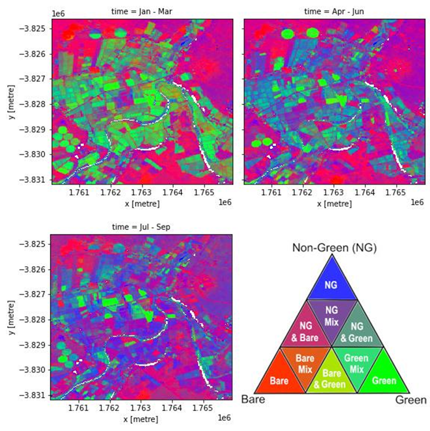
Fractional cover of Olifants River, Koekenaap, South Africa, with 3-month intervals captured in 2020 processed by Digital Earth Africa with legend showing the RBG (Red-Blue-Green) breakdown
Digital Earth Africa Mean NDVIand Anomalies provide a monthly estimate of vegetation health and compares it to the long-term average conditions. The data gives users the ability to compare vegetation conditions from as far back as 1984, identify changes and patterns that may indicate improvement, maintenance, or deterioration across the continent. This can help to understand climate events such as drought, and adapt to or mitigate the effects.
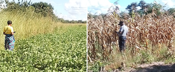
Ministry of Agriculture staff in Zambia mapping and analysing crop production
Planning for the future
Immediate, data-driven measures are crucial to tackling one of Africa's most pressing issues—food security. Earth observation products and tools like those from Digital Earth Australia and Digital Earth Africa are already a key input as industry and policymakers seek to make a difference by better understanding crop growth cycles, optimising water management practices, and making their pesticide use more effective and environmentally sustainable.
International collaboration— helping to map crop types in Africa
Digital Earth Africa, Kenya-based Regional Centre for Mapping of Resources for Development (RCMRD), and FrontierSI collaborated to develop an open-source framework dedicated to crop type mapping, supported by the Zambian Ministry of Agriculture. The international team produced a reproducible algorithm to map and analyse crop production by identified crop types in Zambia. This work is now being scaled to Niger, in partnership with AGRYHMET, and to Rwanda and Mozambique in partnership with Food and Agriculture Organisation of the United Nations (FAO).
This type of innovation will help to enable greater food security for the continent by:
- Accurately predicting crop yields on a national scale
- Empowering smallholders to increase production via increased access to crop analytics
- Improving Digital Earth Africa services through user feedback
Learn more about this collaborative project here.
Identifying and analysing data for sustainable food supply
Mozambique, Africa
Digital Earth Africa products and tools are being used to effectively monitor irrigated agriculture in Mozambique. Understanding the extent of irrigated agriculture across Mozambique is important to assess the resilience of current systems to the impacts of a changing climate.
In sub-Saharan Africa, different agricultural irrigation methods are used across the diverse climatic conditions. Assessing the scale of agriculture and monitoring crop transformations in these areas requires a blend of local expertise and remote sensing technologies. Timon Weitkamp used tools and products from DE Africa, and combined them with field work completed in Mozambique. Mr Weitkamp has worked with the National Irrigation Institute of Mozambique (INIR) to share the skills he learnt using the DE Africa platform to identify and map irrigated agriculture and is supporting them to increase their remote sensing capability. These valuable insights gained from Earth observation data is now helping the local government to promote and inform the adoption of sustainable agricultural practices.
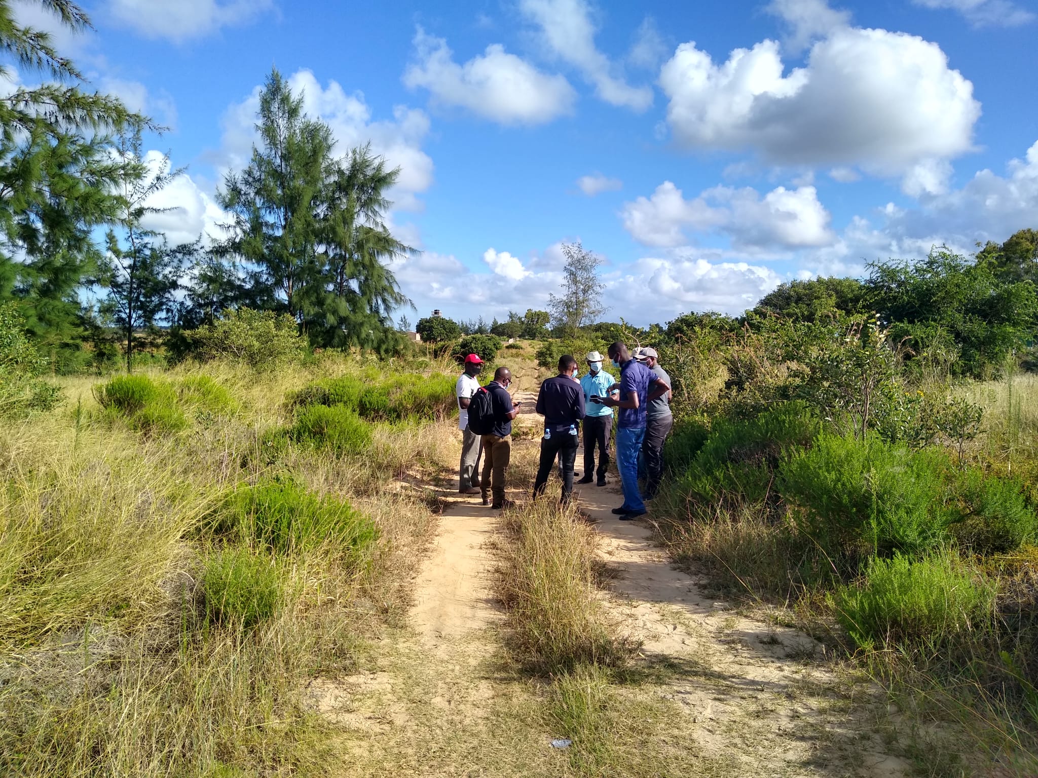
Timon Weitkamp and the team collecting field data on irrigation techniques in Mozambique
Improving sustainable agriculture
Ghana, Africa
The open data technology firm, Big Data Ghana, has created a platform (GAIMS) that collates data to help smallholder farmers in Ghana make informed decisions for food production. After liaising with Smallholder Representative Groups, private sector organisations and the Ghana Irrigation Development Authority, Big Data Ghana was able to attain a holistic understanding of the information required by stakeholders to help local farmers in Ghana predict crop yields and inform food security trends.
Drawing from Digital Earth Africa’s open and analysis ready data and services, including NDVI, the team at Big Data Ghana were able to identify areas of green vegetation and gain insights about irrigation, soil and productivity.
Most farmers in this region practice rain-fed agriculture. By integrating DE Africa data, we can help stakeholders like Ghana Irrigation Development Authority and the financial institutions serving these individuals to know where and what type of irrigation would benefit them and make this information available at their fingertips.
Henry Baffoe, Director Technical and Strategies at Big Data Ghana

The GAIMS agricultural data mapping platform using data from DE Africa’s Monthly Normalised Difference Vegetation Index (NDVI) service within an integrated platform
How to get involved
An introduction to the DE Africa products can be accessed through the DEA Maps platform: https://maps.dea.ga.gov.au/story/DEACoastlines
More information about Digital Earth Africa programs can be found via their website: https://www.digitalearthafrica.org
For map-based access to DE Africa services, as well as many other Landsat-based services, check out Digital Earth Africa Map.
All DE Africa services can also be accessed through the free learning and analysis environments provided by the DE Africa Sandboxes. The Sandboxes include sample data and Jupyter Notebooks that allow you to experiment with DE Africa’s Earth observation datasets and explore proof-of-concept applications.
Visit https://sandbox.digitalearth.africa to sign up for a new account.
About Landsat
Since 1972, Landsat satellites have continuously acquired images of the Earth’s land surfaces, surface waters, and coastal regions, providing uninterrupted data to help land managers and policymakers make informed decisions about natural resources and the environment. The mission is jointly managed by the USGS and NASA. Data acquired by Landsat satellites are distributed from the USGS Earth Resources Observation and Science (EROS) Center in Sioux Falls, South Dakota.
Learn more about Landsat at https://www.usgs.gov/landsat and https://landsat.gsfc.nasa.gov
Learn more about Landsat Products at https://www.usgs.gov/landsat-missions/landsat-science-products