News The beauty of Earth observations – art that informs our modern world
Page last updated:20 December 2019
We have been observing the Earth and its processes for centuries to understand the world around us and how it’s changing.
Since the launch of satellites into space, they have improved our ability to monitor the Earth at a large scale.
Geoscience Australia has collated a vast library of over 40 years of satellite data and a range of other Earth observations across the entire Australian continent. Our work is leading the world in the development of tools and techniques to help industry, governments and communities make informed decisions around our economy and environment.
But these images and observations are not only a valuable tool essential to understanding our world, they are works of art. To celebrate the beauty and importance of Earth observations to our society, we have worked with Questacon – The National Science and Technology Centre to develop a new Earth Observations display.
See below for a taste of what to expect.
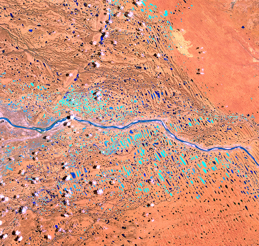
Maya and Yinggarda Country, Gascoyne, WA. Bright blue spots are surface water
Adelaide River (L) and Mary River (R), NT, are bright white and surrounding floodplains reds and yellows
Keeping us safe and informed
In a country where we live with the threat of natural hazards like fire, flood, severe winds, earthquakes and tsunami, Earth observations are vital to help Australian communities monitor, predict and prepare for these events. Satellite images and sensor data are combined with on-the-ground observations to inform emergency managers in their preparation and response to different natural hazards.
Geoscience Australia is using long-term observations to understand the likelihood of natural hazards such as tropical cyclone, tsunami and earthquakes, for use by emergency service agencies, insurers and industry.
Our network of geomagnetic observatories also monitor the effects of space weather to protect communities and infrastructure from the impact of electromagnetic storms. These storms could potentially disrupt satellites, severely degrade high frequency radio communications and also damage transformers and power lines.
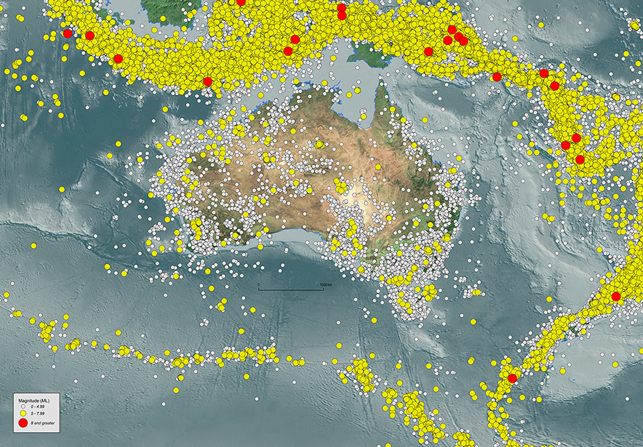
Earthquakes observed in Australia and its surrounding regions 1820–2019 by the Australian National Seismograph Network
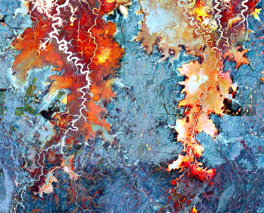
An out of control fire front burning in the Northern Territory in October 2011
Exploring coastlines and oceans
Less than 10 per cent of the ocean floor has been mapped in high definition, which means we know more about the dark side of the Moon. Earth observations are a vital tool to increase our understanding of our oceans.
Australia’s marine jurisdiction is nearly double the size of Australia’s land mass and the marine sector is becoming increasingly important to our economy. Effective and efficient management of this diverse environment relies on baseline mapping, understanding of marine processes and assets, and the ability to measure change over time.
Geoscience Australia is partnering with other science agencies to map the ocean floor using deep-ocean sonar systems. This data is helping us to explore the mountains and valleys of the seafloor to learn more about ecosystems that support marine life.
We’re also using satellites to reveal the extent of tidal zones on Australia’s coasts, which is important information for scientists and environmental managers.
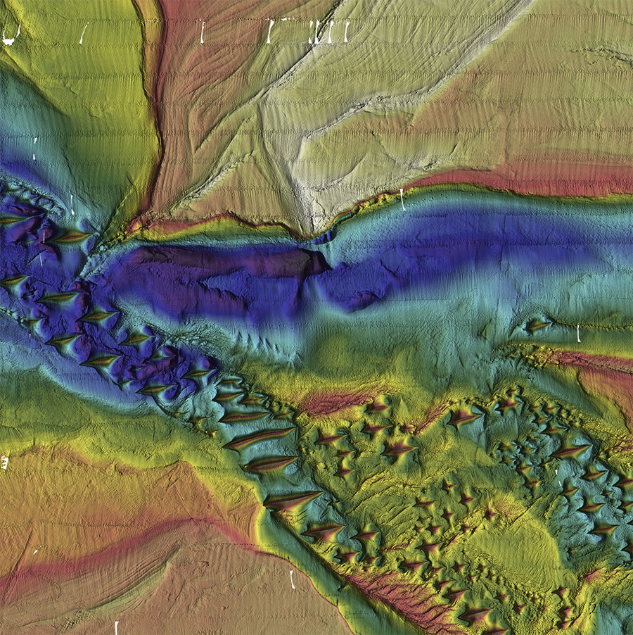
Patterns of steep-sided dunes shaped by ocean currents on the seafloor of the Browse Basin, WA
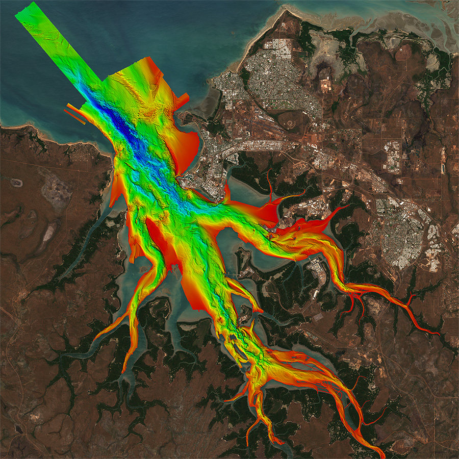
A bathymetric survey of Darwin Harbour. The colours reflect depth
Managing land and water
Earth observations are changing the way we manage and look after the land, grow food and secure water.
Digital Earth Australia provides satellite imagery of Australia as far back as 1986, delivering insights into the changing nature of the Australian continent.
For example, the Water Observations from Space tool shows the surface water of Australia for the past 30 years to the present day. By making Earth observations data more accessible to businesses, we can grow the economy and also encourage them to improve their services and create new products.
Alongside satellite imagery, we are using airborne electromagnetic surveys and gravity surveys to assist us in determining what energy, mineral and groundwater resources might lie beneath the Earth’s surface.
These observations will help to guide us through a time of environmental change and to manage the Earth’s resources sustainably.
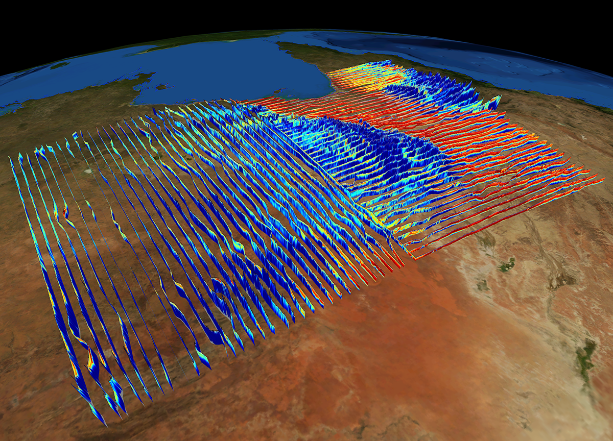
Airborne electromagnetic surveys can see below the Earth’s surface to find minerals and groundwater
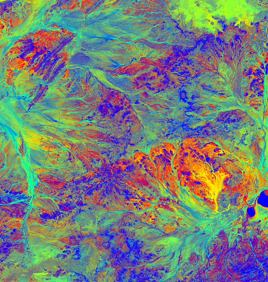
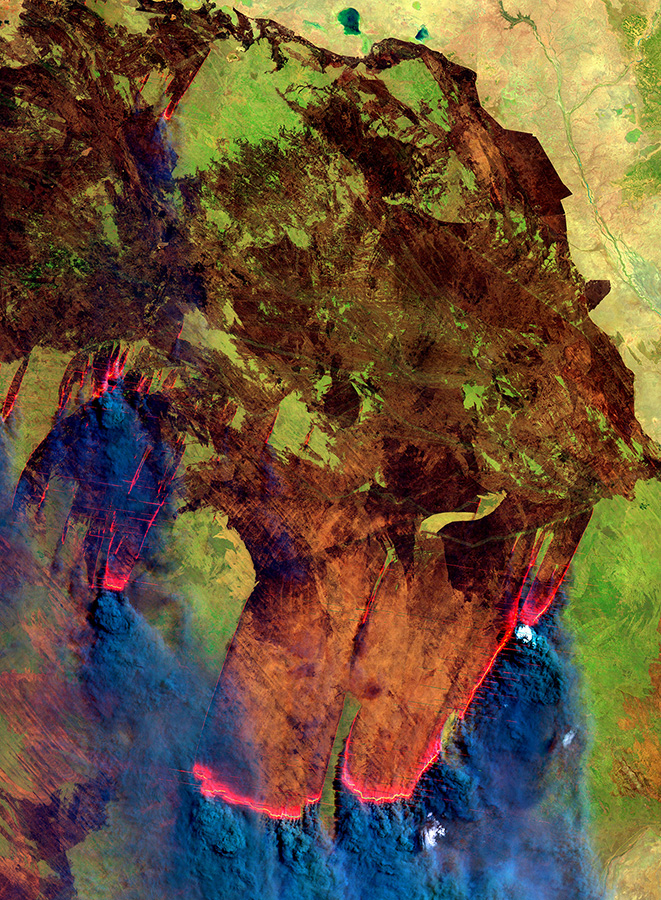
Fractional Cover map showing groundcover type of rangelands in the Pilbara, WA