News
Using Earth observation to address climate change in South-East Asia
Published:25 July 2023
An initiative led by CSIRO and Geoscience Australia has supported Australian and South-East Asian scientists, students and innovators to build market interest for products and services that use Earth observation to address the impacts of climate change across South-East Asia.
Participants of the Earth Observation for Climate Smart Innovation (EOCSI) initiative pitched ideas for business services using CSIRO’s Earth Analytics, Science and Innovation (EASI) platform, a high-performance computing technology that enables users to access and analyse large volumes of satellite data on commercial cloud infrastructure.
CSIRO Centre for Earth Observation Director, and Project Lead Dr Amy Parker said it was great to see such positive outcomes from the initiative.
“Earth observation data is valuable to many different industries. Building connections and capabilities, this initiative is strengthening regional science relations, supporting climate resilience, and promoting sustainable growth and development,” said Dr Parker.
The initiative fostered new partnerships and capacity-building through a week-long ‘hackathon’ (featuring keynote presentations, seminars, demonstrations, brainstorming and training) for over 80 participants from across the region. Three teams were selected to turn their ideas into reality with additional technical training and business development activities.
The Saraqube team – Dr Moritz Muller, Jenny Choo, Asilah Awang and Florina Richard, based in Sarawak, Malaysia – used the hackathon to explore opportunities to address the decline in coastal ecosystems from rapid urbanisation, increased aquaculture activities and impacts from climate change along the Malaysian coastline.
Using Earth observation data, the team can assist local communities and decision makers with the tools to plan for, and provide action towards, strategic and more sustainable development.
“South-East Asia is very affected by climate change,” Dr Muller said. “And a big issue is coastal developments.”
Wanting to develop a product to meet the demands of the blue-carbon market – the carbon captured by sea grasses, mangroves and salt marshes along the world’s coastal ecosystems – the team started by mapping mangroves along the Sarawak coastline.
“Using the EASI platform, we can identify spots of change and identify areas for reforestation,” Dr Muller said. “But we also used the platform to look at a larger scale; this is something we can’t do on a ground map. We don’t know what happens, we don’t see the changes. With Earth observation technology we can check 20 years’ worth of data.”
PhD students Ms Choo and Ms Richard worked directly with the data, using the project to advance their technical skills and capabilities. For the team, a valuable part of the project was access to other scientists, data analysts and business advisors.
“The ability to bounce ideas is really valuable, so we can actually work on products that we can trust,” Dr Muller said. “It’s not just something we derive, we make a code, we get an image that works. We get expert advice that the image we’re looking at makes sense and that we can use the data.”
“Working with the EOCSI project we have all increased our scientific knowledge and skills quite a bit.”
Through engaging with the initiative, participants were not only supported in developing their Earth observation applications on the EASI platform, but also benefited from support in understanding who the end-users are and how to engage with them effectively.
For Ms Richard, the biggest takeaway from the hackathon event was for the team to learn how to convert their ideas into a potential business.
“We do science,” she said. “We don’t know how to make it into a service, how to price it. This has been an incredible platform for all of us.”
Geoscience Australia Project Lead Rachel Horwood said that the ideas that came from the initiative were grounded and technically feasible.
“We found that participants really want to be part of a community that uses practical STEM approaches to act on climate change,” Ms Horwood said. “And through the initiative, we were able to support them in transforming these ideas into reality.”
This initiative is funded by the Australian Government Department of Industry, Science and Resources through the Supporting Australian Innovation in Asia Initiative, with contributions from regional partners.
CSIRO and Geoscience Australia are committed to providing scientific expertise to a range of stakeholders to help develop solutions to one of the biggest challenges of our time – climate change. Bringing together scientists, students and businesses in parts of the world already seeing the impacts of climate change is just one way they are delivering on that commitment.
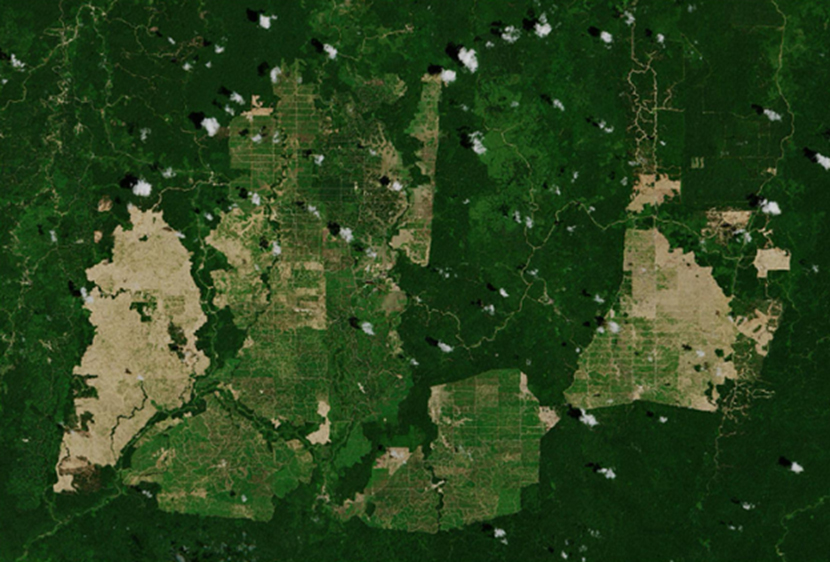
A 2019 Copernicus Sentinel-2 image over palm oil plantations in East Kalimantan, Indonesia. Source: European Space Agency 2019