Australian Geospatial Reference System
Page last updated:17 December 2024
The Australian Geospatial Reference System is the collection of:
- datums (e.g. Geocentric Datum of Australia 2020, Australian Height Datum), reference frames (e.g. Australian Terrestrial Reference Frame) and working surfaces (e.g. Australian Vertical Working Surface) used to define latitude, longitude, height, orientation and gravity throughout Australia;
- infrastructure, including a national network of Global Navigation Satellite System Continuously Operating Reference Stations and survey marks to provide an authoritative and accurate network in support of positioning applications;
- models describing dynamic, geophysical processes that affect spatial measurements; and
- standards to ensure positioning information is Findable, Accessible, Interoperable and Reusable (e.g. ISO / OGC / GeodesyML).
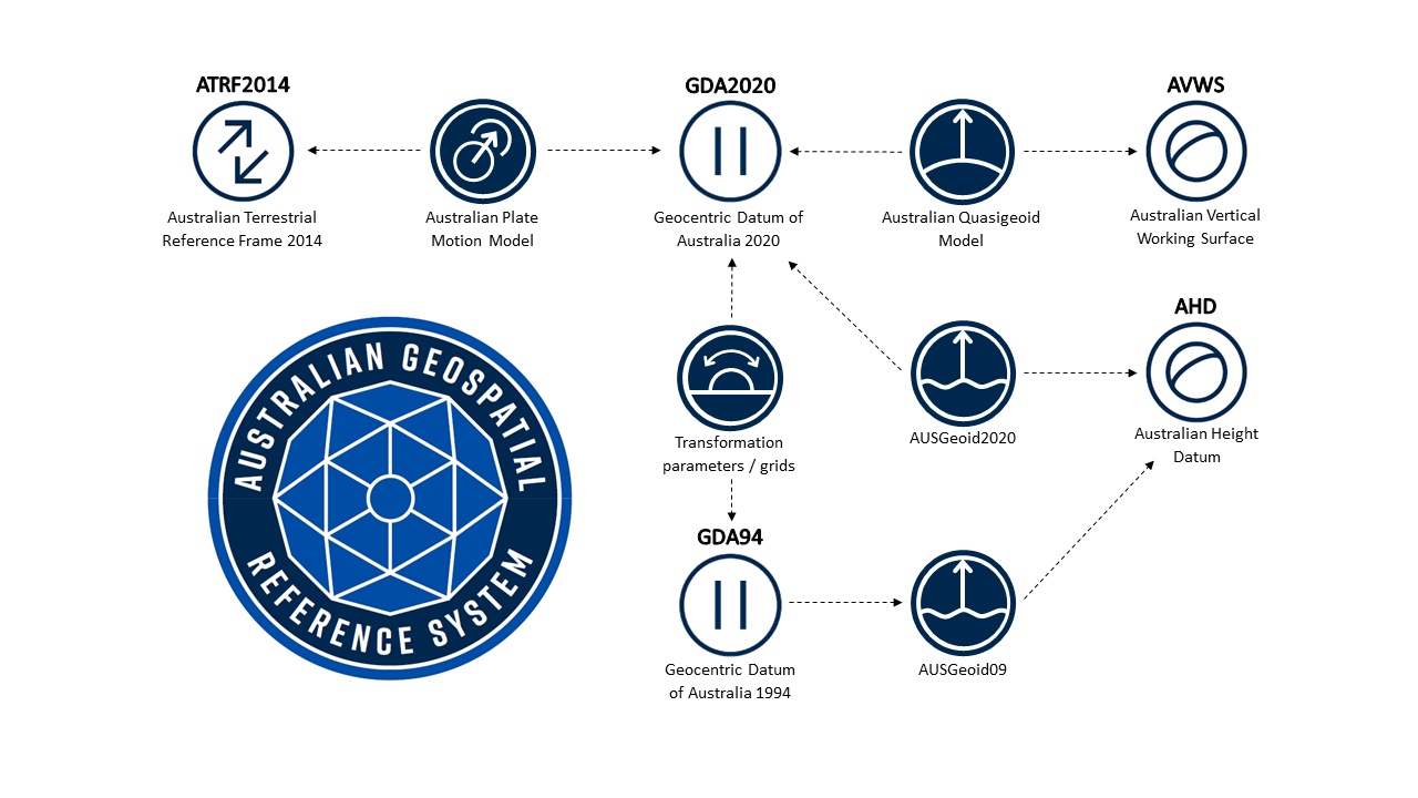
Geoscience Australia has developed a number of tools to assist users working within the Australian Geospatial Reference System, including: datum transformations, coordinate conversions and height conversions using geoid models. The models that these tools depend upon are also available for download. See the AGRS tools and models page.
The Australian Geospatial Reference System is managed by the Intergovernmental Committee on Surveying and Mappings’ Geodesy Working Group. For further information, please refer to The Australian Geospatial Reference System website.