Map Grid of Australia 2020
Page last updated:14 December 2017
Geodetic coordinates (latitude and longitude) are represented on a map or chart, by mathematically projecting them onto a two-dimensional plane. The transverse Mercator (TM) projection is a conformal mapping of geodetic coordinates from the ellipsoid onto a plane where the equator and central meridian remain as straight lines and the scale along the central meridian is constant, while meridians and parallels are projected as complex curves (Figure 1).
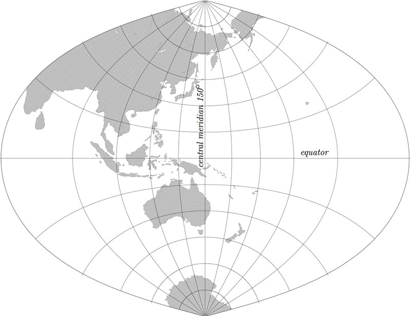
Figure 1: Transverse Mercator projection with central meridian of 150 degrees
The TM projection is useful to map regions with large extents of latitude; however, distortions increase rapidly away from the central meridian.
The UTM system (Table 1) uses the TM projection and attempts to overcome this limitation by dividing the Earth into 60 zones, each with a width of six degrees of longitude. A central meridian is placed in the middle of each longitudinal zone. As a result, within a zone nothing is more than three degrees from the central meridian and therefore locations, shapes and sizes and directions between all features are very accurate.
The true origin for each zone is the intersection of the equator and the central meridian, but a false origin is often used to avoid negative coordinates (Figure 2).
Table 1: UTM system parameters
| Parameter | Value |
|---|---|
| Longitude of initial central meridian (Zone 1) | 177 degrees west longitude |
| Zone width | 6 degrees |
| Central scale factor | 0.9996 |
| False Easting | 500,000 m |
| False Northing (in the southern hemisphere) | 10,000,000 m |
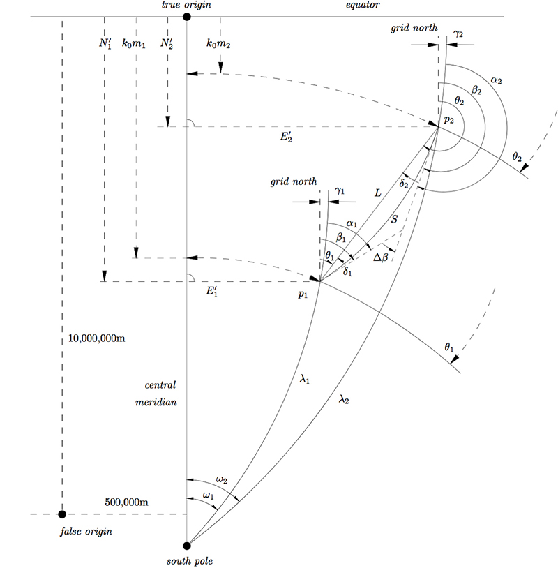
Figure 2: Relationship between geographic coordinates and projected coordinates
The UTM system has been used with the GRS80 ellipsoid and Geocentric Datum of Australia (GDA2020) latitudes and longitudes to define Map Grid of Australia 2020 (MGA2020).
The Krueger n-series or Krueger λ-series formulae are used to convert between UTM (or MGA2020) coordinates and geographic coordinates and vice versa. For more information refer to the Geodetic Calculation Methods page.
For more information about projections and coordinate conversions, please refer to the GDA2020 Technical Manual.