Kauring Airborne Gravity Test Site
Page last updated:8 April 2016
Overview
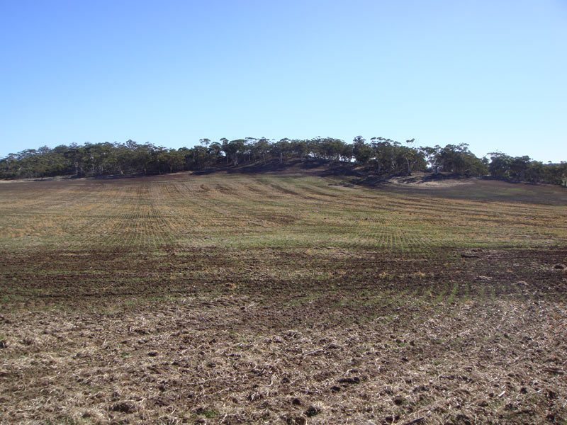
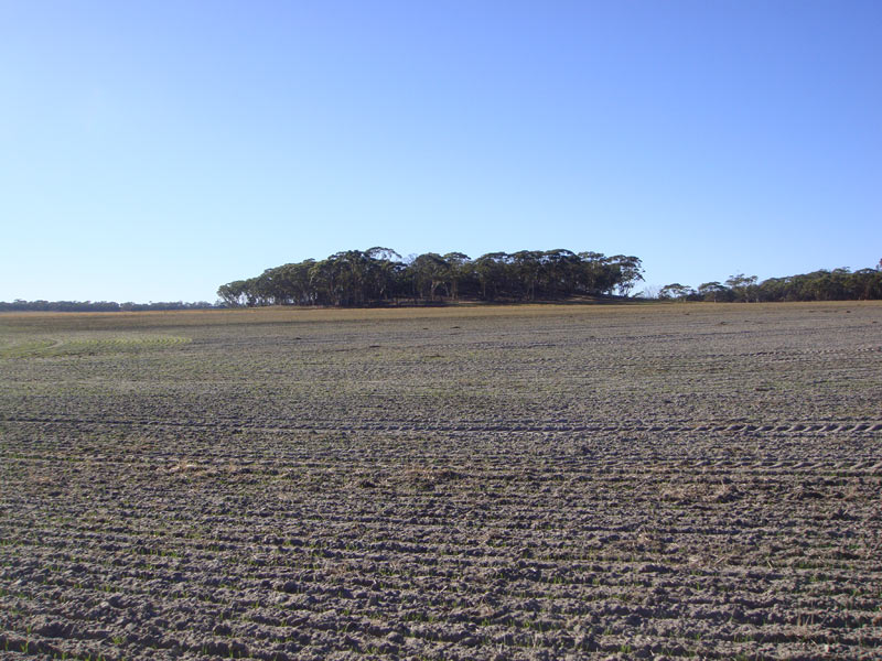
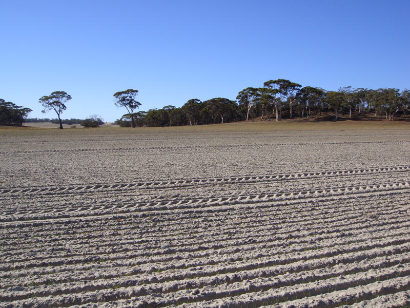
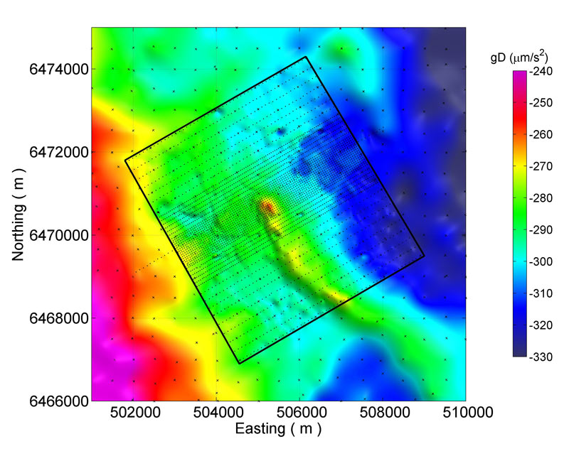
The Kauring airborne gravity test site provides a location for benchmarking the capabilities of airborne gravity (AG), airborne gravity gradiometer (AGG) and other airborne sensing systems. The site, located approximately 100 kilometres east of Perth, Western Australia, is free of low level flight restrictions but before undertaking flights, some liaison with the landholders is required (see below). There is minimal human infrastructure present and the gently rolling topography permits drape flying. Significant gravity and magnetic anomalies have been defined within the Kauring test site by detailed ground and airborne surveys. Individuals, companies or research organisations are invited to acquire data over the test site and make the data (and/or derived products) publicly available for independent analysis via this web page.
The test site data will allow interested individuals and organisations to compare AG and AGG data to the detailed ground gravity data (or products derived from these data). It will also allow direct comparison of different AG and AGG systems over the same gravity features where all other variables, besides the measuring system are defined and constant.
Airborne datasets acquired and made publicly available via this web page will provide the research community with an increasingly valuable resource for developing and demonstrating data acquisition, processing, modelling and interpretation methods. In addition to AG and AGG systems, the site may be used to demonstrate and compare various airborne magnetic systems (total magnetic intensity (TMI), vector, and gradient tensor systems), airborne electromagnetic (AEM) systems and digital terrain mapping systems.
The test site is a collaborative project between Geoscience Australia, the Geological Survey of Western Australia, Rio Tinto Limited and CGG - Airborne.
Location
Kauring Location and Test Flight Protocols
Datasets
Various ground and airborne data sets exist for the Kauring Test Site. Links to those that are publically available are given below.
- Kauring Geophysical Datasets, August 2010
- WorldView-2 Elevation Data
- AIRGrav Data (February-March 2012)
Kauring Geophysical Datasets, August 2010
Public domain geophysical datasets over the Kauring region, with regional to detailed data extents, are available at the following scales:
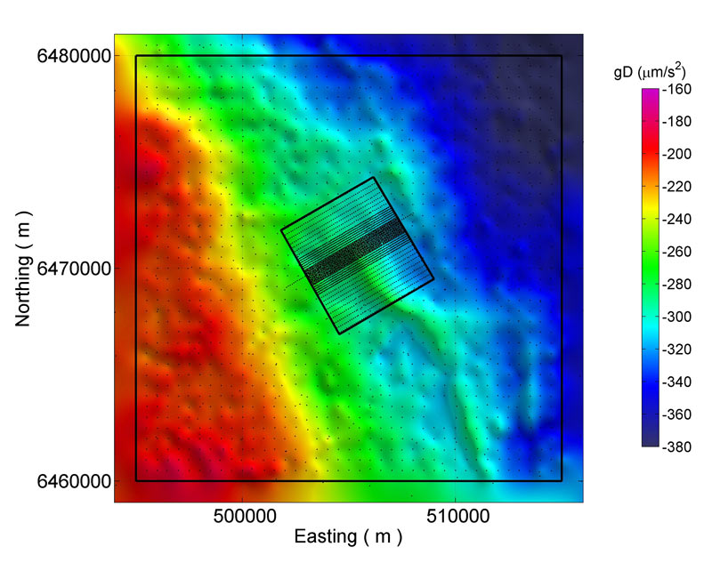
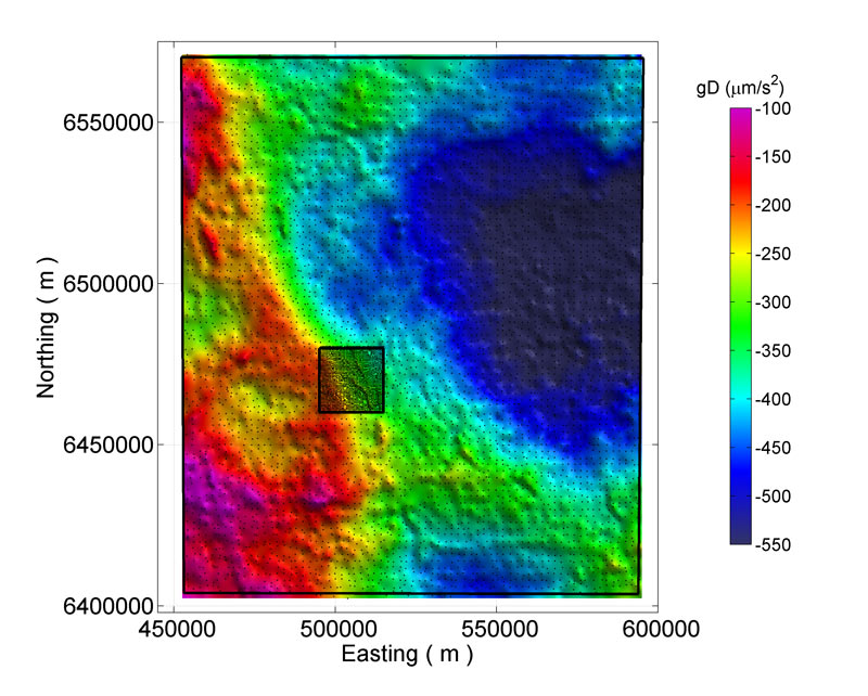
- Airborne gravity gradiometry test area (Kauring detailed) - Figure 1
- Airborne gravity test area (Kauring semi-detailed) - Figure 2
- Cunderdin 2009 gravity survey area (Kauring regional) - Figure 3
Kauring Geophysical Datasets, August 2010 - magnetic, radiometric, elevation, gravity and digital geology datasets.
A data package with airborne magnetic, airborne radiometric, elevation (Airborne LiDAR, ASTER GDEM, SRTM, GEODATA), ground gravity, and digital geology datasets is available for download.
WorldView-2 Elevation Data
In August 2011 the Kauring Airborne Geophysical Test Range was targeted for a survey by the WorldView-2 satellite (© DigitalGlobe 2011) on behalf of the Geological Survey of Western Australia. The WorldView-2 satellite captures high resolution imagery with 8 spectral bands.
This dataset was acquired to create a Digital Surface Model (DSM) and a Digital Terrain Model (DTM) at a 1 metre pixel size suitable for the correction of airborne gravity data. DigitalGlobe has agreed to the release of the DSM and DTM to outside parties.
The DSM is the optical surface as seen by the spectral sensors and includes the height of buildings, vegetation etc. To convert from the DSM to the DTM, which is the height of the ground surface, the height of the buildings and vegetation were removed. Converting the DSM to a DTM required masking out of the trees and buildings and interpolating the height values across these areas.
Analysis of the DTM indicates accuracies of the order of 0.5-0.7 metres can be obtained in areas where sufficient reflections from the ground surface are available.
The final datasets were processed by Geoimage Pty Ltd during August - September 2011 and were made available on 7 December 2011 via the Geophysical Archive Data Delivery System on the Geoscience Portal which is an initiative of the State, Territory and Australian Government geoscience agencies.
AIRGrav Data (February-March 2012)
(The following information is quoted from the "Kauring Gravity Test Site - Airborne Gravity Survey by Sander Geophysics Limited - Licence Agreement and Explanatory Notes" PDF document that is part of the data package.)
The Victorian government commissioned an airborne gravity survey as part of feasibility studies for Carbon Capture and Storage in the Gippsland Basin of Victoria. After the completion of the Gippsland Survey, the Department commissioned a survey over the Kauring Airborne Gravity Test Site in Western Australia. This project received funding from the Australian Government as part of the Clean Energy Initiative.
The Kauring Airborne Gravity Test Site survey was conducted by Sander Geophysics Limited during February and March 2012 using SGL's AIRGrav system in a fixed wing aircraft (Cessna Grand Caravan 208B).
The survey area is divided into an approximately 5km by 5km inner "AGG" area and the surrounding wider 20km by 20km "AG" area. In the AG area, the traverse lines were oriented north-south and spaced at 200m while the control lines were oriented East-West and spaced at 2000m. In the AGG area, the traverse lines were oriented northwest-southeast parallel to one edge of the AGG area boundary and spaced at 50m. The drape surface, designed taking into account the terrain and the performance of the aircraft at the altitudes to be encountered, was flown with a target clearance of approximately 80m above ground level.
Further information on the Gippsland Survey is available on the Victorian government's Energy and Earth Resources website.
A data package with located and gridded AIRGrav data is available for download.
Analyses and applications
The Kauring Test Site and the data acquired at it have been the subject of various analyses and applications. Links to a brief summary and citation are given below for documented examples.
Gravity gradiometry processing and interpretation at the Kauring Test Site - Cericia Martinez and Yaoguo Li (Center for Gravity, Electrical, and Magnetic Studies, Department of Geophysics, Colorado School of Mines).
Gravity gradiometry processing and interpretation at the Kauring Test Site
Gravity gradiometry processing and interpretation at the Kauring Test Site Cericia Martinez and Yaoguo Li (Center for Gravity, Electrical, and Magnetic Studies, Department of Geophysics, Colorado School of Mines).
This work is documented as an Expanded Abstract from the 2012 SEG Annual Meeting Technical Program.
Abstract: The Kauring Gravity Gradiometry Test Site offers a unique opportunity to understand the information content of various types of gravity gradient measurements and the required processing and interpretation techniques. In this paper, we utilize the measured ground vertical gravity data to simulate realistic airborne gravity gradiometry data from several current and future systems using an equivalent-source technique. We then invert these simulated data for the underlying density contrast and evaluate the performance of these inversions. The simulated data and inverted models provide a reference for establishing the validity of available airborne gravity gradiometry data at the site. The major density features recovered from the optimally converted gradient data are highly consistent with those from the original ground gravity and observed gravity gradient data. The consistency seen in this study demonstrates a coherent understanding of the workflow necessary to process and interpret gravity gradiometry.
Martinez, C., and Y. Li, 2012, Gravity gradiometry processing and interpretation at the Kauring Test Site: SEG Technical Program Expanded Abstracts 2012, 1-5, doi: 10.1190/segam2012-1342.1.
References
Following is a list of references to papers, presentations and theses related to the Kauring Test Site.
Bates, M., and S. Elieff, 2012, Technical Report - Kauring Gravity Test Site - Western Australia, 2012, for Victoria State Government Department of Primary Industries: Unpublished Sander Geophysics Limited report.
Christensen, A. N., 2013, Results from FALCON Airborne Gravity Gradiometer surveys over the Kauring AGG Test site: Presented at the 23rd ASEG-PESA International Geophysical Conference and Exhibition, 11-14 August 2013, Melbourne, Australia, ASEG Extended Abstracts 2013, 1-4, doi 10.1071/ASEG2013ab300.
Dransfield, M. H., 2011, Advances in Airborne Gravity Gradiometry: AIG Bulletin, Exploration Technologies 2011, 54, 17-19.
Dransfield, M. H., 2011, Airborne gravity gradiometry - the state of the art: International Workshop on Gravity, Electrical & Magnetic Methods and their Applications, Beijing, China, October 10-13, 2011, 32, doi 10.1190/1.3659073.
Dransfield, M., and A. Christensen, 2013, Performance of airborne gravity gradiometers: The Leading Edge, 32(8), 908-922, doi: 10.1190/tle32080908.1
Dransfield, M., T. Le Roux, and D. Burrows, 2010, Airborne gravimetry and gravity gradiometry at Fugro Airborne Surveys: in RJL Lane (editor), Airborne Gravity 2010 Abstracts from the ASEG-PESA Airborne Gravity 2010 Workshop: Published jointly by Geoscience Australia and the Geological Survey of New South Wales, Geoscience Australia Record 2010/23 and GSNSW File GS2010/0457, pp. 49-57.
Grujic, M., 2010, Optimisation of terrain corrections for practical Airborne Gravity gradiometer surveys: Unpub. Bachelor Of Science Honours thesis, Monash University, Melbourne.
Howard, D., M. Gujic, and R. Lane, 2010, The Kauring airborne gravity and airborne gravity gradiometer test site, Western Australia: in RJL Lane (editor), Airborne Gravity 2010 Abstracts from the ASEG-PESA Airborne Gravity 2010 Workshop: Published jointly by Geoscience Australia and the Geological Survey of New South Wales, Geoscience Australia Record 2010/23 and GSNSW File GS2010/0457, pp. 107-114.
Lane, RJL, 2010 (editor), Airborne Gravity 2010 Abstracts from the ASEG-PESA Airborne Gravity 2010 Workshop: Published jointly by Geoscience Australia and the Geological Survey of New South Wales, Geoscience Australia Record 2010/23 and GSNSW File GS2010/0457.
Lane, R., M. Grujic, T. Aravanis, R. Tracey, M. Dransfield, M, D. Howard, and B. Smith, 2009, The Kauring Airborne Gravity Test Site, Western Australia: Eos Trans. AGU Fall Meeting Supplement, vol.90, Abstract G51A-0656.
Lane, R., R. Smith, M. Dransfield, and D. Robson, 2010, Introduction to Airborne Gravity 2010: in RJL Lane (editor), Airborne Gravity 2010 Abstracts from the ASEG-PESA Airborne Gravity 2010 Workshop: Published jointly by Geoscience Australia and the Geological Survey of New South Wales, Geoscience Australia Record 2010/23 and GSNSW File GS2010/0457, pp. 1-4.
Martinez, C., and Y. Li, 2012, Gravity gradiometry processing and interpretation at the Kauring Test Site: SEG Technical Program Expanded Abstracts 2012, 1-5, doi: 10.1190/segam2012-1342.1.
Martinez, C., and Y. Li, 2012, Understanding gravity gradiometry processing and interpretation through the Kauring test site data: Presented at the 22nd ASEG-PESA International Geophysical Conference and Exhibition, Brisbane, Australia, ASEG Extended Abstracts 2012, 1-4, doi 10.1071/ASEG2012ab238.
Morgan, K. H., and J. H. Herlihy, 1956, The geology of the Kauring area: Unpub. Bachelor of Science thesis, University of Western Australia, Perth.