Bonaparte CO2 Storage Project
Page last updated:8 April 2016
A study of the Petrel Sub-basin (Bonaparte Basin), offshore Northern Territory (Figure 1), has found that the sub-basin is suitable for the geological storage of CO2 (Figure 2). The study, which was funded through the National Low Emissions Coal Initiative, targeted the Petrel Sub-basin because of its proximity to emission intensive industries and favourable geology for potential geological CO2 storage. Geological and geophysical analysis identified two saline reservoir-seal pairs that have a total effective CO2 storage capacity of 15.9 gigatonnes (300 trillion cubic feet).
The study report Regional assessment of the CO2 storage potential of the Mesozoic succession in the Petrel Sub-basin, Northern Territory, Australia: summary report. Record 2014/11 summarises the results of the analysis, and contains supporting appendices, 18 well composites and data packages.
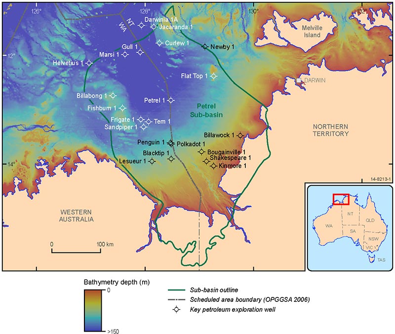
Figure 1. Location map showing study region.
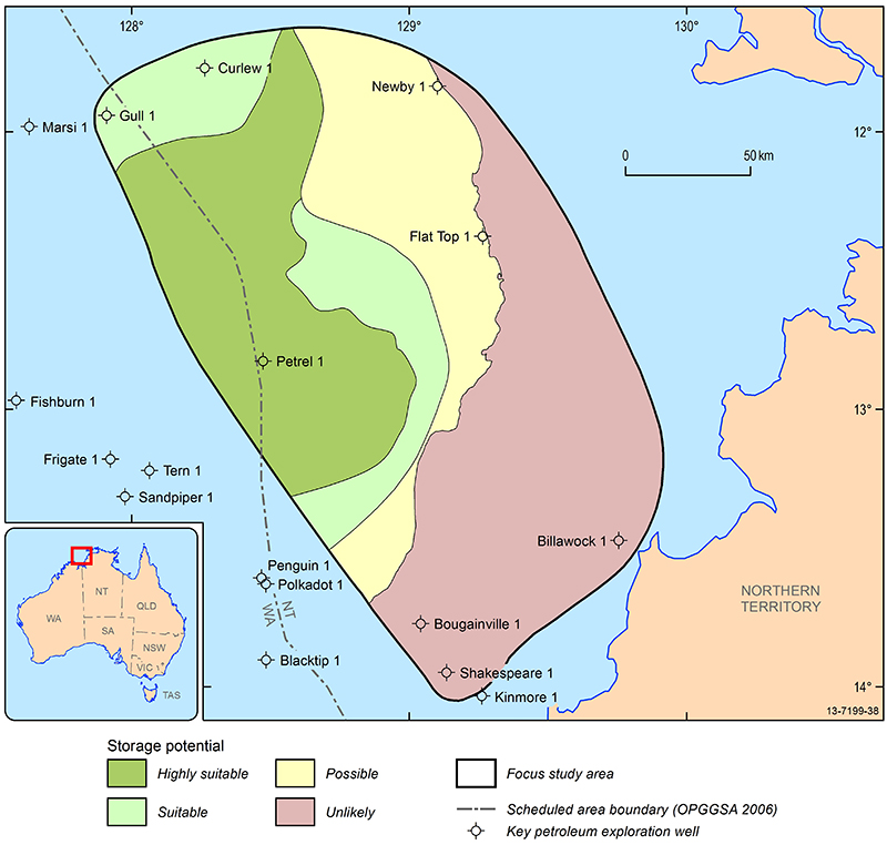
Figure 2. CO2 storage potential of the eastern flank of the Petrel Sub-basin.
Data Packages
Data packages from the study can also be ordered. These comprise the following:
Petrel Sub-basin Seismic Survey (GA336): High resolution multichannel seismic data were acquired between 3 May and 24 June 2012 by the MV Duke (Figure 3). The seismic data have been processed to enhance the stratigraphy in the shallower (<1000 m below sea floor) formations. Seismic and associated datasets are available for download and include:
- 4091 line kilometres of seismic reflection
- 8000 line kilometres of multibeam swath bathymetry
- Chirper sub-bottom profiler data
- Post-stack depth migration and 2D simultaneous inversion analysis of four key lines of GA336 seismic survey
Petrel Sub-basin Marine Survey (GA335): The marine survey, conducted in collaboration with the Australian Institute of Marine Science (AIMS), was completed in May 2012 (Figure 4). A post-survey report is available for download and supporting datasets include:
- 5300 line kilometres of multibeam swath bathymetry
- 655 line kilometres of sub-bottom profiler data
- Underwater video and still images
- Seabed sediment and biological samples
Petrel Sub-basin geological data package: A series of datasets were acquired to support the findings published in the Geoscience Australia Record 2014/11.
- ArcGIS packages
- Mineralogical, petrophysical and pore properties analysis
- Hydrodynamic analysis
- Geological and simulation model data
- Series of key well composites and well sections
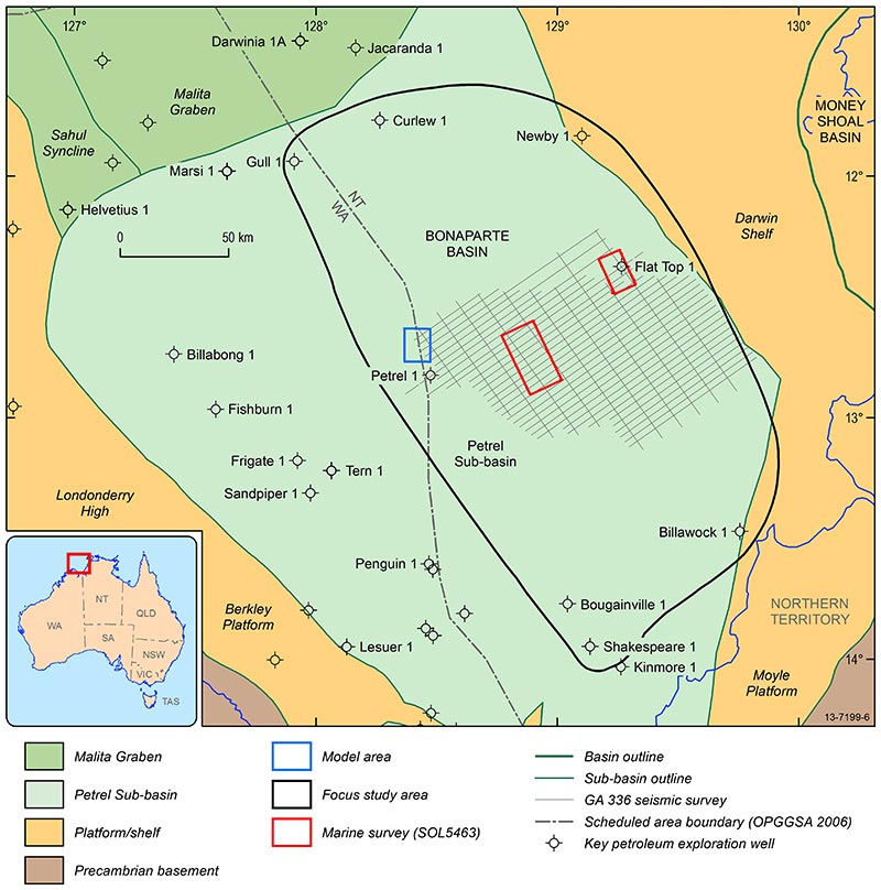
Figure 3. Map showing the location of seismic data and supporting seabed data. Also shown is the location of the geological model (focus study area, in grey) and simulation model (model area, in blue).
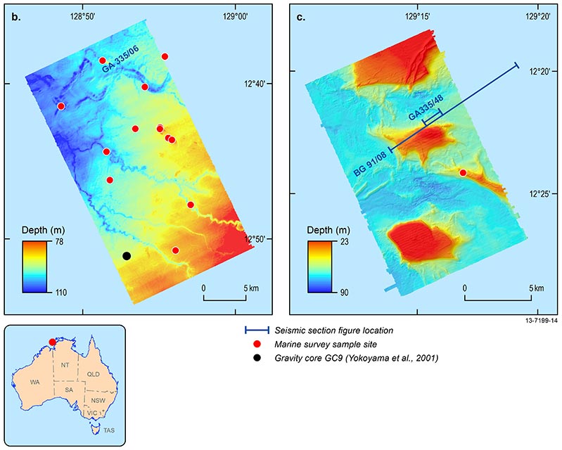
Figure 4. Images from marine survey SOL5463.