Geoscience Australia’s deepest stratigraphic drilling campaign unlocking the secrets of the Adavale Basin
Page last updated:10 December 2025
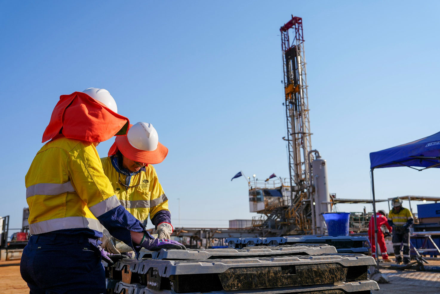
Geoscience Australia has completed the single deepest drilling campaign in modern organisational history, drilling 3,023 metres in the under-explored Adavale Basin in south-eastern Queensland to unlock the region’s geological secrets.
As part of both the Resourcing Australia’s Prosperity initiative and the final phase of the Data Driven Discoveries program, in collaboration with the Geological Survey of Queensland, the campaign aims to assess the Adavale Basin's geology and potential for resources and underground storage. This involves characterising and sampling rocks buried beneath younger sedimentary basins and weathered surface material.
Being a relatively old basin (approximately 419 to 358 million years) and covering a large area of central Queensland including the towns of Charleville, Blackall, and Quilpie, the Adavale Basin is considered challenging to study because it is buried under the younger Galilee and Eromanga basins, and cannot be seen at the surface.
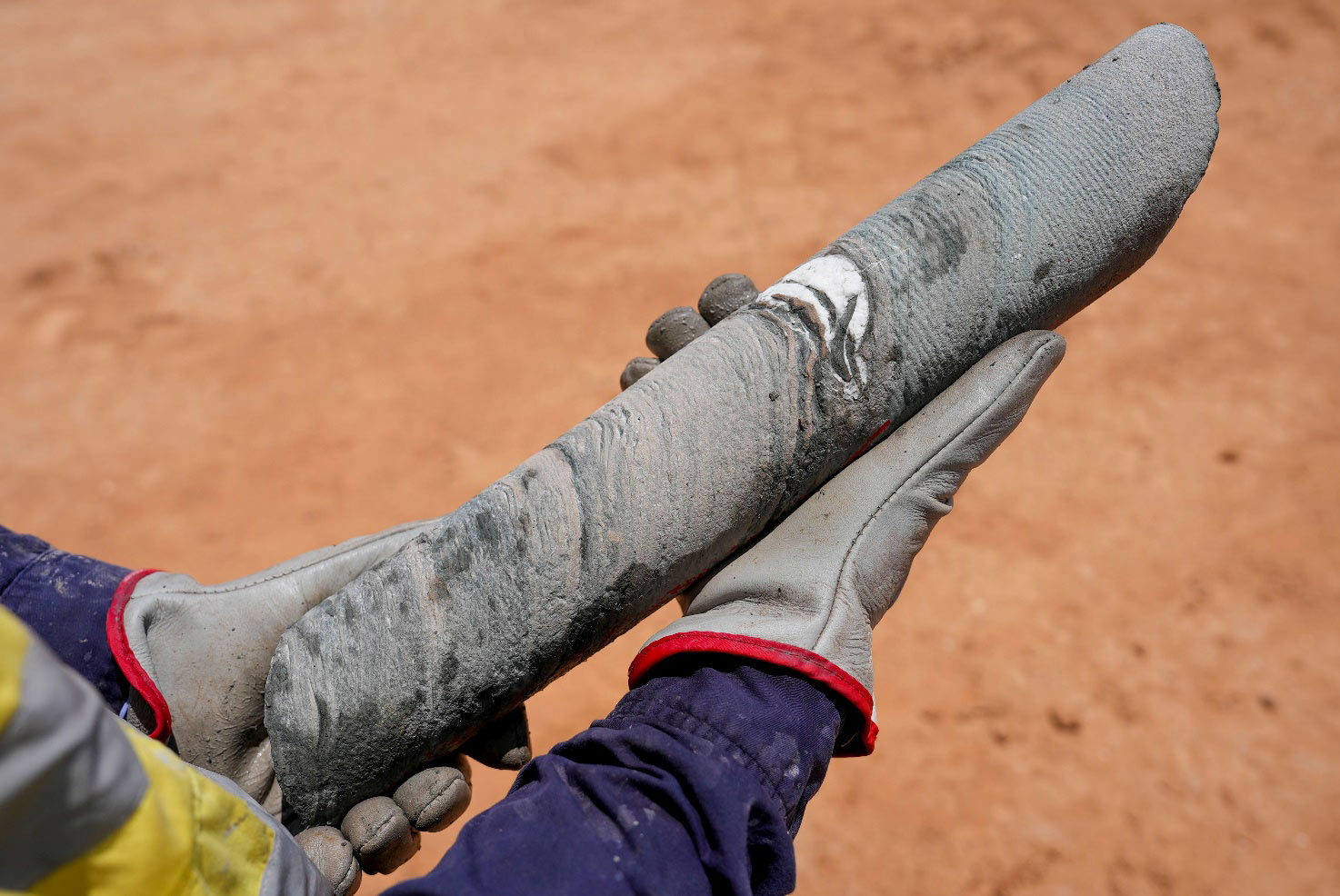
To access the geology beneath younger sedimentary basins and surface materials, the campaign drilled a stratigraphic borehole, located southeast of Blackall, and gathered modern data, including rock chips, groundwater samples, high-resolution geophysical logs and 976 metres of drill core.
Head of Geoscience Australia’s Advice, Investment, Attraction and Analysis Branch, Mitchell Bouma, said that, together with other seismic and airborne data acquisition work, the drilling data will not only help provide further insight into the region’s mineral and groundwater resource potential but will also provide a more comprehensive understanding of the only known thick salt deposit in eastern Australia.
“Basin systems like the Adavale Basin can host a variety of critical minerals and strategic materials, including copper, zinc and cobalt, which are critical to produce wind turbines and electric vehicle batteries. So, we’re excited to see what we can discover through improving our geological models,” Mr Bouma said.
“Through our sampling we will also be able to gain an understanding of the composition and connectivity of the deep groundwater resources, as well as the subsurface geology of the Adavale Basin to help characterise future resource potential.”
“A particular focus of this campaign however is the salt deposits in the Adavale Basin. Large salt bodies are safely used across the world to store hydrogen, natural gas, and even compressed air, as they are impermeable and are therefore a very secure storage option. We believe that the Adavale Basin could be a suitable area for potential hydrogen storage.”
The data produced from this campaign – and the program more broadly – will help to identify ways of locating and mapping the extent of salt bodies within the Adavale Basin, as well as their geological controls, to underpin further storage assessments and exploration.
By delivering vital information about the Adavale Basin and surrounding area, Geoscience Australia is providing government and industry with critical precompetitive data to help secure the region’s prosperity and drive investment as Australia works towards a sustainable low emissions future.
The stratigraphic research borehole has been plugged and will be rehabilitated as required by Queensland law.
Data will be made available on the Geoscience Australia website next year after the data has undergone quality control and has been processed for release.