News
Trusted Environmental and Geological Information Program repository to support sustainable future
Published:5 September 2023
A new repository of geological and environmental data for key basin regions in Queensland and South Australia will help safeguard the environment while securing Australia’s low-emissions future.
The Trusted Environmental and Geological Information Program (TEGI) streamlines access to information and data for four geological basins: the north Bowen, Galilee, Cooper, and Adavale basins.
Developed by Geoscience Australia in collaboration with Australia’s national science agency, CSIRO and funding from the Department of Industry, Science and Resources, it combines data and information on energy, minerals, geological storage of carbon, water resources and the environment in one location for the first time.
This provides Australian communities, regulators and industry with a comprehensive snapshot of the highest quality science available to inform decision-making about future resource development, said Geoscience Australia’s Strategic Basins Director, Dr Sarlae McAlpine.
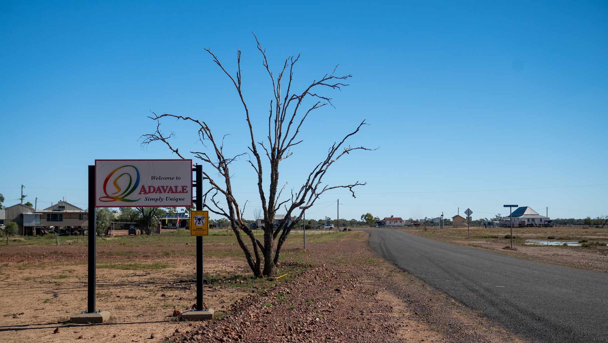
The Trusted Environmental and Geological Information Program (TEGI) team travelled to four basin regions, including the Adavale Basin, to better understand what local communities wanted to know about the areas they live and work in
“TEGI creates a common information base that can support cumulative assessments of development proposals to responsibly support the nation’s energy and emissions reduction needs,” Dr McAlpine said.
“The TEGI repository will help inform the protection of the environment and water resources while supporting the development of resources needed for our transition to net zero and the future prosperity of local communities.”
CSIRO Science Director for the TEGI Program Dr Kate Holland said the TEGI data is a robust body of scientific evidence that will help to safeguard our water and environment from potential impacts associated with future resource development.
“A highlight of TEGI was building our relationships with the people who live and work in the regions to better understand what matters to them, what are the greatest challenges facing their region and how we can protect and support ecosystem recovery in the transition to a low emissions future.”
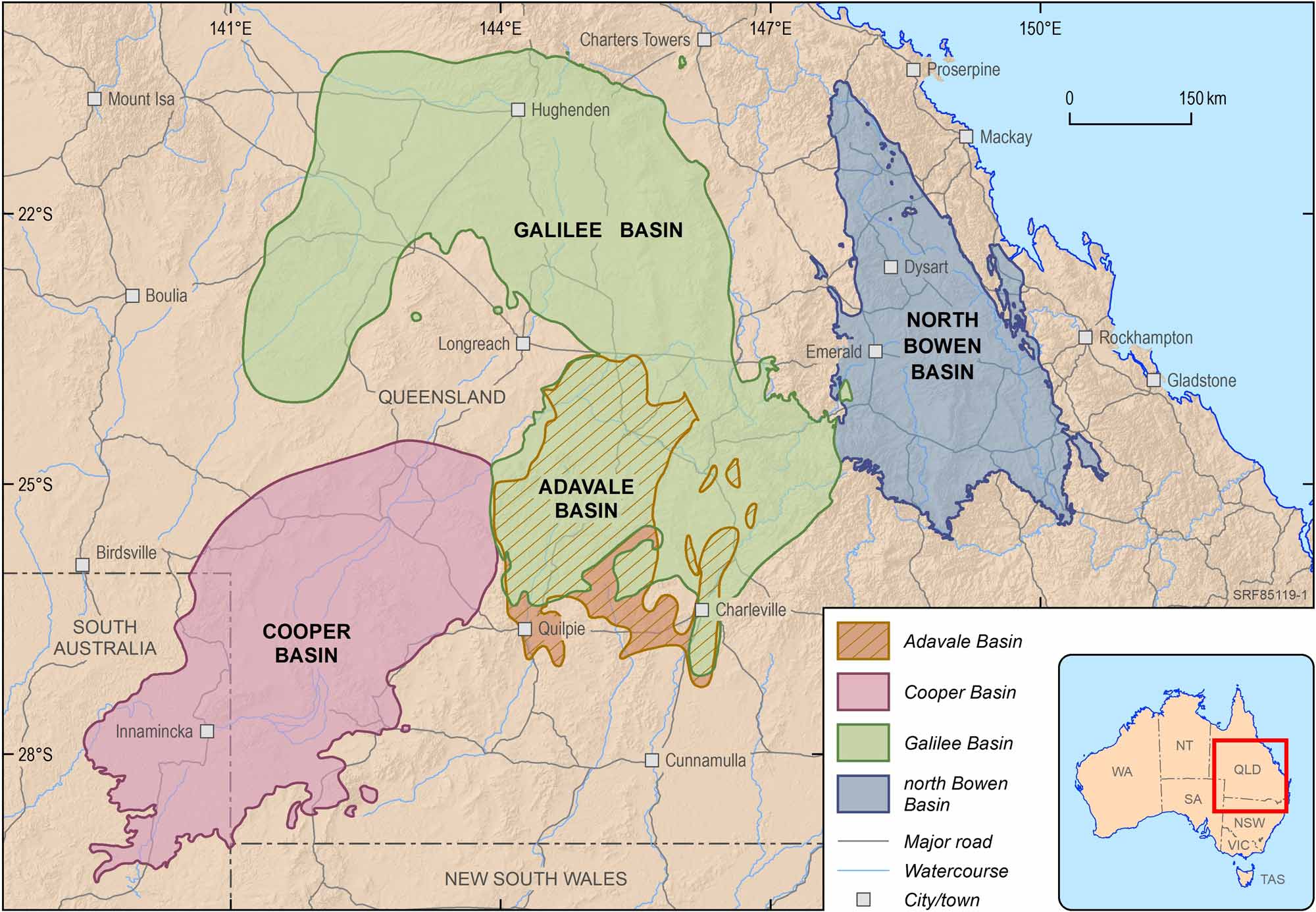
The TEGI program focused on four geological basins: the north Bowen, Galilee, Cooper, and Adavale basins
The basin regions include towns such as Longreach, Charleville, Quilpie, Emerald, Innamincka, Windorah and Blackall.
Throughout this program, the TEGI team worked hand-in-hand with communities in these areas - including First Nations groups, local water users, and local government - to understand what they wanted to know about their basin region, said Geoscience Australia’s Strategic Basins Program Management Director, Mitchell Bouma.
“We wanted to build strong and ongoing relationships with the local communities and First Nations groups of the area and provide a forum through which they could engage with us and each other,” Mr Bouma said.
“We made our experts available throughout the program to engage with these communities, listen to their needs, and explain what we'd learnt.
“For example, many of the communities in these areas are reliant on groundwater, and now through this program we are able to provide three-dimensional data and information on groundwater quality and availability for communities across an area larger than France.”
The repository includes approximately 50 data guides, with themed data packages for each basin region, as well as other information and tools developed from the TEGI program.
This data will also be returned to the communities of the area that were involved in the Basin Reference Groups to share the results.
Explore the repository on Geoscience Australia’s website.