Case studies
Page last updated:20 June 2017
Remotely sensed data is utilised for many different purposes by many different disciplines. The following case studies illustrate how satellite imagery, acquired and analysed by Geoscience Australia, contribute to community safety, environmental research and policy development.
Mapping bushfires
Bushfires are a natural part of the Australian landscape. Many of our native flora and fauna have adapted to the specific fire regimes of the regions in which they live. If Australian communities are to do the same then it is important that we are able to accurately map and monitor fires on a near real-time basis. Such information allows emergency services to control bushfires, develop risk assessments and disaster relief plans.
Bushfires and grassfires are common throughout Australia. Grassfires are fast moving and smolder for minutes while other fires can sweep across vast areas and continue burning for many weeks.
Digital Earth Australia Hotspots is an internet-based national bushfire monitoring and mapping system run by Geoscience Australia to provide timely information to emergency service managers across Australia about 'hotspots' (areas of elevated thermal spectral response). The mapping system enables users to identify the locations of fire which create a potential risk to communities and property. The system is not isolated to emergency service usage it is also used by climate change researchers, media, policy makers and the broader public.
The Digital Earth Australia Hotspots system uses the Moderate Resolution Imaging Spectroradiometer (MODIS), Advanced Very High Resolution Radiometer (AVHRR) and Visible Infrared Radiometer Suite (VIIRS) sensors to detect areas producing high levels of infrared radiation accurately, and pinpoint their position to within 1.5km. At present the use of multiple sensors allows Digital Earth Australia Hotspots to be updated daily.
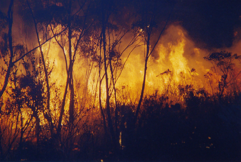
Image of large bushfire: Reproduced with permission from Emergency Management Australia
Water observations from space
Water Observations from Space (WOfS) is a web service displaying historical surface water observations derived from satellite imagery for all of Australia for the period 1987 to present. WOfS displays the detected surface water from the Australia-wide Landsat 5, Landsat 7 and Landsat 8 satellite imagery archive. The aim of WOfS is to better understand where water is usually present; where it is seldom observed; and where inundation of the surface has been occasionally observed by satellite. Find out more about WOfs.
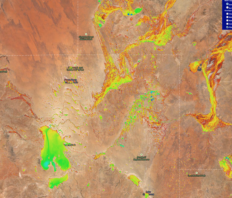
Screenshot image of WOfs web service