Ginan brings enhancements and invites collaboration
Page last updated:7 February 2024
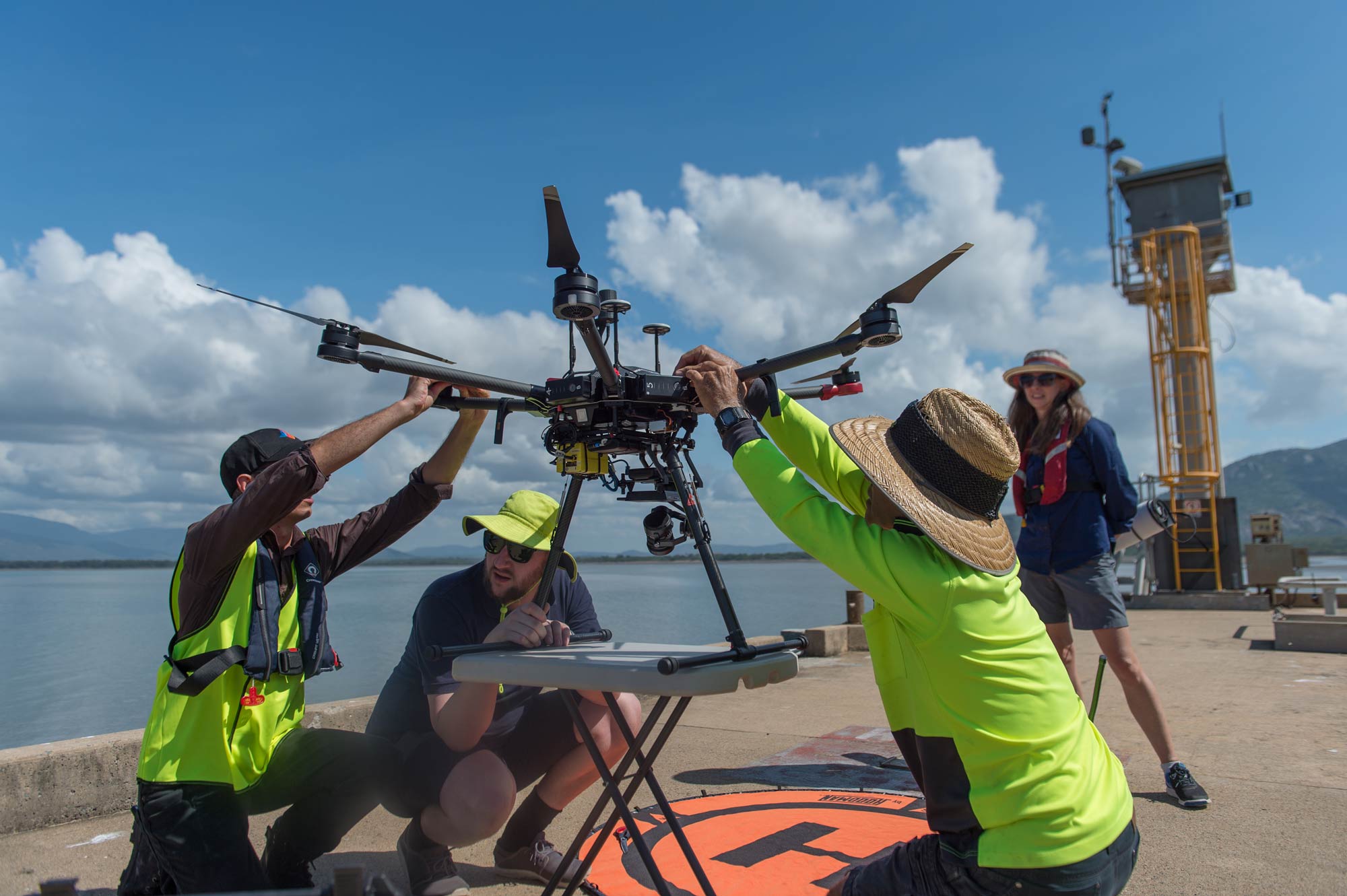
Ginan positioned both aquatic and aerial drones with centimetre accurate real-time positioning, in support of the Australian Institute of Marine Science’s (AIMS) work on the Great Barrier Reef. This was a collaboration between Geoscience Australia, AIMS and FrontierSI. Pictured in photo is Vic Grosjean (AIMS), Chris Marshall (FrontierSI), Joe Gioffre (AIMS), and Anna Riddell (Geoscience Australia). Photo attributed to Dan Woodrow, FrontierSI
Ginan, a home-grown and free to use open-source toolkit that determines precise point positioning with centimetre level accuracy based on global navigation satellite system (GNSS) observations has now released version 3.
“The latest enhancements to Ginan, allow users to use the toolkit to determine precise orbits for low Earth orbit (LEO) satellites,” said Anna Riddell, Director GNSS Analysis.
“The benefits of the version 3 release will see simplified software configuration, improved positioning performance, the ability to estimate LEO orbital trajectories as well as a range of bug fixes and performance improvements.
“This is a great achievement for Geoscience Australia and our collaborators which includes leading Australian universities, Curtin University, the University of Newcastle and RMIT University, as well as industry partners FrontierSI and the Industrial Science Group.
“Through this collaboration, we have already seen the impacts through research opportunities, such as RMIT University’s study on the Ionospheric effects of the 2022 Hunga Tonga Volcano Eruption and the Geoscience Australia, FrontierSI and the Australian Institute of Marine Science’s (AIMS) marine case study demonstrator.
“The marine case study saw us collaborating with AIMS and FrontierSI to trial Ginan at Reefworks, the tropical marine technology test range that offers to test equipment in a real-world environment.
“In this environment, Ginan positioned a ‘surf-bee’ aquatic drone and an aerial drone with centimetre accurate real-time positioning, which is now supporting AIMS’s work on the Great Barrier Reef.
"I invite the global position, navigation and timing (PNT) community to join us to be part of the Ginan story through on-going open-source collaboration and the development of the toolkit.
Further information about Ginan is available on the Geoscience Australia website at www.ga.gov.au/positioning.