Resource potential One region, vast potential: Diving deep into the Delamerian
By uncovering new opportunities for the Delamerian region, we are turning precompetitive geoscience into real-world outcomes.
Deep dive projects reduce uncertainty, inform decisions and create the confidence needed to unlock future investment.
Published:17 November 2026

Resourcing Australia's Prosperity initiative, the Delamerian Deep Dive project
By integrating millions of data points collected through drilling, seismic surveys, geophysics, geochemistry and groundwater investigations, we have built the most comprehensive picture yet of one of the largest concealed geological regions in south-east Australia.
The first regional deep dive completed under the Resourcing Australia's Prosperity initiative, the Delamerian Deep Dive project combined more than 57,000 line-kilometres of airborne electromagnetic data, 1,275 kilometres of seismic data, 17 drill holes and 6.5 million geochemical data points to uncover the region's geological history.
Spanning more than 300,000 square kilometres across South Australia, New South Wales, Victoria and Tasmania, we now know that the Delamerian region is not a single geological system, but the result of multiple episodes of continental extension, volcanic arc formation and tectonic collision over hundreds of millions of years.
The project identified new exploration opportunities for copper, gold and critical minerals, while also improving knowledge of groundwater resources that support communities, industry and the environment.
Most importantly, the work is already influencing industry activity. The open-access datasets, interpretations and resource assessments reduce exploration risk, helping industry target investment more effectively and with greater confidence.
The Delamerian Deep Dive project demonstrates the power of precompetitive geoscience. By making high-quality geoscientific information freely available, we are helping industry identify opportunities, attracting investment into prospective regions and supporting better decisions about Australia's resources.
Related information
- Learn more: The Delamerian Deep Dive project
57,000
57,000 line-kilometres of airborne electromagnetic data
1,275
1,275 kilometres of seismic data
Discover more

Our highlights
Across the year, our people have delivered a wide range of outcomes that addressed some of Australia's most significant opportunities and challenges.
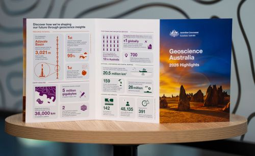
Highlights at a glance
The highlights included in this annual snapshot showcase just some of the diverse and impactful work that has created value for Australia through trusted science, data and insights during 2026.

Message from the CEO
Geoscience Australia and our predecessors have always played a central role in leading applied geoscience knowledge that underpins the safety, resilience and prosperity of our nation.