National Land, Marine and Coastal Mapping Over 500,000 users: Exploring a nation of insights in one digital atlas
The Digital Atlas of Australia is transforming how people use national data.
The platform is helping governments, businesses and communities turn information into insights.
Published:17 November 2026

Supporting better decisions about Australia’s people, environment and economy
The Digital Atlas of Australia demonstrates how we're moving beyond simply publishing data to making it discoverable, accessible and usable. Putting users at the centre and delivering decision-ready insights, the Digital Atlas brings together trusted national datasets into a single place-based platform that helps governments, businesses and communities better understand Australia's geography, economy, people and environment.
The platform's rapid growth reflects strong demand for a national view of Australia. In the last 9 months, the public interface reached 242,288 active users, while the government environment recorded 515 users. Since January 2026, 174 datasets were included in the Digital Atlas for public environment, bringing the total number of datasets to 472 since launch.
By integrating data from across governments and presenting it through intuitive tools and maps, the Digital Atlas is helping users move from information to action. Whether supporting policy development, planning, investment decisions or community understanding, the platform is making national data more useful, connected and impactful.
Related information
- Learn more: Digital Atlas of Australia
242,288
In the last 9 months, the public interface reached 242,288 active users
174 datasets
Since January 2026, 174 datasets were included in the Digital Atlas for public environment, bringing the total number of datasets to 472 since launch
Discover more

Our highlights
Across the year, our people have delivered a wide range of outcomes that addressed some of Australia's most significant opportunities and challenges.
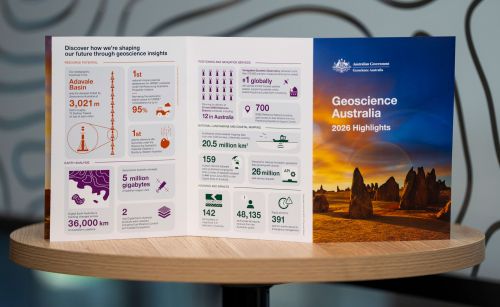
Highlights at a glance
The highlights included in this annual snapshot showcase just some of the diverse and impactful work that has created value for Australia through trusted science, data and insights during 2026.

Message from the CEO
Geoscience Australia and our predecessors have always played a central role in leading applied geoscience knowledge that underpins the safety, resilience and prosperity of our nation.