Earth science is wherever you are!
Page last updated:10 October 2025
Wherever you are, Earth science is right there with you - helping everyone understand where we stand in the world, keeping us safe, and supporting informed decisions that benefit all Australians.
From accurate mapping to real-time data and monitoring systems Earth science touches our lives in more ways than you might expect. When you use precise positioning from space-based Earth science, you know exactly where you are on the map. But, how do you know if that spot on the map truly reflects what’s around you? What can Earth science reveal about that location? What characteristics does it have? Are there natural hazards nearby? And if that spot is in the ocean, how do we make sense of it?
Earth science helps answer all these questions.
We call this kind of location-based information, geospatial data. It’s a powerful tool that brings data and information from diverse sources, census data, satellite imagery, weather patterns, geological observations, and even hand-drawn maps, and combines it all together with location. It helps us understand the world around us with clarity and confidence.
️Did you know that geospatial data improves our lives in countless ways?
It is a vital part of evidence-based decision making. After all, everything happens somewhere. Whether we’re delivering government policy, supporting industry growth, or enhancing community wellbeing, location is the common thread. Geospatial data is essential to helping communities mitigate bushfire risks, guiding the development of our roads, infrastructure and cities, tackling environmental challenges and even building detailed models of the landscape.
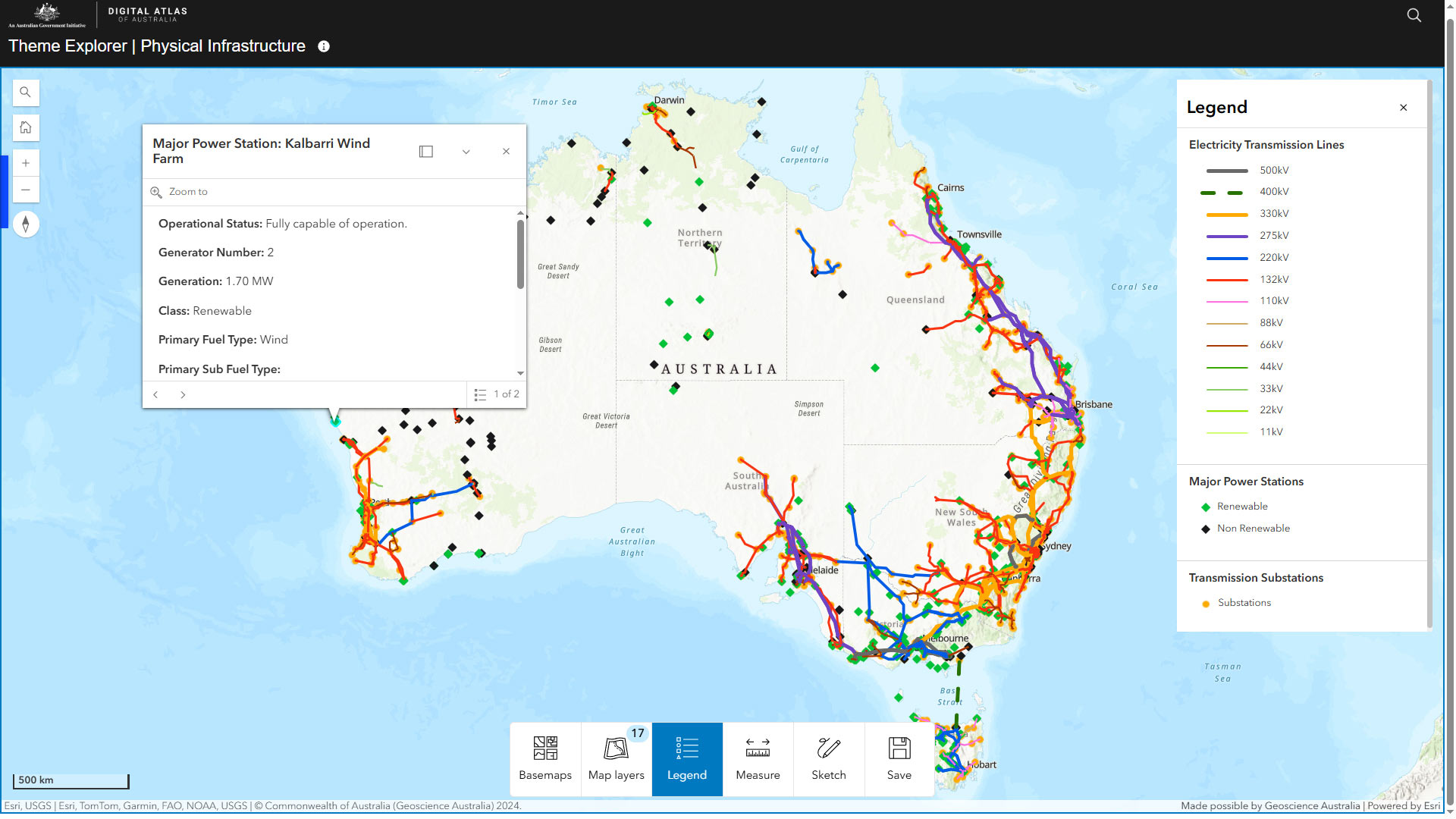
By visualising data spatially, such as through the Digital Atlas of Australia, we can uncover connections, trends, patterns and gaps. This insight helps us identify areas of greatest opportunity, highest level of need or where further work is required to close gaps.
The Digital Atlas of Australia brings together, curates and connects trusted national location data in an interactive, secure, and easy-to-use online platform. (Source: Geoscience Australia YouTube)
Did you know geospatial data helps protect lives and property?
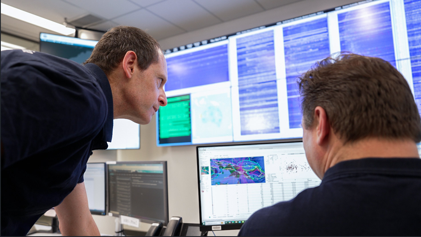
Geoscience Australia’s National Earthquake Alerts Centre monitors our seismic network 24/7 to make sure we identify seismic events as they happen. (Image: Geoscience Australia)
Australia experiences around 100 earthquakes over magnitude 3 every year. To monitor and respond to these events, our National Earthquake Alerts Centre relies on real time data from both international stations and the Australian National Seismograph Network – a network of over 100 seismic monitoring stations located across Australia, its offshore territories, and parts of the Pacific, Southern and Indian Oceans. These stations continuously collect seismic data, enabling experts to detect, locate and analyse seismic events as they happen.
Want to hear from one of our experts? Join Dr Trevor Allen on the Ockham's Razor podcast, as he busts the myth that Australia doesn't have earthquakes! Learn more
Earth science and geospatial data play a vital role in how Australia prepares for and responds to natural disasters, hazards and risks – beyond just earthquakes.
Thanks to the skills, knowledge and dedication of our geoscientists, we can understand hazard risk, help communities be better prepared, monitor unfolding events and deliver critical data and information in real time. Whether it’s an earthquake, flood, bushfire or a cyclone, Earth science from beneath our feet to the space above us - helps us prepare for, respond to, and recover from a natural disaster.
For the kids! Make your own earthquake and see the damage they can cause! When we think of earthquakes, we usually think of things breaking like roads and buildings, but in some circumstances the shaking can cause the earth below our feet to become wobbly and liquefy. This fun and hands-on activity introduces kids to the powerful processes and forces that play when the ground shakes - the same forces that shape our environment and influence how we respond to natural disasters.
This experiment connects directly to the work our geoscientists do to understand and prepare for natural hazards. Whether it’s monitoring earthquakes or modelling flood risks, it all starts with understanding how the Earth changes over time.
Watch the video and get shaking - because learning about Earth science can be sweet and powerful!
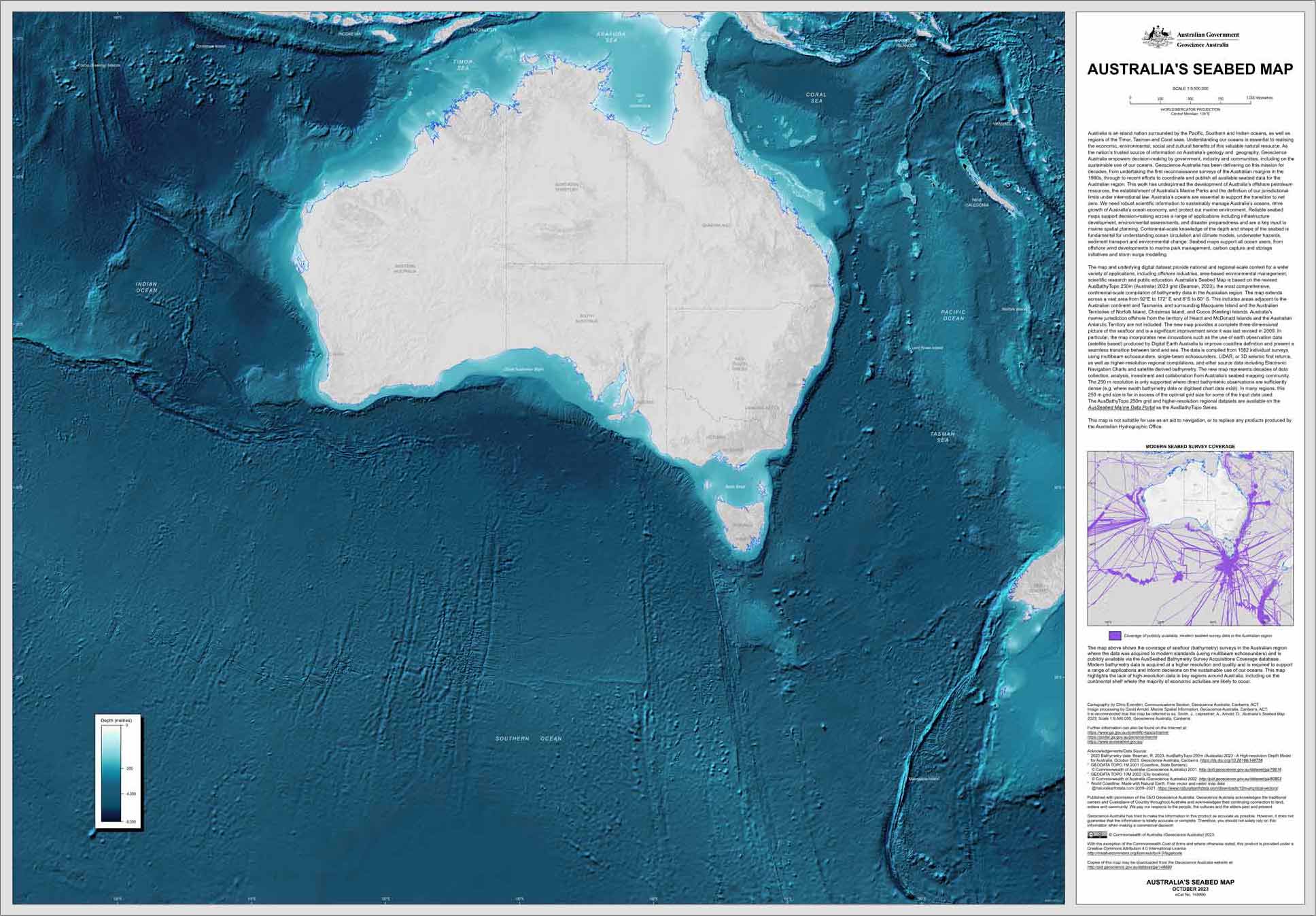
Did you know that Australia has one of the largest marine jurisdictions in the world and that cutting-edge geospatial data is helping us understand our ocean floor?
Earth science doesn’t stop at the beach, it also reveals incredible insights into the world beneath the waves and it is a big world at that! Australia’s marine jurisdiction is approximately twice the size of our land mass and makes up 4% of the world’s oceans. As of August 2024, we have detailed maps of 35.2% of Australia's marine jurisdiction! A remarkable achievement using bathymetry - the science of measuring and mapping the underwater depth and topography of the seafloor, riverbeds, and lakebeds underwater.
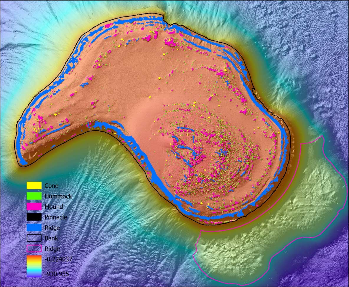
Bathymetric images, such as this one of Malay Reef in the Coral Sea Marine Park, off the coast of Queensland beyond the Great Barrier Reef, give vital information about the ocean environment. (Image: Geoscience Australia)
As an island continent, Australia is surrounded by oceans. With growing global demand for energy, food and security, understanding our marine jurisdiction and where things are, is more important than ever for our economy and future. Thanks to Earth science, we’re able to gather vital data to inform decisions about our oceans, reefs, coasts and the Antarctic. This knowledge is essential to unlocking the economic, environmental, social and cultural benefits of our marine resources.
Press play to learn about seabed geomorphology and how we are mapping Australia's way to a sustainable ocean economy!
Seabed geomorphology describes shape and evolution of underwater landscapes. These landscapes interact with ocean currents to create diverse marine habitats. Similar to geological maps on land, maps of seabed geomorphology are vital for making informed decisions to support the sustainable growth of our Ocean Economy. (Source: Geoscience Australia YouTube)
Careers in Earth Science? There are so many ways to study ‘where on Earth!’
If you want to always understand where you are or why things are happening there or how to help improve outcomes from a natural hazard emergency, there are endless career options for you.
Want to work out where? Look into geospatial and location careers, these include
- cartographer,
- mapping specialist,
- satellite engineer,
- spatial scientist,
- GIS officer.
Want to help understand and plan for Natural Disasters? Maybe a role in community safety is for you?
- seismologist,
- satellite imagery expert,
- mathematician,
- hazard modeller,
- demographer,
- science communicator.
Love the ocean and wonder what the surface looks like under all that water? Perhaps a career in marine and Antarctic science is your calling?
- marine geologist,
- ecologist,
- geospatial analyst,
- geophysicist,
- satellite imagery expert,
- environmental scientist,
- Antarctic scientist.
Wondering what to study? Check out our flyer ‘What on Earth is a career in geoscience?’. It’s packed with information to help you find the right course and career path – no matter where your interests lie.
Get to know a seismologist!
Seismologists are the experts on earthquakes! If you’ve ever wondered why the ground shakes or how the tectonic plates bump up against each other, you need to talk to a seismologist. Michelle Salmon is part of our Community Safety team and gave us a quick insight into her work and how she got here.
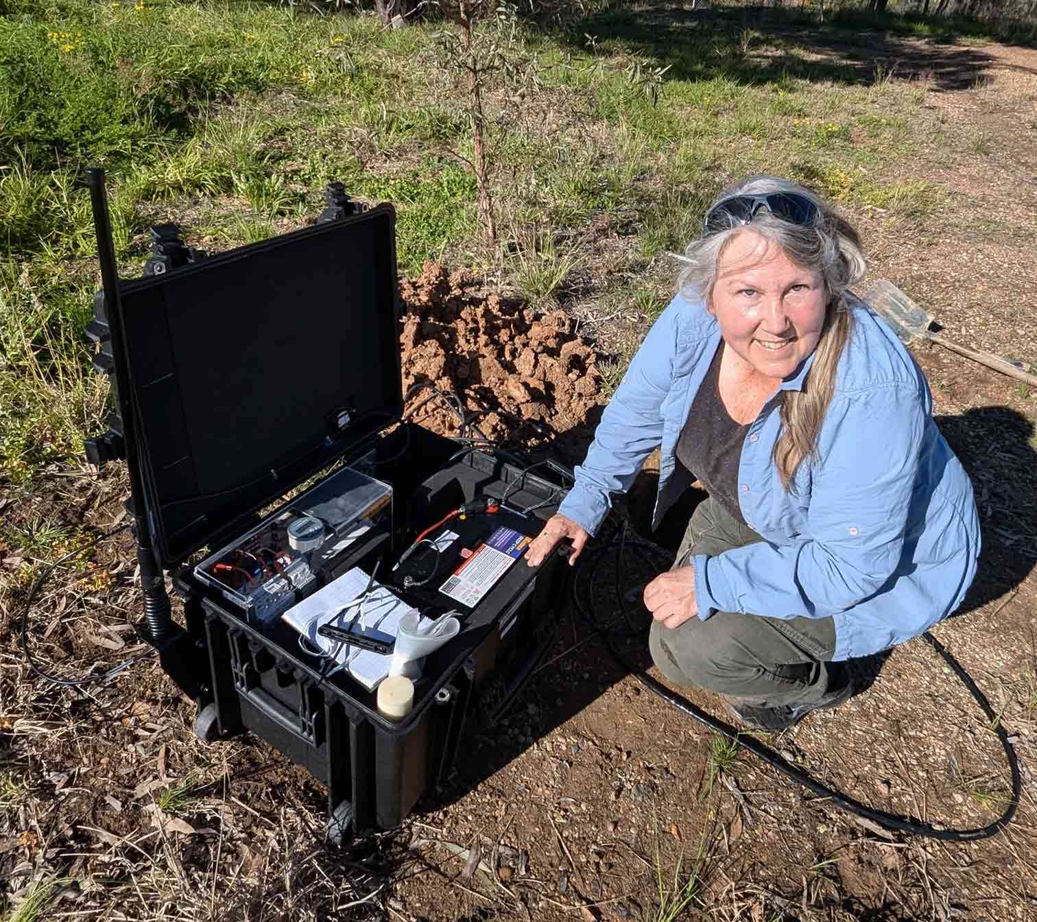
Michelle Salmon installing a small seismometer in Muswellbrook, NSW, following a large earthquake. (Image: Geoscience Australia)
What does a day in the life of a seismologist look like?
A lot of my day is spent making sure that our Australian National Seismic Network is running properly. I watch the planet shake and help people understand what has happened when there is a significant earthquake.
What is the best part of your job?
The best part of my job is when we use seismology for something a bit out of the ordinary. For example, tracking unexploded bombs, or meteorites. We also know before everyone else when a significant earthquake has occurred.
What inspired you to become a seismologist?
I am a New Zealander, so earthquakes have always had a presence in my life. Feeling the Earth shake beneath your feet is a great motivator to understand why.
What did your pathway to this career look like?
I started as a structural engineer working to strengthen buildings for earthquakes. That lead me to going back to university to do a PhD in geophysics. Then I moved to Australia to work at the Australian National University where, among other things, I ran the Australian Seismometers in Schools Program. In 2024 it was time for a change, so I joined the team at Geoscience Australia to help with the Australian National Seismic Network.
What impact does seismology have on our lives?
Australians often think that earthquakes aren’t something to think about here. But large earthquakes can happen in Australia. Don’t worry, seismology provides the information engineers need to keep us safe when they do occur.
What is your favourite example of your work in action?
I am passionate about data sharing so I love it when I can give a web address to someone to look at the seismic waves for themselves. Before I came to Geoscience Australia, a large part of my job was working in STEM outreach running the Australian Seismometers in School program so I have seen the impact we can have sharing data and expertise.
What is your favourite Earth science themed song?
Well, this one is easy. A few years ago, a Nepalese colleague teamed up with two famous Nepalese folk singers to create the Earthquake Awareness song. Makes me smile. Check it out on YouTube. Don’t worry there are subtitles.
Want to see Michelle in action? Check out how we responded to a recent large earthquake in Queensland, featuring Michelle as lead seismologist! Learn more.
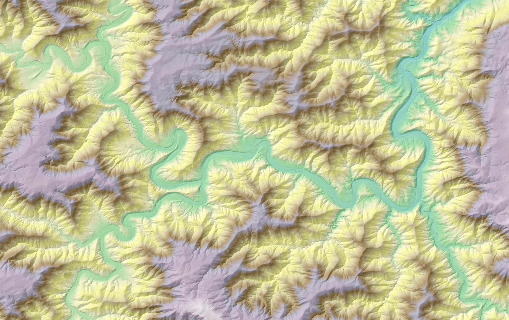
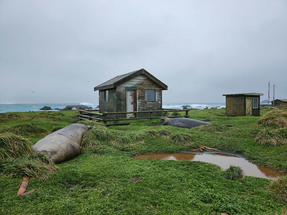
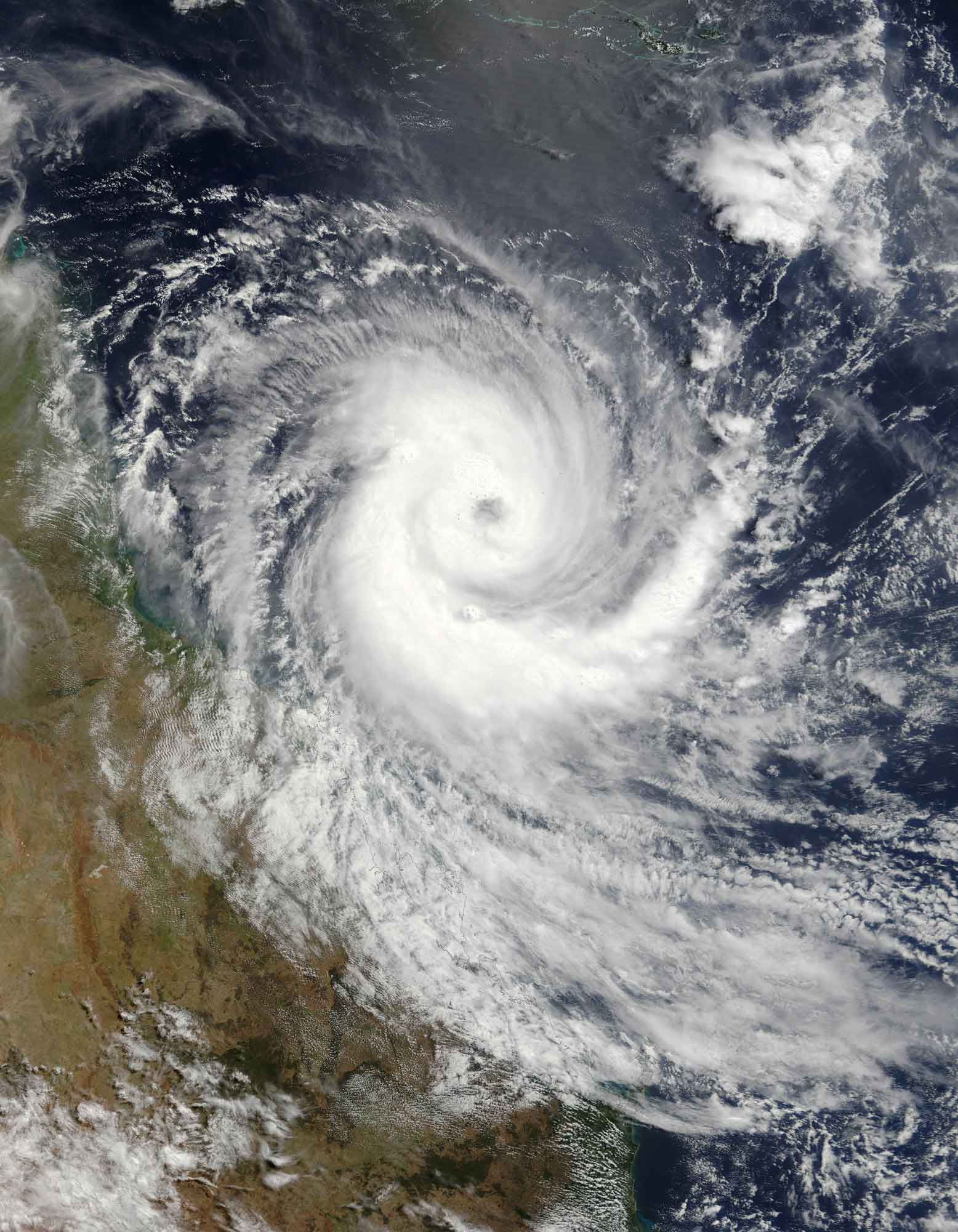
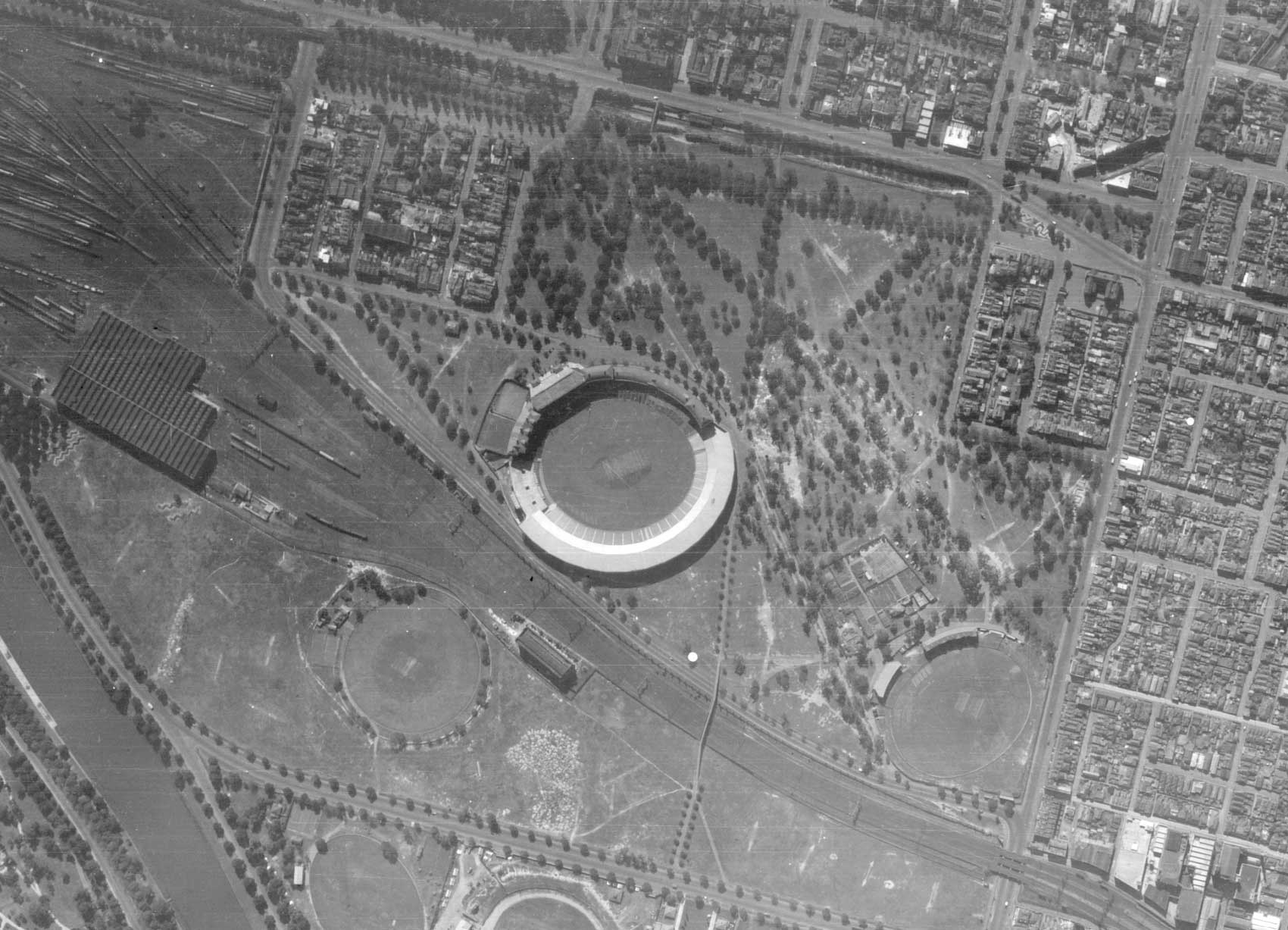
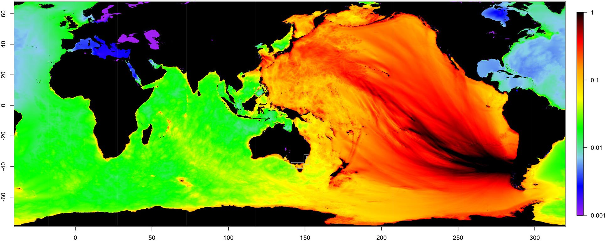
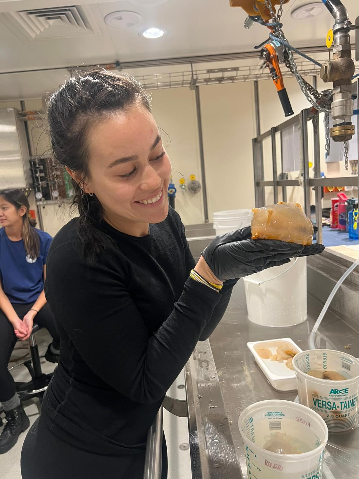
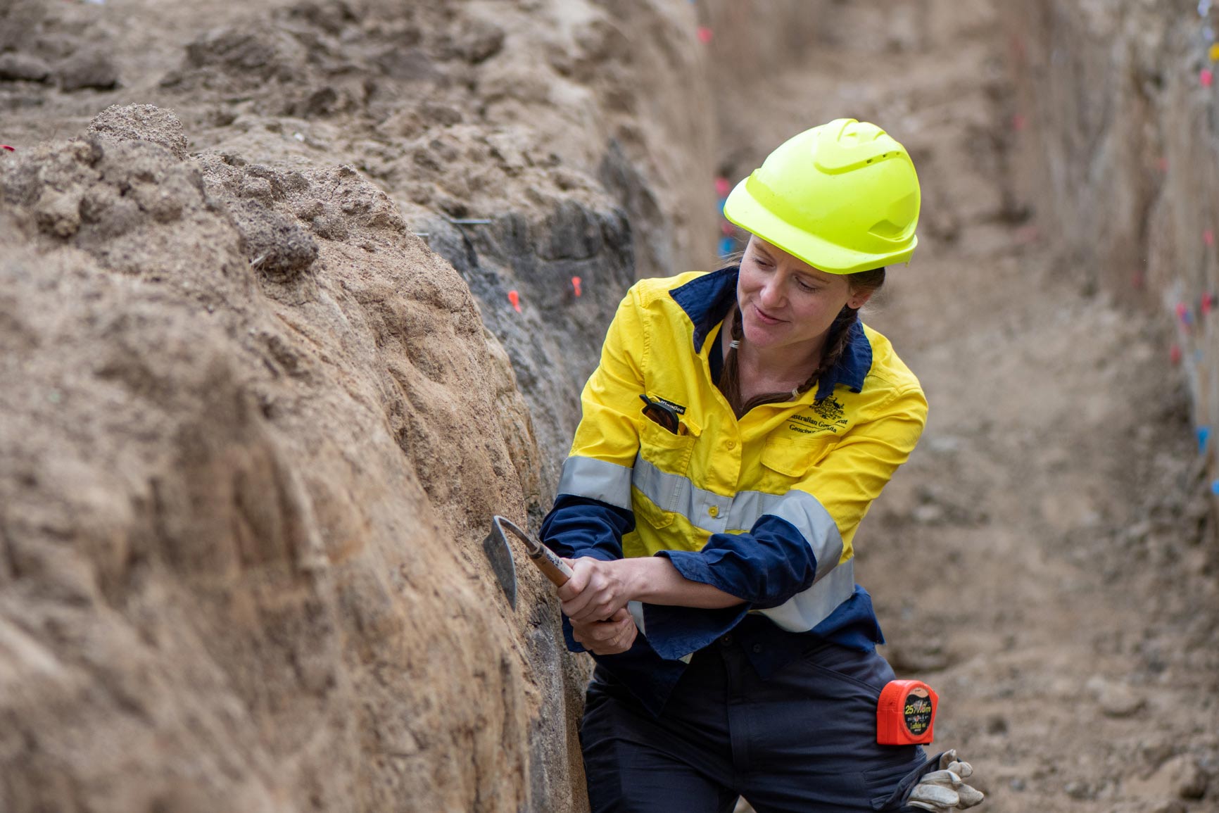
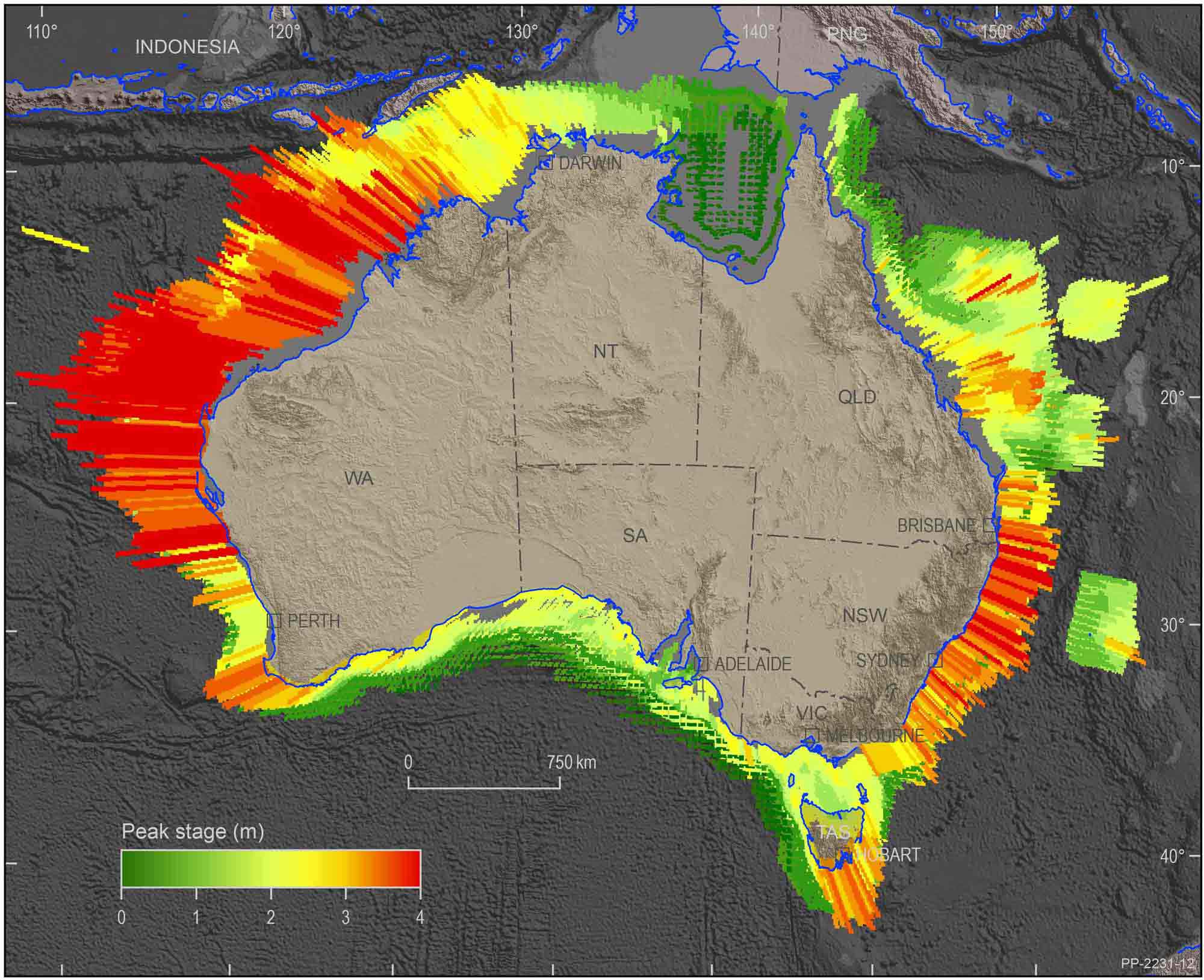
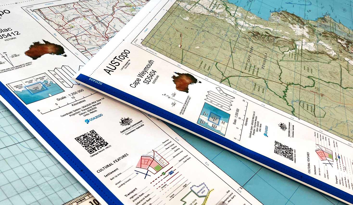
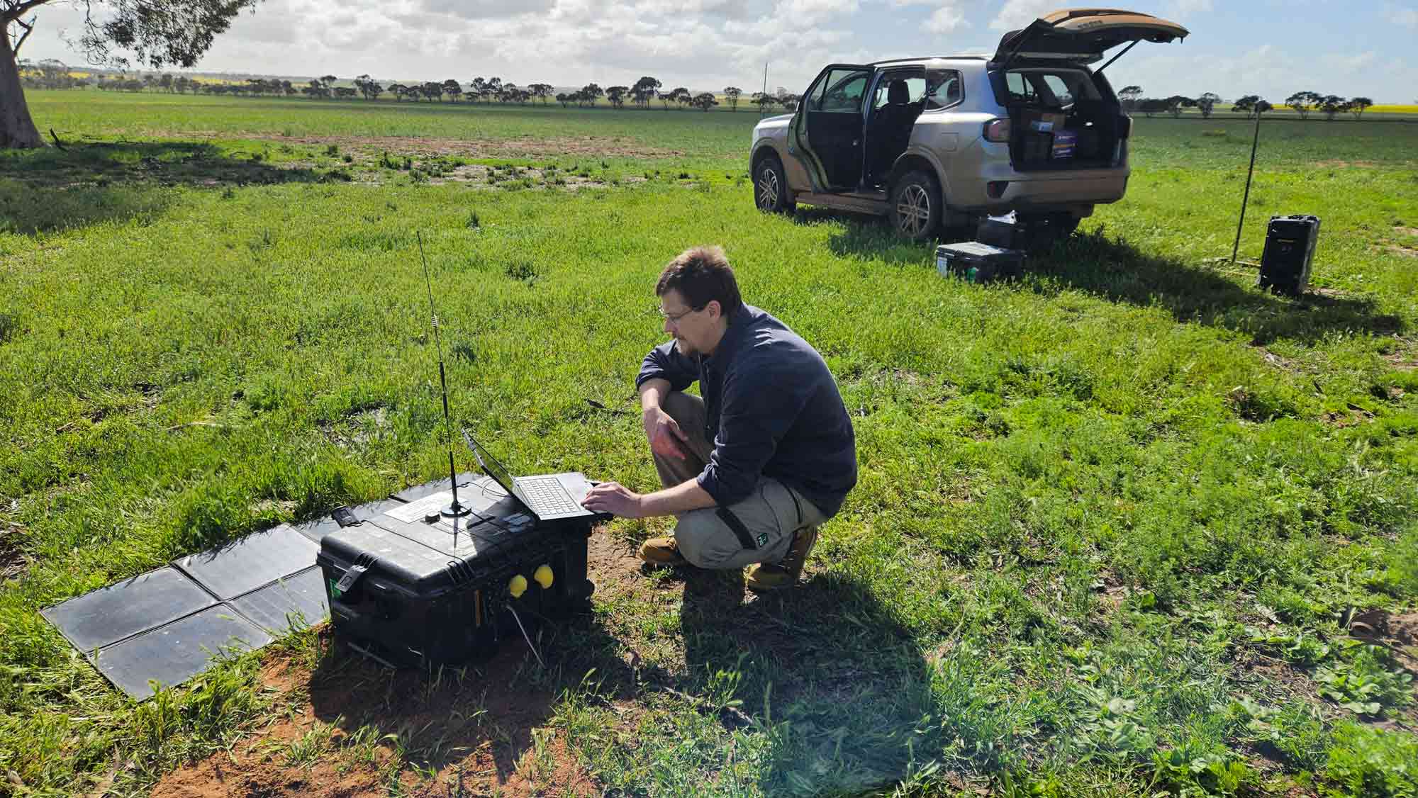
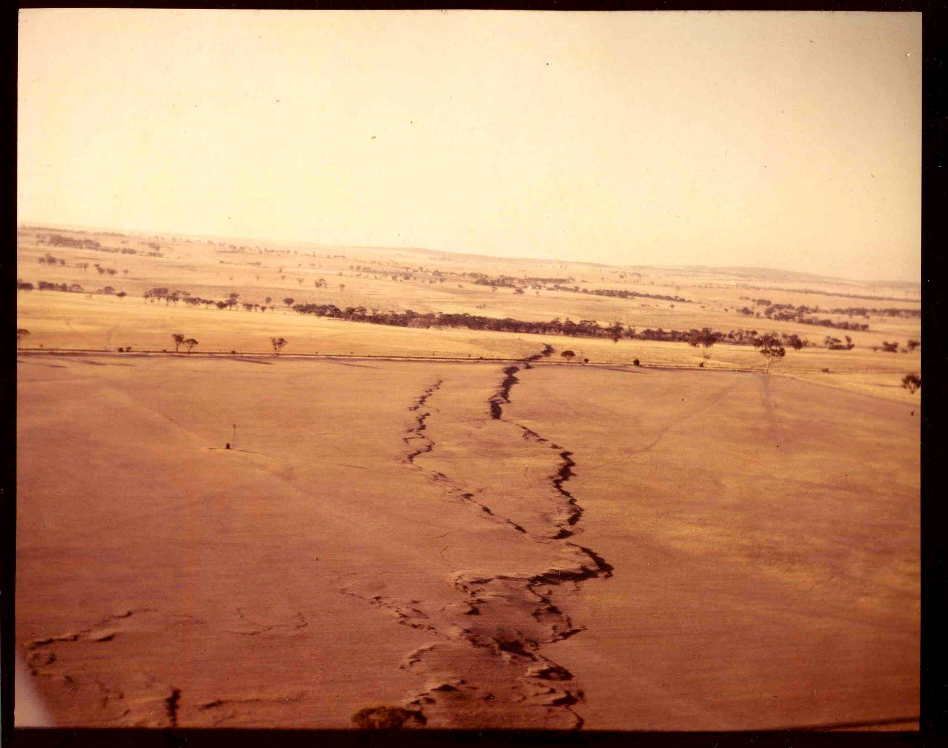
Check out these images which show how Earth science helps us understand the world around us!