Derived data product DEA Coastal Ecosystems
Page last updated:17 December 2025
Mapping Australia’s vast and varied coastal ecosystems
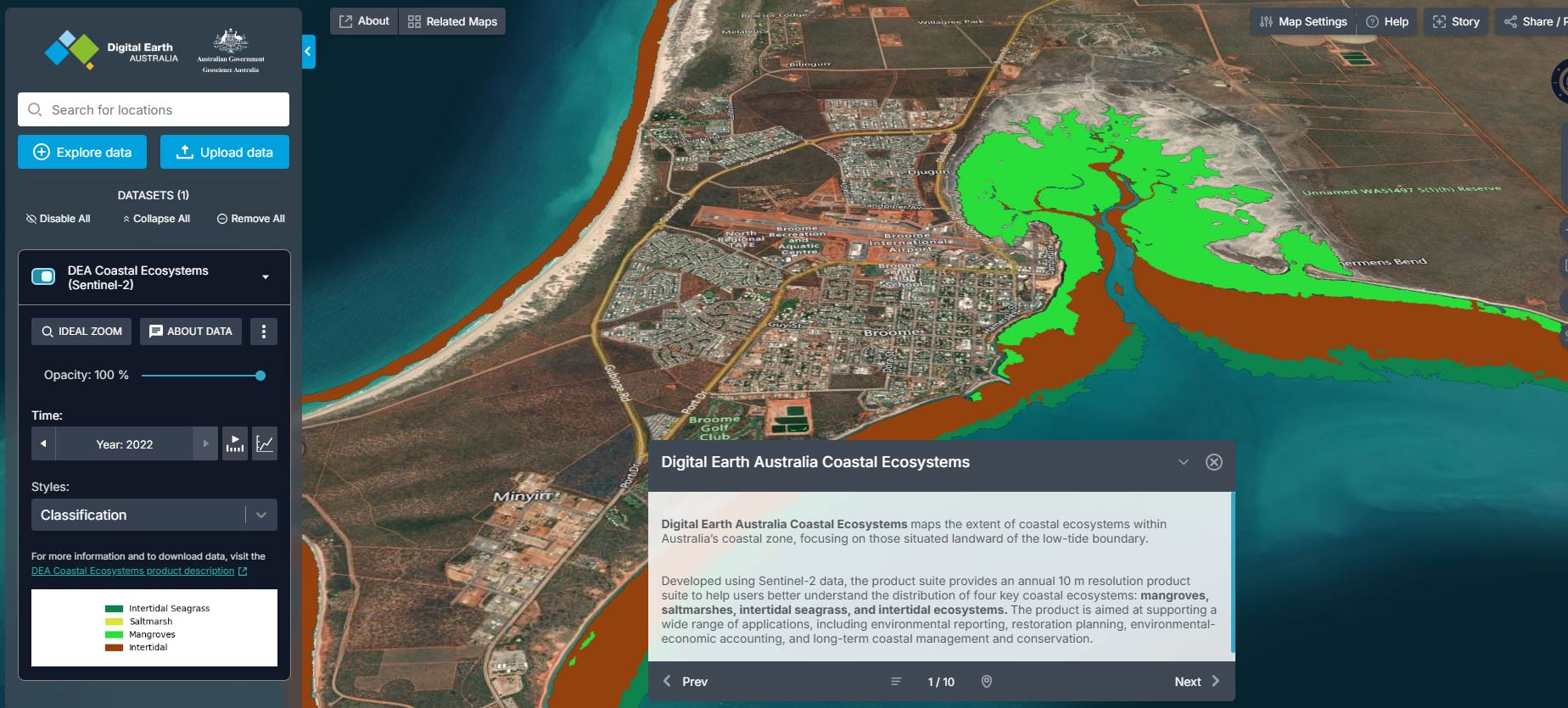
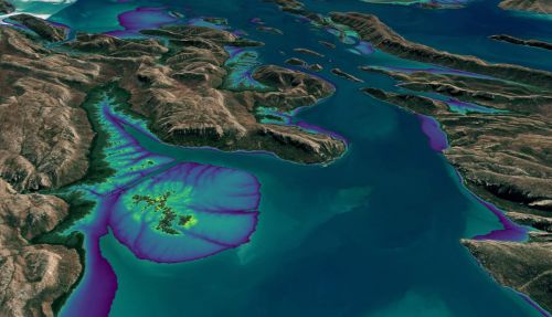
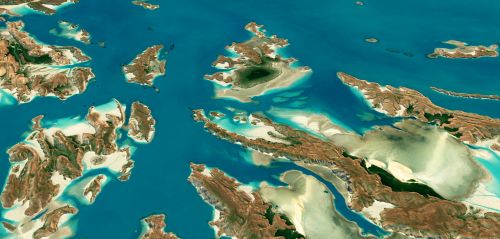
The Digital Earth Australia (DEA) Coastal Ecosystems product suite delivers nationally consistent, 10-metre resolution maps of Australia’s mangroves, saltmarshes, intertidal seagrass, and intertidal habitats. Annual mapping and probability layers provide clear, customisable insights into continent-wide ecosystem extents over the time period.
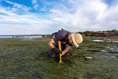
These coastal ecosystems protect communities, store carbon, support biodiversity, and underpin industries such as fisheries and tourism. DEA’s mapping can support governments and stakeholders to target investment, meet reporting obligations, monitor environmental change, and plan smarter coastal management.
Developed with leading research partners and initiated through discussions with the Department of Climate Change, Energy, the Environment and Water, the suite complements existing state and academic datasets. Powered by Sentinel-2 satellite imagery and a machine-learning framework adapted for Australian conditions, the products could be used to support a national foundation for environmental reporting, restoration planning, and long-term coastal resilience.
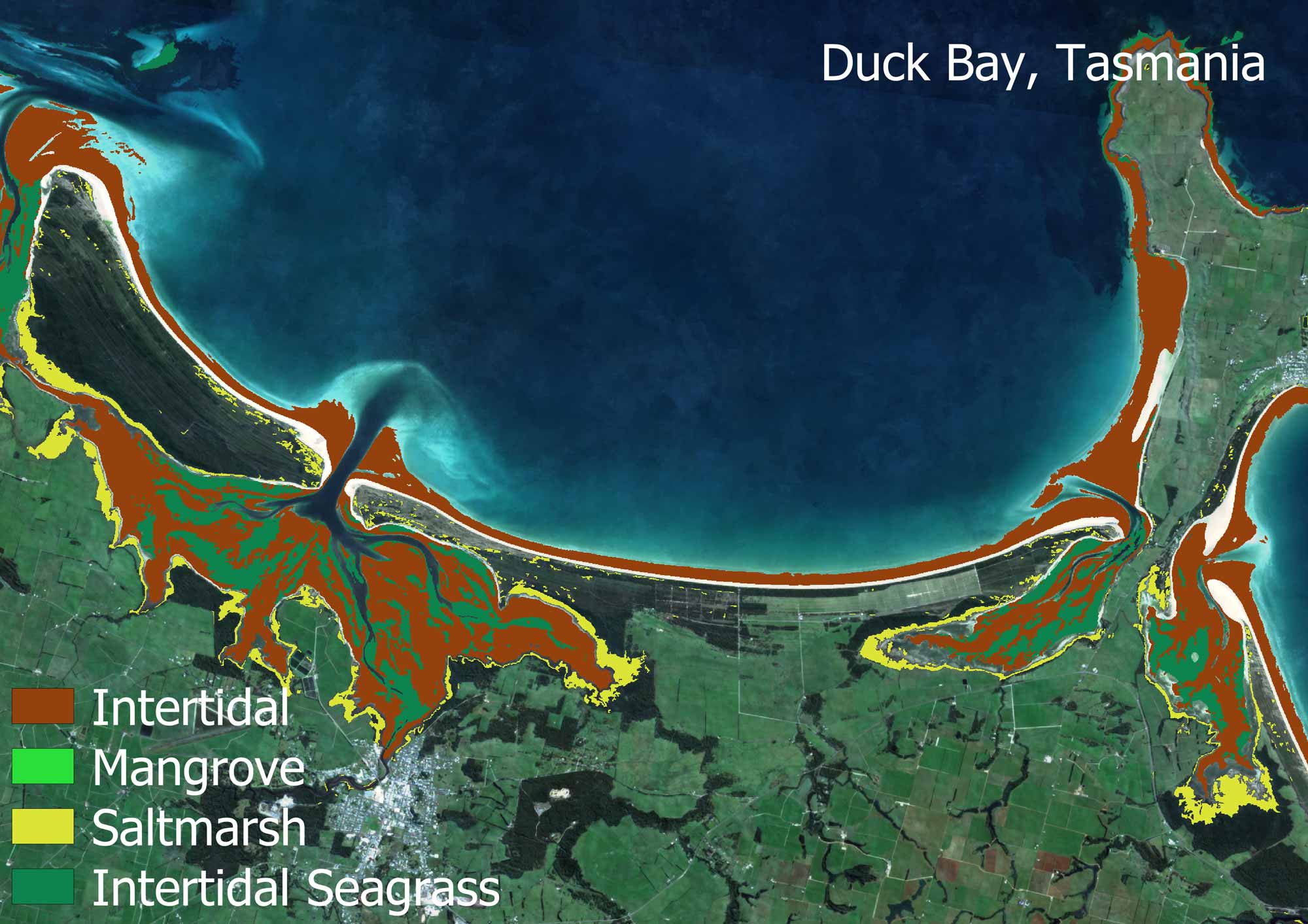
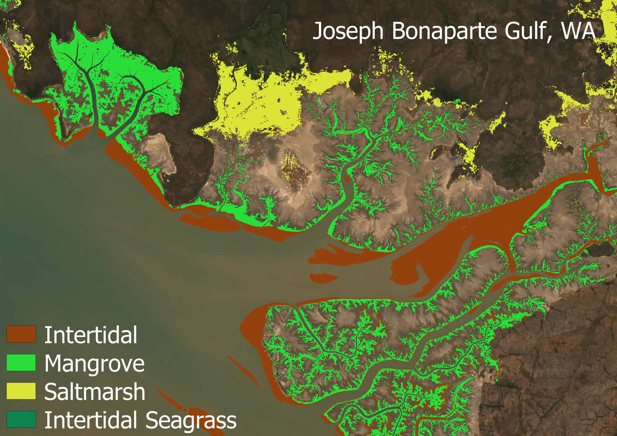
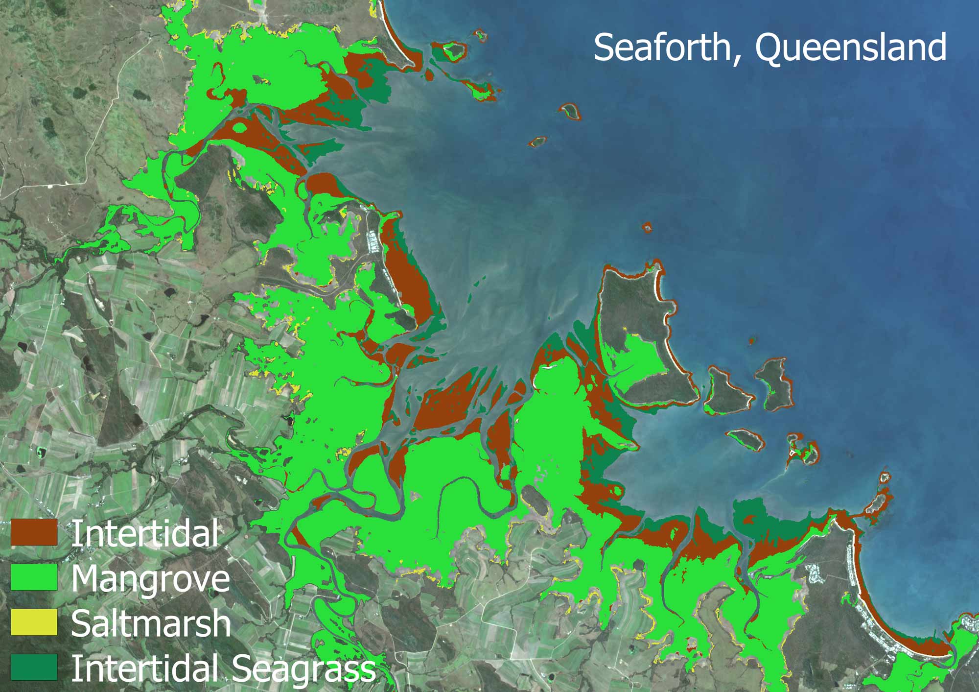
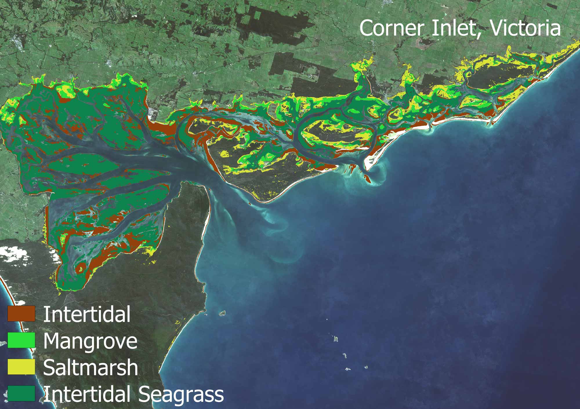
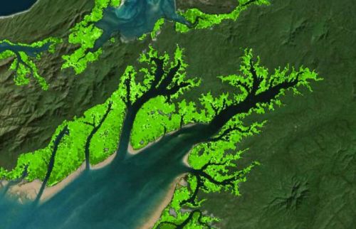
The 2021 DEA Coastal Ecosystems classification around Australia.
Take a walk-through DEA Coastal Ecosystems
Learn how DEA Coastal Ecosystems classification extents could be used in conservation, management, restoration and conservation efforts for the entirety of Australia’s coastal regions.
- DEA Maps: A user-friendly interactive interface that allows users to view and analyse DEA Coastal Ecosystems data and explore a wide range of other DEA products and geospatial datasets.
- DEA Knowledge Hub: A central repository where users can find comprehensive information on DEA products and services. It brings together user guides, data product information, DEA Notebooks, and more into one easily accessible location. The DEA Knowledge Hub is generally utilised by more technical users.
What you can do with our product:
- Explore the extents of coastal ecosystems over the time period, including mangroves, saltmarsh, intertidal, and intertidal seagrass.
- Provide accurate, comprehensive and customisable mapping to support management, restoration, and conservation efforts, allowing planners to identify priority areas, monitor ecological change, and assess the effectiveness of interventions.
- Complement existing coastal programs by filling spatial and temporal gaps in higher resolution expert mapping (aerial and drone mapping, field surveys).
Related resources
DEA Intertidal
Digital Earth Australia’s Intertidal product suite captures Australia’s dynamic coastal regions in unprecedented detail.
Uncovering habitat change in Australia’s north
Digital Earth Australia data is supporting studies into threatened and migratory species.
DEA Tidal Composites
An annually updated snapshot of Australia’s coasts, estuaries and reefs at low and high tide.
DEA Mangrove Canopy Cover
Annual maps breaking canopy into three classes according to greenness of satellite image pixels at 30 m resolution.