Regional Geology of the Bass Basin
Page last updated:19 September 2023
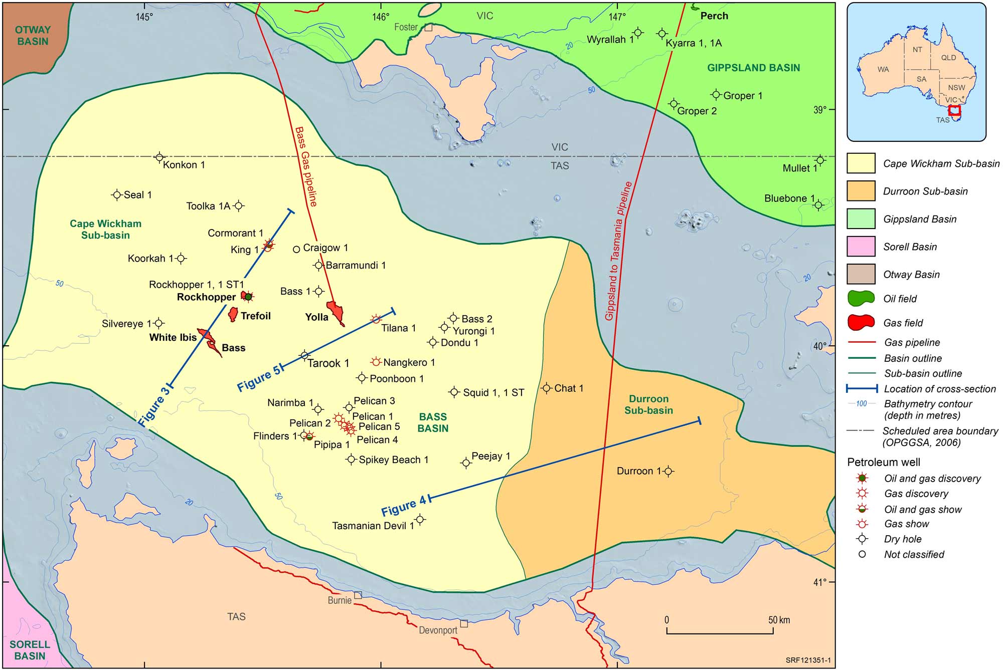
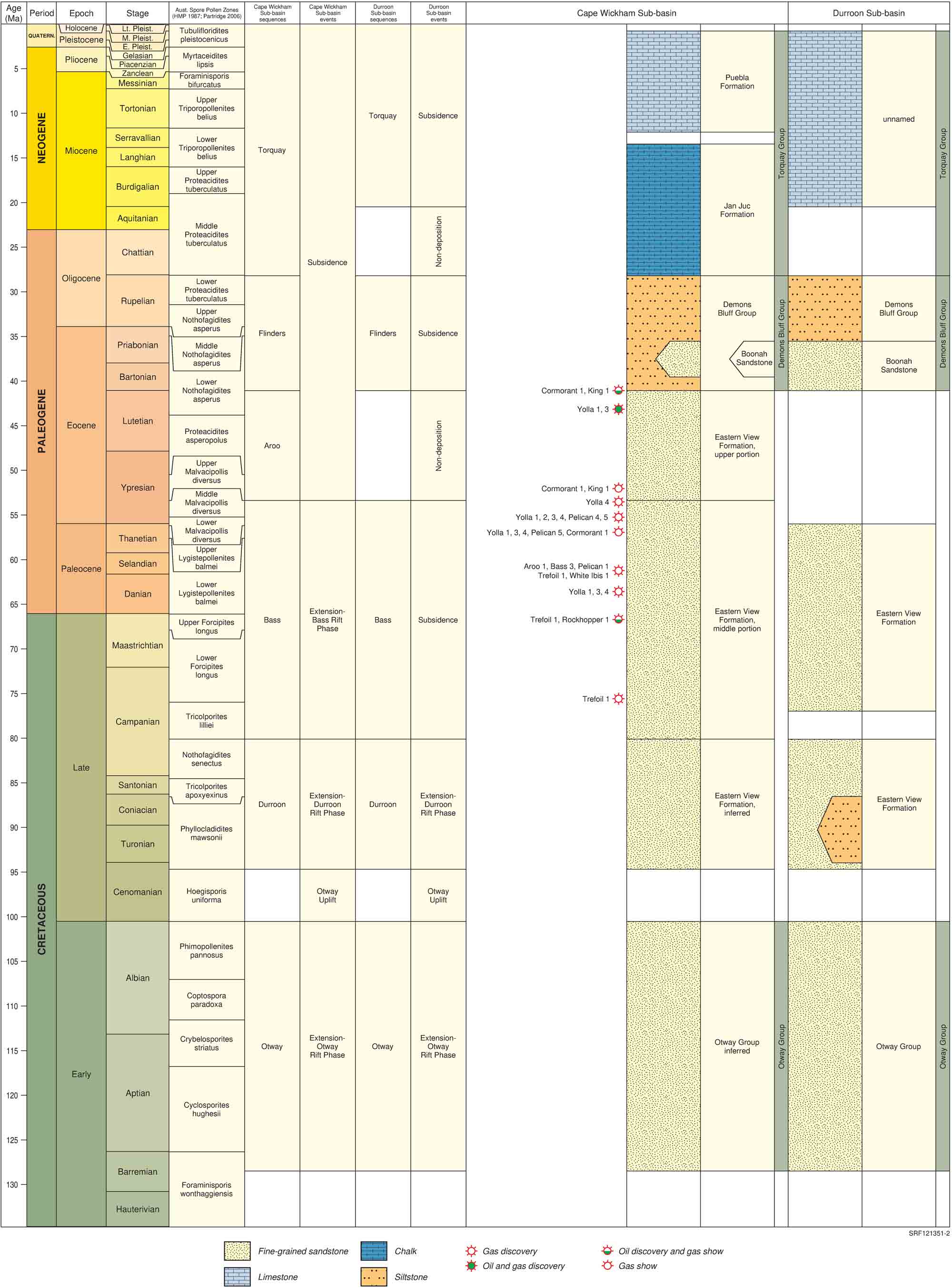
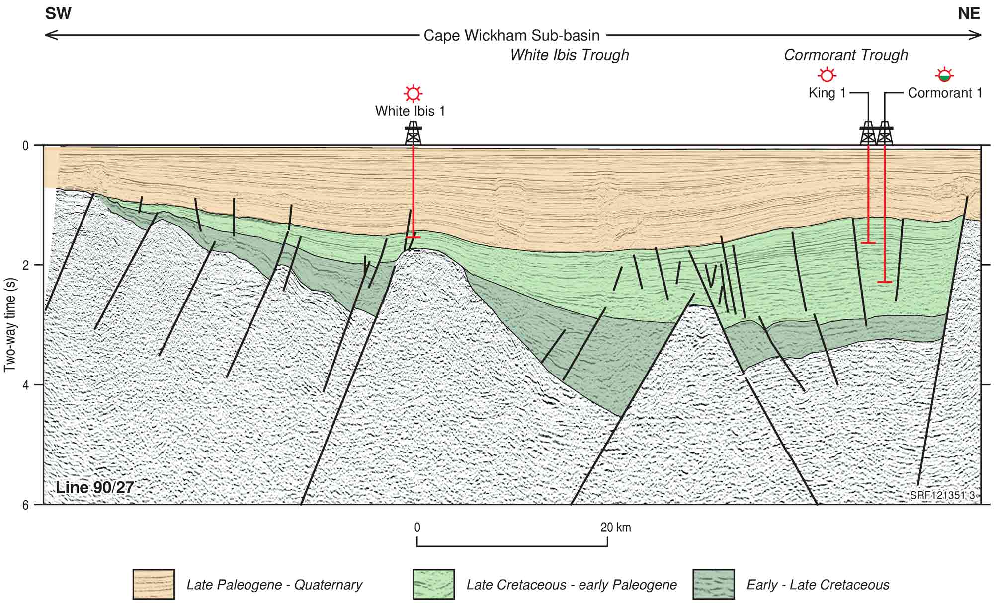
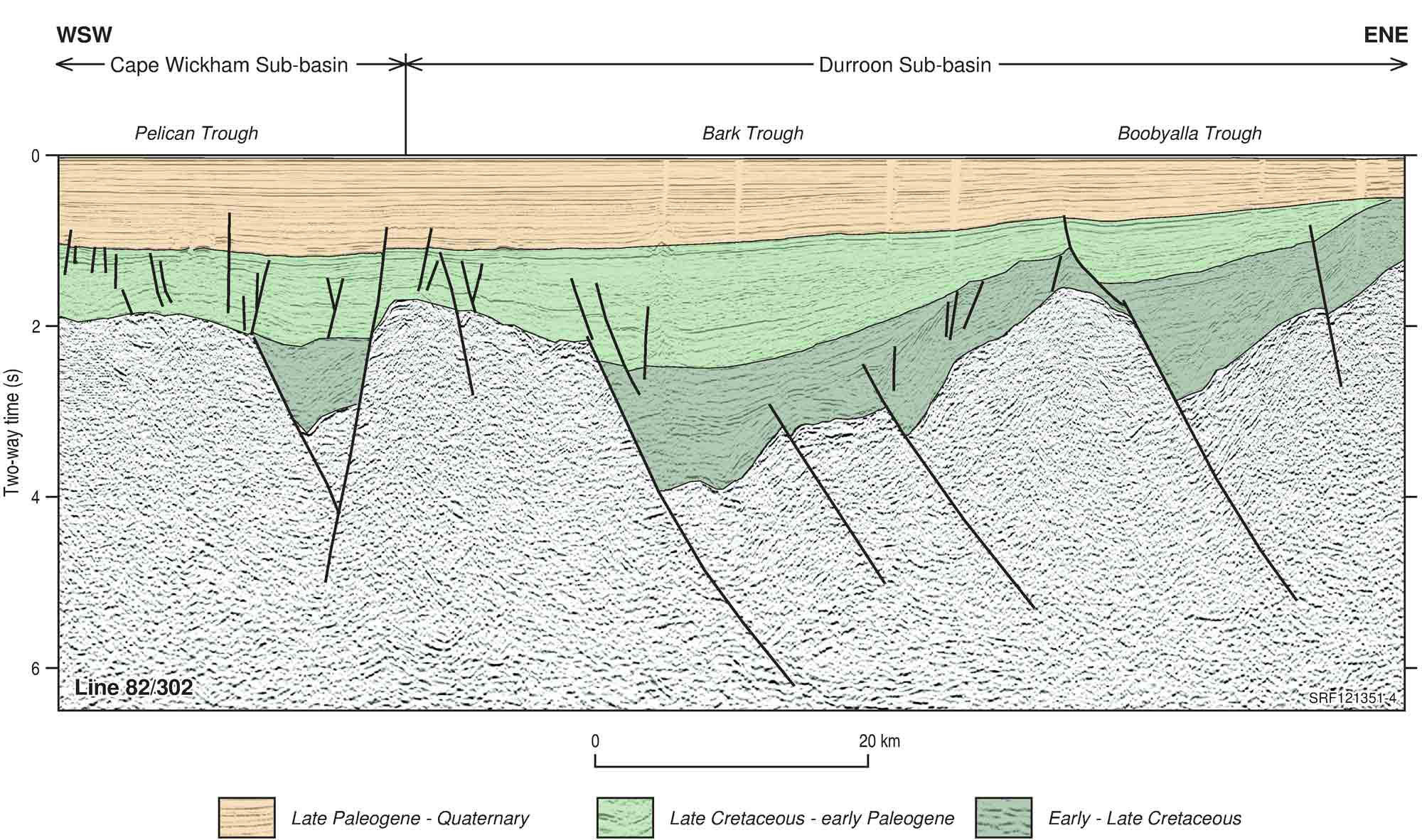
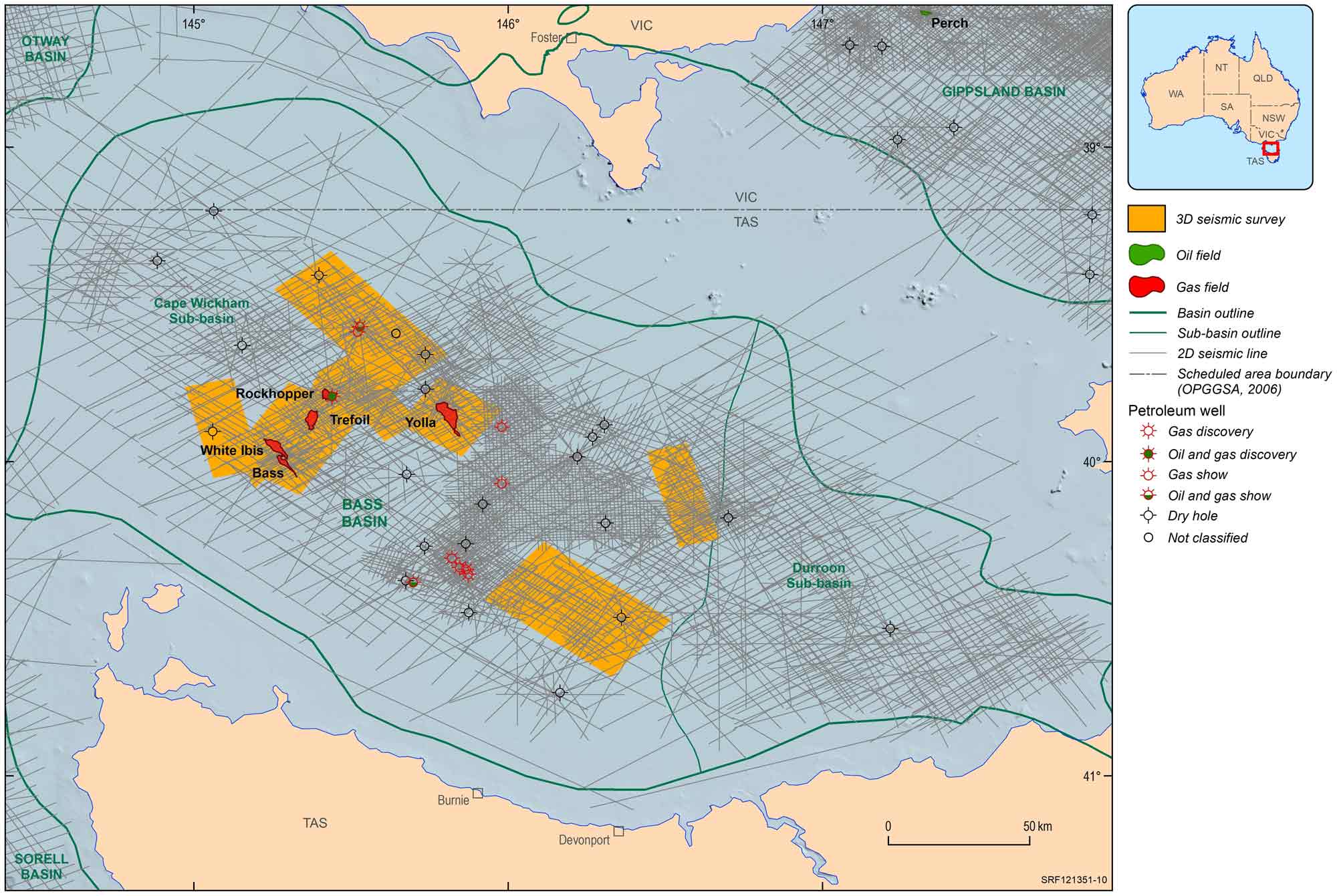
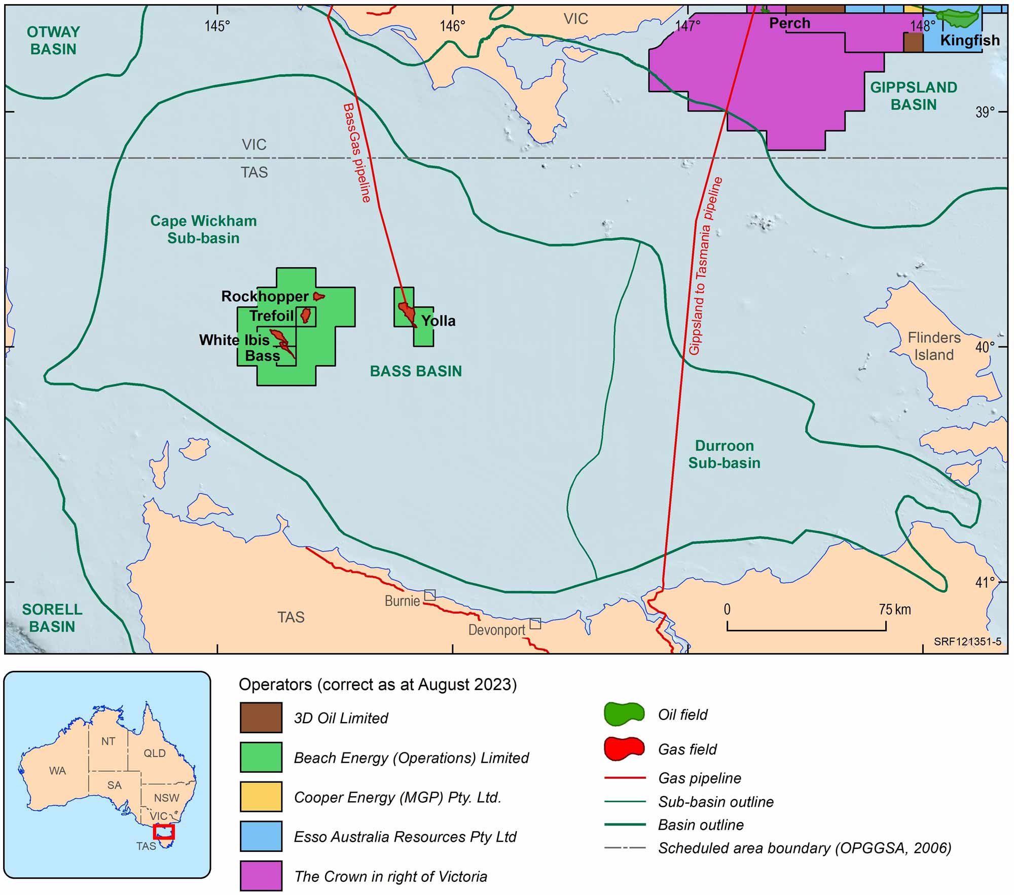
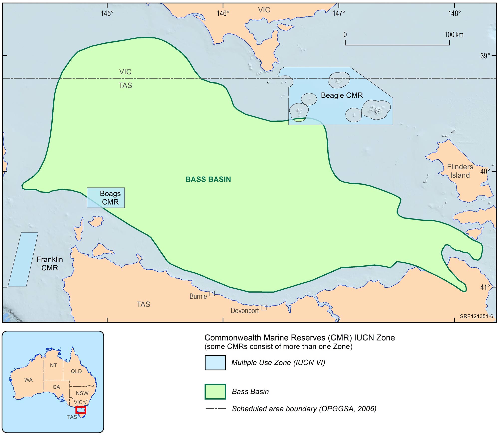
The Bass Basin is a Cretaceous–Cenozoic northwest-trending, intracratonic rift basin that underlies the Bass Strait between northern Tasmania and southern Victoria. The Bass Basin is separated from the Otway and Sorell basins to the west by the King Island High, and from the Gippsland Basin to the northeast by Flinders Island and the Bassian Rise (Figure 1). The Bass Basin is divided into the Cape Wickham Sub-basin in the west and the Durroon Sub-basin in the east (Figure 1). The Cape Wickham Sub-basin is a proven hydrocarbon province, hosting several gas discoveries and a producing gas and condensate field (Yolla). In comparison, the Durroon Sub-basin is underexplored, and no discoveries have been made in this portion of the Bass Basin. A comprehensive report on the petroleum geology of the Bass Basin is presented by Blevin (2003a).