Regional Geology of the Bonaparte Basin
Page last updated:31 August 2022
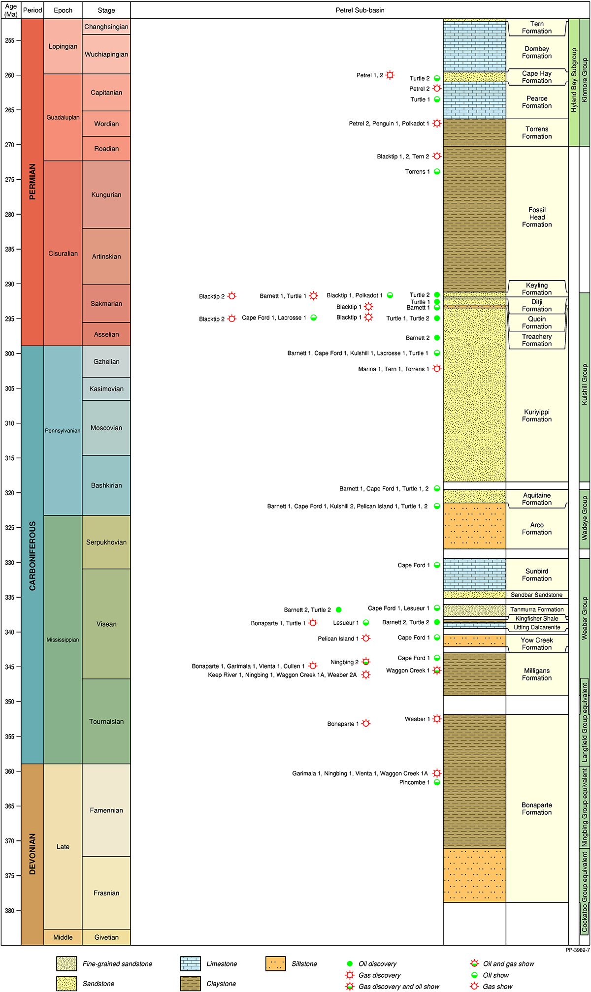
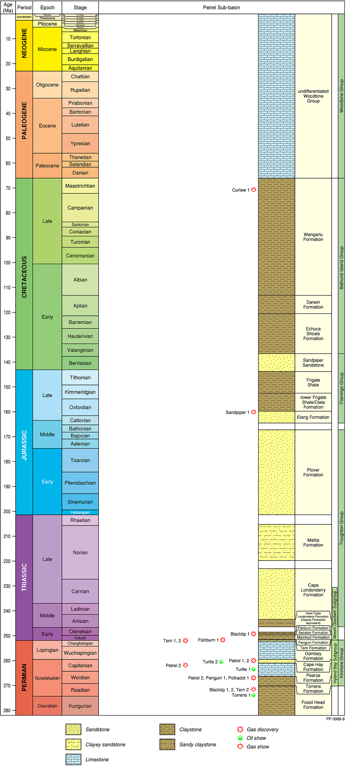
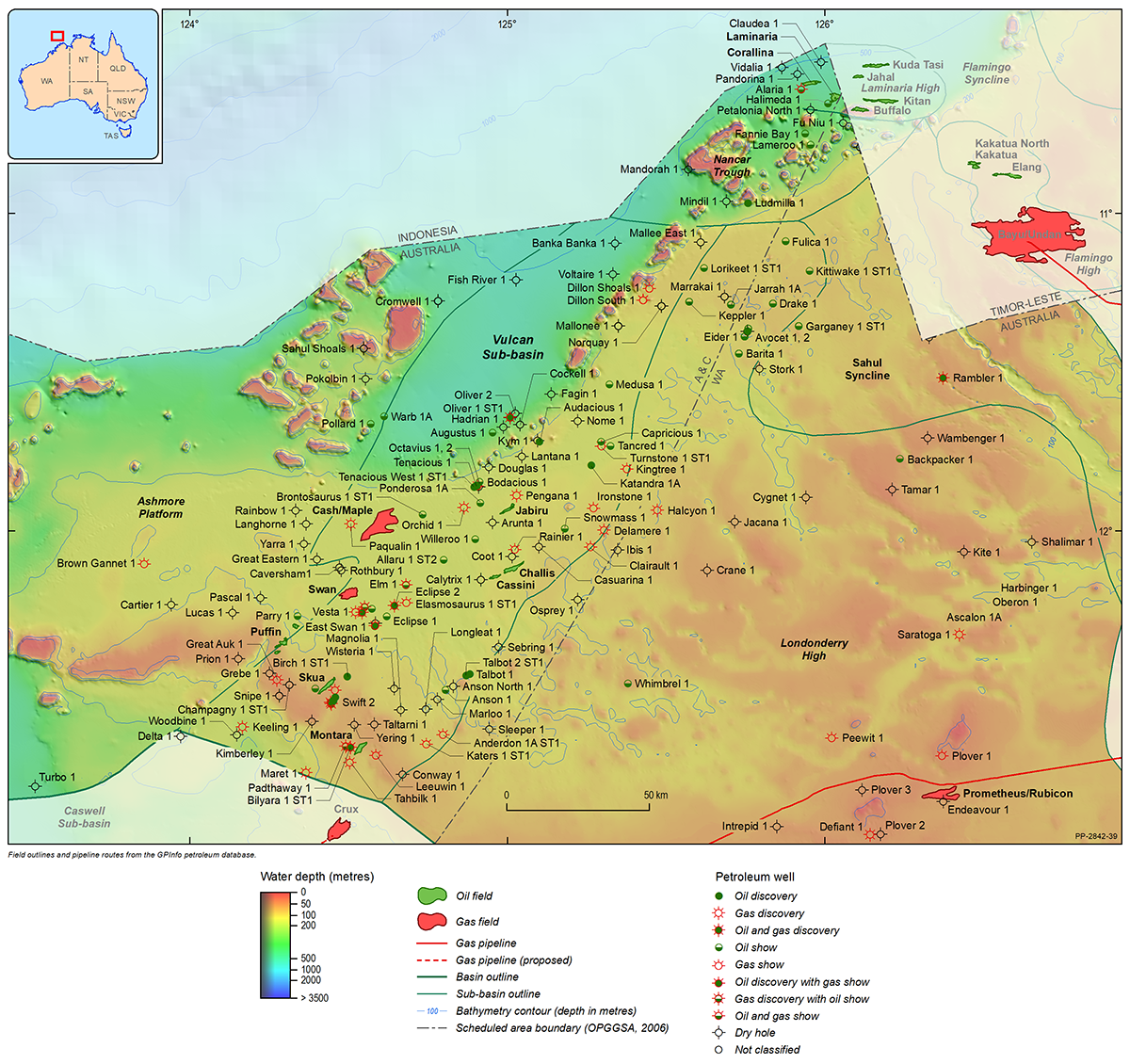
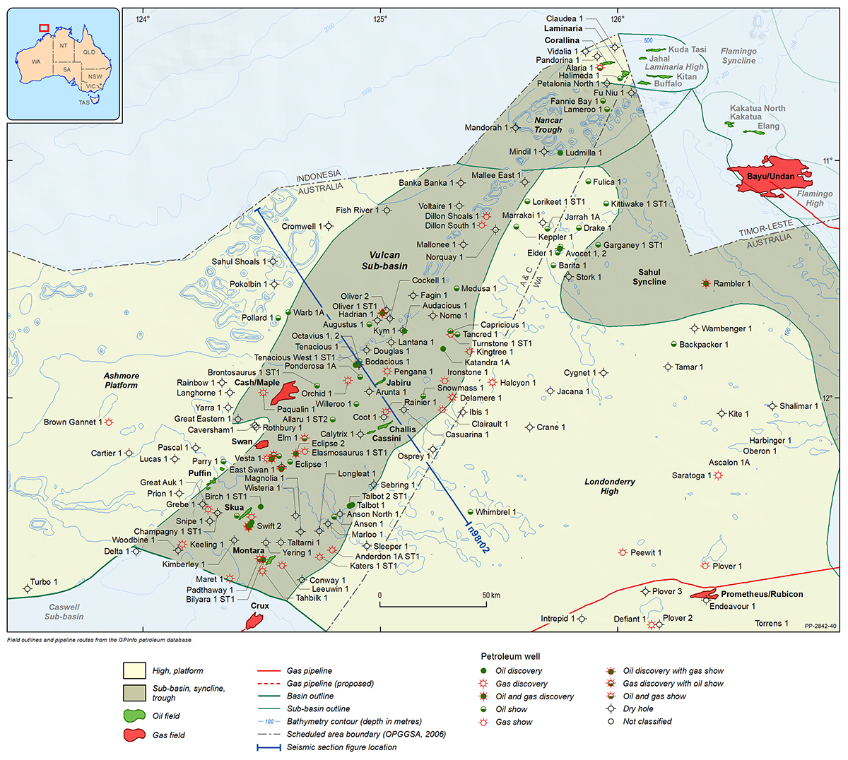
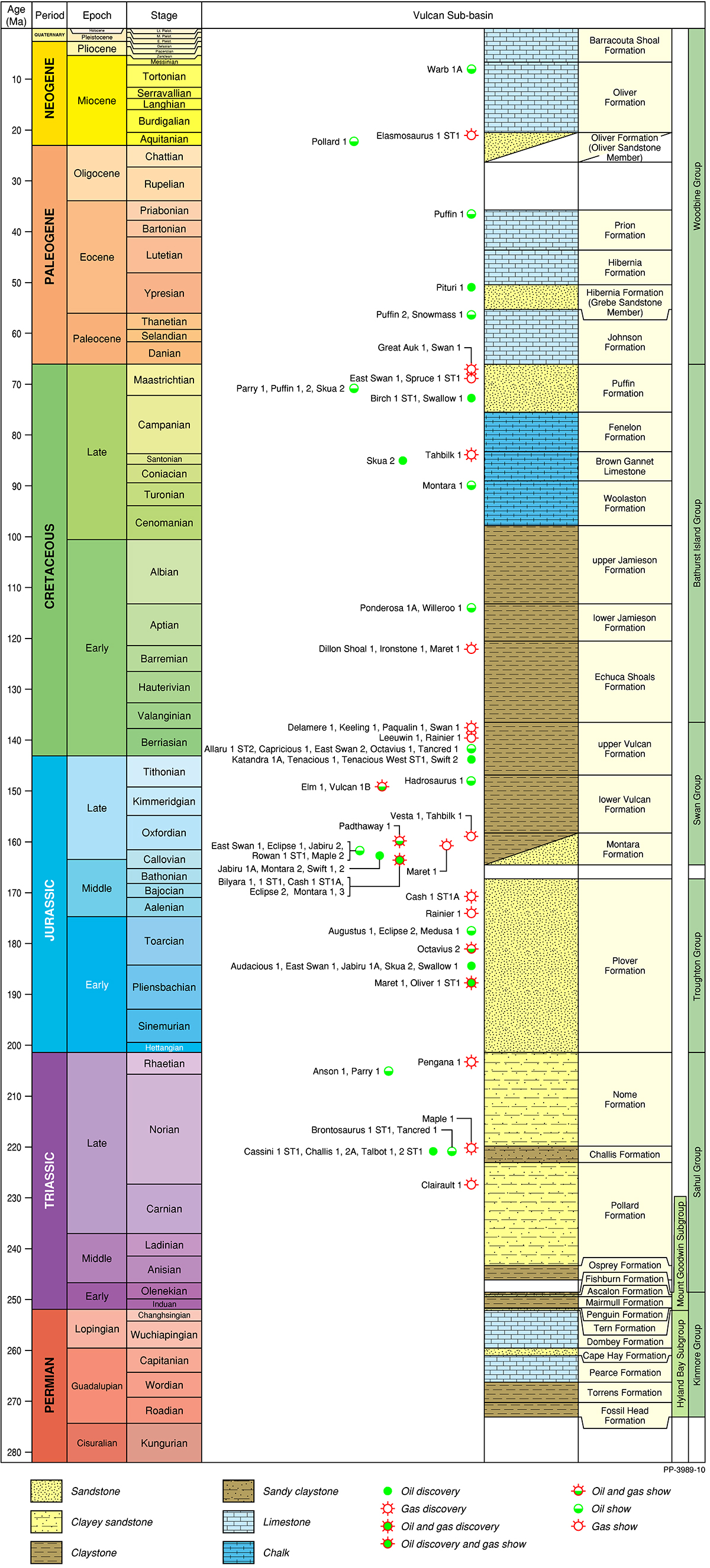
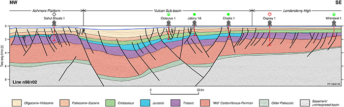
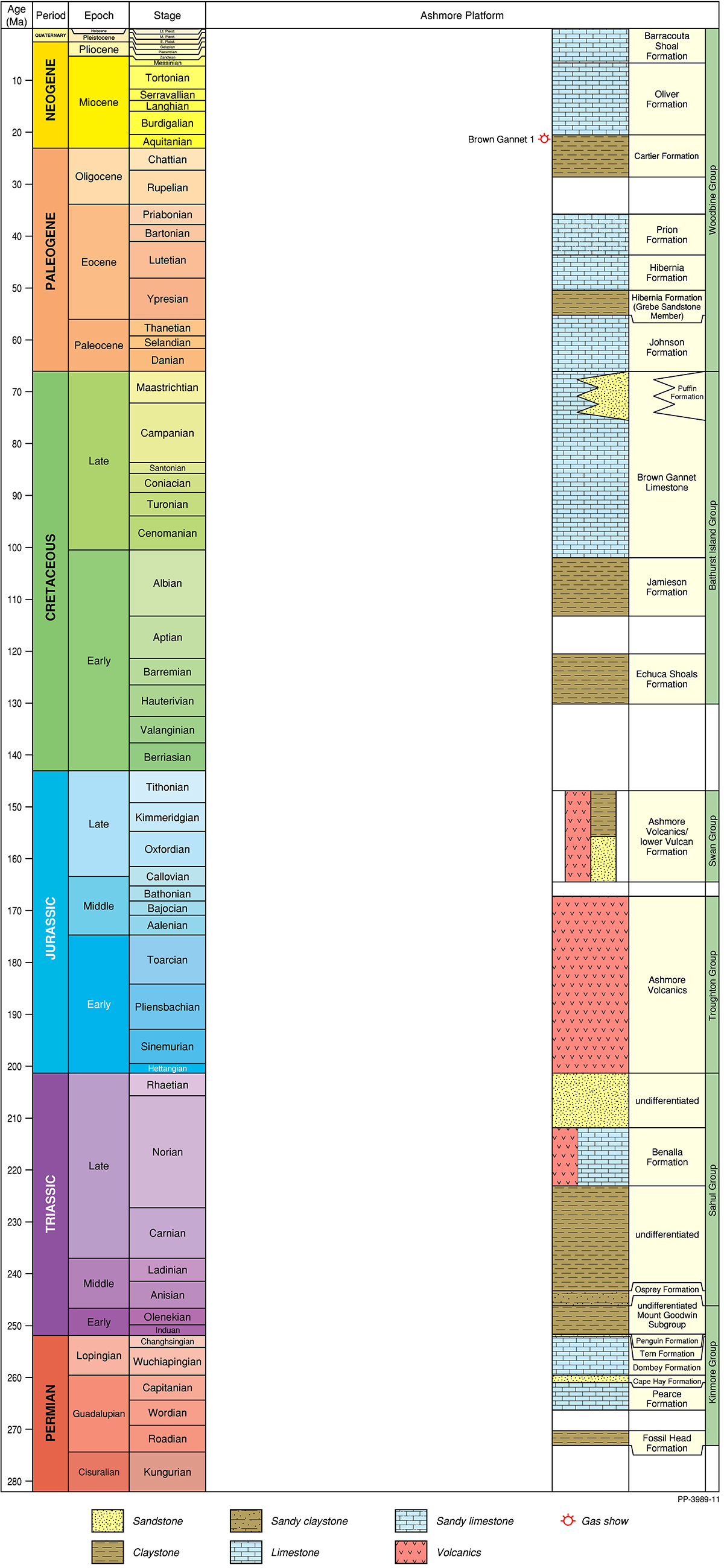
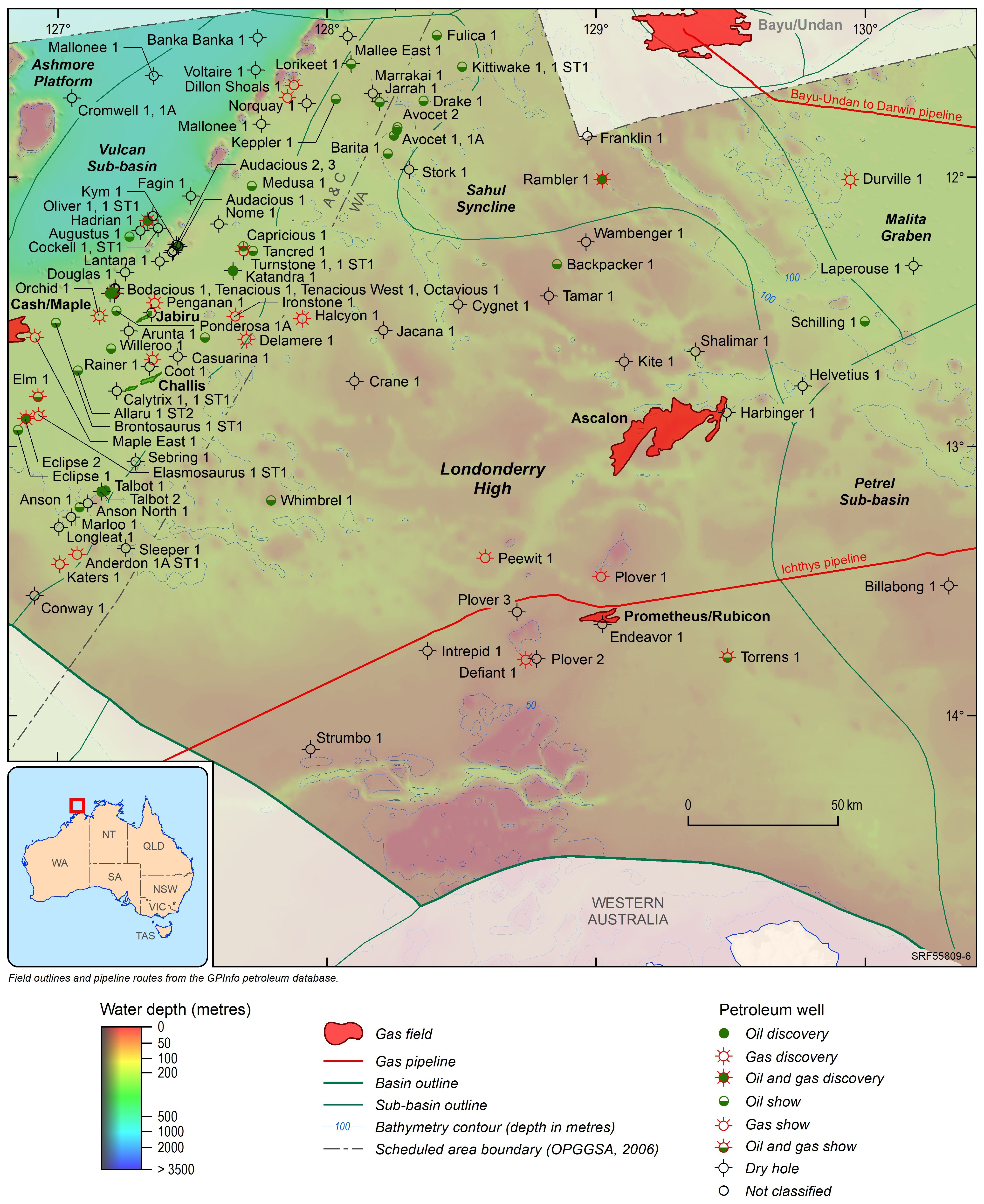
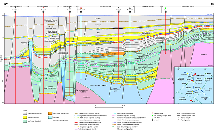
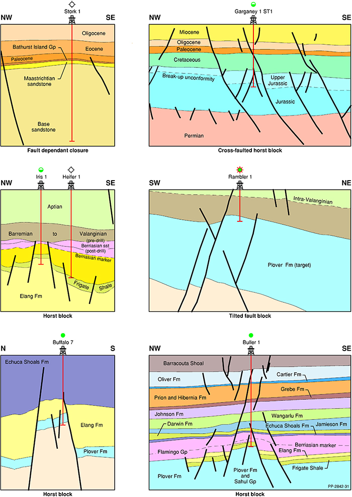
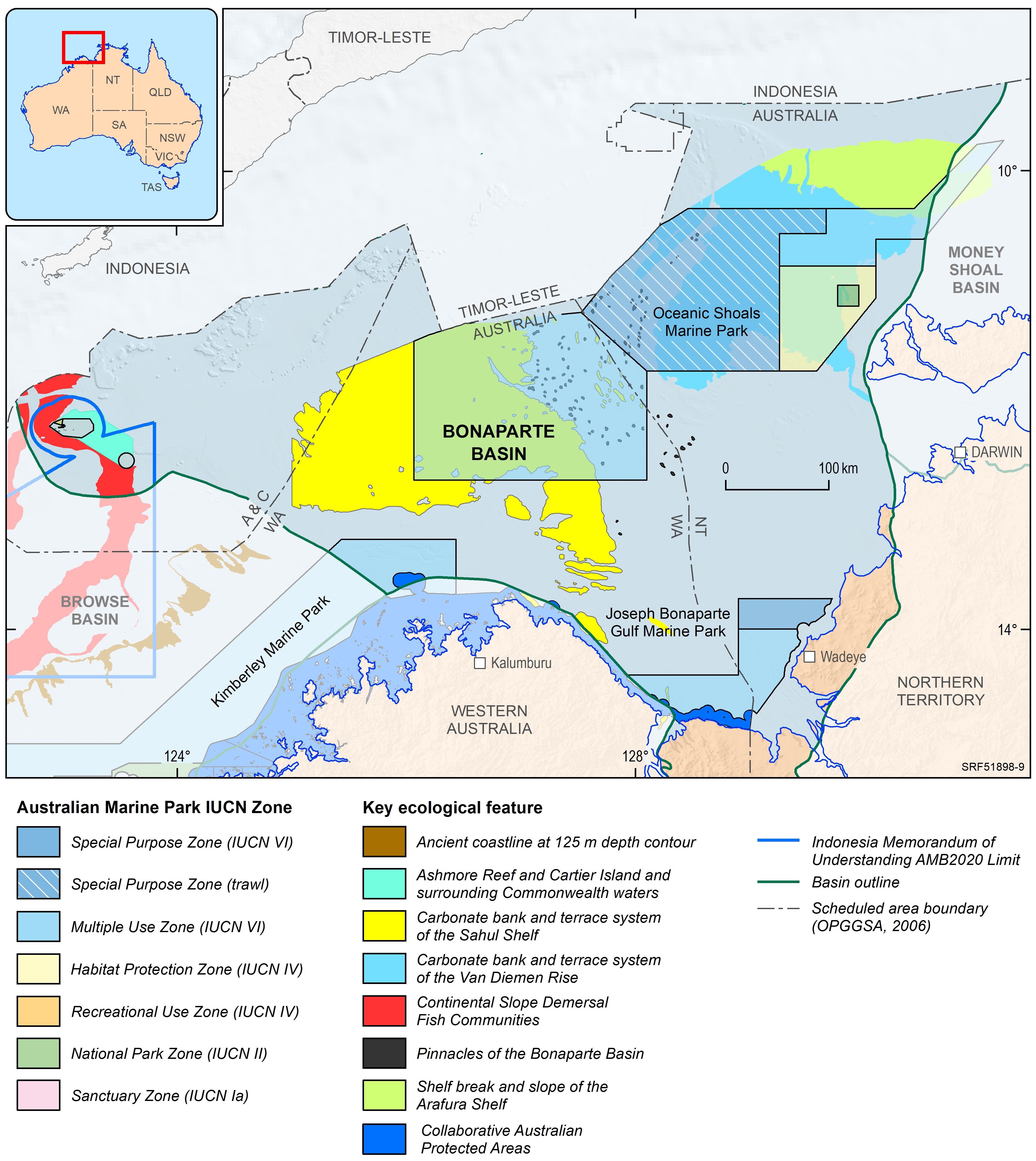
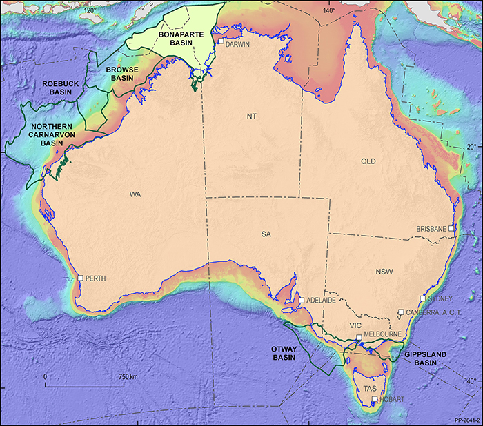
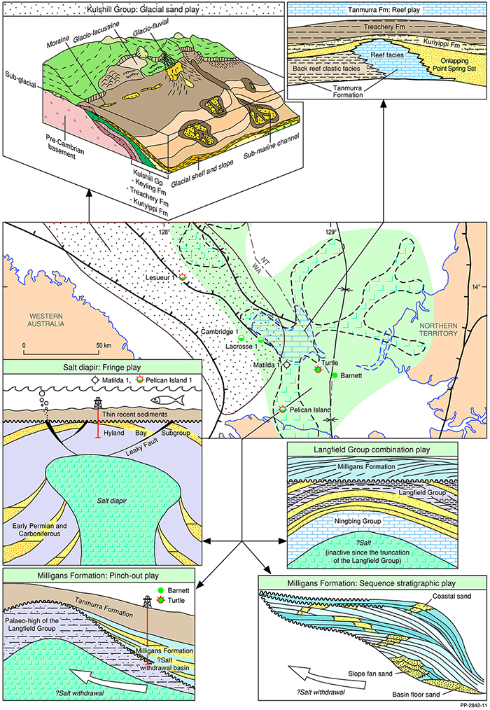
The Bonaparte Basin represents the easternmost offshore province of Australia’s North West Shelf comprising also the Browse, Roebuck, Offshore Canning and Northern Carnarvon basins (Figure 1). Located predominantly offshore (Figure 2), the Bonaparte Basin contains a Paleozoic, Mesozoic and Cenozoic sedimentary succession that exceeds 15 000 m in thickness in the southern portion (“Petrel Sub-basin”) and a Mesozoic-Cenozoic basin fill in the northern part. The basin has been an established oil and gas province since the development of the Bayu-Undan and Blacktip gas discoveries (1995 and 2001 respectively) and first oil discoveries in the Vulcan Sub-basin (Jabiru in 1986; Challis and Cassini in1989).

For information on the 2022 acreage release areas in the Bonaparte Basin visit the Department of Industry, Science and Resources website.