Regional Geology of the Northern Carnarvon Basin
Page last updated:31 August 2022
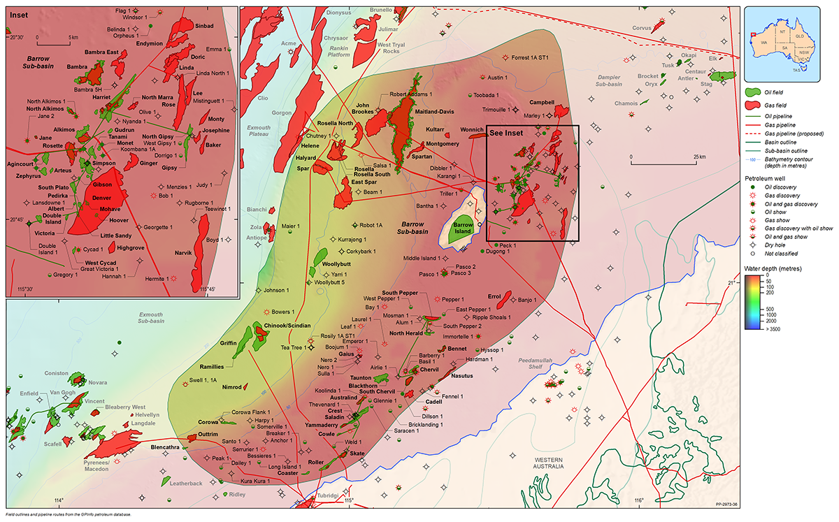
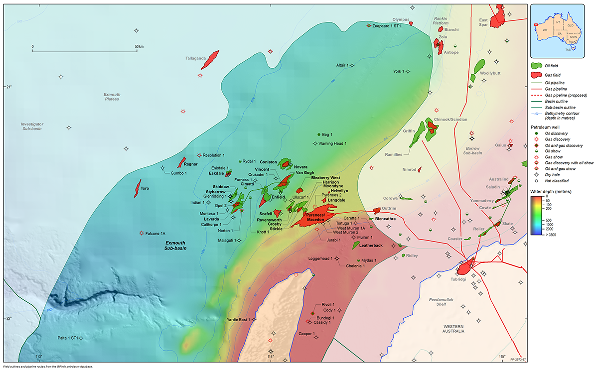
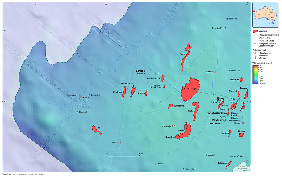
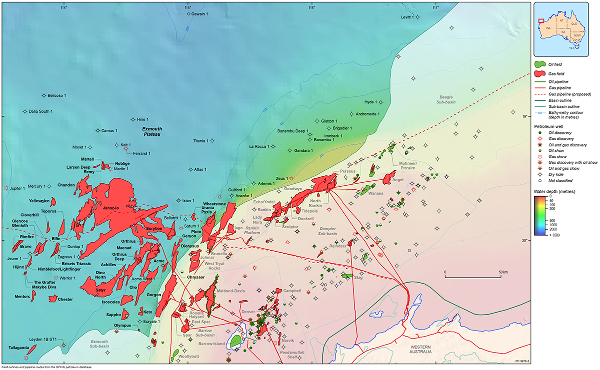
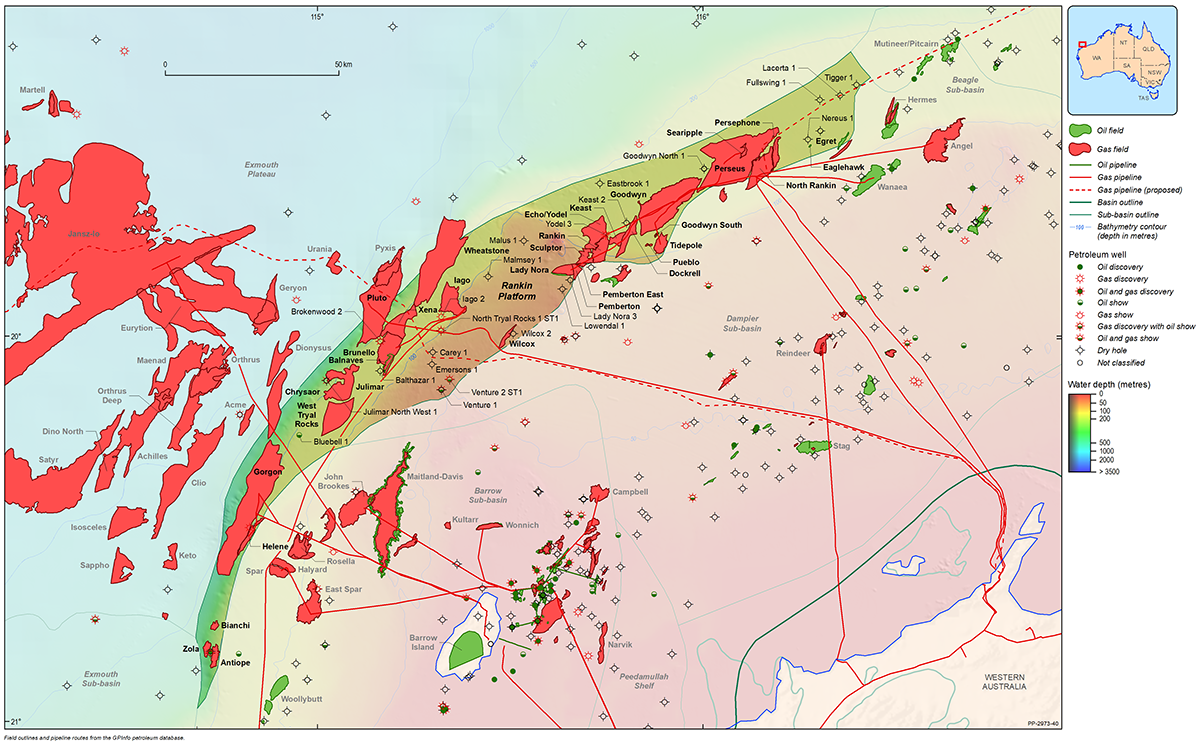
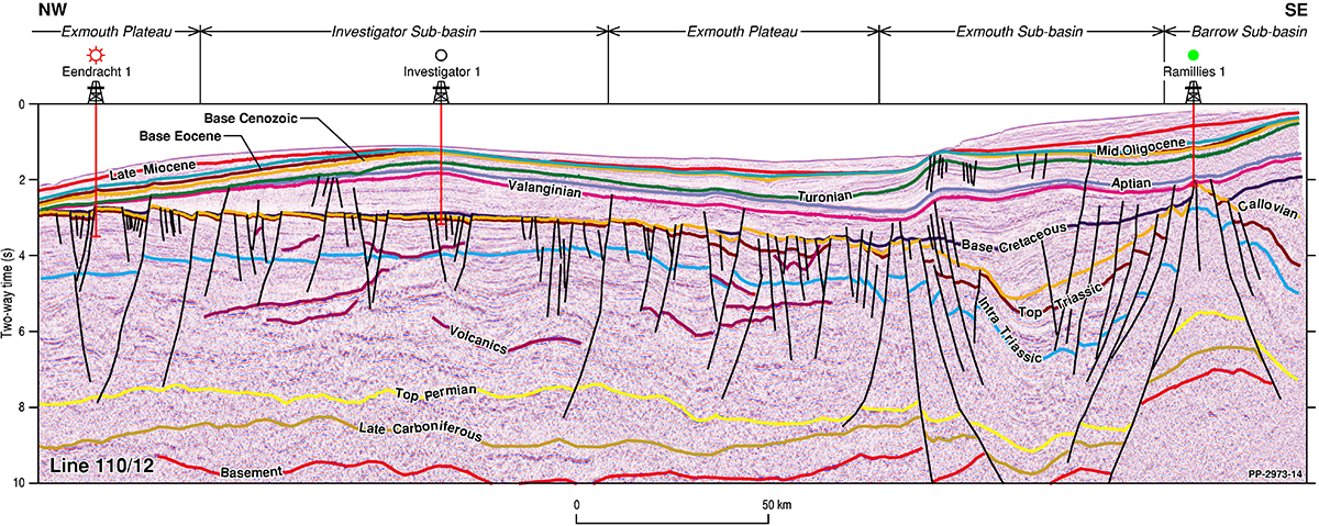
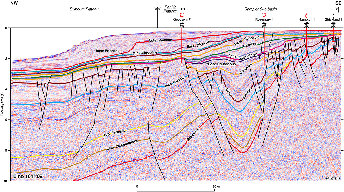
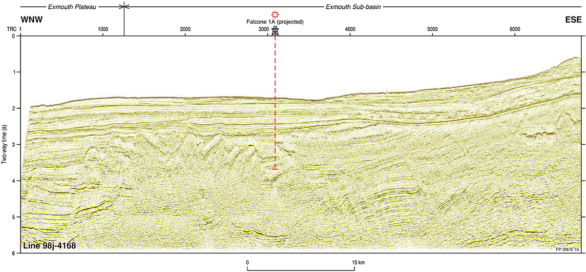
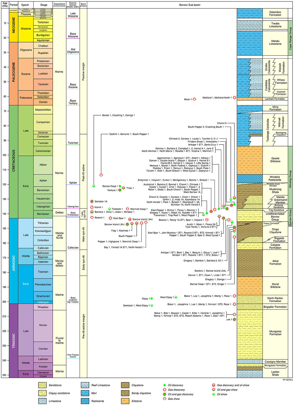
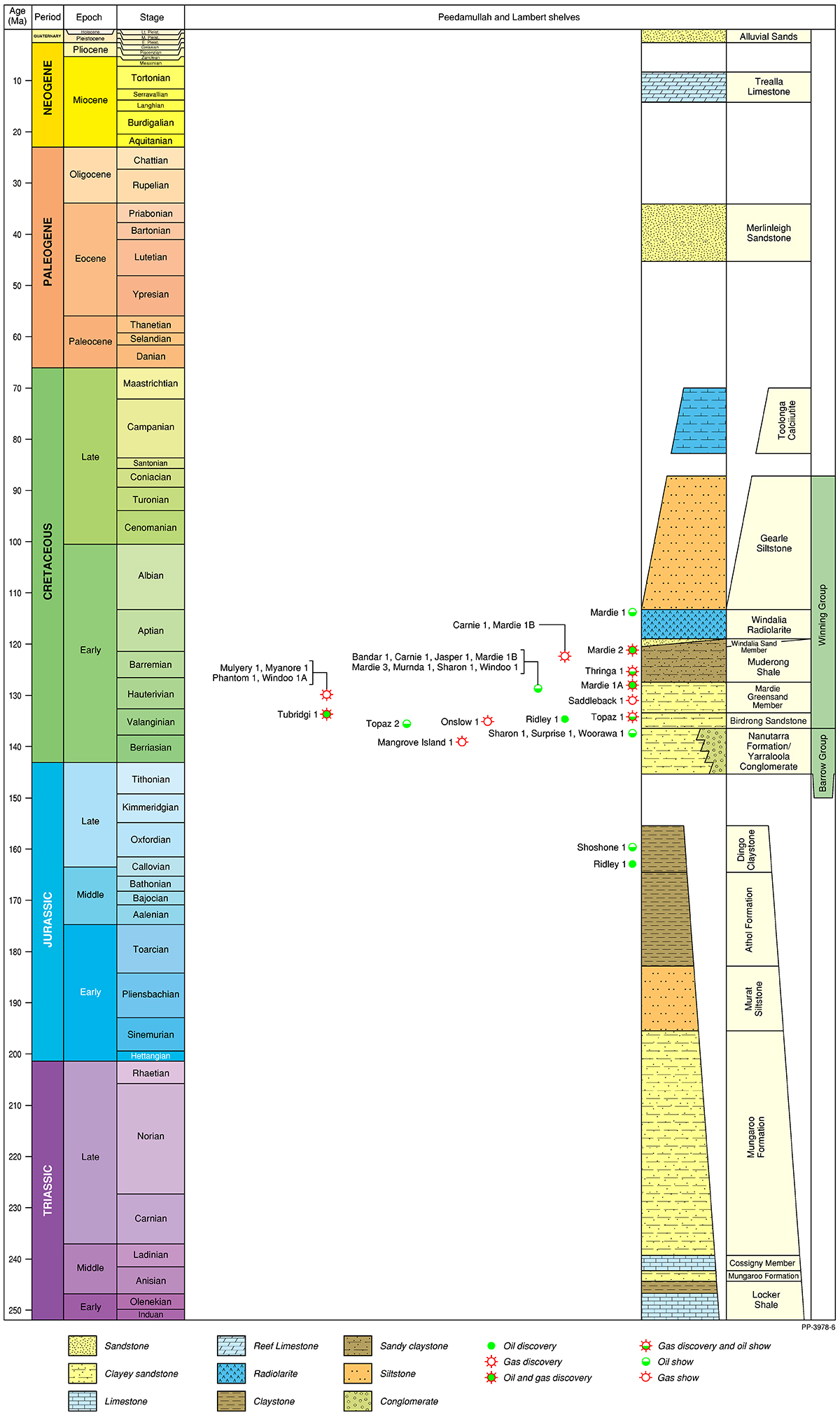
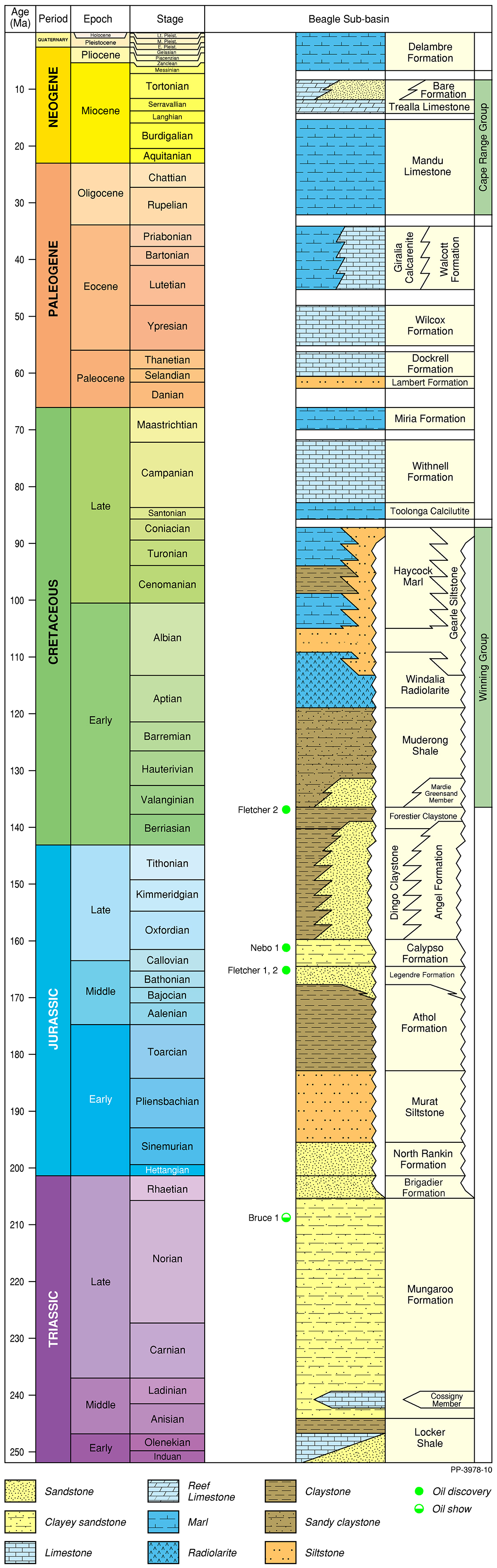
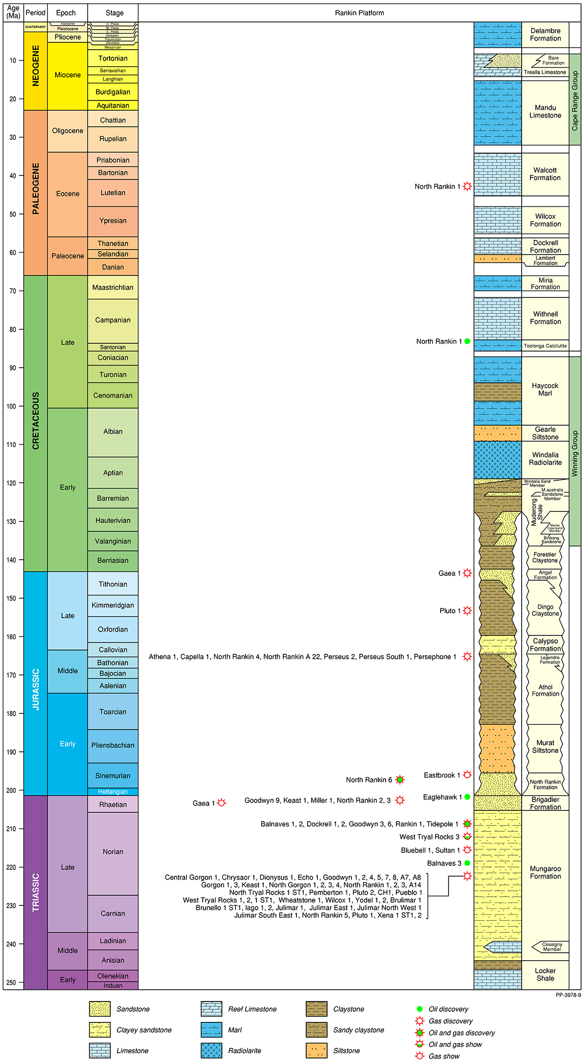
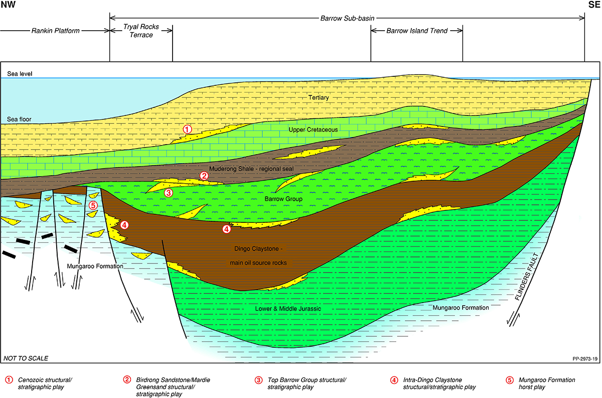
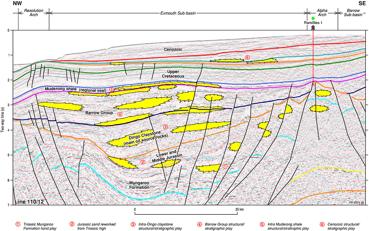
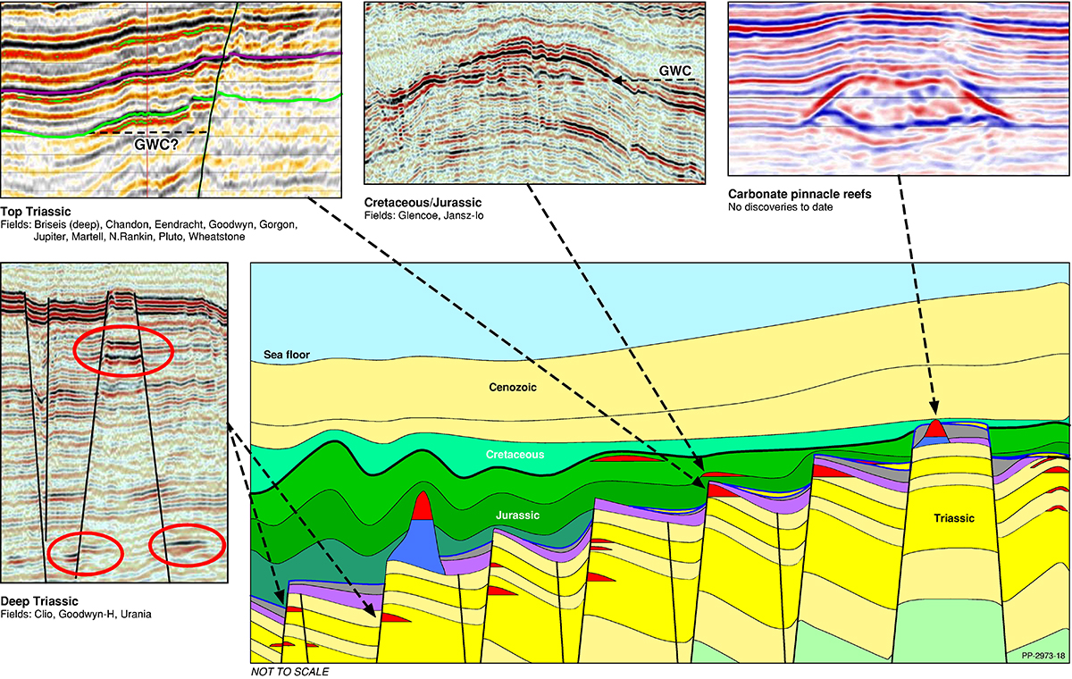
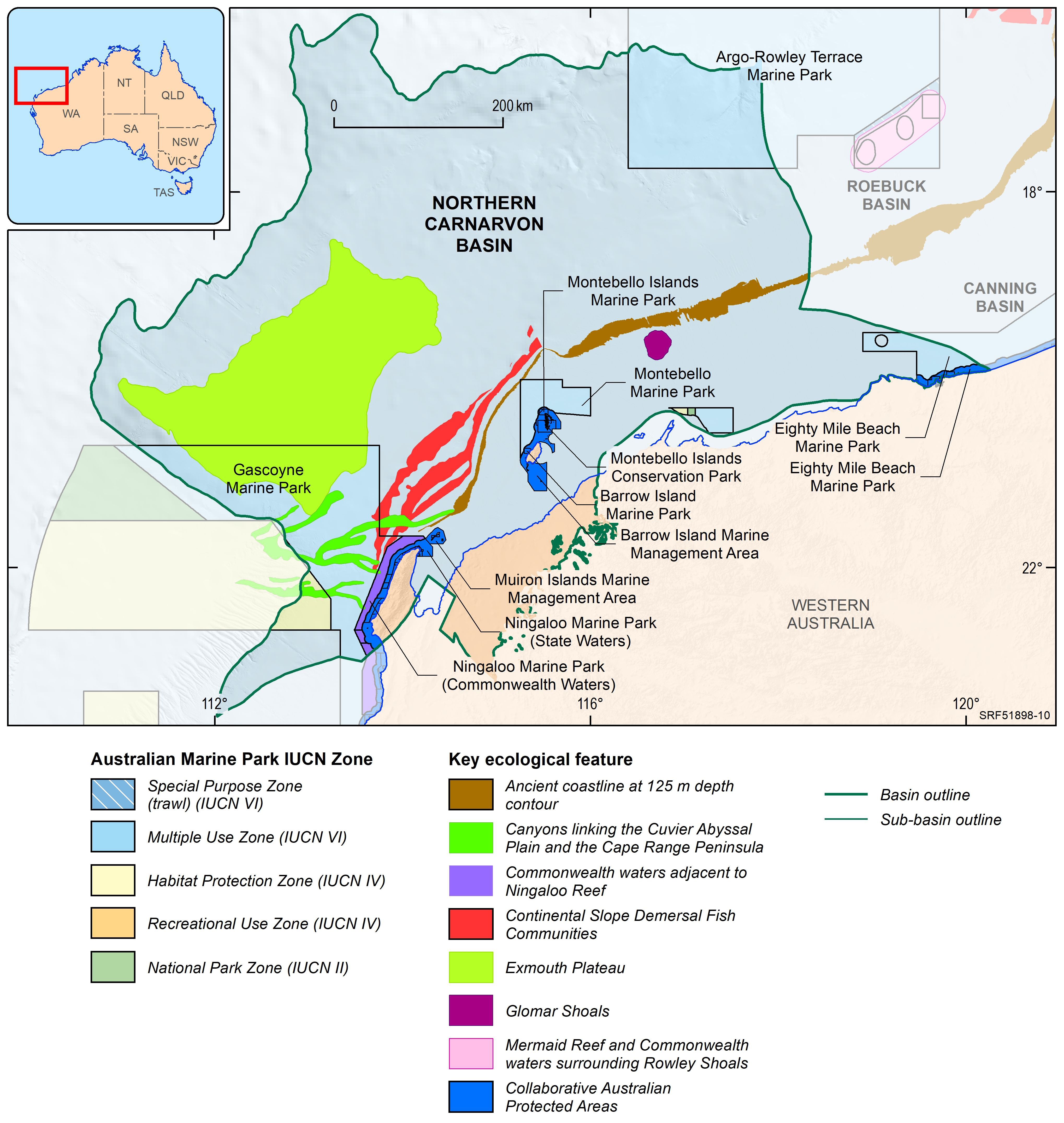
The Northern Carnarvon Basin represents the westernmost offshore province of Australia’s North West Shelf comprising also the Browse, Roebuck, Offshore Canning and Bonaparte basins (Figure 1). The Northern Carnarvon Basin covers an area of approximately 535 000 km2, predominantly offshore, in water depths of up to 4500 m (Figure 2). It contains a Paleozoic, Mesozoic and Cenozoic sedimentary succession up to 15 000 m thick, which is dominated by deltaic to marine siliciclastics and shelfal carbonates of Mesozoic to Cenozoic age. Two Mesozoic petroleum supersystems (Westralian 1 and Westralian 2) have been identified and numerous commercial oil and gas discoveries have been made within the basin. The basin is Australia’s premier hydrocarbon producing province and contains an established network of oil, condensate and gas production infrastructure (Figure 4). As of May 2022, the total proved and probable reserves for the Northern Carnarvon Basin are 3140 PJ (534 MMbbls) of oil and natural gas liquids and 50 982 PJ (45.33 Tcf) of natural gas and ethane (EnergyQuest, 2022).
For information on the 2022 acreage release areas in the Northern Carnarvon Basin visit the Department of Industry, Science and Resources website.