Regional Geology of the Southern Carnarvon Basin
Page last updated:31 August 2022
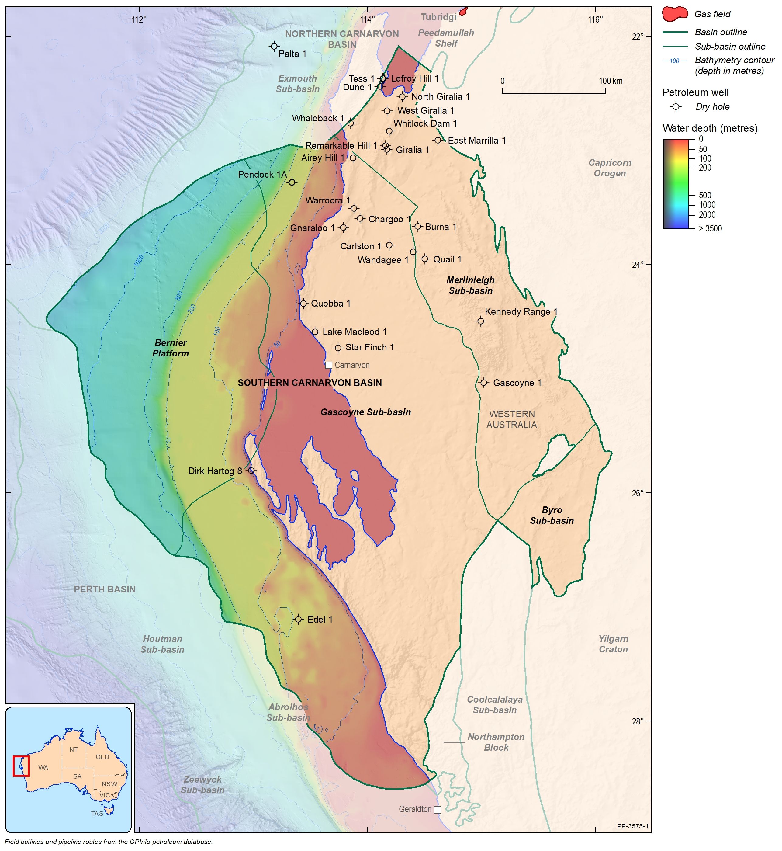
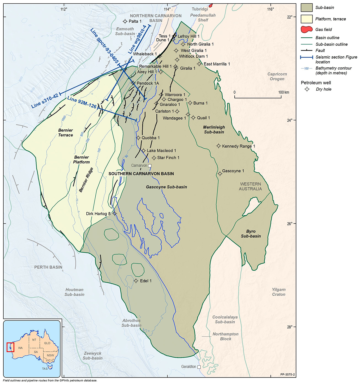
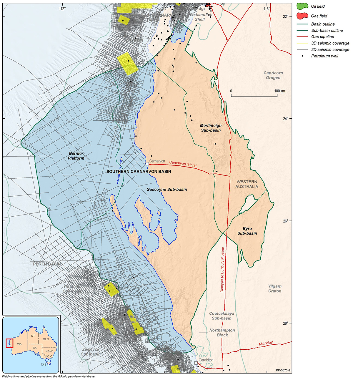
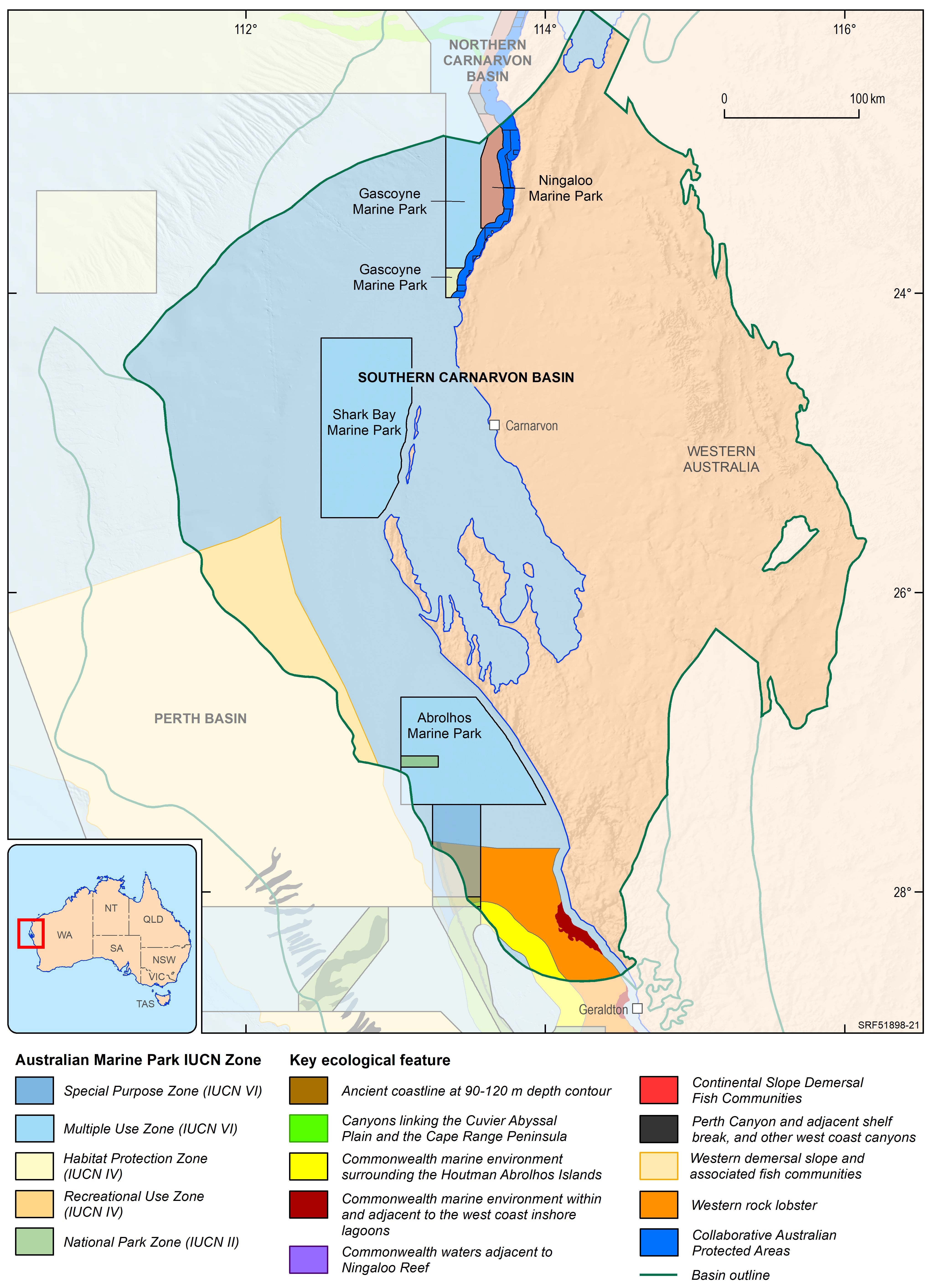
The Southern Carnarvon Basin is a large (192 000 km2) predominantly Paleozoic sedimentary basin covering onshore and offshore regions of north-western Western Australia. It lies to the south of the Mesozoic Northern Carnarvon Basin, Australia’s premier oil and gas producing basin. The Southern Carnarvon Basin comprises the Gascoyne, Merlinleigh and Byro sub-basins and the Bernier Platform (Figure 1 and Figure 2). Of these, the Bernier Platform and western Gascoyne Sub-basin lie offshore. The offshore part of the Gascoyne Sub-basin lies mostly in shallow water (50–200 m), whereas the Bernier Platform is in much deeper water (200–2000 m). The offshore part of the Southern Carnarvon Basin covers an area of approximately 95 000 km2.
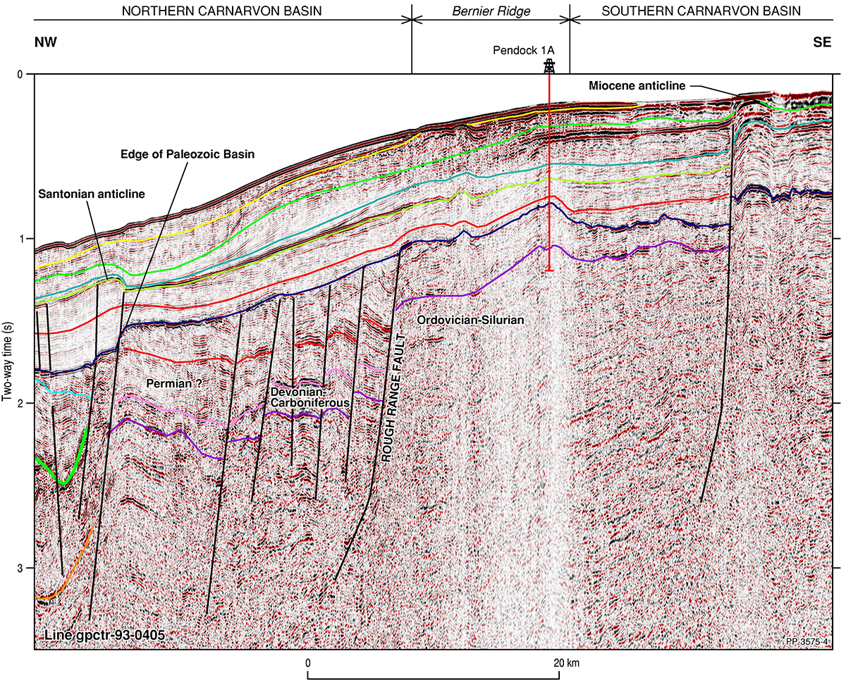
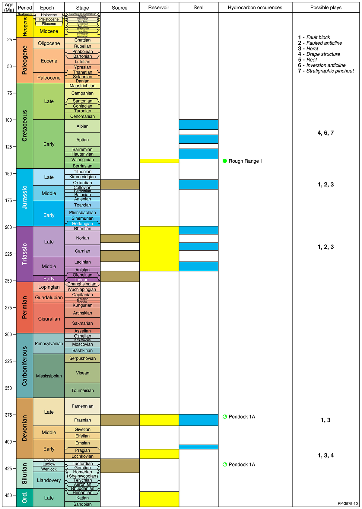
Petroleum exploration of the Southern Carnarvon Basin began with the discovery of Rough Range oil field in 1953. It was followed by two decades of regional mapping and unsuccessful drilling. By the mid-1970s, petroleum discoveries in the adjacent Northern Carnarvon Basin attracted exploration focus and exploration in the Southern Carnarvon Basin almost ceased. Systematic mapping of the onshore basin by the Geological Survey of Western Australia and offshore exploration by industry in the 1990s demonstrated the potential prospectivity of this underexplored region. To date, 76 onshore (including 57 stratigraphic tests) and only two offshore wells (Pendock 1a and Edel 1; Figure 1) have been drilled in the Southern Carnarvon Basin. No offshore fields or accumulations have yet been discovered. The Southern Carnarvon Basin is close to infrastructure at Carnarvon which connects to the West Australian pipeline network (Figure 1).