Regional Geology of the Otway Basin
Page last updated:12 December 2025
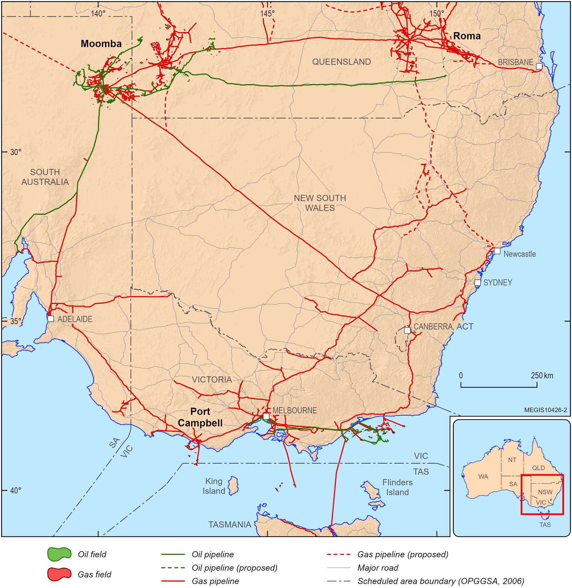
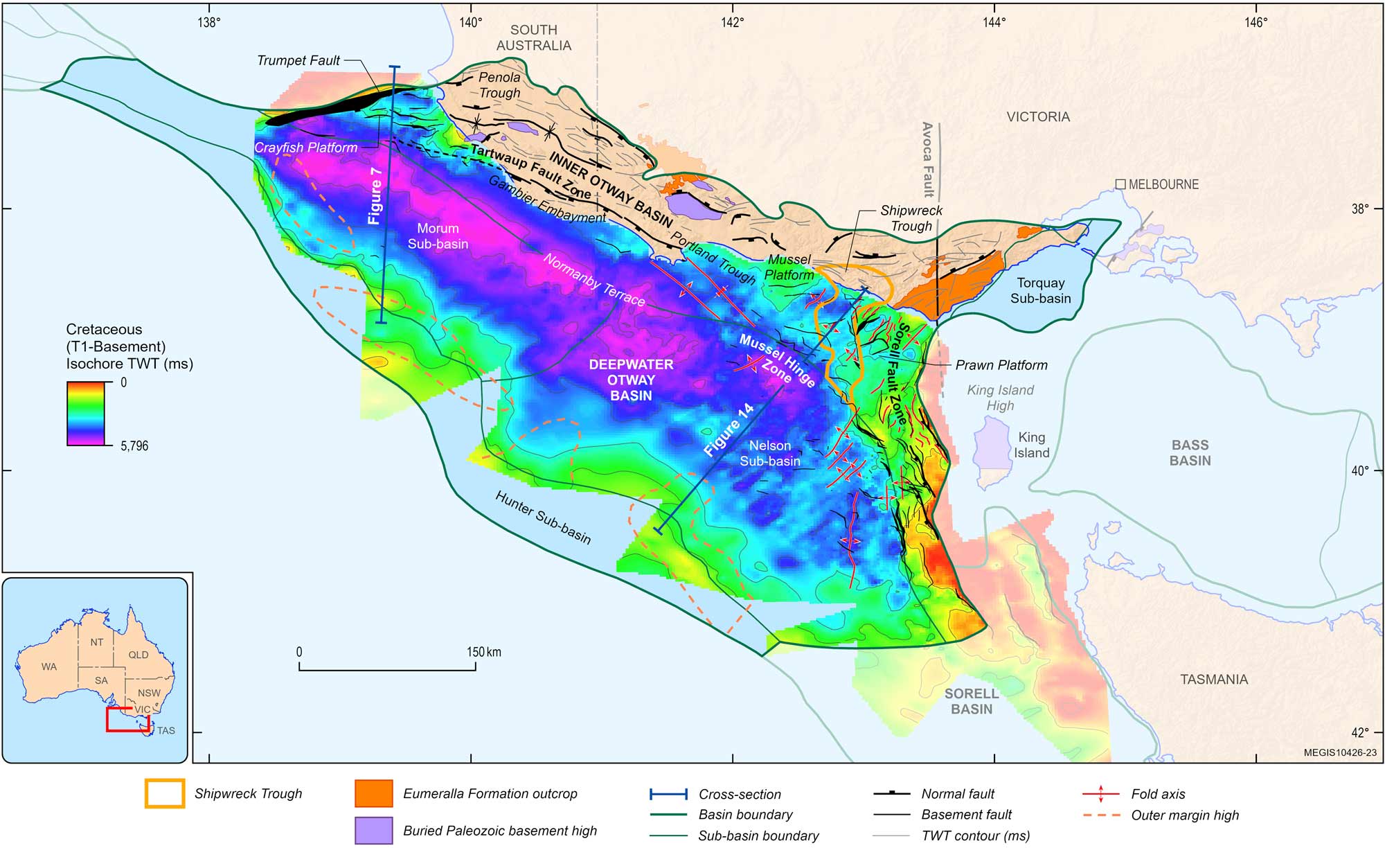
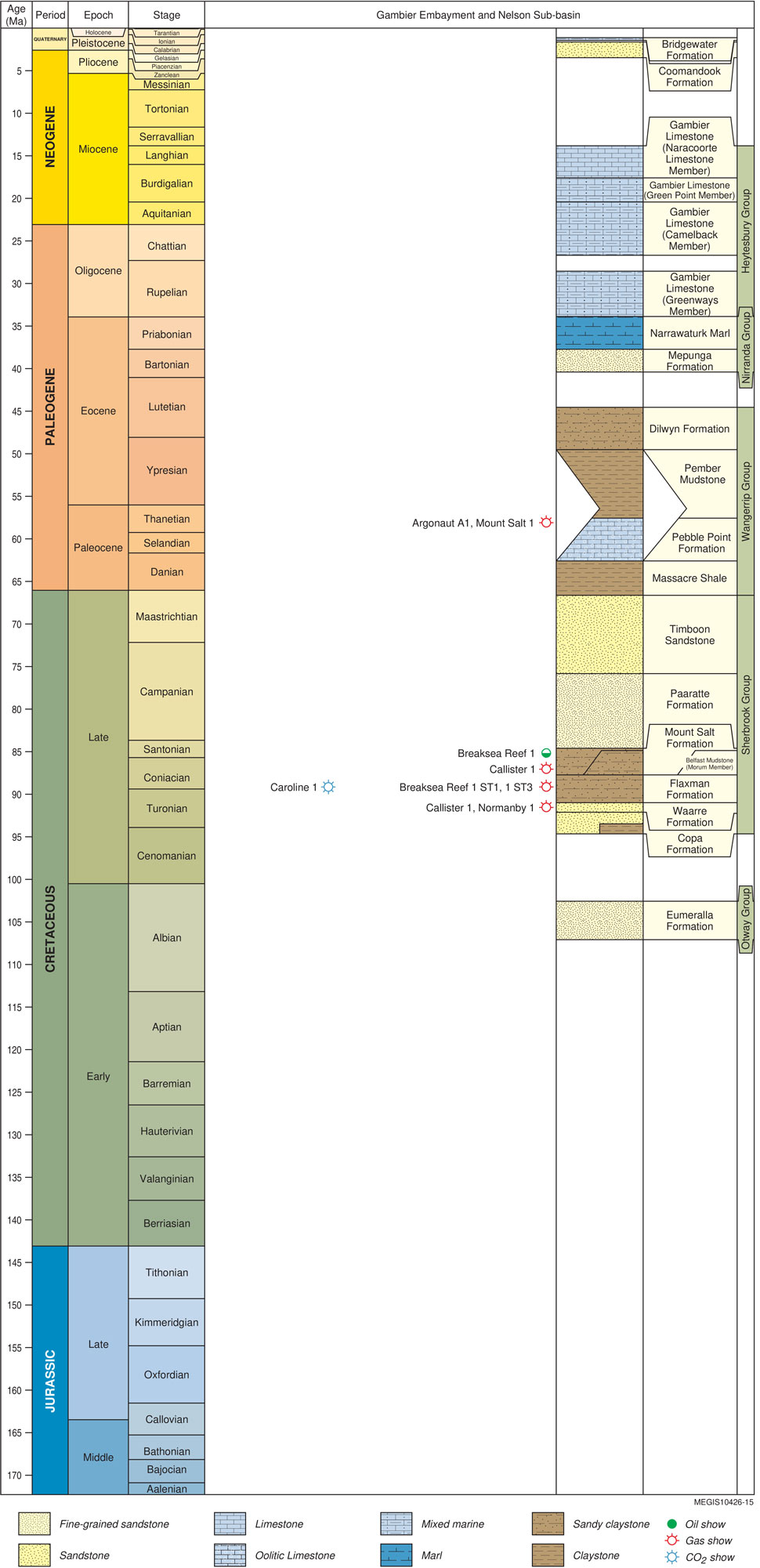
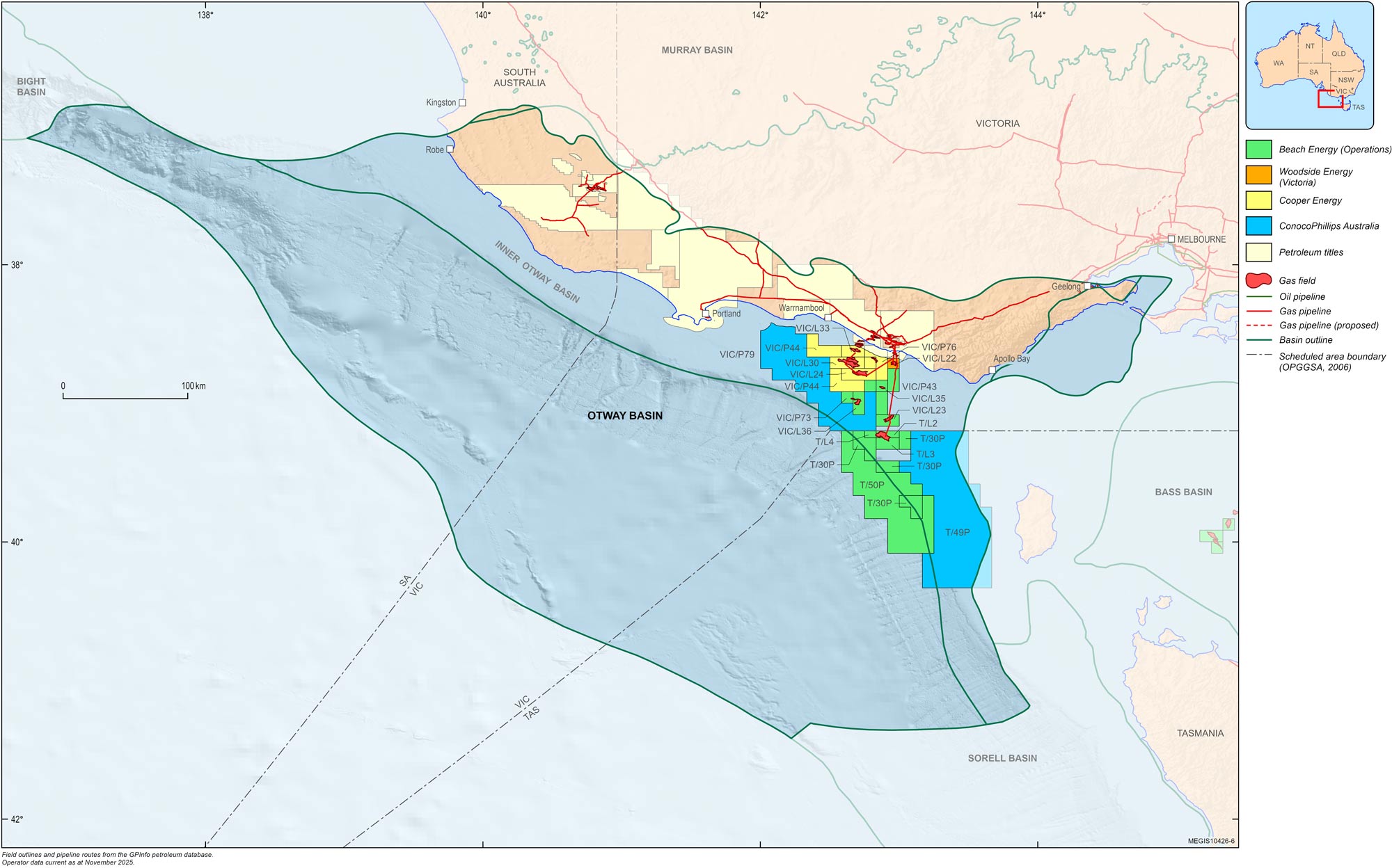
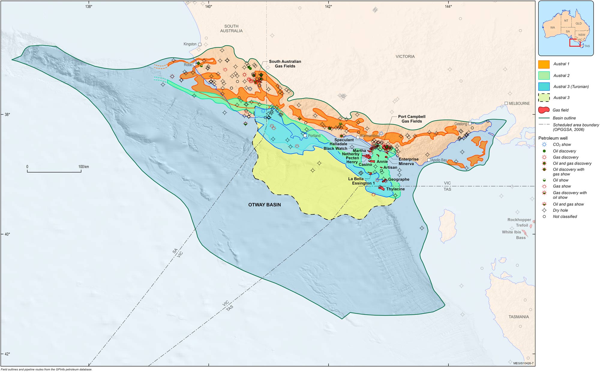
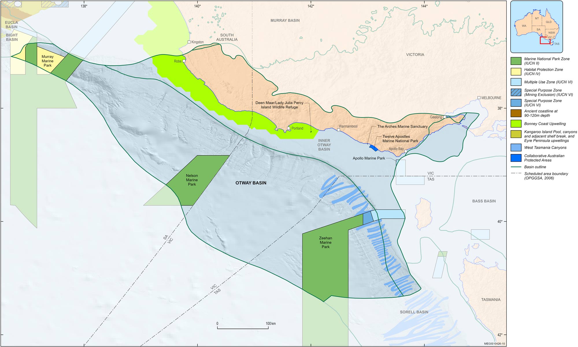
The Otway Basin is a broadly northwest to southeast striking rift basin that extends for approximately 500 km along the onshore and offshore parts of southeastern Australia (Figure 1). The basin covers an area of approximately 165 000 km2 in offshore Victoria, South Australia and Tasmania and onshore Victoria, South Australia. Approximately 83% of the basin is located offshore and 17% onshore.
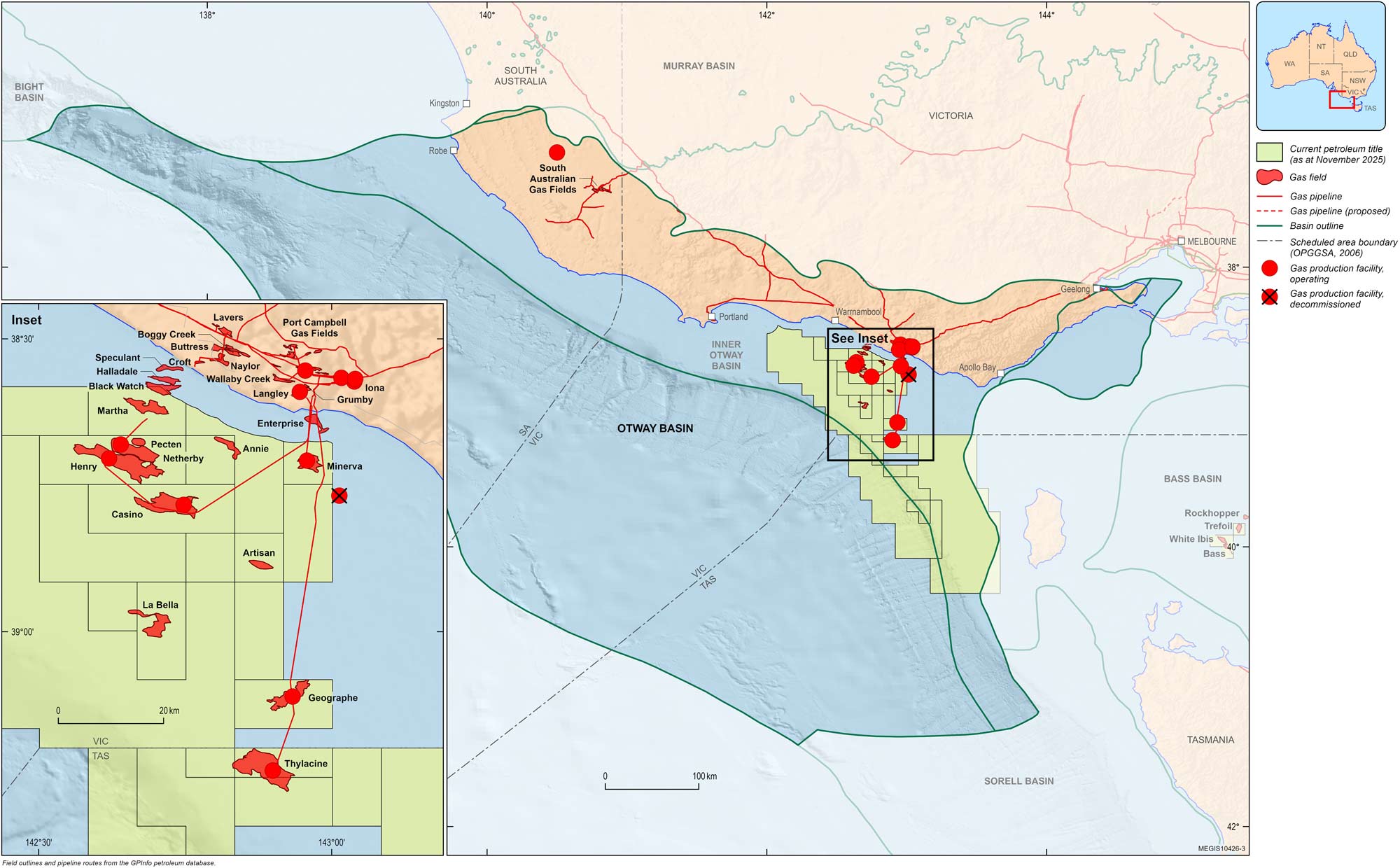
The Otway Basin is an important gas-producing region with discoveries onshore and in shallow water areas offshore approximately 170–220 km west-southwest of Melbourne, the State Capital of Victoria, delivering gas to the southeastern Australian energy market (Figure 2). Natural gas from Victoria, transported via the Port Campbell−Adelaide pipeline and the South East South Australia Pipeline, powers the 80 MW Ladbroke Grove power station adjacent to the Katnook facility. This gas also supplies markets serviced by the South East Pipeline System, replacing declining supply from the local onshore fields (Figure 3). The greater Melbourne region represents a large domestic gas market. Portland, on the western Victorian coast, is a deep-water port suited to offshore operations and is serviced by an excellent road and rail network.


For information on the 2025 acreage release areas in the Otway Basin visit the Department of Industry, Science and Resources website and see Geoscience Australia's overview of the release areas.