Insights for impact Preparing for coastal disasters: What happens when tsunamis strike Australia?
A deeper knowledge of Australia’s seabed and coastal zone is helping emergency managers understand the potential impacts of tsunamis — enabling them to be better prepared before disaster strikes.
Page last updated:27 August 2026
The challenge
When a tsunami warning is issued, emergency managers may have only hours — sometimes less — to make decisions that affect entire coastal communities. Which areas should evacuate? Which roads may become inaccessible? Which ports, marinas and low-lying neighbourhoods are most at risk?
Unlike a bushfire, which typically spreads over time, a tsunami can affect hundreds of kilometres of coastline within hours, leaving little time to move people and assets out of harm's way.
Traditionally, evacuation planning has relied on broad hazard zones, such as identifying all areas within one kilometre of the coast and less than 10 metres above sea level. These zones can encompass large populations and extensive infrastructure, creating evacuation demands that may exceed the capacity of emergency services.
More targeted planning depends on something most people never see: the shape of the seabed and coastal landscapes beneath the water.
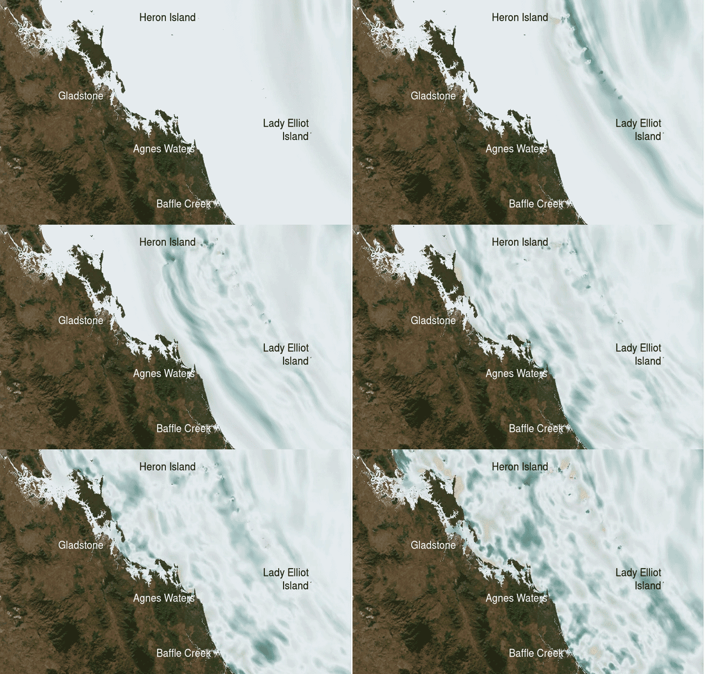
How might a magnitude 9.0 earthquake off the Solomon Islands impact the Gladstone area in Queensland? Our models demonstrate possible scenarios.
From offshore earthquake to onshore impact
Most tsunamis are generated by undersea earthquakes. The 2011 Tōhoku earthquake and tsunami in Japan, which claimed nearly 20,000 lives, was a powerful reminder of the importance of understanding coastal hazards before disaster strikes.
As tsunami waves travel across the ocean, they are shaped by the seabed and coastline. Continental shelves, submarine canyons, reefs, harbour entrances, estuaries and coastal landforms can all influence wave height, speed and the extent of coastal inundation.
Understanding these interactions requires detailed modelling — and detailed modelling depends on high-quality bathymetry, elevation and coastal data.
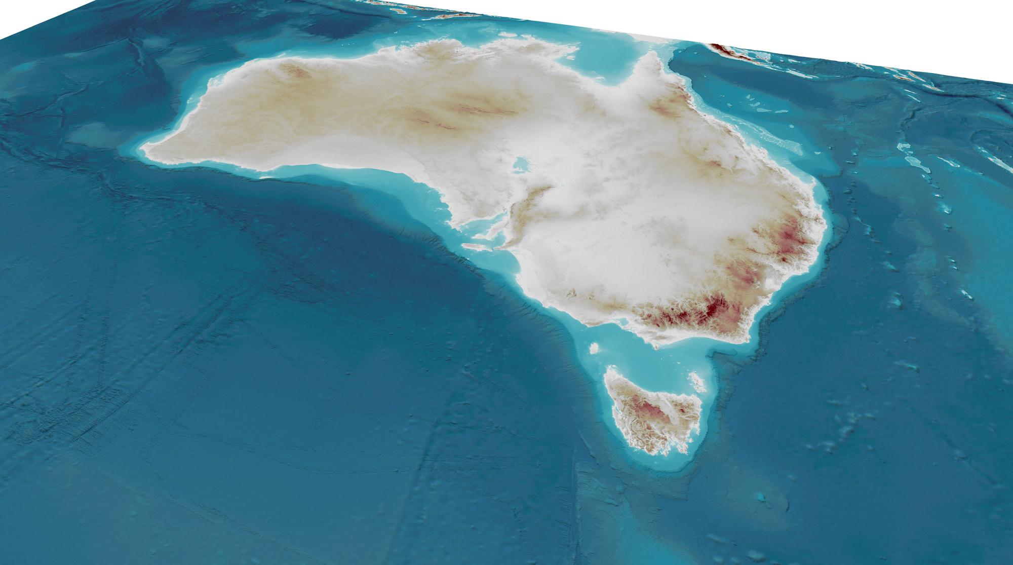
Geoscience Australia’s AusBathyTopo grid series provides Australia's only seamless national-scale representation of the land–sea interface — providing valuable information for coastal hazard modelling.
Constructing a clearer view of Australia's coast
Around Australia, Geoscience Australia and its partners are improving the information used to model tsunami hazards and coastal inundation.
By combining high-resolution seabed mapping, elevation data and advanced probabilistic modelling based on thousands of potential earthquake scenarios, scientists can estimate tsunami wave heights, flow speeds, inundation extents, and even arrival times.
This work relies on data, products and infrastructure from across Geoscience Australia, including:
- The AusSeabed Marine Data Portal, which improves discovery and access to marine data collected by governments, researchers and industry.
- The ELVIS Elevation Information System, which provides access to national elevation datasets, including high-resolution LiDAR-derived terrain information.
- The national AusBathyTopo grids bring marine and terrestrial elevation data together into seamless bathymetry-topography products.
Supporting critical action plans
Improved tsunami modelling is already supporting emergency planning in Queensland, New South Wales and Western Australia.
In Queensland, detailed inundation modelling developed for the Gladstone region is helping inform tsunami evacuation planning and improve understanding of potential impacts to communities and infrastructure.
In New South Wales, Geoscience Australia and the NSW State Emergency Service developed tsunami inundation modelling for the entire NSW coastline, including many areas where detailed assessments had not previously been available.
In Western Australia, modelling from Geraldton to Dunsborough supported work with the Department of Fire and Emergency Services to improve tsunami evacuation mapping and planning.
These projects help emergency managers better understand where hazards may emerge, how severe impacts could be, and how communities may need to respond under different warning conditions.
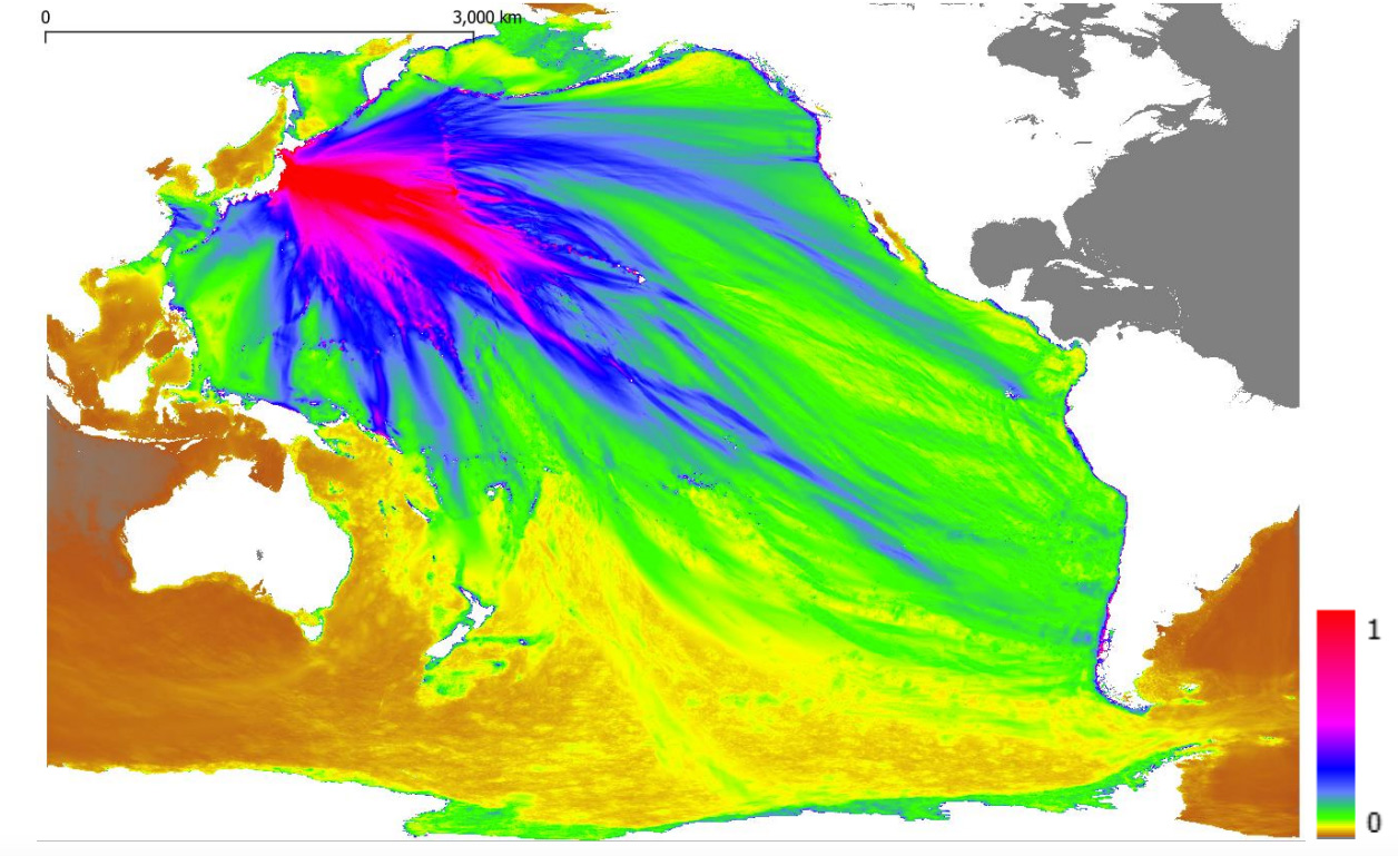
Models of the magnitude 9.1 2011 Tōhoku earthquake-induced tsunami were used to understand its behaviour in Gladstone Harbour, Queensland, 12–36 hours after the event.
More than a hazard model
Marine and coastal data collected for one purpose often delivers value far beyond its original application.
The data used to model tsunamis also supports coastal resilience, environmental management and infrastructure planning. By reusing bathymetry, elevation and geospatial information, we can better understand hazards such as storm surges, erosion and inundation while delivering broader value from existing datasets.
Blue geoscience for better decisions
With more than 87 per cent of Australians living within 50 kilometres of the coast, high-resolution seabed and elevation data underpins decisions that affect communities, infrastructure, industries and ecosystems around the nation.
By integrating data from many sources and partners, Geoscience Australia is equipping emergency managers for better preparedness, more targeted responses and a stronger understanding of risk before the next warning is issued.
Discover more
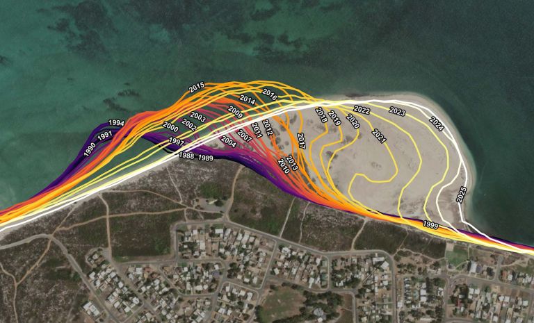
We bring together satellite observations, coastal mapping, seabed data and geospatial analysis to help inform decisions about Australia’s changing coasts.
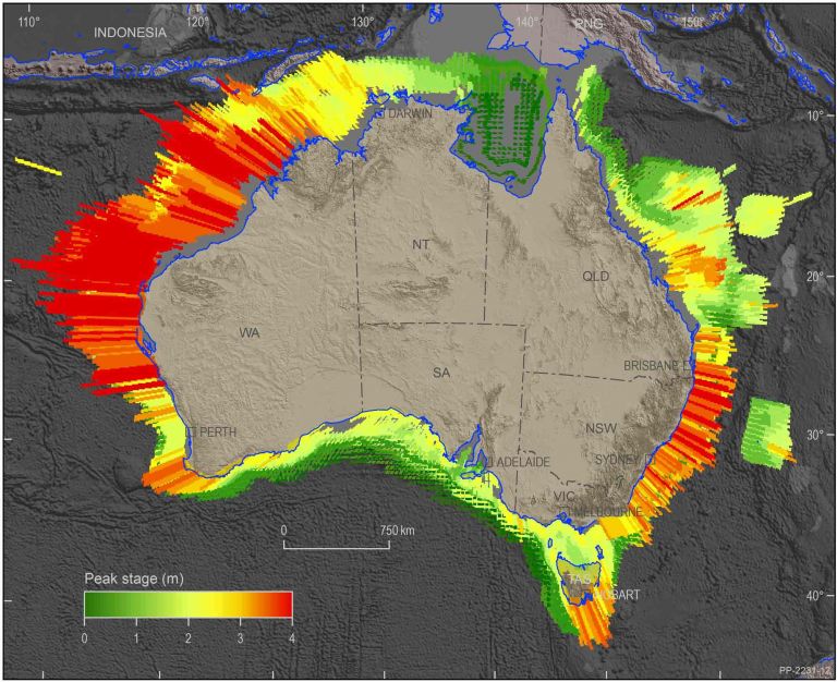
Mapping and modelling the impact of earthquake-generated tsunamis on the coastal communities of Western Australia.
Advancing tsunami preparedness through science and collaboration: The 2011 earthquake and tsunami in Tōhoku in northern Japan was a critical reminder of the importance of preparedness, understanding of the hazard and effective evacuation planning.