Knowledge article Where is the centre of Australia?
Page last updated:4 November 2026
Different methods of calculation produce different geographic centre points for Australia, reflecting the shape of the continent and the way its centre is defined.
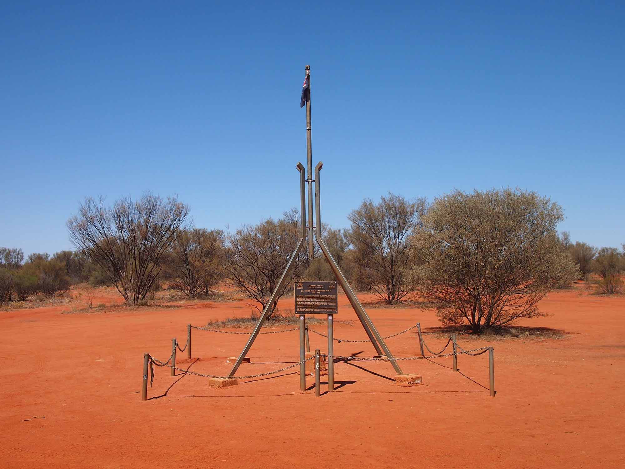
The Lambert Centre of Australia marker is about 200 km south of Alice Springs in the Northern Territory
Where is the dead centre of Down Under?
There is no single, officially defined centre of Australia. Different methods of calculation produce different centre points because Australia has an irregular shape and there are several valid ways to define its geographic centre.
Several methods have been used to calculate possible centre points for mainland Australia. These include the centre of gravity, gravitational centre, furthest point from the coastline and geodetic median point.
Methods used to calculate possible centres of Australia
Centre of gravity
The centre of gravity method uses more than 50,000 digitised points representing the coastline of mainland Australia. Each point is assigned a unit weight. The calculation accounts for the changing distance represented by longitude at different latitudes, using the cosine of latitude.
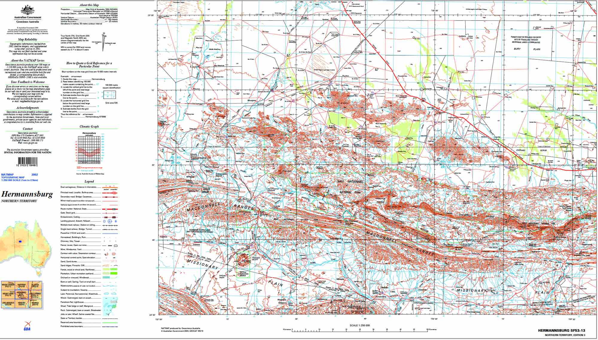
Using this method, the centre of mainland Australia is: 23° 07' South, 132° 08' East
This position is shown on the SF53-13 Hermannsburg 1:250 000 scale map, seen below.
Lambert gravitational centre
The Lambert gravitational centre was calculated from 24,500 points along the high-water mark of Australia's coastline.
The Royal Geographical Society of Australasia determined this geographic centre in 1988 as part of a Bicentennial project. A monument was erected at the location in honour of Dr Bruce P Lambert, a former Director of the Division of National Mapping.
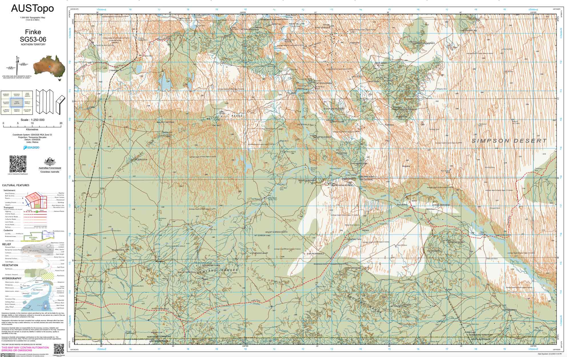
The calculated position is: 25° 36' 36.4" South, 134° 21' 17.3" East
This position is shown on the SG53-06 Finke 1:250 000 scale map, seen below.
Furthest point from the coastline
This method uses a series of concentric circles drawn on a 1:5 million-scale map of Australia. The circles are moved until one touches the coastline at three points. The centre of that circle is then taken as the point furthest from Australia's coastline.
Using this method, the centre point is: 23° 02' South, 132° 10' East
The result is close to the centre calculated using the centre of gravity method, reflecting the shape of Australia's mainland.
Geodetic median point
The geodetic median point is calculated from the midpoint between the extremes of Australia's latitude and longitude. The method uses geodesic lines joining the northern, eastern, southern and westernmost points of the continent.
Using Vincenty's formula and the GRS80 ellipsoid, the calculated position is: 23° 33' 09.89" South, 133° 23' 46.00" East
This method produces a point close to the centre of gravity and furthest-from-coastline methods, despite using a different approach.
Where are the centres of Australia's states and territories?
For states and territories, Geoscience Australia has used a simple conical projection — a cartographic technique that imagines a hollow cone placed over a fixed point — and projected coordinates using the Australian Geodetic Datum (AGD66). The resulting points are based only on the mainland areas of each state or territory.
**Please add images to the Image Gallery folder**
The centre of the ACT is near the former Honeysuckle Creek Tracking Station, approximately 35 kilometres south-south-west of Canberra. The tracking station played a leading role in NASA's Apollo missions, closing in 1981.
Location: 35° 29' 24" South, 149° 00' 05" East
Position on SI55-16 Canberra 1:250 000 and 8726 Michelago 1:100 000 scale maps.
One possible centre of New South Wales is located near Cockies Road, about 33 kilometres west-north-west of Tottenham. The site is marked by a large sign constructed for Australia's Bicentennial celebrations.
Location: 32° 09' 48" South, 147° 01' 00" East
Position on SI55-03 Narromine 1:250 000 and 8333 Tottenham 1:100 000 scale maps.
The geographic centre of Queensland is about 17 kilometres north-west of Muttaburra. The area is also significant palaeontologically, with fossilised remains discovered there, including previously unknown species.
Location: 22° 29' 13" South, 144° 25' 54" East
Position on SF55-09 Muttaburra 1:250 000 and 7753 Culloden 1:100 000 scale maps.
South Australia's irregular coastline means its geographic centre is not as easy to define as that of a state with a simpler shape. One calculated centre is near the Churchill Smith bore, approximately 12 kilometres north-east of the Mt Eba cattle station.
Location: 30° 03' 30" South, 135° 45' 48" East
Position on SH53-11 Kingoonya 1:250 000 and 6037 Eba 1:100 000 scale maps.
One possible centre of Tasmania is on the western shore of Little Pine Lagoon, between Bronte and Miena. A cairn marks the site, commemorating the work of Tasmanian surveyors who explored and mapped the state.
Location: 42° 01' 17" South, 146° 35' 36" East
Position on Tasmania South East 1:250 000 and 8214 Meander 1:100 000 scale maps.
A possible centre of Victoria is about 10 kilometres south-southeast of Bendigo. The site corresponds with centroid calculations made by several organisations, including Geoscience Australia, the Department of Natural Resources and Environment and the Royal Melbourne Institute of Technology.
Location: 36° 51' 15" South, 144° 16' 52" East
Position on SJ55-01 Bendigo 1:250 000 and 7724 Bendigo 1:100 000 scale maps.
A possible centre of Western Australia is in the Gascoyne region, east-southeast of Glenayle Homestead and north-east of the Glenayle–Carnegie Road.
Location: 25° 19' 41" South, 122° 17' 54" East
Position on SG51-06 Stanley 1:250 000 and 3347 Glenayle 1:100 000 scale maps.
One possible centre of the Northern Territory is approximately 91 kilometres west-northwest of Tennant Creek. The location lies a short distance beyond Kartijirarrakanya Claypan, in a particularly harsh and arid part of the territory.
Location: 19° 23' 00" South, 133° 21' 28" East
Position on SE53-13 Green Swamp Well 1:250 000 and 5559 Lee 1:100 000 scale maps.
About Geoscience Australia
Geoscience Australia delivers the trusted national geospatial and Earth science information that helps Australia understand, manage and plan for its land, resources, environment, infrastructure and resilience.
Discover more about Australia’s geography and people in the Digital Atlas of Australia, or return to the Australian Geography Knowledge Hub.
Discover more
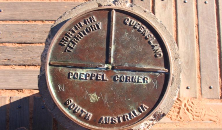
Australia's state and territory borders reflect geography, historical decisions and the challenges of surveying a vast country. Find their lengths compared and their origin stories revealed.
Australia's maritime zones are measured from the territorial sea baseline under the UN Convention on the Law of the Sea. Establishing baselines relies on geoscience, geospatial science, coastal mapping and law.
Learn how Australian place names are managed, coordinated nationally, brought together in the Composite Gazetteer of Australia, and made available via the Place Names app.