Knowledge article How Australia's maritime boundaries are calculated
Page last updated:27 August 2026
Australia's maritime zones are measured from the coastline of all Australian features when they are exposed at low tide. Establishing these baselines relies on geoscience, geospatial science, coastal mapping and law.
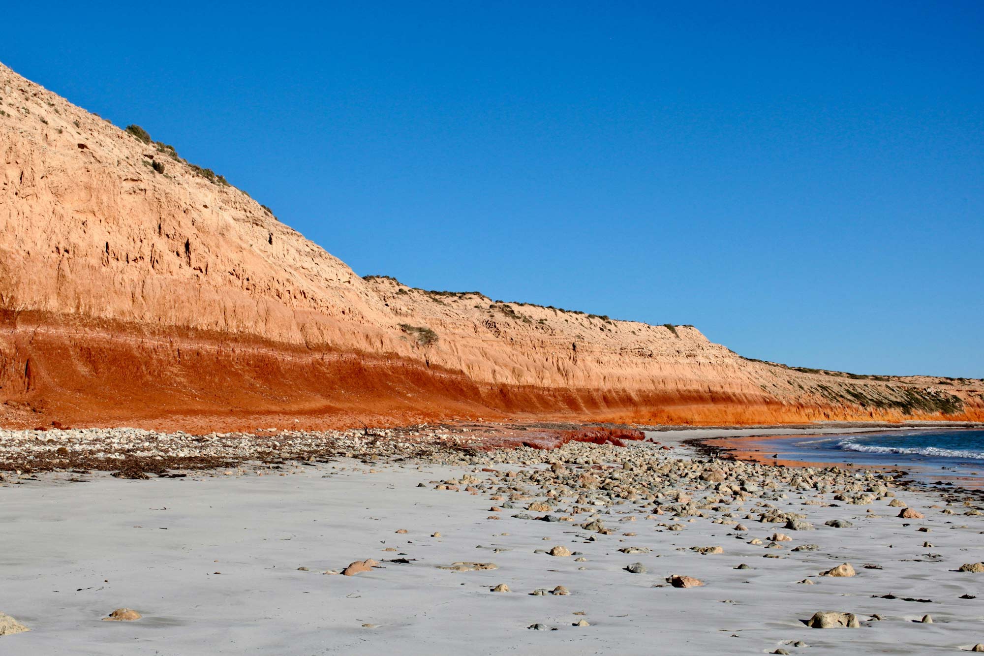
The calculation of maritime zones and boundaries at sea depends on knowing precisely where the coastline is.
Parts of Australia's coastline, particularly its beaches and estuaries, are by nature dynamic and changing. However, many of the coastal features that help define Australia’s maritime zones, such as rocky headlands and islands, are highly stable.
Providing authoritative geographic reference points for Australia's coastline is an important first step in determining the maritime zones where Australia's rights and responsibilities apply.
Everything begins with a baseline
Australia’s maritime boundaries are measured from a series of reference lines known as baselines.
Geoscience Australia provides the technical expertise and authoritative geographic information used to define and communicate the baselines — a process that combines coastal science, tidal analysis, geospatial data and international law.

Defining the territorial sea baseline
Critical to the determination of all maritime boundaries is the determination of the territorial sea baseline (TSB) around Australia and its remote offshore territories.
Essentially, the TSB is the line of low water along the coastline.
However, United Nations Convention on the Law of the Sea (UNCLOS) allows for the TSB to jump across bays (bay closing lines), rivers (river closing lines) and between islands, as well as along heavily indented areas of coastline (straight baselines) under certain circumstances.
Article 5 of UNCLOS defines the baseline as 'the low-water line along the coast as marked on large scale charts officially recognised by the coastal State'.
'Low-water' is not defined and Australia has elected to use Lowest Astronomical Tide (LAT) as this is the datum used on hydrographic charts.
The TSB was originally determined in the early 1970s based on small scale mapping supported by some aerial photography. This data has now been completely revised using the most appropriate and current source information available, such as State mapping data, hydrographic charts and satellite imagery.
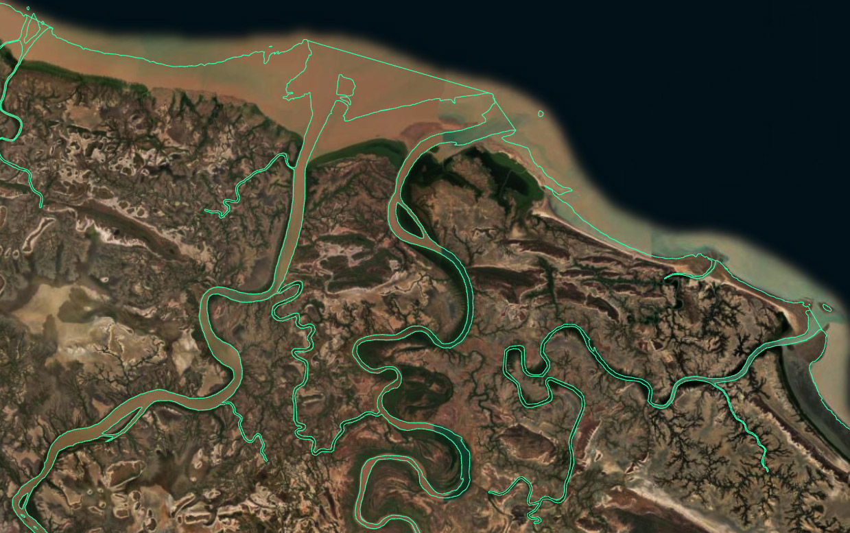
Australia’s territorial sea baselines and the low-water coastline in the Gulf of Carpentaria, including river and estuary extents
What is the lowest astronomical tide?
Lowest Astronomical Tide (LAT) is the lowest level to which sea level can be predicted to fall under normal meteorological conditions.
It would be a laborious and costly exercise to determine an exact LAT along all of Australia's vast coastline and therefore a best estimate is usually based on current charting, topographic maps, satellite imagery, and other sources.
Australia's TSB is generally consistent with hydrographic charts. However, Australian charts are prepared for the purposes of safe navigation and may not depict all physical features relevant to the generation and delineation of Australia's maritime zone. Physical changes to the coast and improved methods of locating the LAT line in the future may lead to differences between the TSB and the information depicted on charts in certain areas.
Use of straight baselines
Under Article 7 of UNCLOS, outer points of deeply indented coastlines, or fringing islands, may be linked by straight baselines. The co-ordinates of the terminal points of these baselines were originally proclaimed in 1983, for the Seas and Submerged Lands Act (1973). Many of these co-ordinates were based on small scale topographic maps (the best available information at the time).
Geoscience Australia has updated these baselines against more recent and accurate information supplied by the individual State and Territory mapping agencies as well as the Australian Hydrographic Office and other Commonwealth agencies and new terminal points were proclaimed in February 2006.
Computing the outer limit
The computation of the outer limit of the various maritime zones is a complex task. It requires the selection of appropriate basepoints on the TSB from which to compute an envelope of arcs. In addition, allowance must be made for sections of the boundary derived from straight line segments, such as straight baselines.
A rigorous computation of the location of the outer limit line requires geodetic calculation on the spheroid rather than simple line buffering.
Measuring the extent of maritime zones
Once the territorial sea baselines have been established, maritime zones can be measured offshore in accordance with the United Nations Convention on the Law of the Sea (UNCLOS) and Australian domestic law.
Together, these zones form the framework of Australia’s maritime jurisdiction.
Learn more: What are Australia’s maritime zones?
Data products and tools for better understanding
Geoscience Australia provides authoritative maritime boundary information and technical advice that helps government understand, maintain and communicate Australia's coastal baselines and maritime jurisdiction.
This work supports the consistent interpretation and administration of Australia's maritime jurisdiction, providing the certainty, stability and predictability required to manage activities ranging from shipping and fisheries to offshore energy development, marine conservation and scientific research.
Learn more
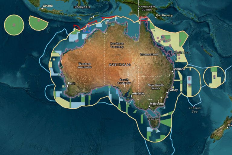
AMSIS connects geography with legislation, maritime boundaries and regulatory frameworks, providing an accessible, trusted view of what applies where across Australia’s marine domain.
Learn how AMSIS brings together trusted marine geospatial information to show what applies where across Australia's marine domain. Discover the technology, design principles and thinking behind its development and evolution.
Learn how Geoscience Australia provides technical advice and geospatial expertise to support Australia's maritime jurisdiction.