Knowledge article Australia’s external territories
Page last updated:4 November 2026
Australia’s territories span the Pacific, Indian and Southern oceans and the Coral Sea. From tropical coral reefs and islands to remote subantarctic landscapes, they encompass a diverse range of environments and geographic features.
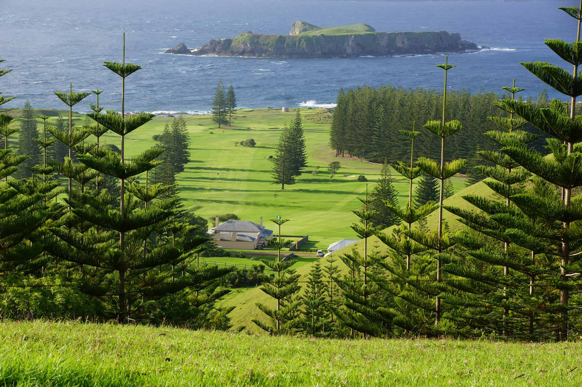
Captain James Cook first landed on Norfolk Island in 1774. Within 26 years, 40 per cent of the island’s natural vegetation had been cleared.
Australia’s external territories have diverse histories, environments and communities, shaped by their distinctive geography and isolation. They include protected natural areas, important marine habitats, unique geological features and places with long histories of human use and connection.
Geoscience Australia provides authoritative geographic information about Australia’s land, marine and coastal geography. This information supports mapping, environmental management, maritime planning and other national and international decisions.
The Territory of Ashmore and Cartier Islands comprises the West, Middle and East Islands of Ashmore Reef, Cartier Island and the surrounding 12-nautical-mile territorial sea. The islands are small, low-lying and uninhabited, and are composed of coral and sand, with some grass cover.
The territory is located on the outer edge of the continental shelf in the Indian Ocean and Timor Sea, approximately 320 kilometres off Australia's north-west coast and 170 kilometres south of the Indonesian island of Roti.
Ashmore Reef
Ashmore Reef is 840 kilometres west of Darwin and 610 kilometres north of Broome, at 122°59'E, 12°11'S. It comprises a shelf-edge reef system of approximately 583 square kilometres, rising from the western edge of the Sahul Shelf. The West, Middle and East Islands lie within the reef rim and have a combined area of 1.12 square kilometres. The largest island is about one kilometre long.
Indonesian fishers visit Ashmore Reef each year under a memorandum of understanding between the Australian and Indonesian governments. The agreement allows Indonesian fishers to access areas of the sea that they have traditionally used for centuries.
The first recorded European sighting of the reef was on 11 June 1811 by Samuel Ashmore, who named the nearby Hibernia Reef after his ship. During the 1850s, American whaling ships operated in the region. Phosphate mining was also carried out on West Island during the latter half of the 19th century.
Ashmore Reef has high species and habitat diversity. The area contains 14 varieties of sea snake, 433 species of mollusc, 70 fish species and 255 varieties of coral. The islands also provide important nesting areas for marine turtles and habitat for migratory birds. Dugongs, various cetaceans and whale sharks are regularly sighted around the reef.
The island vegetation is mainly shrubland and herbland. Plant growth is particularly dense during the wet season, contrasting with the dry season when dead plant material covers much of the islands.
The Australian Government declared Ashmore Reef a National Nature Reserve in 1983 to protect the reef and its surrounding environment.
Cartier Island
Cartier Island is 70 kilometres east of Ashmore Reef in the West Sahul region of the Indian Ocean, at 12°31'S, 123°33'E. The island is approximately 300 kilometres off Australia's Kimberley coast and 200 kilometres south of the Indonesian island of Roti.
The reef flat surrounding Cartier Island rises steeply from the surrounding deep water to an unvegetated sand cay at its centre.
The Cartier Island Marine Reserve covers 167 square kilometres within a radius of 7.2 kilometres from the centre of the island. The reserve protects the unique and vulnerable ecosystems of Cartier Island and its surrounding reefs, which have high biological diversity. At least 547 fish species have been identified in the area, representing about 16 per cent of Australia's fish species.
Like Ashmore Reef, Cartier Island and its surrounding reefs have been visited by Indonesian fishers for centuries. Traditional activities have included collecting birds, bird eggs, clams, holothurians (sea cucumbers), shells, turtles and turtle eggs for consumption and trade in Asian markets.
Located 2,607 kilometres north-west of Perth, Western Australia, Christmas Island is at latitude 10°25'S and longitude 105°43'E. The island covers 135 square kilometres, of which approximately 60 per cent is protected as national park.
Christmas Island is the summit of a submarine mountain that rises steeply from the ocean floor to a central plateau. The plateau reaches heights of up to 361 metres and consists mainly of limestone with layers of volcanic rock.
A narrow tropical reef surrounds the island and drops steeply into deep water. Within 20 metres of the shoreline, some of the underwater slopes are among the steepest in the world, reaching depths of about 500 metres within approximately 200 metres beyond the edge of the reef. These underwater formations, combined with the diverse marine life around the reef, make the waters around Christmas Island popular for diving.
Christmas Island is well known for its red crabs and their annual migration across the island, which can temporarily block roads and affect local traffic. More than 20 species of terrestrial and intertidal crab have been described on the island, including the large robber crab, also known as the coconut crab. Robber crabs have powerful claws that allow them to open coconuts and feed on their contents.
Phosphate mining has been carried out on Christmas Island since the late 19th century and remains an important contributor to the island's economy. Tourism and related industries are also becoming increasingly important.
The Cocos (Keeling) Islands Territory, at 96°50'E and 12°10'S, is Australia's most westerly tropical territory. It comprises 27 coral islands forming 2 large coral atolls in the Indian Ocean, approximately 2,935 kilometres north-west of Perth. The islands have a total land area of 14 square kilometres and a population of 593 people (2021 Census), mainly living on Home Island and West Island.
The territory is one of the remaining relatively undisturbed tropical island groups in the Indian Ocean region. Its wildlife includes seabirds, land crabs and turtles, while the surrounding marine environment supports a wide variety of corals, fish, molluscs, crustaceans and other species. The islands support an internationally significant seabird rookery.
The northern atoll consists of North Keeling Island and the surrounding marine area. The marine area extending 1.5 kilometres around North Keeling Island forms Pulu Keeling National Park, Australia's most remote Commonwealth national park.
The islands were discovered by Captain William Keeling in 1609 but were not permanently inhabited until 1826, when Alexander Hare established a settlement on the main atoll. In 1827, John Clunies-Ross, a former employee of Hare, settled on Home Island and brought Malay workers to harvest coconuts.
Britain annexed the islands in 1857. In 1886, the islands were granted to the Clunies-Ross family.
In 1978, the Australian Government acquired the islands from the Clunies-Ross family. In 1984, residents voted to retain their links with Australia.
Today, the Cocos (Keeling) Islands are an external territory of Australia administered by the Australian Government.
The Coral Sea Islands Territory comprises many small islands and reefs spread across an extensive area of the Coral Sea, extending east and south from the outer edge of the Great Barrier Reef. It includes Heralds Beacon Island, Osprey Reef, the Willis Group and 15 other reef and island groups. The coral and sand islands are small, with a combined land area of approximately 7 square kilometres.
The Coral Sea Islands became a Commonwealth territory in 1969 under the Coral Sea Islands Act 1969. It is administered by the Australian Government.
The islands were discovered in 1803 and were briefly exploited for guano (accumulated seabird droppings used as fertiliser) in the 1870s and 1880s before being abandoned.
During the 19th century, numerous ships were wrecked in the area, partly because of constantly shifting sand cays. Many of the reefs and islands were subsequently named after ships that were wrecked there.
The islands remain uninhabited and support significant seabird populations. Two species of sea turtle nest in the area, and at least 24 bird species have been recorded. The islands and reefs support important breeding colonies of seabirds, including species that are uncommon elsewhere in Australian waters.
In 1982, the Coringa-Herald National Nature Reserve and Lihou Reef National Nature Reserve were established to protect wildlife in the territory. Elizabeth and Middleton Reefs were declared a Marine National Nature Reserve in 1987. These reefs now form part of the Lord Howe Island Marine Park.
Tropical cyclones occasionally pass over the islands, particularly between November and April. Weather stations, navigation beacons and a lighthouse are located on some islands and reefs, with weather observations supported by the Bureau of Meteorology.
Heard Island and the nearby McDonald Islands are located 4,100 kilometres south-west of Perth, Western Australia, and about 1,500 kilometres north of Antarctica. The islands are home to Australia's only active volcanoes.
Volcanic activity has occurred on Heard Island since the mid-1980s, while activity on the McDonald Islands, approximately 43 kilometres to the west, occurred during the 1990s. Volcanic activity on the McDonald Islands group resulted in the main island doubling in size and increasing in elevation by about 100 metres.
Together with the French Kerguelen group of islands, 440 kilometres to the north-west, Heard and McDonald Islands form the only exposed parts of the submarine Kerguelen Plateau.
The Kerguelen Plateau covers approximately 2 million square kilometres and rises about 3,000 metres above the surrounding sea floor. The islands are surrounded by stormy seas where temperate waters from the Indian Ocean meet the cold Antarctic waters.
The extreme environmental conditions mean that most days are cloudy, making satellite imagery and photographs of the islands difficult to obtain. The rugged terrain, including cliff-lined coasts and rocky shoals, also makes access by sea difficult. As a result, only two successful landings have been made on McDonald Islands, in 1971 and 1980. The larger Heard Island is more accessible, and scientific research visits have been much more frequent.
Heard Island
Heard Island is located at 73°30'E, 53°05'S and covers 368 square kilometres. It is approximately 40 kilometres long from east to west and 20 kilometres wide at its widest point.
The island is dominated by the active volcano Big Ben. Its summit, Mawson's Peak, rises to 2,745 metres above sea level — 517 metres higher than Australia's highest mainland mountain, Mount Kosciuszko, at 2,228 metres. A second major volcanic cone, Mount Dixon, rises to 700 metres above sea level in the centre of the Laurens Peninsula on the island's western extremity.
McDonald Islands
The McDonald Islands are small compared with Heard Island. The main island covers only 2.45 square kilometres and rises to 230 metres. Located at 72°36'E, 53°02'S, the principal island experienced volcanic activity during the 1990s that obliterated some landmarks and created new ones. The activity also resulted in the complete loss of vegetation from the islands.
The Territory of Heard Island and McDonald Islands includes the islands and the surrounding ocean extending 12 nautical miles from their shores. The territory was inscribed on the World Heritage List in December 1997 because of its pristine sub-Antarctic ecosystems and geological activity. In October 2002, the Heard Island and McDonald Islands Marine Reserve was declared under the Environment Protection and Biodiversity Conservation Act 1999.
Heard Island and McDonald Islands are unique in that they form the only sub-Antarctic island group with an intact ecosystem and no known species introduced by humans.
Norfolk Island is located 1,676 kilometres north-east of Sydney, at 167°57'E, 29°02'S. The Territory of Norfolk Island comprises Norfolk, Phillip and Nepean islands, with a combined area of just over 37 square kilometres.
Most of Norfolk Island is a plateau formed from horizontal layers of basalt. The island is the exposed summit of an elongated shield volcano, with its highest point at Mount Bates, 319 metres above sea level. The continental shelf surrounding Norfolk, Phillip and Nepean islands extends approximately 95 kilometres from north to south and 35 kilometres from east to west.
Captain James Cook first landed on Norfolk Island in 1774. Within the following 26 years, approximately 40 per cent of the island's natural vegetation had been cleared. Today, only about 5 per cent of the native forest remains undisturbed.
The Norfolk Island pine, which has become an iconic feature of the island, can grow to more than 60 metres high and, in some cases, reach a girth of 11 metres.
The Australian Antarctic Territory (AAT) encompasses a vast, ice-covered landscape with some of the coldest, driest and windiest conditions on Earth. Australia has maintained a continuous scientific presence in Antarctica since 1954, supporting research into this remote and distinctive environment.
‘External territories’ or ‘remote offshore territories’ — what’s the difference?
The terms are not interchangeable!
Under Australian law, external territories is a formal term that defines the group of Commonwealth territories that are distinct from Australia’s internal territories (Australian Capital Territory, Northern Territory and Jervis Bay Territory).
Remote offshore territories on the other hand, is not a legal term. Instead, it is a geographical description of Australian territories that are literally ‘remote’ from the mainland.
Macquarie Island, for example, is a geographically remote offshore island, but as it is in fact part of the State of Tasmania, it is not one of Australia’s external territories.
Territory trivia
The size of Australia's external territories varies greatly.
The largest is the Australian Antarctic Territory, covering almost 5.9 million square kilometres. The smallest are the Ashmore and Cartier Islands, which cover just 2 square kilometres.
Christmas Island is Australia's most northerly territory, located just 10° south of the equator and 1,565 kilometres northwest of the nearest point of the Australian mainland, at North West Cape. Its closest Australian neighbour is the Cocos (Keeling) Islands, 900 kilometres to the south-west.
Discover more
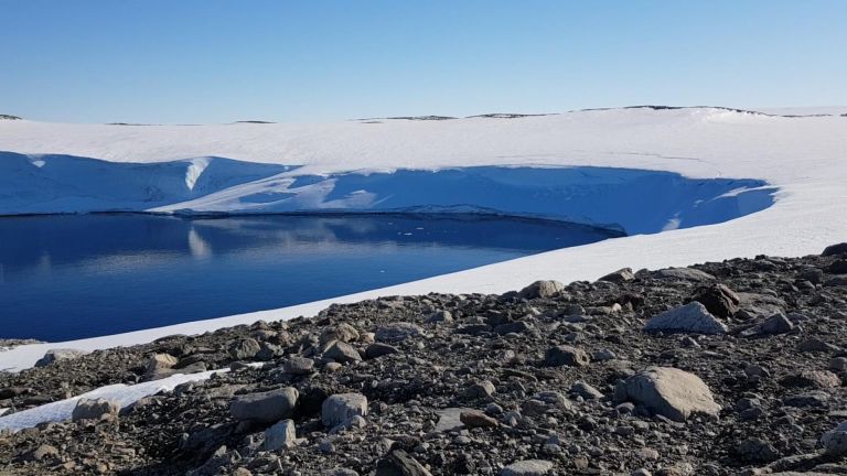
The Australian Antarctic Territory encompasses a vast ice-covered landscape with distinctive geography, environments and a long history of scientific activity.

Australia's maritime jurisdiction defines where the nation may exercise specific rights, responsibilities and obligations at sea under international and Australian law.
Geoscience Australia provides the geospatial and scientific insights that help shape Australia’s marine and coastal future. Explore data, maps and tools for understanding our seabed, coasts, maritime jurisdiction and Antarctica.