Knowledge article How are topographic maps numbered?
Page last updated:4 November 2026
Australia’s topographic maps use a standard numbering system to identify map sheets and show how they fit together across different scales.
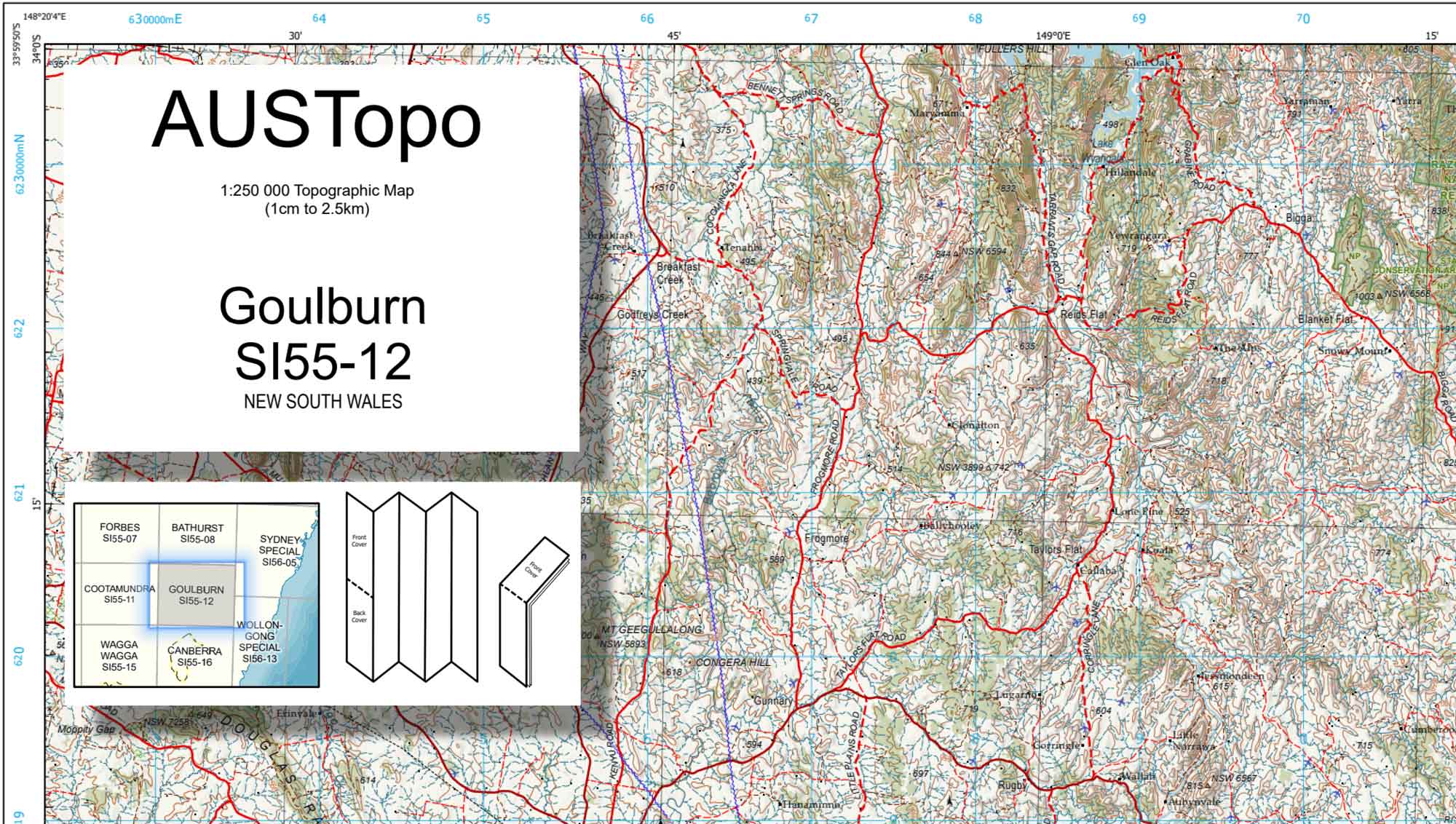
Australia is covered by topographic maps at a range of scales. Each map sheet has a unique number that identifies its location within the national map series. The numbering system changes with map scale, allowing users to identify individual map sheets and understand how different map series relate to each other.
Why do topographic maps have numbers?
Australia is covered by thousands of topographic map sheets at different scales. Map numbers provide a consistent way to identify each sheet and understand where it sits within the national map series.
The numbering system is based on geographic areas, with each scale using a different level of detail.
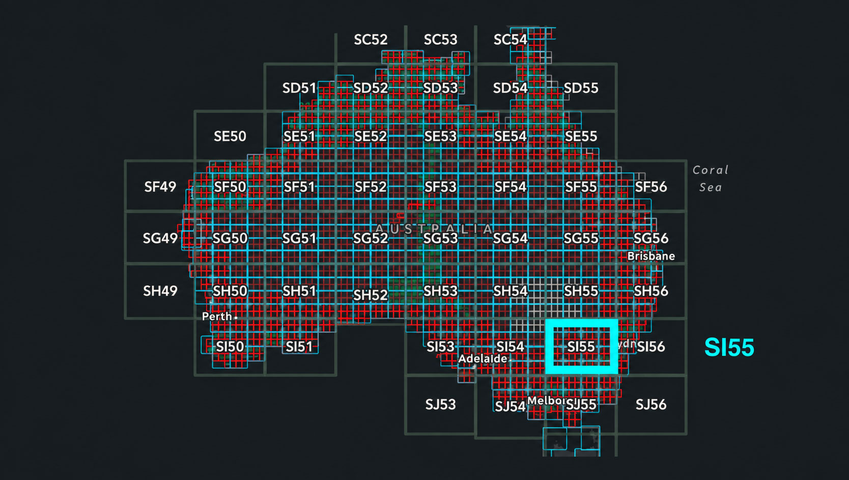
1:1 million scale map numbering
The 1:1 million scale map series uses a standard international map numbering system.
Each map sheet is identified using a combination of letters and numbers that indicate its position by latitude and longitude. The system divides the world into large geographic areas, allowing individual 1:1 million scale map sheets to be identified consistently.
For example, in map number SI55:
- S identifies the southern hemisphere
- I identifies the 4° of latitude band — its position north or south
- 55 identifies the 5° of longitude band — the map’s position east or west.
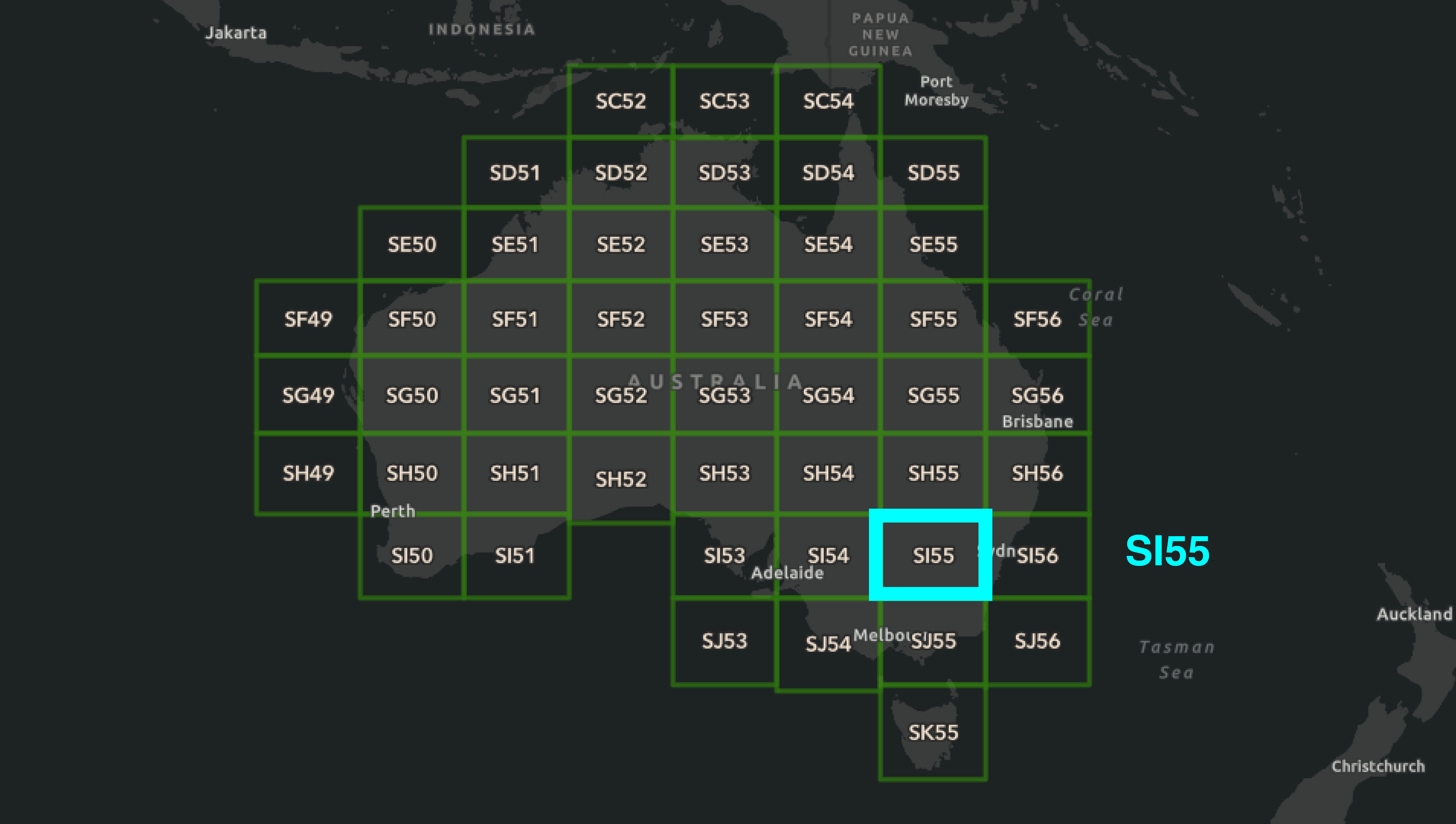
The 1:1 million SI55 map sheet is divided into 16 map sheets at the 1:250 000 scale
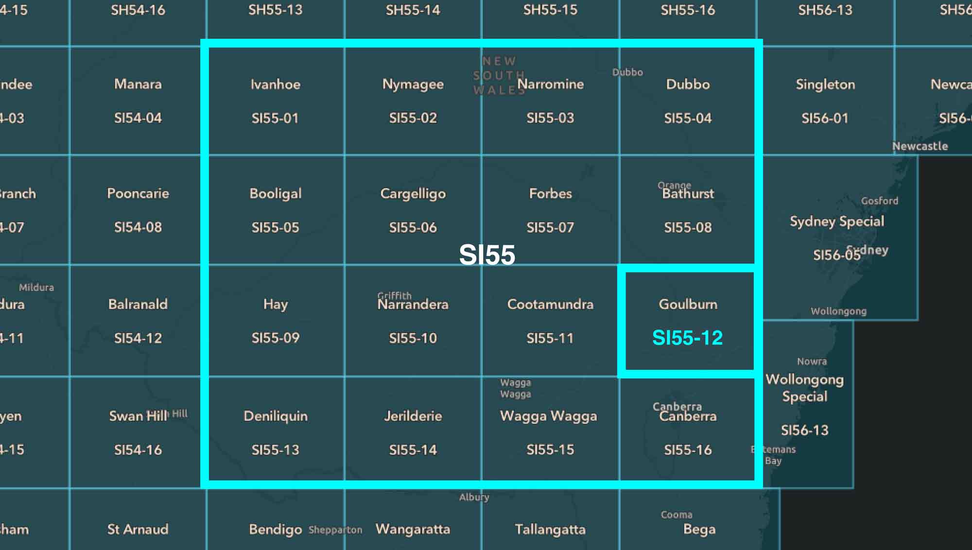
The 1:1 million SI55 map sheet is divided into 16 map sheets at the 1:250 000 scale
1:250 000 scale map numbering
The 1:250 000 scale map series is divided into smaller map areas based on the 1:1 million scale framework.
Each 1:1 million scale map area is divided into 16 smaller rectangles. These are numbered from left to right and top to bottom.
Combining the 1:1 million map number with the rectangle number identifies the corresponding 1:250 000 map sheet.
For example, map number SI55-12 (Goulburn)
- SI55 identifies the larger 1:1 million map reference
- 12 identifies the 1:250 000, 1° by 1.5°, section of the larger map.
Good to know: Some 1:250 000 maps do not follow this standard arrangement because they cover areas that require a different map extent. These are identified as special maps and are usually along the coast.
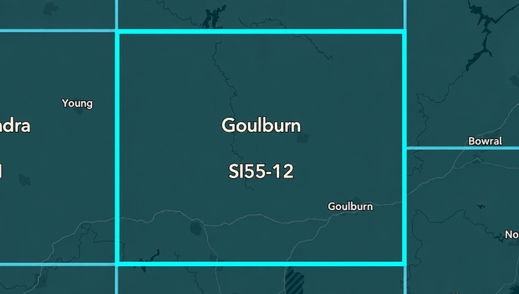
The 1:250 000 SI55-12 (Goulburn) sheet is divided into six map sheets at the 1:100 000 scale
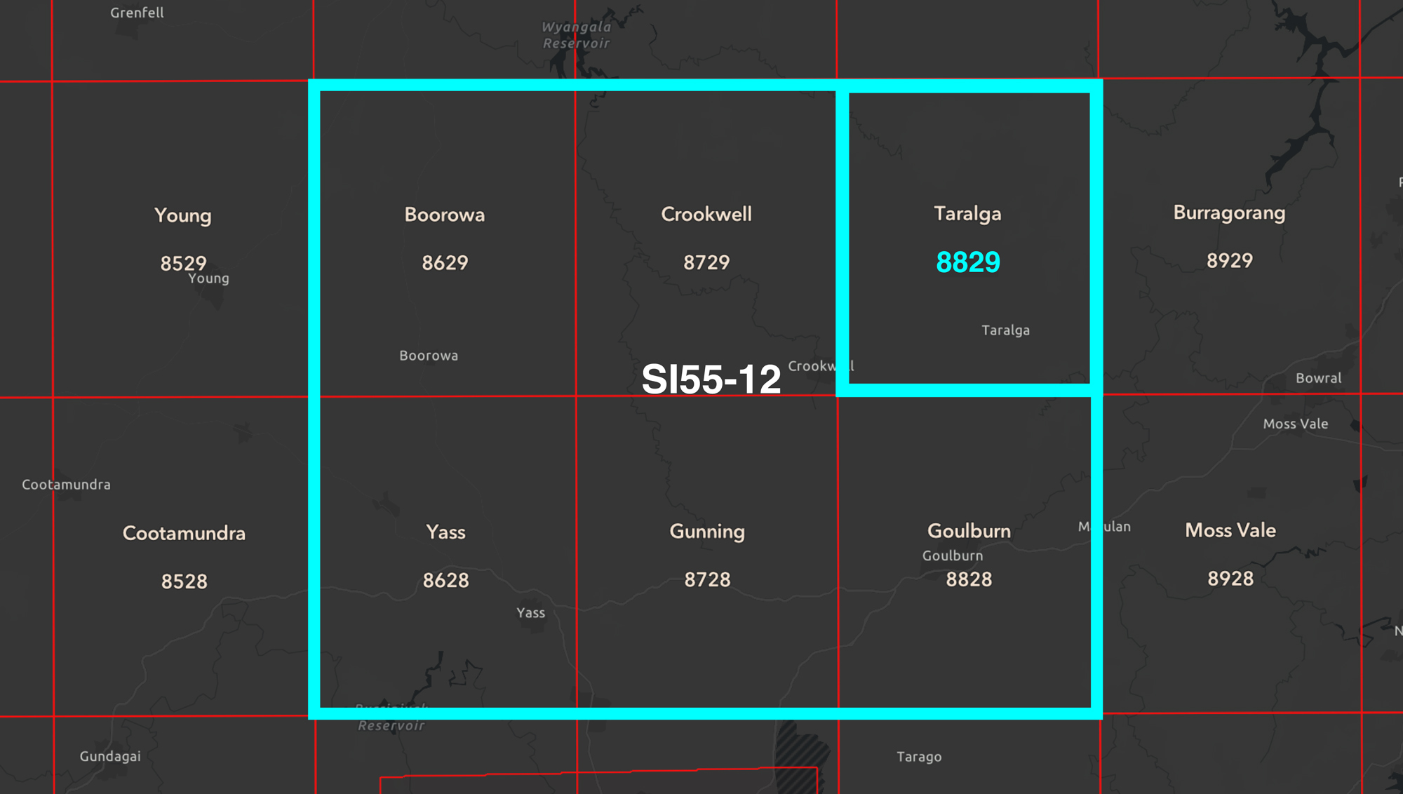
The 1:250 000 SI55-12 (Goulburn) sheet is divided into six map sheets at the 1:100 000 scale
1:100 000 scale map numbering
The 1:100 000 scale map series simply uses four-digit sheet numbers.
The first two digits define a longitude band 0.5°-wide, north-south, and the second two digits a latitude band 0.5°-wide, east-west.
Six standard sized 1:100 000 map sheets can be identified within each standard sized 1:250 000 map area.
For example, map number 8829 (Taralga) is one of six 1:100 000 map sheets that nest within the Goulburn SI55-12 1:250 000 map area.
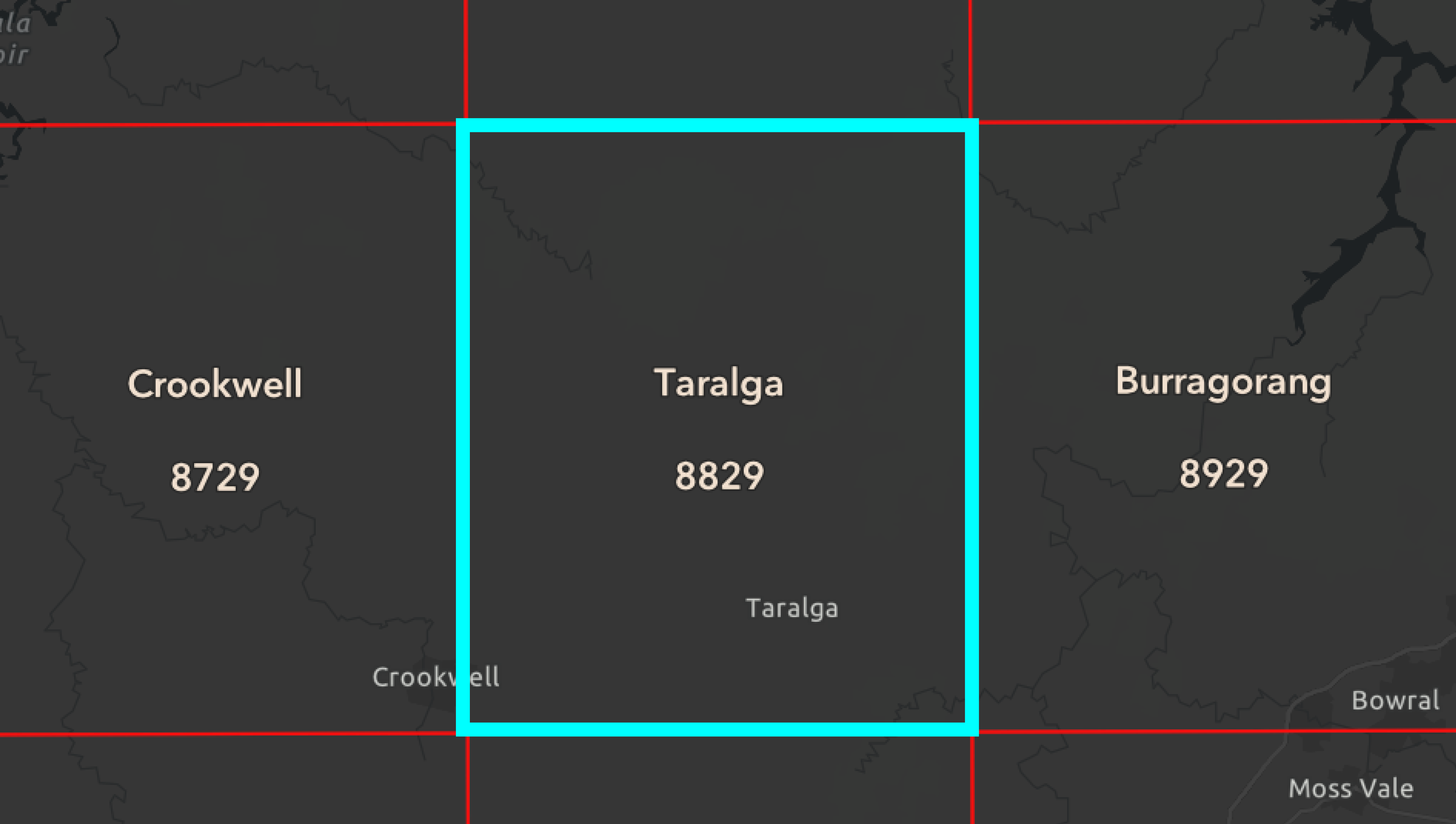
The 1:100 000 8829 (Taralga) sheet is divided into four map sheets at the 1:50 000 scale
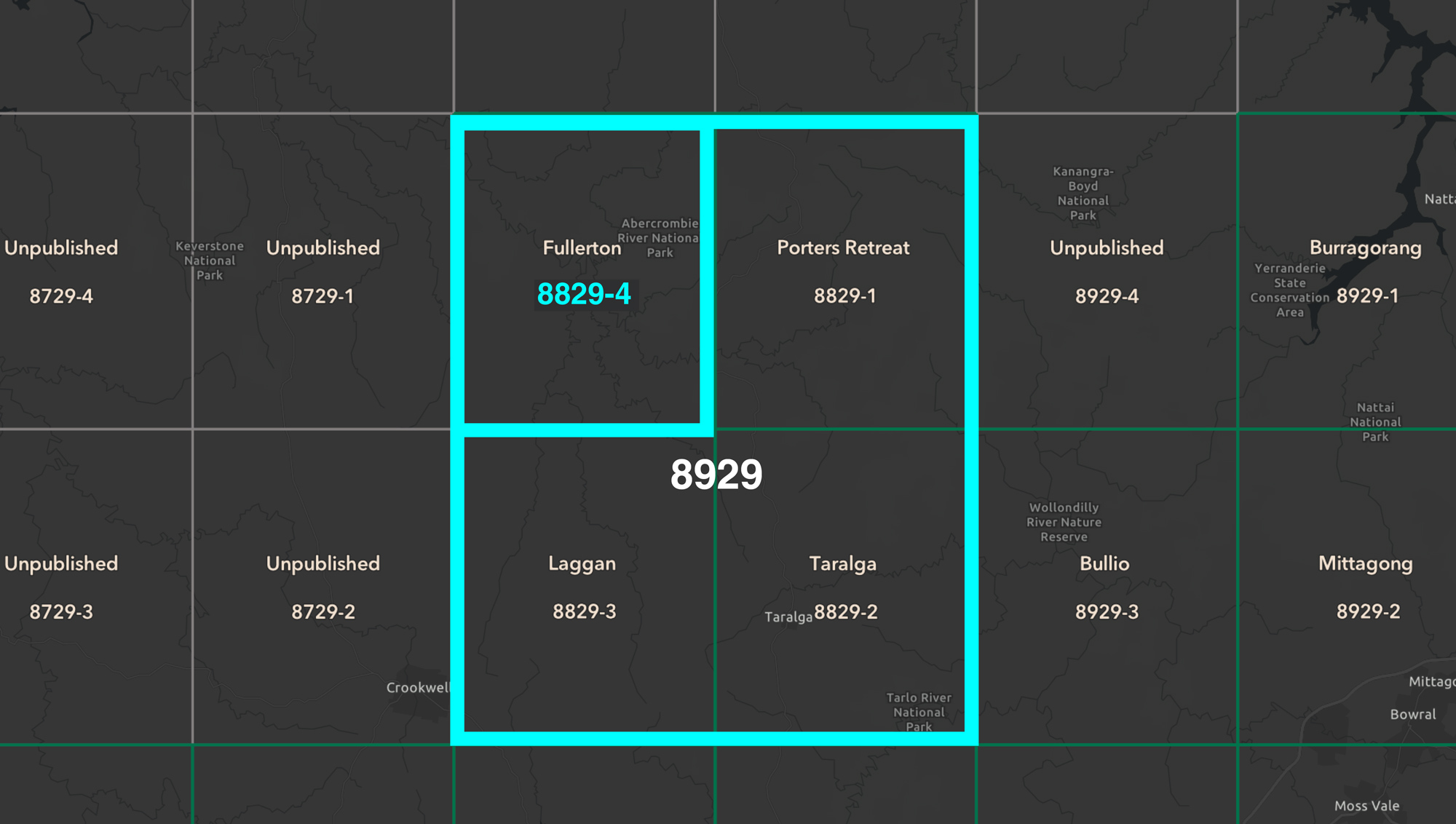
The 1:100 000 8829 (Taralga) sheet is divided into four map sheets at the 1:50 000 scale
1:50 000 scale map numbering
The 1:50 000 scale map series uses five-digit sheet numbers.
The first four digits identify the corresponding 1:100 000 map area. The final digit identifies which quarter of that area the map covers, numbered clockwise from the top-right quarter.
This allows four standard sized 1:50 000 map sheets to be identified within each standard sized 1:100 000 map area.
For example, in map number 8829-4 (Fullerton):
- 8829 = the corresponding 1:100 000 map area.
4 = the fourth quarter of that area, numbered clockwise from the top-right.
Finding the right map
Map numbering works alongside other information printed on a topographic map, including the map name, scale, grid references and coordinates. Together, these help users identify the area covered by a map and locate features accurately.
When looking for a map, start by checking:
- Map name — identifies the main area covered by the sheet.
- Map number — identifies the sheet within its map series.
- Scale — tells you the level of detail and area covered.
- Grid references and coordinates — help you locate a specific position on the map.
About Geoscience Australia
Geoscience Australia delivers the trusted national geospatial and Earth science information that helps Australia understand, manage and plan for its land, resources, environment, infrastructure and resilience.
Explore our topographic maps of Australia or return to the Topographic Maps Knowledge Hub.
Discover more
Discover how geographic data, standards and cartography are combined to create accurate, nationally consistent topographic maps.

Understand map scale, how it affects detail and area covered, and how to choose the right scale for different uses.
Learn how to read topographic maps, interpret symbols, coordinates, contours and bearings, and navigate with a map and compass.