Showcasing our work Survey Coordination Tool recognised for innovation
Page last updated:27 August 2026
The AusSeabed Survey Coordination Tool is attracting growing recognition as a practical solution to one of marine mapping's enduring challenges: coordinating fragmented survey activity across Australia’s vast marine estate.
Since its launch in 2020, the AusSeabed Survey Coordination Tool has become a nationally recognised mechanism for planning, prioritising and coordinating seabed mapping surveys.
The tool provides a central location where organisations can submit and prioritise their areas of interest, share survey plans, and coordinate future survey activity across the Australian region.
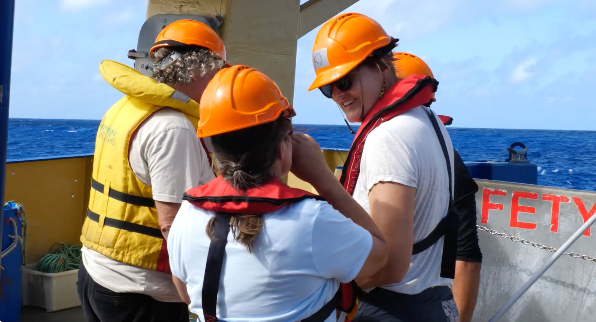
Connecting plans, priorities and opportunities
The AusSeabed Survey Coordination Tool supports collaboration through three kinds of sharing:
- Areas of interest allows users to publicly share their organisation’s areas of survey interest, increasing awareness of these needs across the marine community, and informing future national seabed mapping priorities. Published information appears in the AusSeabed Data Portal.
- Survey plans allow organisations to alert the broader community to planned survey activities.
- HIPP requests are sent to the Australian Hydrographic Office’s (AHO) HydroScheme Industry Partnership Program (HIPP) for inclusion in their planning. Through HIPP, the AHO uses commercial survey companies to collect hydrographic data, primarily to support national charting priorities and safety of navigation.
Multiple agencies, including the Australian Hydrographic Office, CSIRO, and the Australian Antarctic Division, use the information in the tool to refine their survey plans to maximise the benefit of their work.
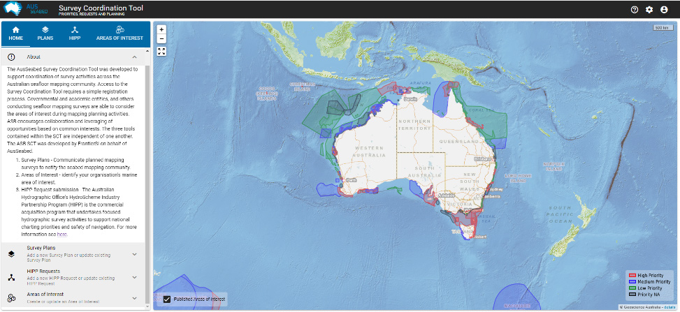
AusSeabed Survey Coordination tool — add your survey plans, areas of interest, and HIPP requests
Accelerating the national value of survey efforts
No single organisation can map Australia's maritime jurisdiction alone.
By providing a shared view of survey plans and priorities, the AusSeabed Survey Coordination Tool helps organisations identify opportunities to align activities, reduce duplication and maximise the value of survey effort.
“The tool connects organisations that need seabed data with vessel operators who want to maximise the impact of the data they collect during their already planned voyages,” says Dr Pip Bricher, Geoscience Australia Director of National Seabed Mapping. “It’s a win-win.”
"Seabed surveys are expensive and technically challenging, so coordinating helps make every hour of survey time more effective as we work to understand Australia's marine environment.”
How much of Australia’s seabed has been mapped?
An achievement in information management
Originally developed through collaboration between Geoscience Australia, the Australian Hydrographic Office and FrontierSI, the AusSeabed Survey Coordination Tool has attracted recognition from both the Geospatial Council of Australia and the Australasian Hydrographic Society.
In 2026, the delivery team behind the tool received the Australasian Hydrographic Society’s Award of Merit – Information Management Achievement by a Group, recognising the collaborative effort that made the platform possible and its contribution to Australia's seabed mapping capability.
In 2025, the Geospatial Council of Australia jointly awarded the Hydrographic Excellence Award to Geoscience Australia and Lachlan Hurst from FrontierSI, for their work on the tool.
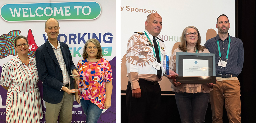
Hilary Thompson and Richard Cullen, from the Australian Hydrographic Office, and Natalie Lennard, from Geoscience Australia, accepting the Geospatial Council of Australia’s 2025 Hydrographic Excellence Award for the AusSeabed Survey Coordination Tool. Commander Nigel Townsend, Natalie Lennard and Scott Lytton accepting the 2026 Australasian Hydrographic Society award of merit for information management achievement.
Building a stronger seabed mapping community
As demand for seabed data grows across offshore renewable energy, conservation, infrastructure planning and environmental management, coordination is critical.
The Survey Coordination Tool is a demonstration of the collaborative principles driving Geoscience Australia’s leadership of the AusSeabed initiative.
“By better connecting the people who need to understand the seabed and the people who can collect the necessary data, we’re forging an accelerated approach to understanding Australia's marine environment,” Dr Bricher says.
Use the tool
Discover more
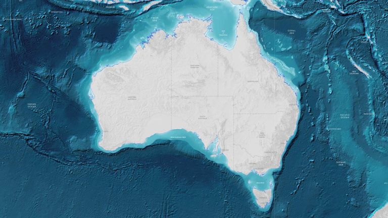
Understanding Australia's seabed is critical for managing our environment, economy and national security. Explore maps, data and scientific insights about Australia's marine environment.

Discover how bathymetry data is collected and why it provides the foundation for navigation, marine planning, hazard assessment and ocean science.
Every year, new surveys, improved technologies and the digital recovery of historical data help reveal a more complete picture of Australia's seabed.