


News
A new frontier for mineral exploration
Published:5 March 2021
A new frontier for mineral exploration
The first results from the National Drilling Initiative have highlighted exciting new opportunities for the resources industry in the Northern Territory.
The first results from the National Drilling Initiative have highlighted exciting new opportunities for the resources industry in the Northern Territory.
The collaboration between Geoscience Australia, MinEx CRC and the Northern Territory Geological Survey completed their first stratigraphic drilling campaign approximately 200 kilometres east of Tennant Creek in December 2020.
The 10 drill holes are in an area that had been overlooked for mineral exploration in the past because of the uncertainty, risk and expense of exploring through the overlying cover of the Barkly Tablelands.
However, data from the Australian Government’s Exploring for the Future program, which is being led by Geoscience Australia, showed the area warranted closer investigation.
Geoscience Australia’s Chief of Minerals, Energy and Groundwater Division, Dr Andrew Heap, said early analysis of the drilling data confirmed the East Tennant region had the right geology for a range of minerals, in particular copper and gold.
“Drilling has identified rocks of the right age to host mineralisation and has uncovered evidence for key mineralising processes such as the presence of major structures, hydrothermal alteration, and base metal sulphides.This shows the East Tennant area is an exciting frontier area for mineral exploration in Australia,” Dr Heap said.
“The drilling also confirmed cover thicknesses in the region ranged between 120 metres and 200 metres, which is well within reach using modern exploration techniques.”
Northern Territory Geological Survey Executive Director Ian Scrimgeour said the drilling had improved the understanding of the geological evolution and resource potential of the basement geology and overlying basin cover of the East Tennant area.
“It suggests that the East Tennant region has undergone a similar stratigraphic, tectonic, and magmatic history to rocks exposed in the prospective Warramunga Province around Tennant Creek, and forms a region of elevated prospectivity stretching to the Queensland border,” Dr Scrimgeour said.
"Insights from analysis of these rocks will provide a framework to assess the mineral potential of this previously poorly understood part of the North Australian Craton.”
MinEx CRC Chief Executive Officer Andrew Bailey said while further analysis of the data needed to be conducted, the results would provide the resources sector with a solid evidence base for the region's prospectivity.
“This will give companies the knowledge and confidence to explore the region more effectively,” Mr Bailey said.
Geoscience Australia is delivering this data into the hands of industry more rapidly than ever before through an innovative Borehole Completion Report tool.
This approach shortens the timeframe for releasing this data from around one year to just a few months and allows data to be readily updated as it becomes available in the future.
The tool also enables users to visualise multiple datasets without requiring specialist software.
MinEx CRC is a $220 million collaboration between government, industry and research organisations over 10 years.
The National Drilling Initiative (NDI) is one of three MinEx CRC’s research programs. It aims to overcome the technical challenges of exploring for mineral deposits in prospective rocks concealed under the cover of younger rocks and sediment through new exploration tools and techniques.
The data can be accessed through the Exploring for the Future Data Discovery Portal and the MinEx CRC National Drilling Initiative Portal.
Read more about the announcement from Minister for Resources, Water and Northern Australia Keith Pitt here.
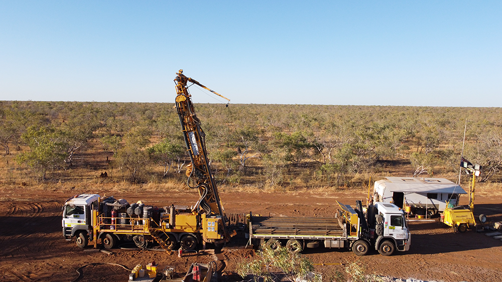
Photograph courtesy of MinEx CRC.
Contact:
Phone:
Email: